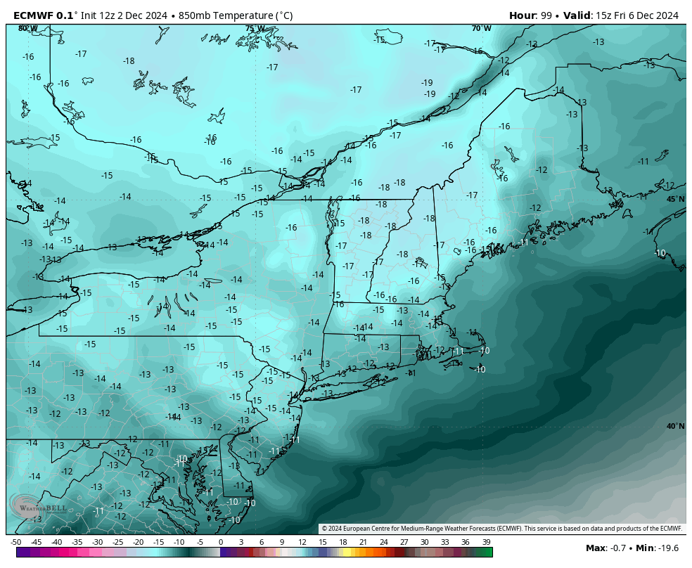
If you’ve been around teenagers in the last year, you’ve probably heard the term “full send” — so I’m deeming this week “full send snowmaking” — we have lots of opportunity, often times through the day, all the way through the weekend. This may vacillate a bit more in the Mid-Atlantic as we have more …
Category Archives: Whitetail Resort
The Week Ahead – Pattern Change Settles In 11/25
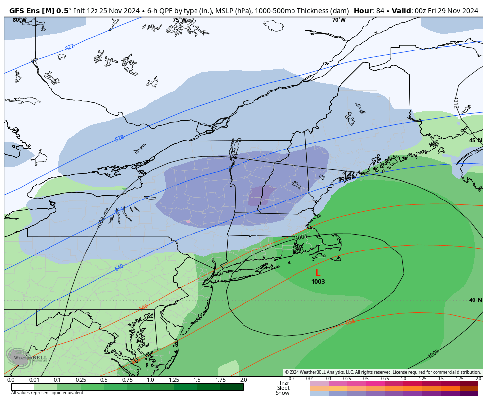
We’ve been talking about a pattern change for two weeks now, but it’s taken some time to settle in, delivering some waves of precipitation and slight warmth within it, but ultimately providing a big trend toward cold, and possibly snowy. The big talk of the town this week is a Thanksgiving storm that the models …
Continue reading “The Week Ahead – Pattern Change Settles In 11/25”
The Week Ahead: Pattern Change Continues 11/18
Our pattern change began last week, and we’re continuing the trend of change into this week with a cut-off low impacting us into the latter part of the week. While there’s a shallow cold air mass settling in tonight and Tuesday, it’s just that — shallow. We’ll see some temperature modification heading through Wednesday before …
Continue reading “The Week Ahead: Pattern Change Continues 11/18”
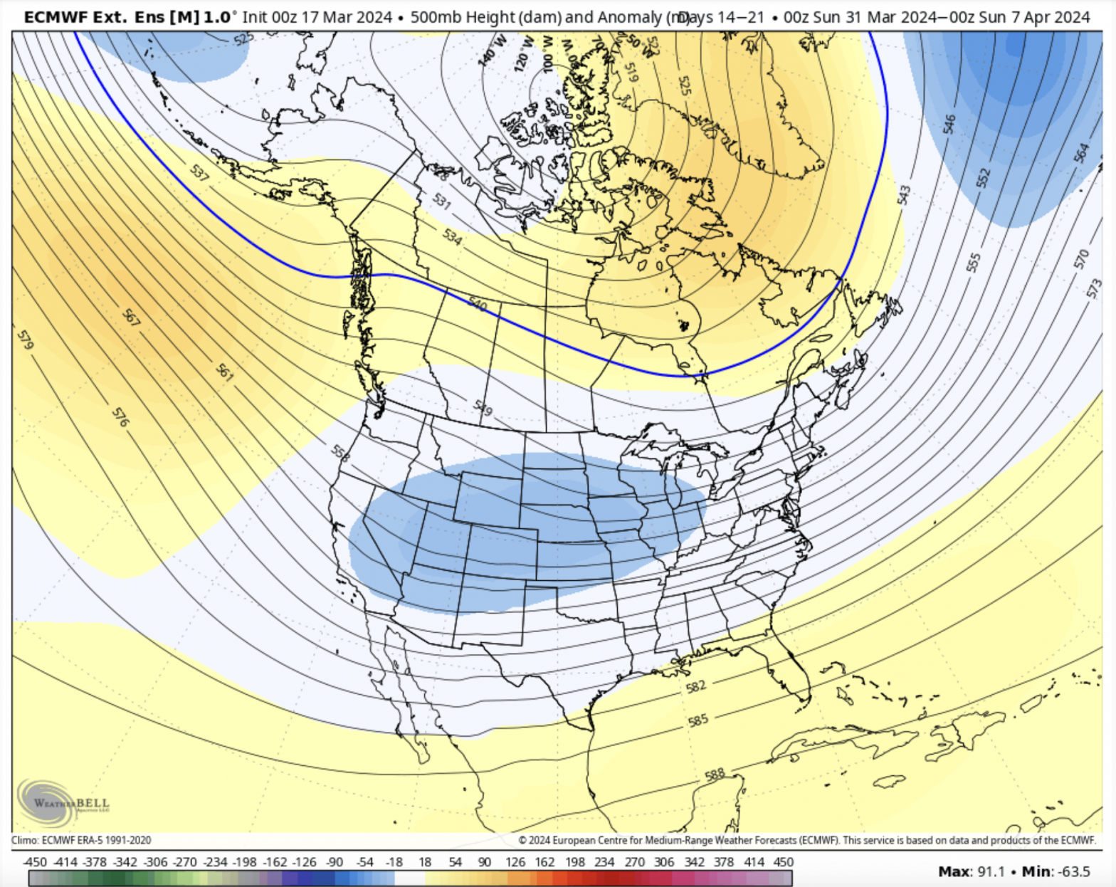
Long Term 3/29
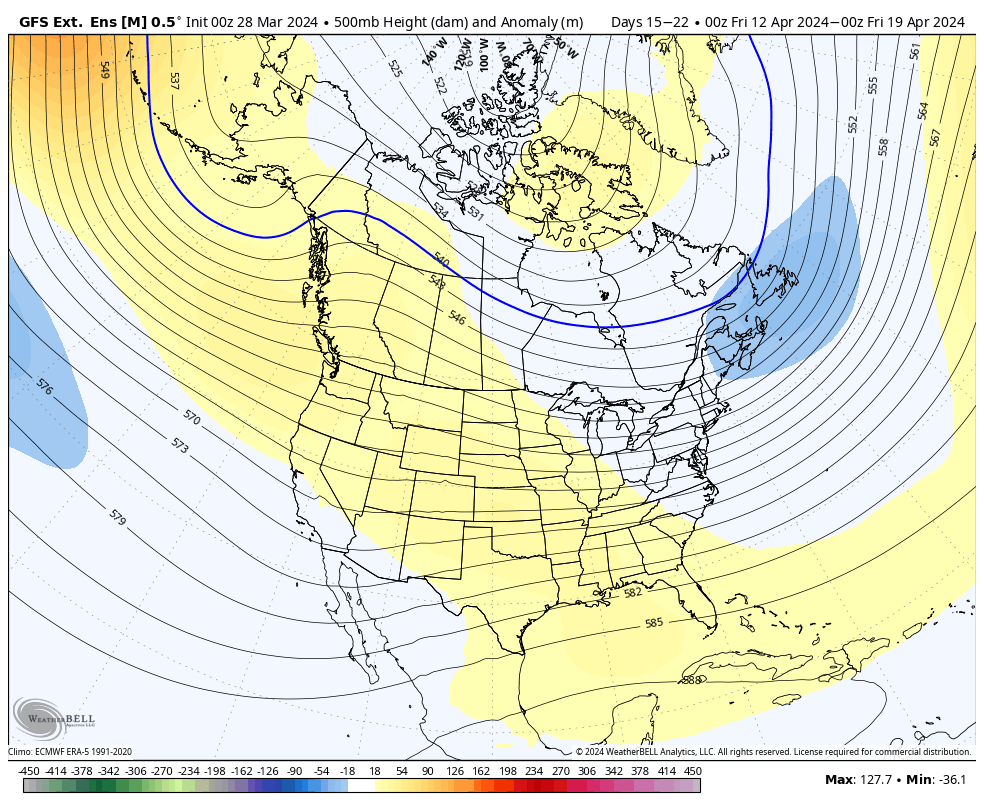
We’re heading into April shortly and while the calendar says spring, winter continues to prevail through the first week. The spring snow doesn’t seem to be over, and with the weakening El Niño, late seasons snow remain in play. For Days 7-14, we’re going to moderate a little bit out of the cooler pattern we’ve …
Week Ahead 3/25

The week ahead isn’t nearly as exciting as last week, despite the global weather pattern having us in a fairly decent early spring position. Latest information from the Climate Prediction Center has us squarely in a moderate El Niño, which means fun is still there to be had over the next couple of weeks. But …
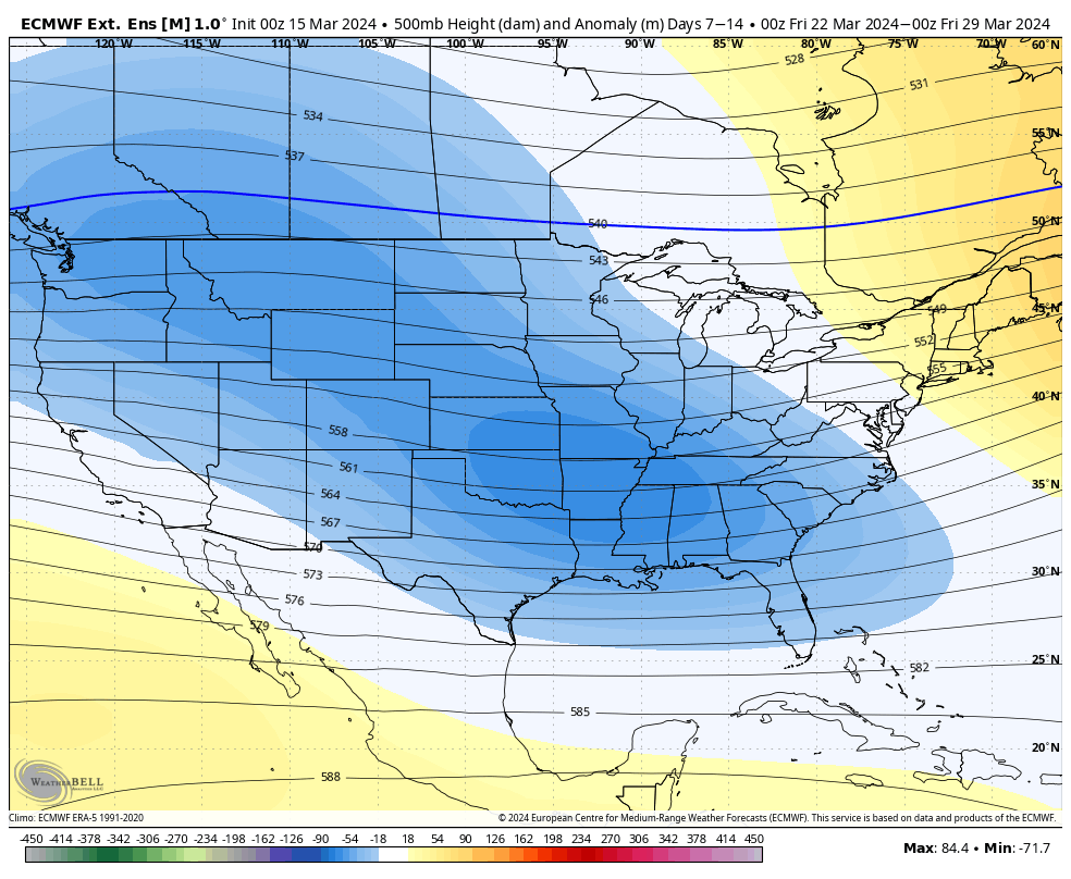
Long Term 3/22
The big story is of course the incoming storm system bringing possibly the largest widespread snow of the season. Mixing will occur in portions of central/southern NY, VT, NH and ME which may impact totals, but we’ll still have a significant amount of snow expected before any changeover. Would also not be surprised to hear …
The Week Ahead 3/18
We’re back to a more winter-like pattern this week, with several opportunities of snow and an overall cooler pattern. Upslope snows will be continuous through the favored slopes through most of the week. We’ll have a system come through on Wednesday which may spawn a triple-point low and create some localized stronger banding. Depending on …
Long Term 3/15
We’re heading into a cooler pattern for next week and it will start to ease up in Days 7-14. The EPO/WPO trend back to neutral in this period. It doesn’t swing hugely positive, therefore I don’t believe we’ll swing wildly the other way temperature wise. The NAO/AO stay negative through the time period as well, …
The Week Ahead 3/11
The rollercoaster ride continues into the second week of March, but overall we are colder. Windy conditions persist into Tuesday, with gusty NW winds continuing in most areas and upslope snows coming to an end in the favored slopes. Those with the upslope topography are nearing or surpassing two feet of new snow from the …
Long Term 3/8
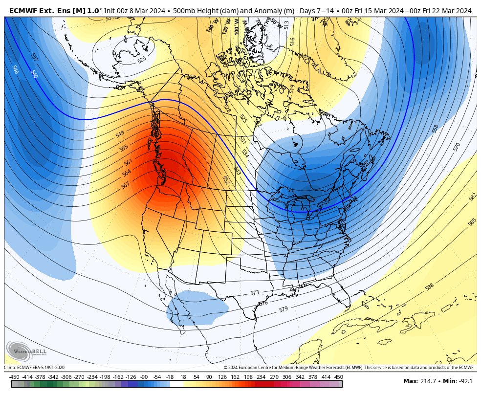
We’re entering back into more of a winter like pattern as El Niño drops down to more of a moderate phase. However, with March comes a stronger sun angle, and therefore we’re inherently running warmer in storm systems. Lower heights return to the east for Days 7-14. The AO/NAO are slightly negative, but not overwhelmingly …