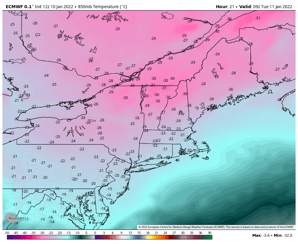
There’s not too much more to this week than the cold. Some of the lowest temperatures seen in the last 4-5 years will be rivaled in the next 48 hours. Pept0-pink is always exciting on snowfall maps, but not quite as welcomed on temperature maps. Wind Chill Warnings and Advisories are in place for much …
Category Archives: Whiteface
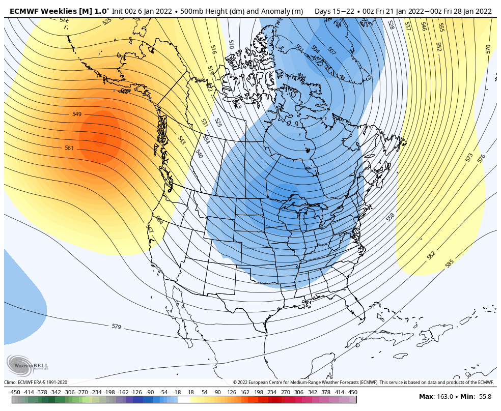
Long Term Views 1/7
It was a lackluster storm today, but it was something! Most areas received 1-3″ of very light and fluffy snow out of this system. We’ll see some upslope snow showers continue into the overnight hours in New England. We have another weak system of mixed precip/light snow on Sunday before the arctic front comes through …
The Week Ahead 1/3
The cold is here and it will settle in deeper Monday night – we see some of the longest and deepest snowmaking windows for the season so far in the Mid-Atlantic. We’ll see a cold start to Tuesday with the sun making a reappearance as well in the east, and a brief warmup ahead of …
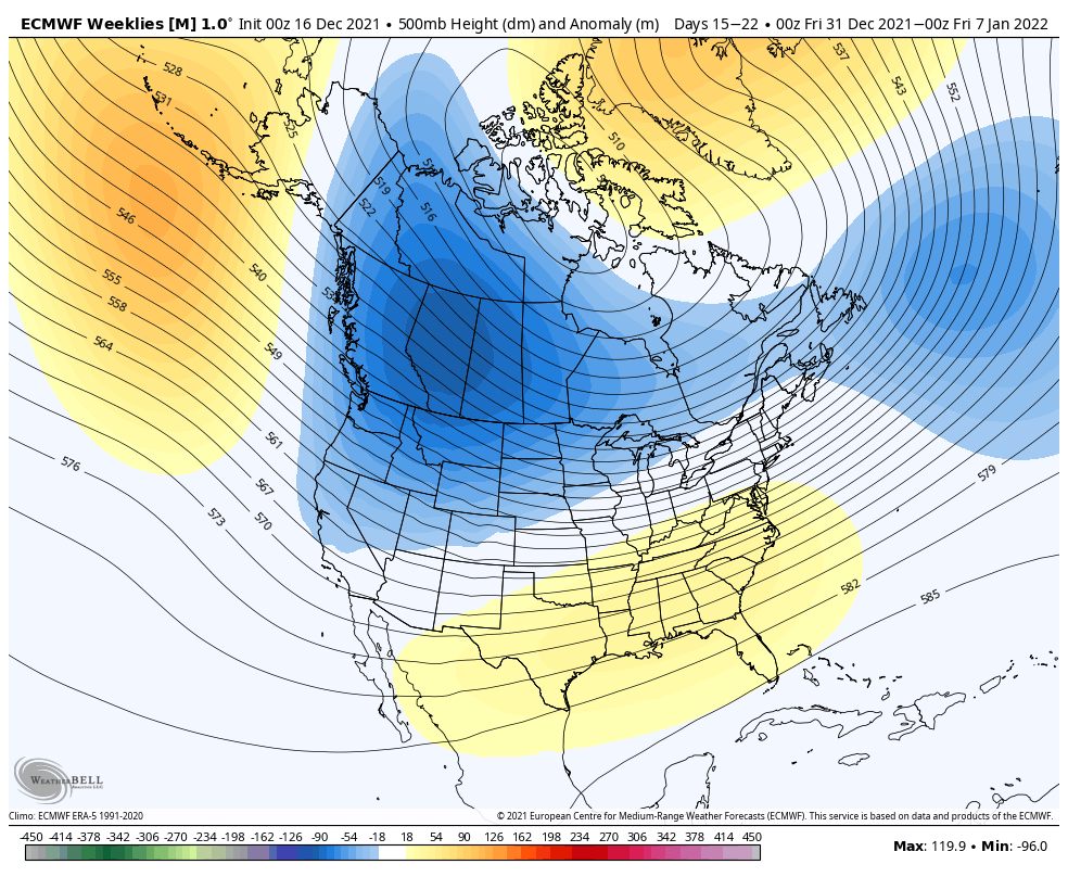
Long Term Views 12/31
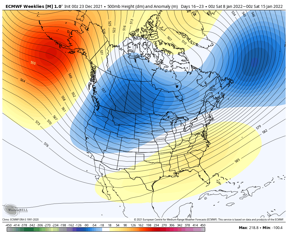
Happy New Year everyone! We’re taking a look into the first couple weeks of January. While it’s not the most ideal overall pattern for the east, it’s one of the most favorable for since we entered the late fall/early winter season. The Euro has not been performing well with this pattern and the winter as …
New Years Weekend System

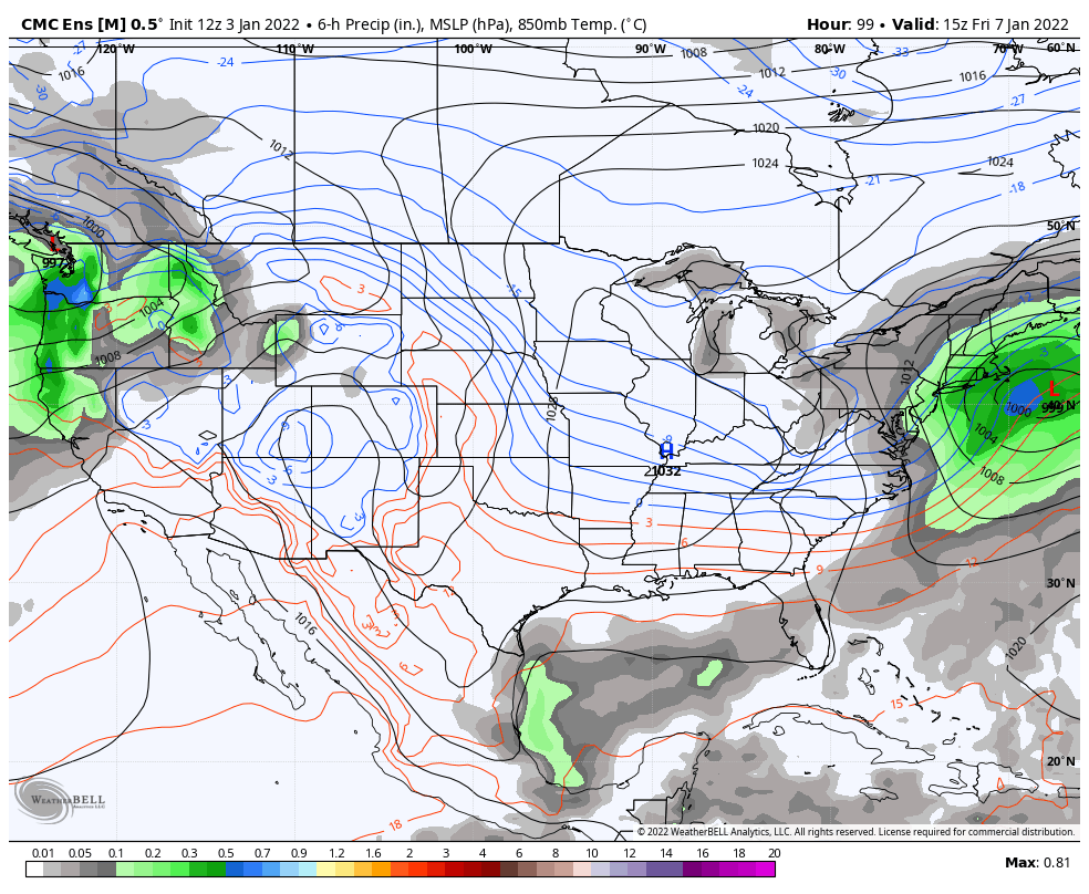
I wanted to provide a quick update to following the discussion on this system in the Monday blog. As expected, models have had a terrible time distinguishing features in this system. With the multiple lows and upper air interactions, it’s been quite a mess to analyze. However, also as we discussed, it would be on …
Long Term Views
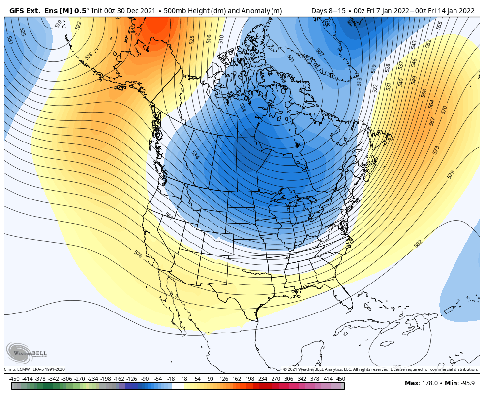
A quick note on the long term views ahead of the holiday weekend… After a temperate week between Christmas and New Year’s, it’s likely for us to see a return to some cooler temperatures for the first week of January. We have the SE ridge that continues to build in the coming week, and starts …
Christmas Storm System
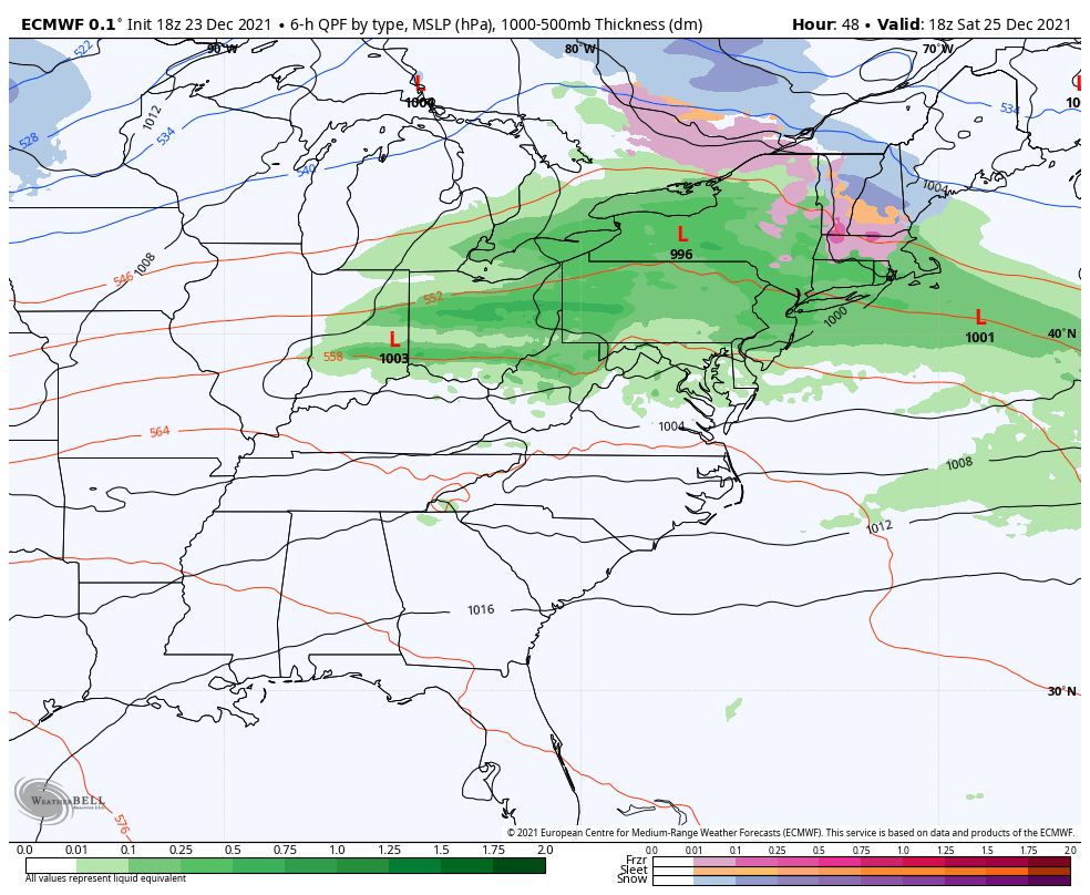
We’ve been keeping close tabs on this Christmas storm system for quite some time now. The SE ridge has had a significant impact on storm tracks and models seem to be confused by storm progression, strength, and overall structure of systems moving overtop the ridge into the Atlantic. By Christmas afternoon, the showers have moved …
The Week Ahead – Unstable Temps, Several Storms
With this progressive pattern into the holiday weekend, we’re seeing wild movements in temperatures as air masses quickly move in and out of regions, which means a continuation of non-diurnal temperature patterns with rising overnight temperatures and falling daytime temperatures becoming commonplace through Thursday. We’ll have two low pressure systems moving through the eastern half …
Continue reading “The Week Ahead – Unstable Temps, Several Storms”
Long Term Views 12/17
Last week we went over a lot of information in several different topics (teleconnections, ensembles and long term) and what we found was that there were several contradicting factors. In the end, we came to the conclusion that it wasn’t the worst of places to be in, because it typically meant that we were dealing …
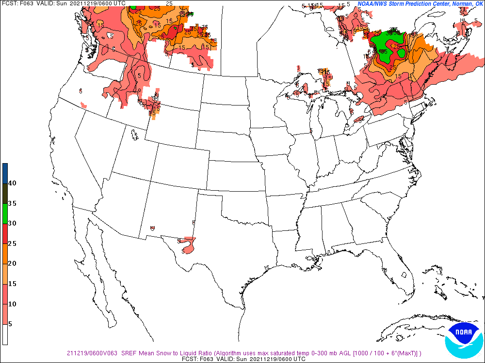
First Decent Storm of the Season
We have our first major snow of the season for the east as a low pressure rides along the stalled front that moves through tonight. While we’re still waiting for our first major snow, this will have to do to get us through Christmas week (although there are some other storms to come before Christmas). …