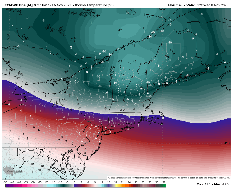
The week ahead will have some volatility to it; we don’t stay in the same place for very long until we get to the weekend. Temperatures rise tonight as the first of two systems this week arrives from the Great Lakes (after bringing some heavier rain there). The band with the warm front is fairly …
Category Archives: Waterville Valley
Long Term Trends 11/3
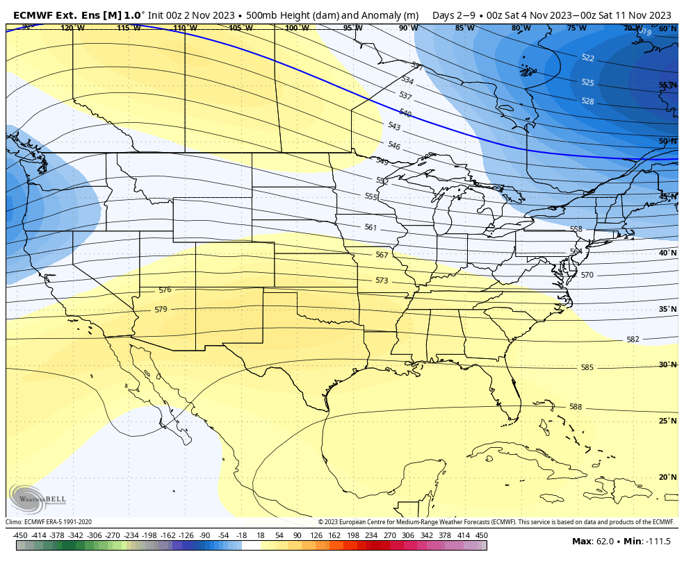
We’ve ventured through our first block of cold, and for now, it retreats until the middle of next week. Heading out into Days 7-14, the eastern trough does begin the retreat, and there’s decent consensus on that. The trough isn’t intensely deep in the East, so the pattern should stay active with the combination of …
The Week Ahead 10/30

Here comes the first cold punch of the season… We’re looking at a slow, gradual temperature decrease tonight with many summits and even base areas getting well into the 20’s for the first time this season. Tuesday will be a colder day but uneventful weather-wise. Many areas will keep the cold despite some sunshine expected. …
Mobile Alert Update
Over the summer, our third-party mobile messaging service implemented new rules and regulations for mobile messaging, including vetting companies utilizing mobile messaging services (to avoid spam messaging). Snowmaker alerts have been successfully vetted and will be re-implemented October 30th after 9pm. A couple notes… Our new number is 1-207-407-5073. You can update your notification preferences …
Long Term Trends 10/27
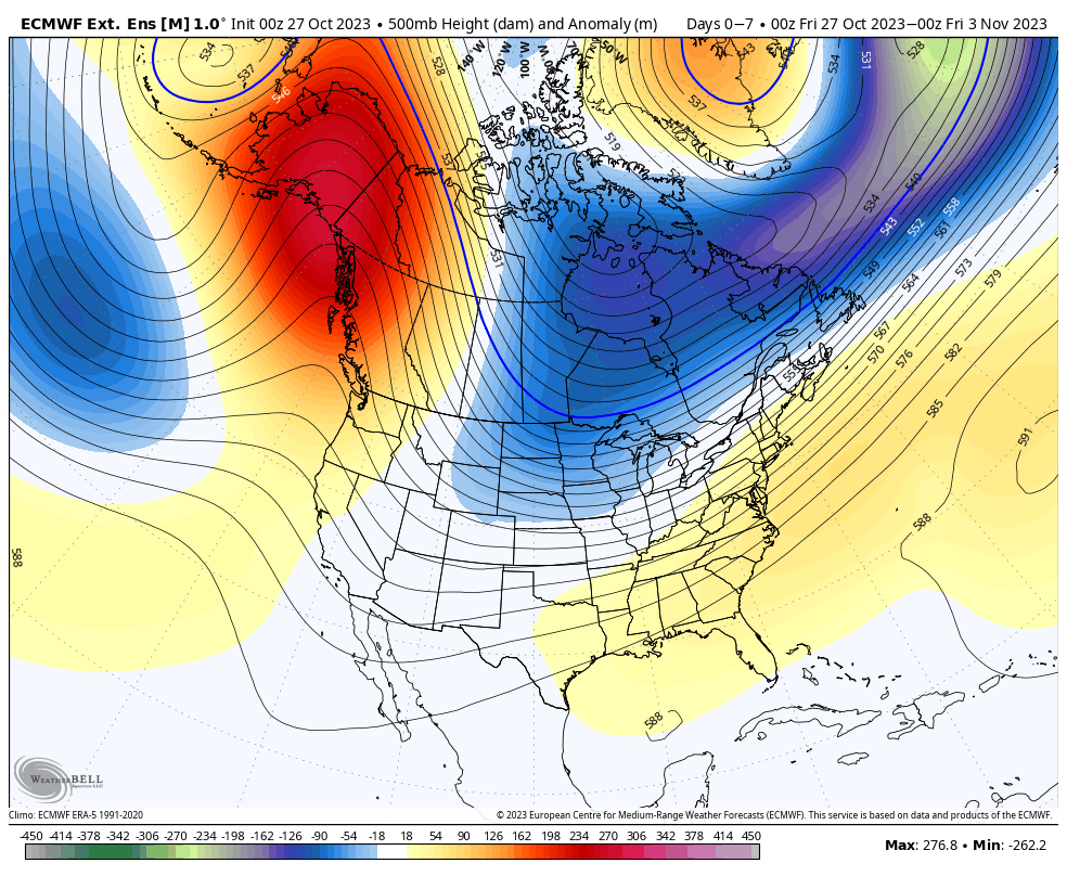
While our first blast of cold is coming in next week, there is some wobble to the depth of the cold. Until the tropics die down, we’re not going to see long term, deep cold. The good news is that week the first full week of November is starting to track a touch colder than …
The Week Ahead 10/23

After another rainy weekend, we’re heading into a warm pattern for the end of the week. I hesitate to call it the last hurrah of warmth, because I think November will be a transition month, but it could be last prolonged stretch of it. Temperatures will be some 8-12 degrees above average through the weekend …
The Week Ahead 10/16
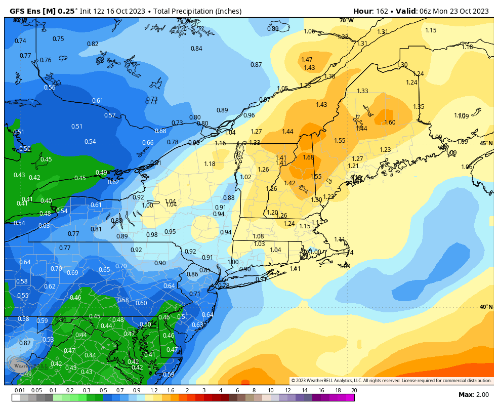
We’re in a typical fall pattern heading into mid-month, with some lingering showers to start the week, and heavier rain possible over the weekend – again. While the thought of another rainy weekend isn’t exciting, it’s encouraging to see a cycle forming in the weather pattern. This is something we haven’t seen since the spring. …
Here we go! The Winter Ahead, 10/9
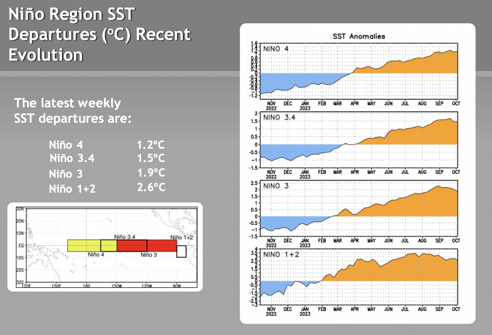
We’re approaching mid-October and there’s been some interesting developments through the last couple of months. Many of us were able to chat about the winter ahead in our summer meetings, but some of those were over 2 months ago, so I wanted to create a quick blog about the winter outlook. We’ve had a bizarre …
Long Term Views 4/14
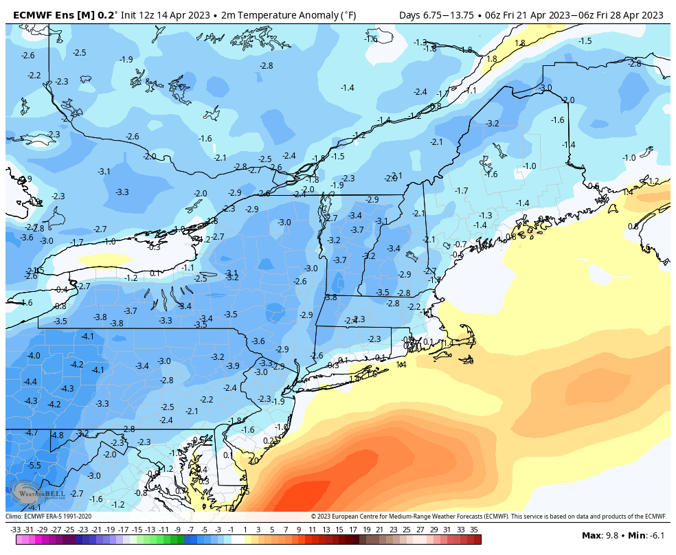
We’ll end up above average temperature-wise for next week despite more rain and active weather coming in. Much of this is skewed from the weekend’s temperatures, as those will remain well above average before we cool into early next week. However, for Days 7-14, we’ll see temperatures even out or even fall slightly below average. …
The Week Ahead 4/10
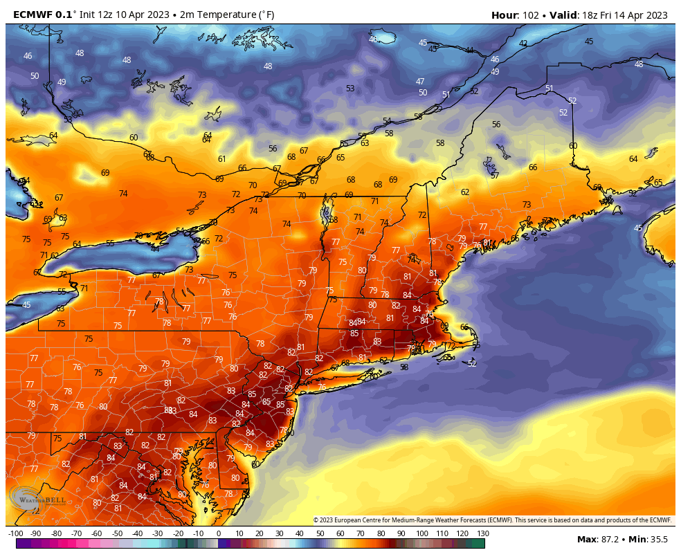
The week ahead is fairly boring weather-wise, but providing some stellar spring ski conditions to areas remaining open. Aside from some showers late Tuesday night in northern New England, we’re very dry this week. Fire Weather Watches have been issued in many areas as well. Temperatures continue rising through the end of the week – …