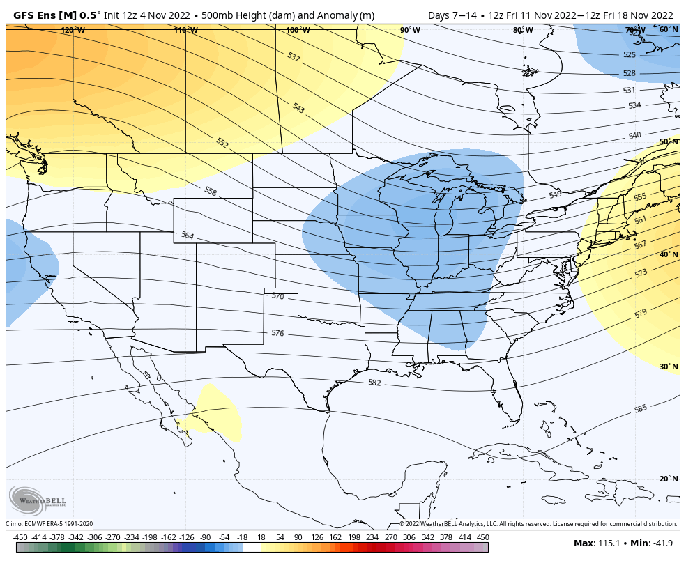
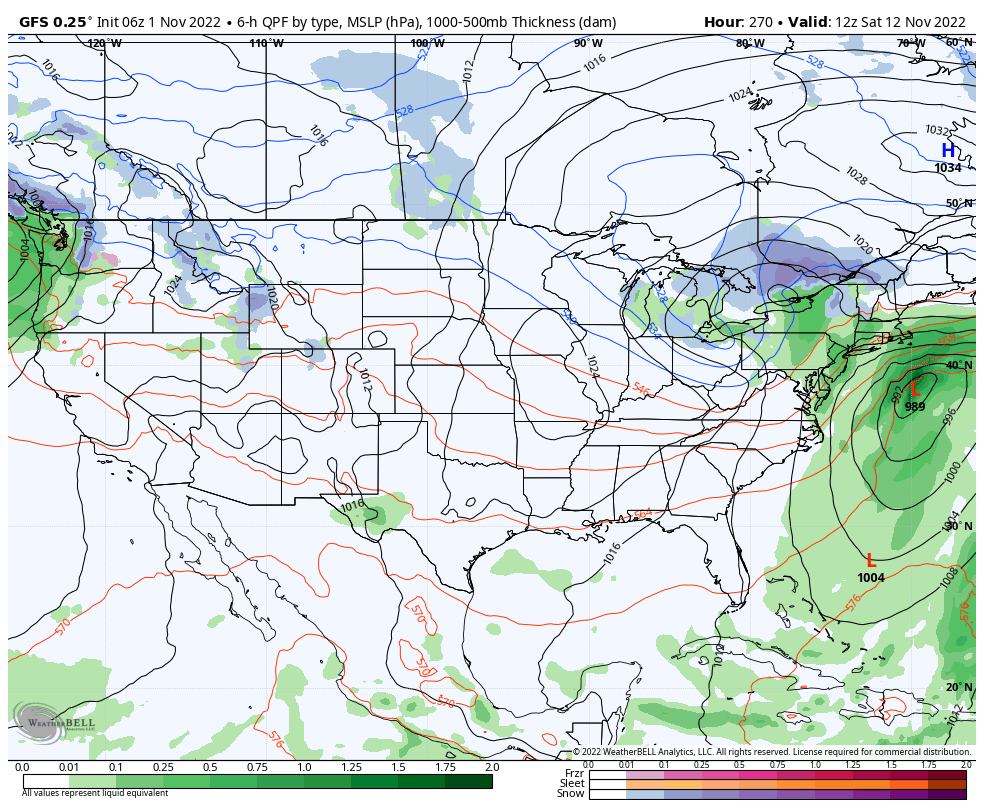
We are finally turning the corner after a warm weekend headed our way. The first infusion of cold comes quickly next week (11/8), however sustained cold will begin coming in surges beginning next weekend (11/12). The pattern will be active and there are still pieces of tropical energy that are roaming around the Atlantic, therefore …
Category Archives: Waterville Valley
Additional Note on Tropics 11/1
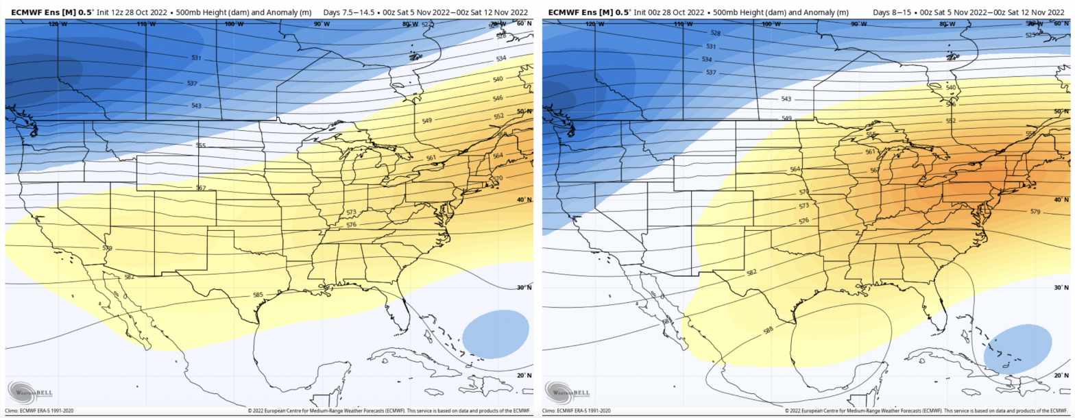
For the last several weeks, we’ve been talking about the active tropics creating volatility in the long term. Due to the weak handling of tropical systems by models, we tend to have high variability in model runs for Days 5+, and cold surges not coming to fruition. I wanted to show you the last 4 …
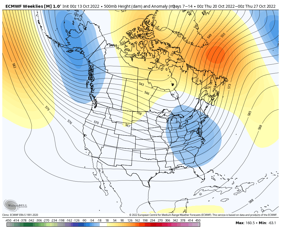
The Week Ahead 10/31

It’s fairly quiet and warm during the week ahead as we’ve been talking about for a couple weeks now. The potential cold surge over the Sunday-Monday time frame has flattened out with the tropics remaining active. The only chance of precipitation comes from some stray showers throughout the area late Monday into early Tuesday. We …
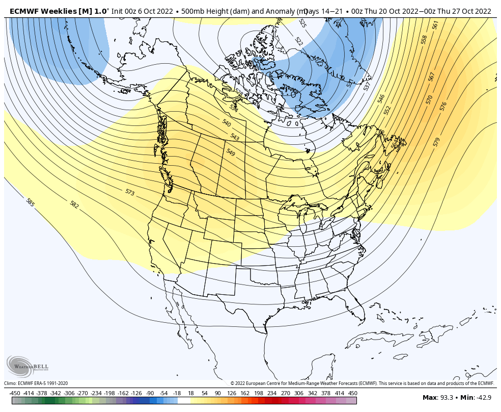
Long Term Views 10/28
With the tropics remaining active, we’re not seeing much in the way of sustained, deep cold. However, we should be seeing some pattern changes heading into mid-month. Several models have been juggling cold surges beginning next weekend, which I’ve mentioned in the forecast notes over the past couple of days. There’s quite a bit of …
The Week Ahead 10/24
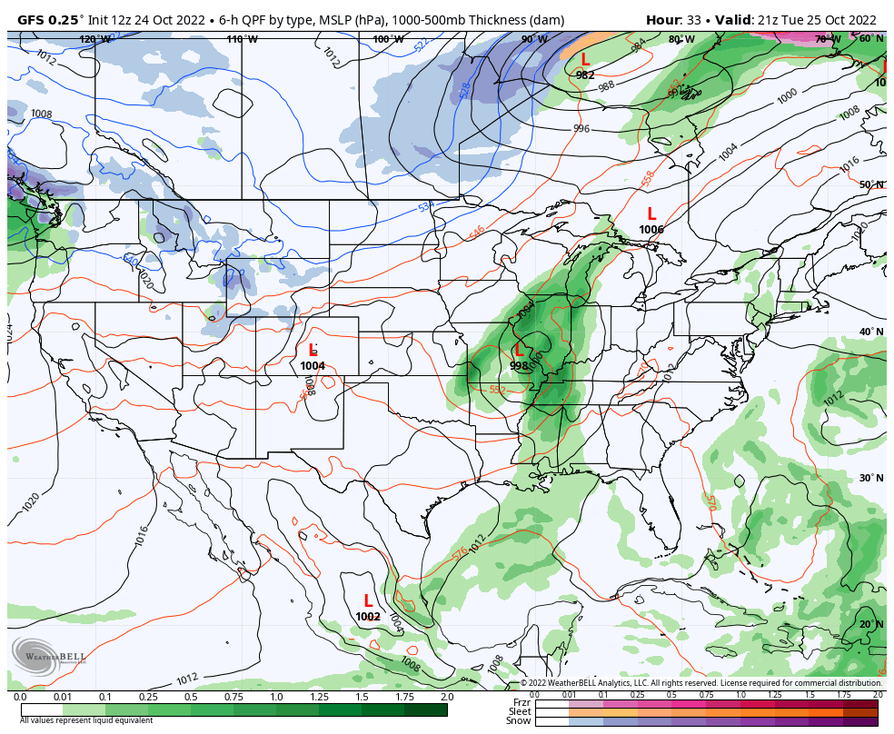
Another rainy start to the week for the Northeast as a weak low pressure system continues to bring showers and a couple isolated thunderstorms. We are also watching the tropics for a piece of energy near Bermuda that’s attaining tropical characteristics. The National Hurricane Center actually gives it a high chance of formation in the …
Long Term Views 10/21
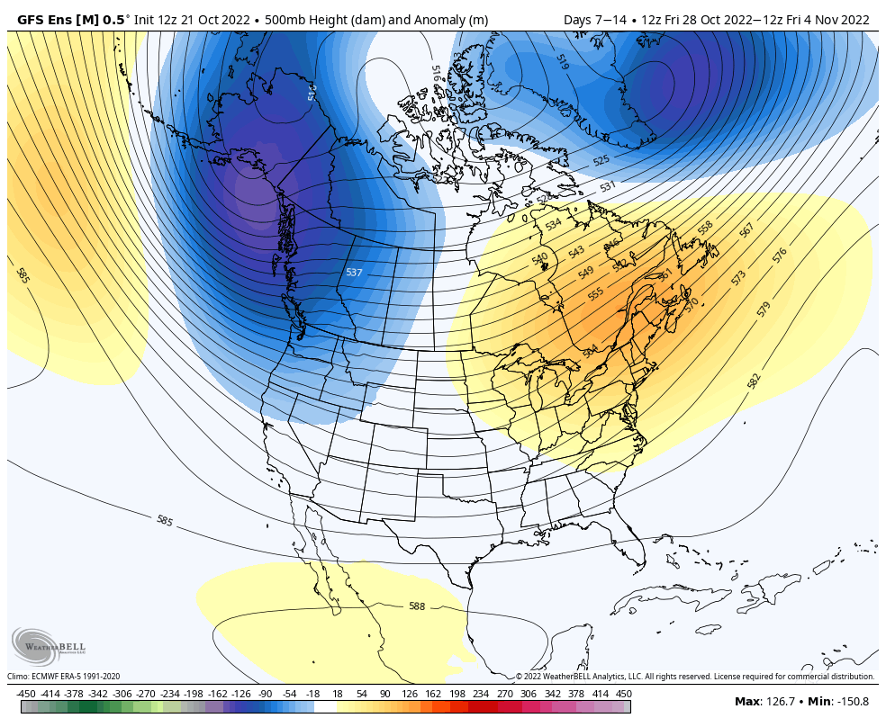
Unfortunately, we haven’t seen much change in the pattern heading toward the end of the month and early November, yielding not-so-great news in terms of snowmaking opportunities. While tropics aren’t very active, there are still a couple areas of interest that have popped up in the past week. We’re also still seeing lingering overall global …
The Week Ahead 10/17
This week features some of the first lake effect snow bands in the Great Lakes, another round of rain in the Northeast (though not as heavy as last week), and a brief cool down. The depth and strength of the cold doesn’t quite make it in to the Northeast as compared to the Great Lakes, …
Long Term Views 10/14
As briefly mentioned in the long term blog last week, a lot of the cold depth and geographical movements can be altered by what’s occurring in the tropics. With activity still apparent this week and into the next week or so, it’s not surprising that the once-seemingly-robust cold burst next week is getting a little …
The Week Ahead 10/10
There’s not much excitement this week in terms of cold or snowmaking windows. Temperatures begin moderating midweek, with a fairly nice, relatively warm day expected Wednesday before some substantial rain arrives with a cold front and attending low pressure later Thursday into Friday. After a fairly dry last couple of weeks, the rain is welcomed …
Long Term Views 10/7
While the first push of true “cold” arrives this weekend, it’s tempered a bit by a still active tropical Atlantic. We’re not seeing things quite as cold as projected earlier in the week. In addition, a secondary batch of cold that looked like it would arrive around 10/14, looks to be closer to 10/18, give …