The old March saying is “in like a lion, out like a lamb” – I’m going to switch that up and say “in like a lamb, out like a lion” because we have some interesting movements in the teleconnections right now. I don’t think this will be a March 2018 repeat (unfortunately) when we had …
Category Archives: Vail Resorts
The Same Old, Same Old
If we want to find the silver lining, it’s that we won’t see a total washout of a rain event for Vermont. There is a chance of rain mixing at the bases, but above 2,000 feet we should be seeing snowfall. While the EPO/NAO turned neutral, it wasn’t enough to lock in the cold air, …
Could The Stars Be Aligning?
Stars certainly aligned for vacation week – some windy days here and there, but fresh snowfall, plenty of sun, and warming temperatures to end the week made for a stellar holiday period, and vacation week for the ME/MA/northern NH districts. A couple blogs back we spoke about the NAO (North Atlantic Oscillation) starting to dip …
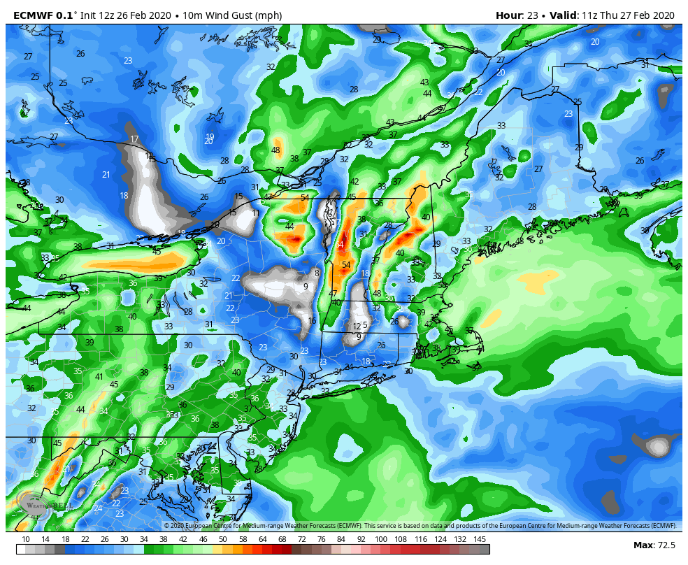
High Pressure Winning Out?
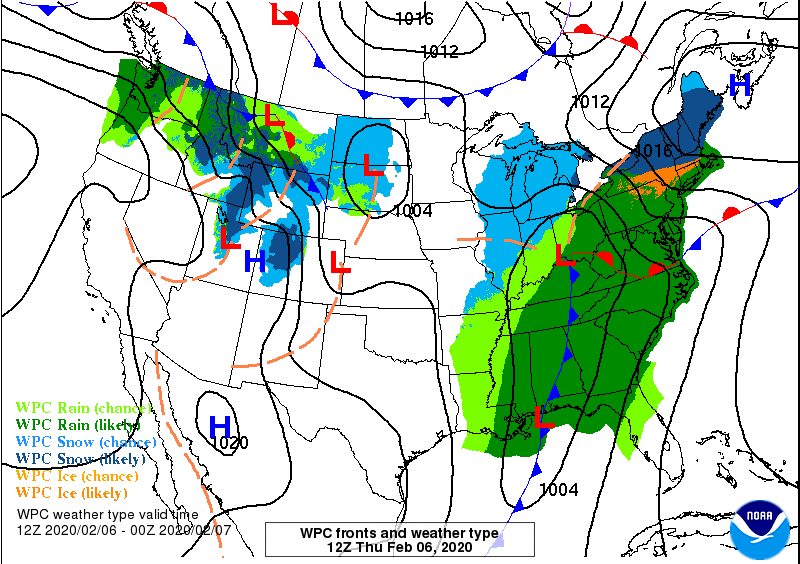
With the lack of blocking, or a negative NAO/AO in our teleconnections, our best bet are well-placed high pressures, and it looks like that may come into line and in our favor for the 3rd storm in a row. Notice the wall of high pressure systems from the Midwest into eastern Canada – this is …
Light Snowfall & Vacation Week
We have a light refresher snowfall coming our way at the most important time frame – right before vacation weeks. It’s a quick moving system with marginal temperatures, so it will be a wetter snow for Hunter, Mount Snow, and likely Attitash. Wildcat may sneak away with a less-wet snowfall. Overall, amounts will range from …
Update to Video Blog
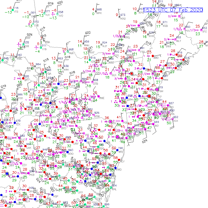
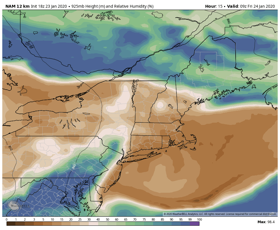
Since posting the video blog around 9am this morning, we’ve started to see some more snow transition occurring. Intermittent snowflakes already at the summit of Mount Snow, and at the base/summit of Wildcat/Attitash. As the low ramps up, the warm layer aloft could still be moving around, which means we could still see some mixing …
One-Two Punch Thursday/Friday
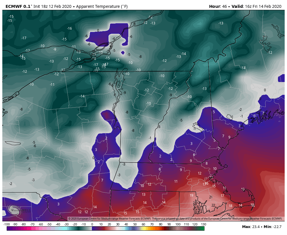
As we mentioned in the previous blog, with the NAO and AO staying overwhelming positive, we’ll be hard-pressed to see all snow events for our region. Events will be marginal and we’ll likely see rain and snow events in the same week, or for this week, nearly in the same storm. Arctic air settles in …
It’s About To Get…Interesting
Lack of blog posts means the weather’s been boring, or quiet might be a better word. But quiet has been great for conditions – key words from last week were “bluebird” and “perfection”. I was able to ski in Maine on Friday and it was indeed those two things. But alas, all good things must …
Incoming Storm Trends Warm
With humidity values plummeting to near zero % this afternoon in some cases, we had warmth a day early. Though a freeze/thaw pattern was expected for the end of the week, temperatures in the 40’s came in early this afternoon briefly before coming down with the lowering sun angle. The temperature rollercoaster ride is likely …
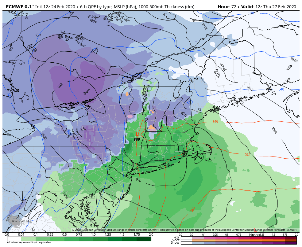
Snow to Liquid Equivalents
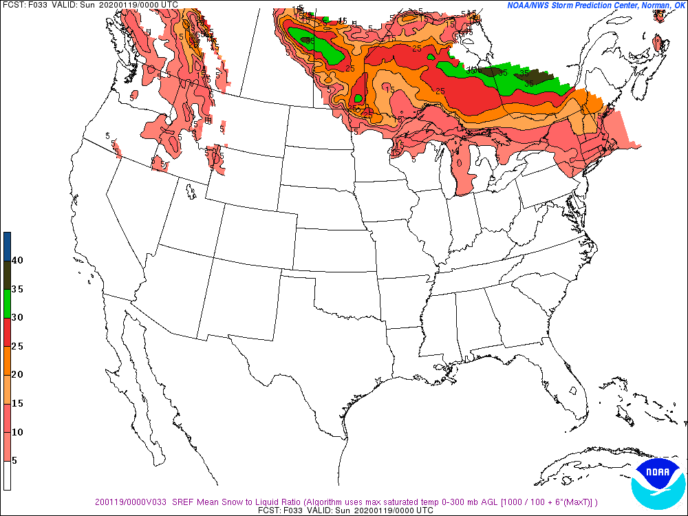
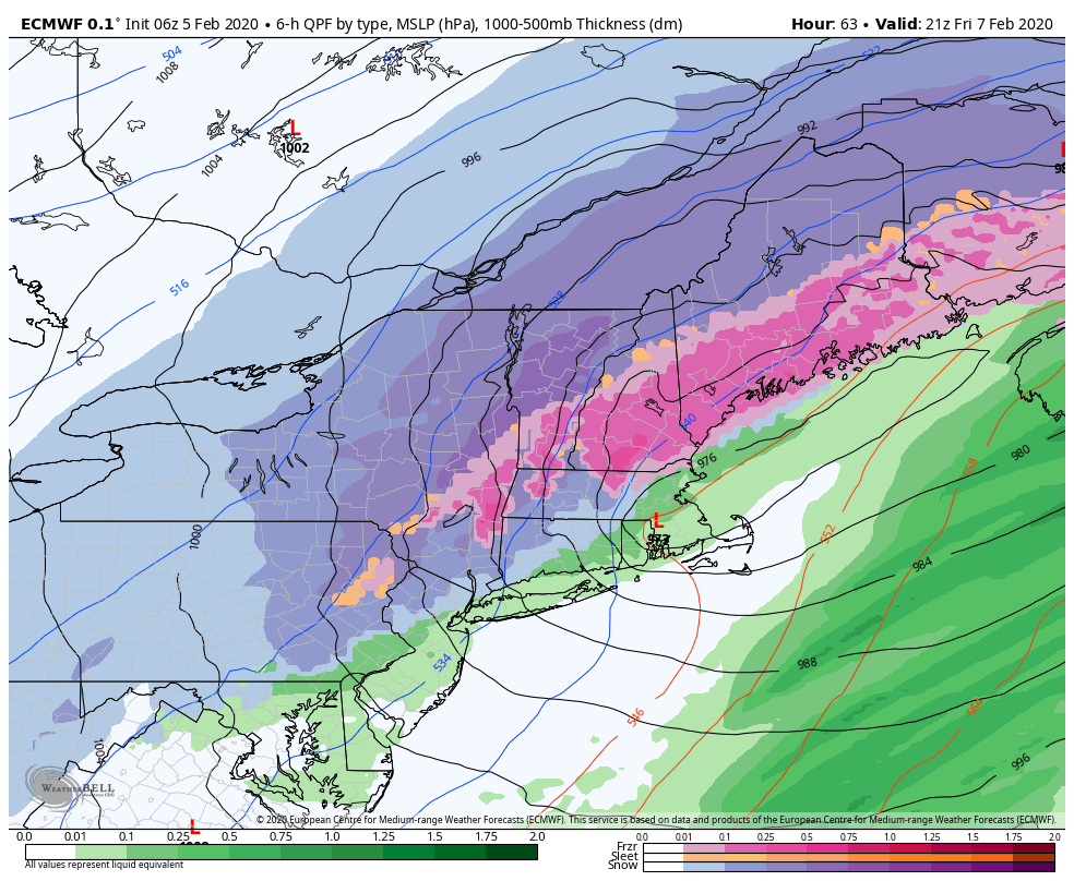
We have an incoming storm that all in all, isn’t very different from the last one if you look at the amount of liquid coming down. It’s a little larger, but same speed and low track. However, we’ll actually have some really interesting snowfall discrepancies, especially when you compare Hunter/Mount Snow to Wildcat/Attitash. The first …