Snow showers continue today as wind gradually lessens throughout the day. We’ll have some colder air come in tonight, though it will be a bit short lived as a weak impulse of energy comes in Wednesday. This will spark a slow rise in temperatures for Wednesday, but cold air returns for Thursday. This happens again …
Category Archives: Vail Resorts
Daily Update 1/16
The storm continues to move through New England this morning with a variety of precipitation. Most areas above 1,000 feet have done fairly well, and we’ll continue to see the snow pile up in the higher elevations. In terms of the “battleground” between rain and snow, it’s been over my house in Norway, Maine and …
Daily Update 1/13
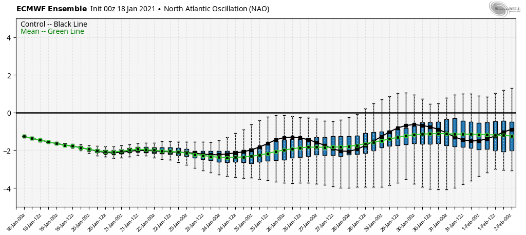
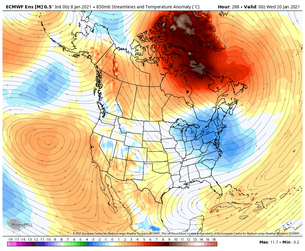
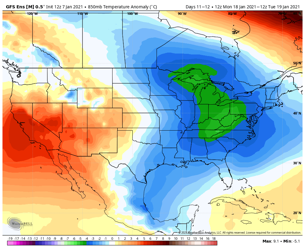
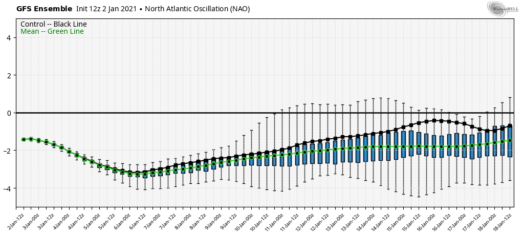
The low placement continues to be of key concern heading into Saturday’s cold front moving through the region. Models continue to try to decipher where the rain/snow line will form, and elevation will play a big role in precipitation type too. We have a negative AO & NAO, which should theoretically hold some cold air …
Daily Update/Week Ahead 1/11
We have another quiet few days before the pattern picks back up later this week into the weekend. Ahead of a cold front, we’ll have some warming late in the week, though it’s not expected to be significant warming given the current air mass. However, we’re watching the incoming front for possible low pressure development, …
Daily Update 1/8
While the relatively boring weather pattern continues, the pockets of dry air moving in randomly have been playing quite the temperature roulette game. Fluctuations of 7-10 degrees in a matter of minutes have been seen, along with sun snow showers, and some incredible inversions. This is overall due to the lack of flow at certain …
Daily Update 1/7
The weather pattern continues on this uneventful path for the next couple of days. We’re starting to introduce some drier air Thursday and especially Friday, therefore expect some erratic temperature movements, in addition to base/summit temperatures not having the usual spread. We’ll stay in this zone until Saturday, when we’ll finally be influenced by something …
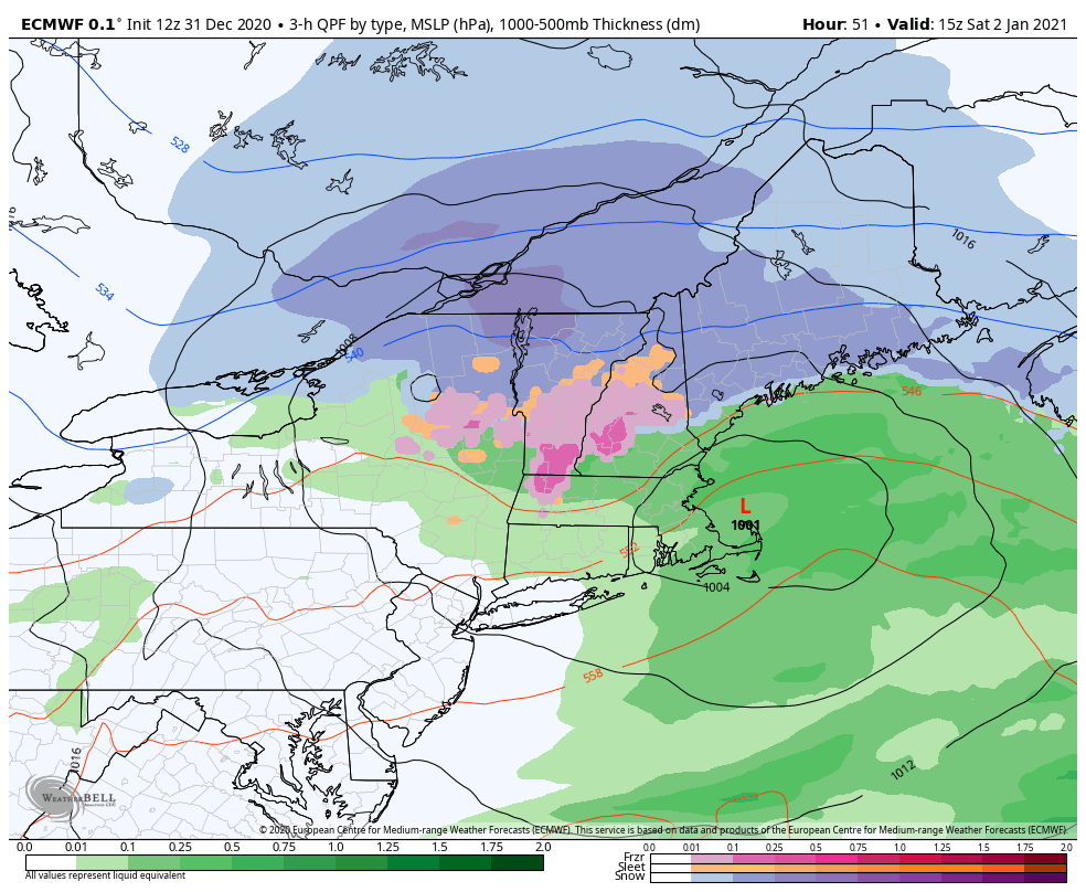
Daily Update 1/2
Not too much to update on today – the storm has departed and left a blanket of snow in its wake throughout Vermont, New Hampshire and Maine. Highest amounts were in the expected areas of northern VT, NH and into Maine. Up to 8″ have been reported. We’ll have a quiet 24 hour period before …
Stratospheric Warming
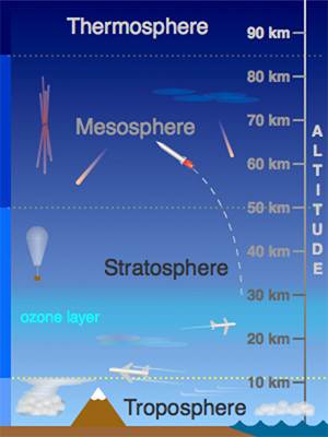
While you may not hear much of this on TV or in normal weather websites, stratospheric warming can have a large impact on the weather in the eastern United States. The stratosphere is roughly 10-50km into the atmosphere, the next “sector” of atmosphere above the troposphere, which is where weather lies, as do we. The …
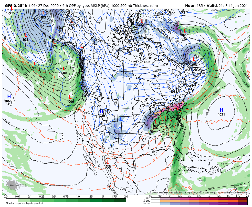
Daily Update 12/31
We close out 2020 with temperatures on the move downward after some rain/snow showers came through earlier today. This front will sag to the south of the Mid-Atlantic as the next piece of energy gears up in the south. There’s a fair amount of energy with this system, producing a swath of severe weather in …
Daily Update 12/27
After a cool start, temperatures begin to moderate today ahead of a front coming through on Monday. Though not “warm”, it will be warmer than yesterday with more cloud cover as well. The front approaches Monday morning and is through the Northeast by Monday evening, along with some light snow and rain showers. Snow may …