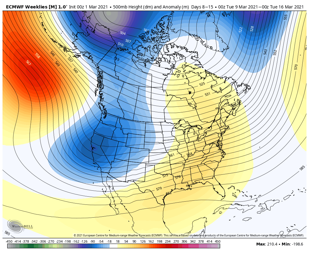
We’re looking at a fairly quiet week precipitation-wise, but the warmth is coming in, especially by the middle and end of the week. For most, these are our highest temperatures since Christmas. The “breaker” of the warmth is going to be a front that sags south on Friday, which will end up being our transition …
Category Archives: Vail Resorts
Long Range Views 3/5
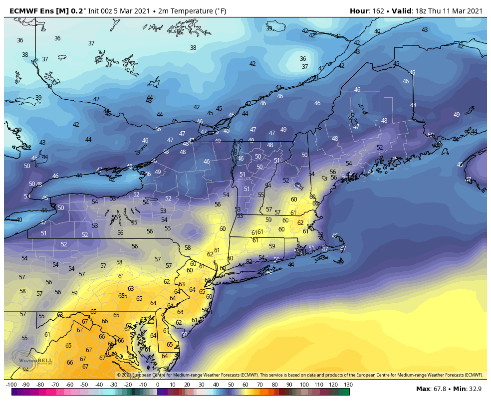
Perhaps the most striking piece to begin with is that a week from today, when the next long range forecast comes out, temperatures may be some 40-60 degrees higher than they are right now. Currently, the peak of the warmth looks to hit on Thursday/Friday after a several day build. March warmth can be bullish, …
Daily Update 3/4
The pattern returns to a very dry solution with the cold arctic high shunting everything to the south of us. Aside from snow showers on the favored slopes in Vermont, New York and New Hampshire, precipitation will be at a minimum until the middle of next week. Wind is going to be the biggest player …
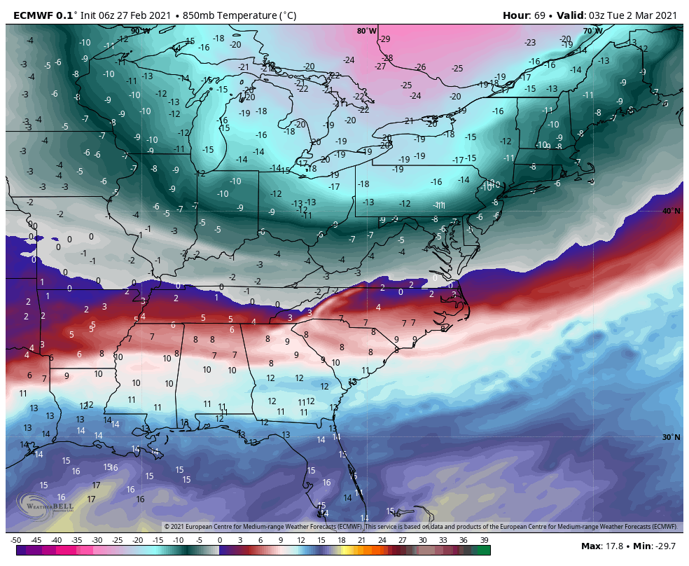
Daily Update 2/27
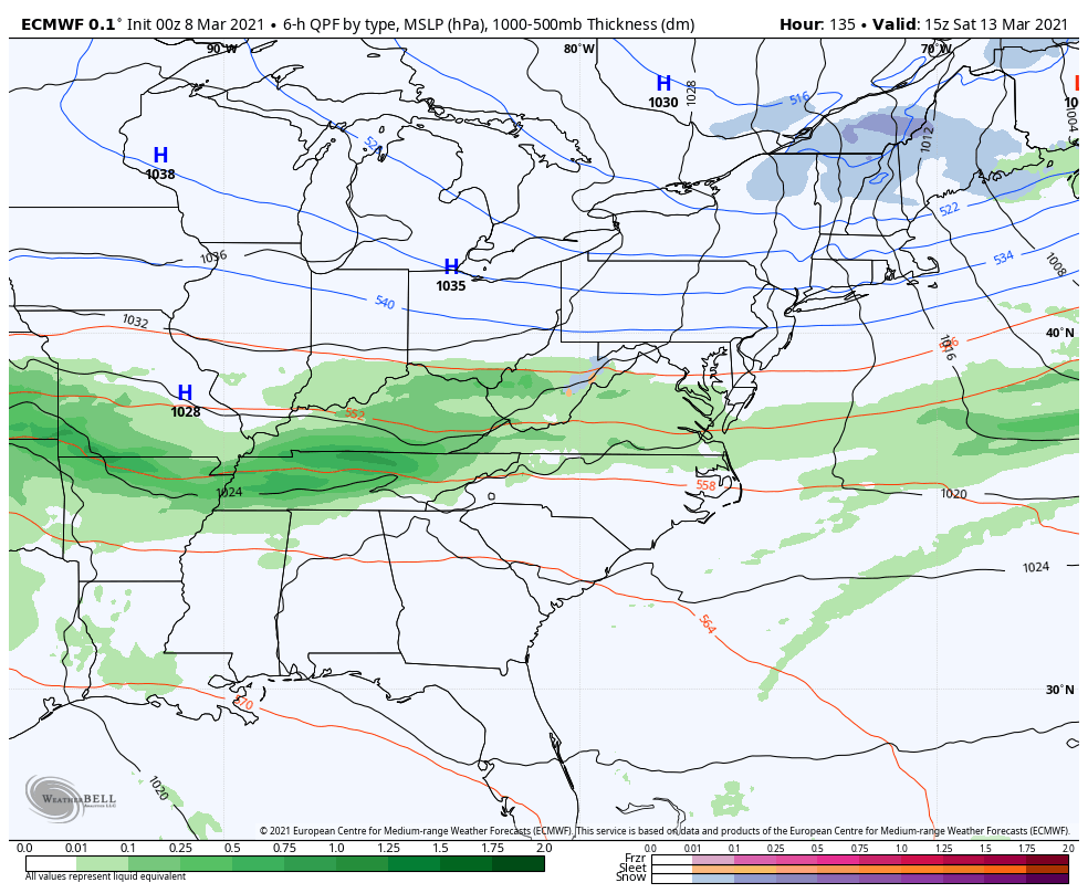
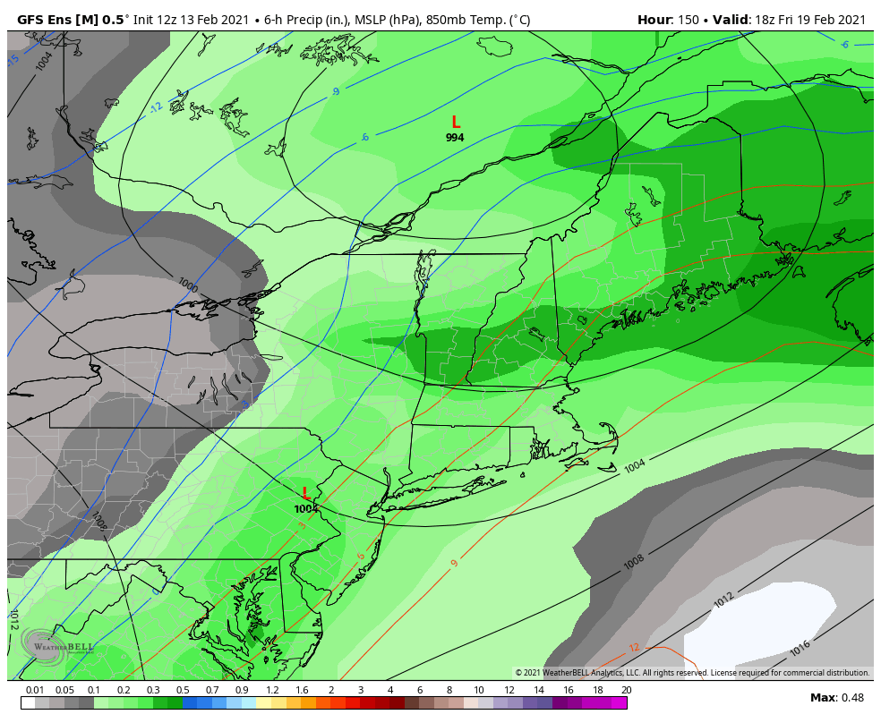
Our storm system continues to move through this morning with mixed precipitation and rain in the Mid-Atlantic and even southern New England. Most accumulation remains below 2″, with the exception of the Whites and into Maine where we could pick up 2-4″. This particular system departs this evening ahead of another wave that arrives along …
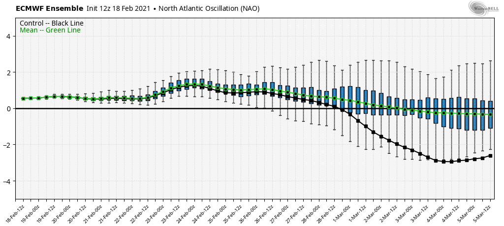
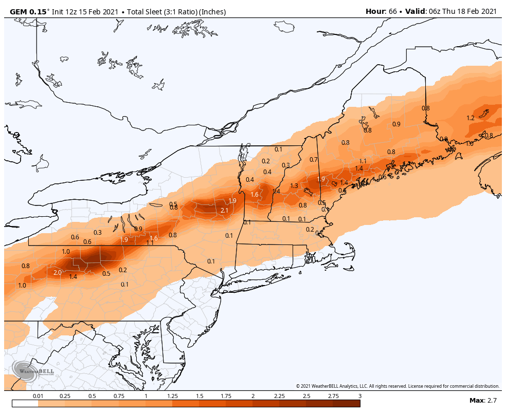
Daily Update 2/18
The incoming system is fairly weak and won’t bring too much excitement north of the Catskills. We’ll stay cloudy through Saturday before the system and lingering snow showers depart. Farther south, another round of sleet and snow can be expected, with a widespread 3-6″. We’ve hit that point in the winter where we are on …
Storm Update 2/15
The warm air aloft is winning out with the incoming storm – the NAO has shifted positive, which was a concern in this flip – and therefore we’re not able to hold the cold through the entire column of air. We keep cold at the surface thanks to cold air damming, but that can only …
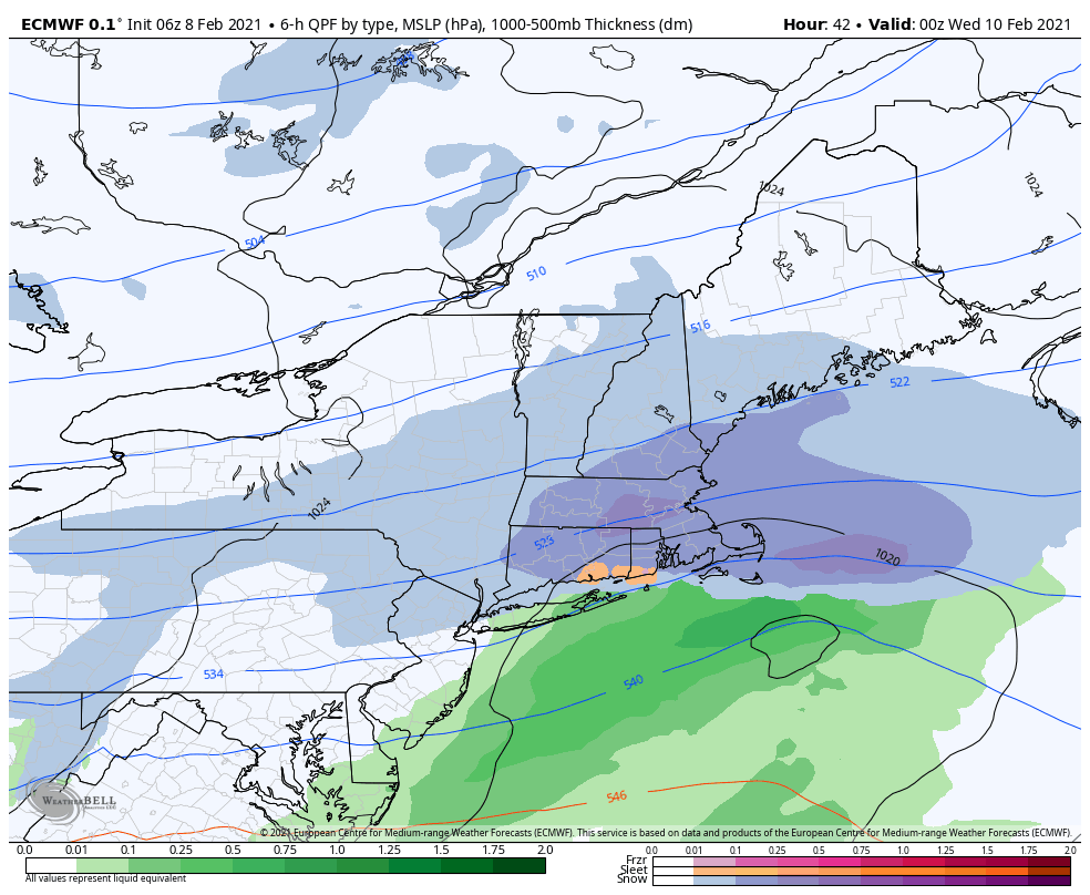
Storm(s) Update 2/13
Not too much change with the incoming pieces of energy. We’ll have some very light snow shower activity in New England on Sunday, which may be accompanied by freezing drizzle. The Mid-Atlantic will certainly be dealing with light icing. The moisture levels for Monday look low, however given a pattern that has strung out pieces …
The Week Ahead 2/8
It looked more exciting previously, and while there will still be areas of energy coming through, they are being shunted to the south due to the strong blocking to our north and the arctic intrusions. The initial possibility of several light to moderate systems may just be light, at best, until we can get the NAO …
Daily Update 2/6
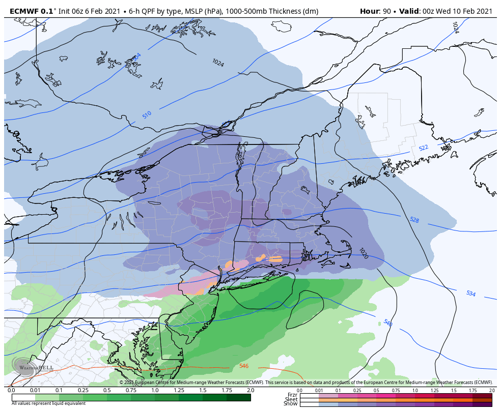
Wind has started to pick up as colder air settles in, especially into tonight. Sunshine has allowed temperatures to warm a bit above forecast, but they will come down quick as the sun angle falls. We’ll have a cold start to Sunday with our incoming system. This will be a fairly low impact, low snowfall …
Daily Update 1/30
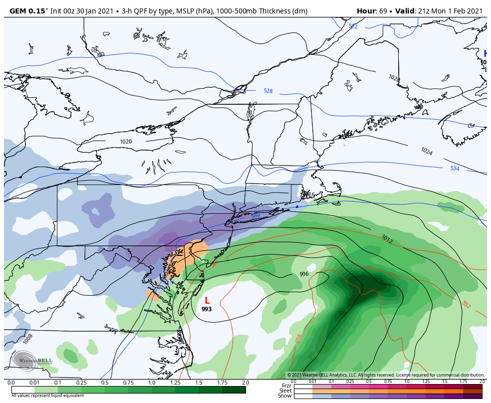
As the arctic grip lessens throughout today and Sunday, we’re watching our next system come in with some disorganized potential. I say disorganized because it doesn’t look like the classic nor’easter; the phasing is slightly off but good enough to develop a potentially significant snowfall, not only for New England but for much of the …