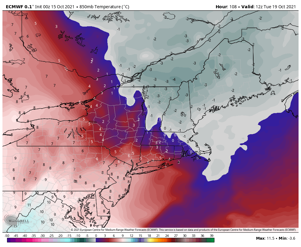
For the past couple of weeks, we’ve been highlighting the necessity of the tropics to shut down before we can get cold shots in and try to sustain it for any reasonable amount of time. There’s one disturbance in the middle of the Atlantic meandering around with a 0% chance of formation in the next …
Category Archives: Vail Resorts
The Look Ahead – Final Thoughts
We have a busy week ahead with weather systems – that will bring a wide variety of temperatures to the area. Temperatures warm into the midweek before a cold front comes through Wednesday. We’ll have a low pressure move along the front, which brings rain to the area, though we may see some snow on …
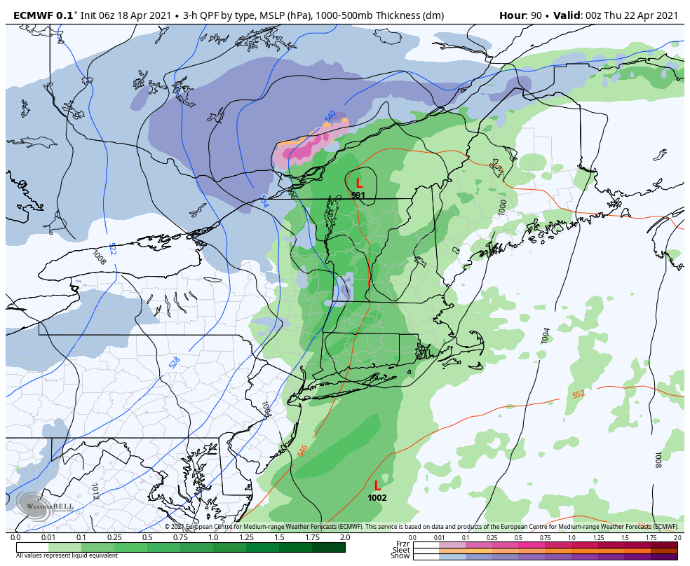
April’s Revenge – Storm Update 4/14
We’ve had a cut-off low in the Great Lakes that’s been circling up there for a couple days now. Combine that with a southern stream piece of energy flying up at the east coast, and we have ourselves a mid-April nor’easter – something we’ve been eyeing and watching for since late last week. You can …
The Look Ahead – The Season Winds Down
With the warmth of last week, the season is winding down quickly heading into this weekend. It was certainly a season filled with twists and turns from Mother Nature. Looking ahead to this week and the weekend, we have dueling spring/winter feels coming in with a cut-off upper level low that will keep clouds and …
Long Term Views 4/9
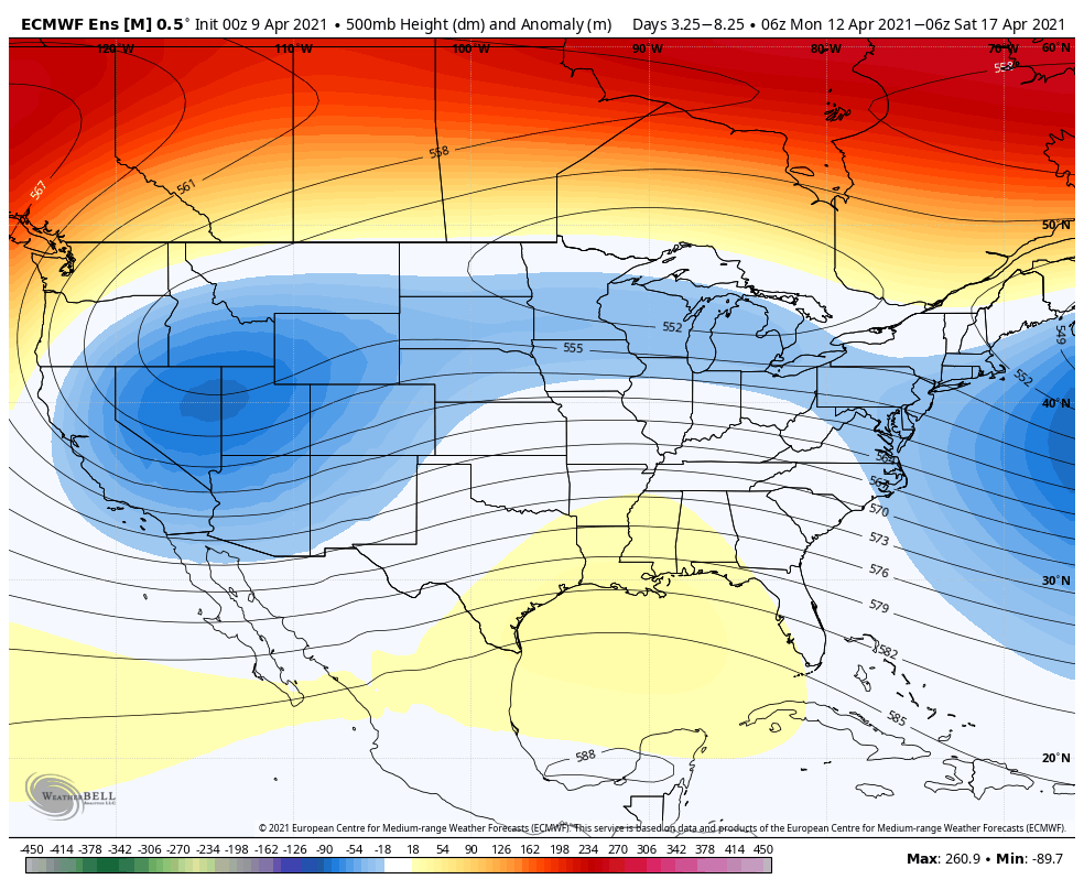
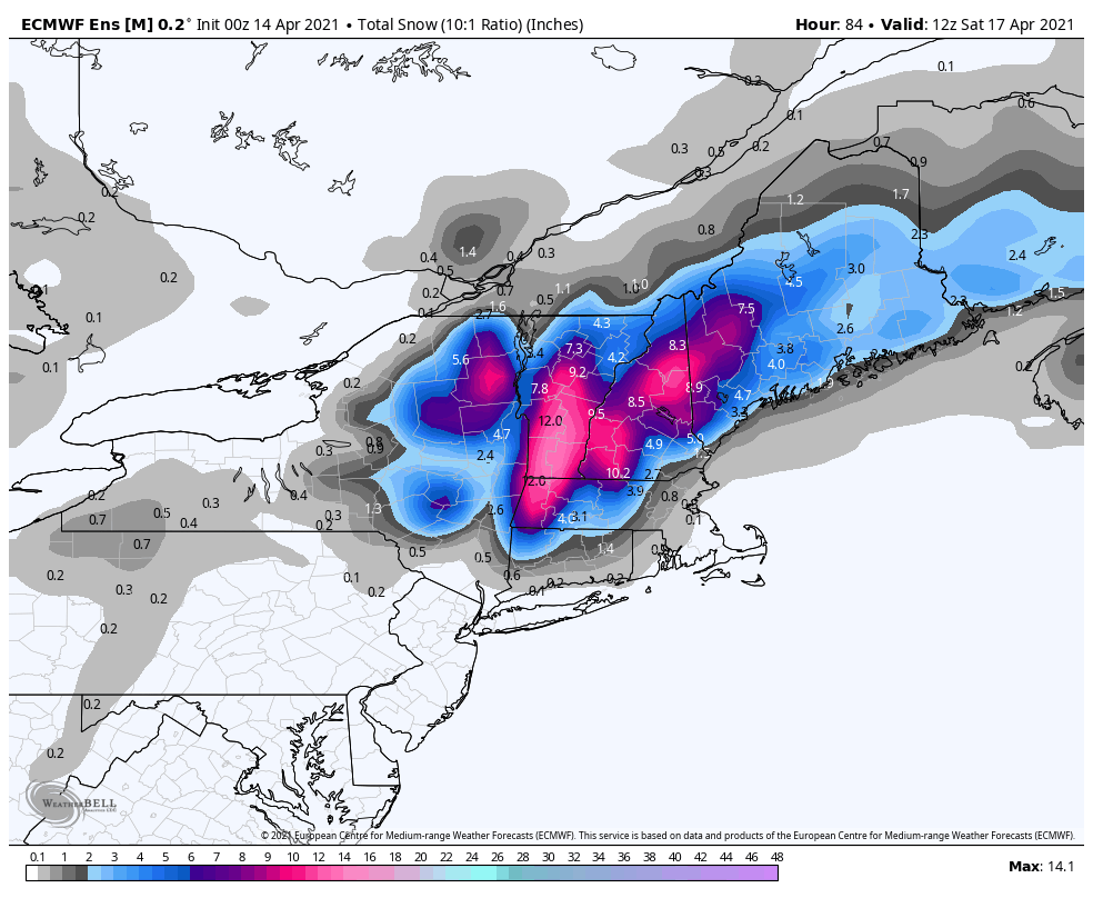
The overall pattern looks to stay relatively unchanged in the next 10 days. We have some level of blocking that’s staying consistent in the Northeast which, on one hand, will hold back any long term warmth to just a couple days. Earlier this week we were talking about snow at some high elevations, and now …
Long Term Views 4/2
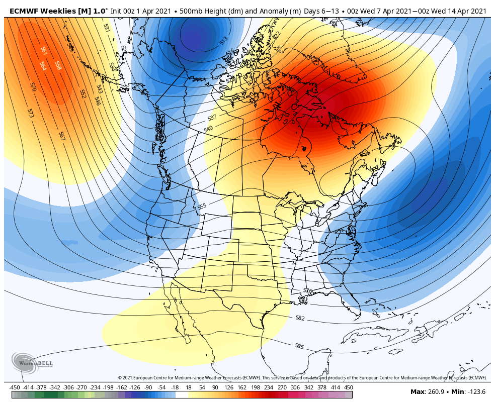
Last week we touched on the alignment of the thickness lines being conducive for some back door cold fronts or pieces of energy coming in from the east (retrograding energies). That has indeed come to fruition for next week and may impact the entire weather pattern due to some overall “lack of flow” aloft. What …
Storm Update 3/25
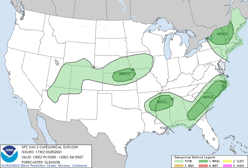
We have two significant systems moving through the eastern half of the country over the next 4 days. Clouds departed earlier than expected today, allowing for more warmth and destabilization to set up in the Northeast. The approaching cold front will bring rain and even thunderstorms to the area Friday. Storms have been outlined in …
Long Term Views 3/19
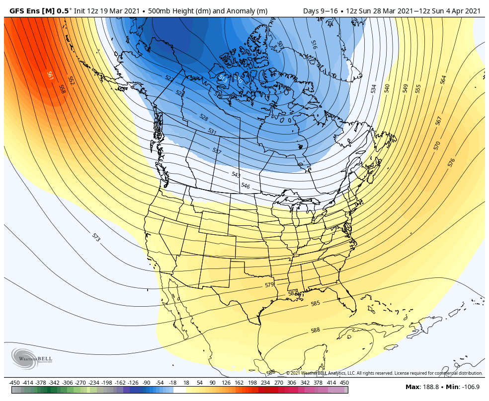
The cold was certainly short lived into this morning and we’ve quickly warmed up, with a continual warming trend expected throughout the week. Looking into the week ahead, we have temperatures that will routinely be in the 50’s during the day, and likely some inversions (especially at lower elevation bases) at night with light wind. …
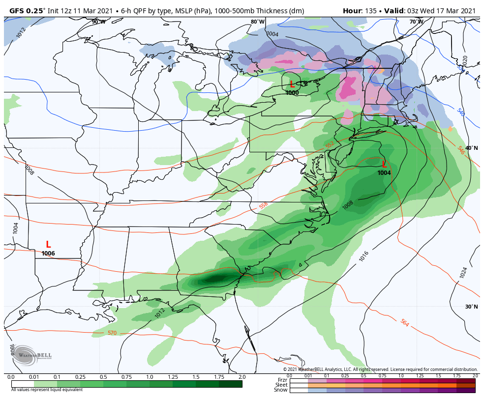
Morning Update 3/17
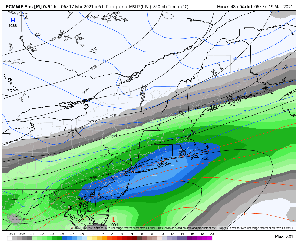
The weather pattern is going to calm down from this rollercoaster ride in a couple days, but until then we have some decent temperature movements and a weak low pressure system to move up/along the eastern seaboard. We’ll be fairly warm today with temperatures boosting into the 40’s and 50’s throughout the East, and the …
Weather Update 3/11
It’s the last warm day before our cold front comes through tonight into Friday morning. There will be a few punches of the cold – we’ll have an initial one but still warm up Friday afternoon a couple degrees, followed by a stronger punch Friday night into Saturday morning. We somewhat moderate into Sunday before …