
The cold slowly begins to move in this evening after getting hung up to our west earlier this afternoon. Our coldest point in the Northeast will be just around sunrise on Tuesday morning. Wind remains high, especially at higher elevations. The depth remains relatively shallow, with a sharp 0C 850mb line right along the MA …
Category Archives: Vail Resorts
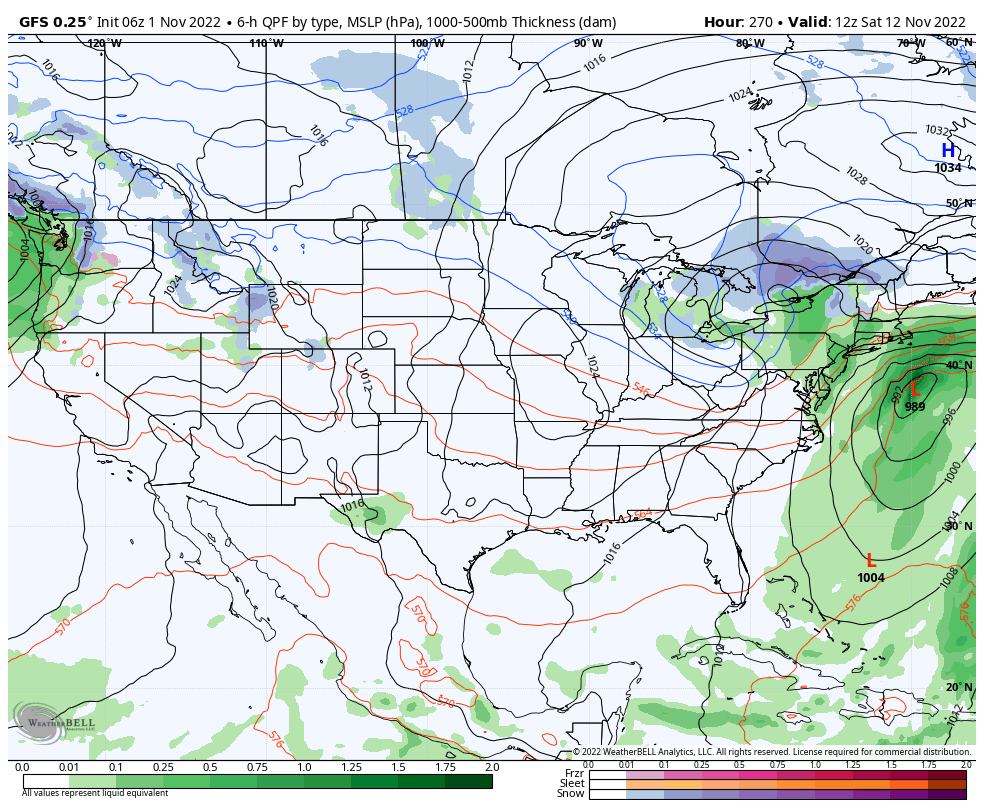
Long Term Views 11/4
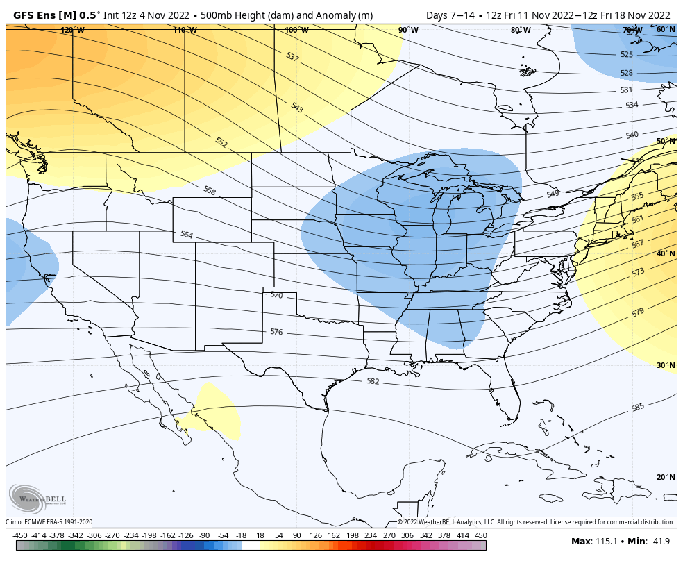
We are finally turning the corner after a warm weekend headed our way. The first infusion of cold comes quickly next week (11/8), however sustained cold will begin coming in surges beginning next weekend (11/12). The pattern will be active and there are still pieces of tropical energy that are roaming around the Atlantic, therefore …
Additional Note on Tropics 11/1
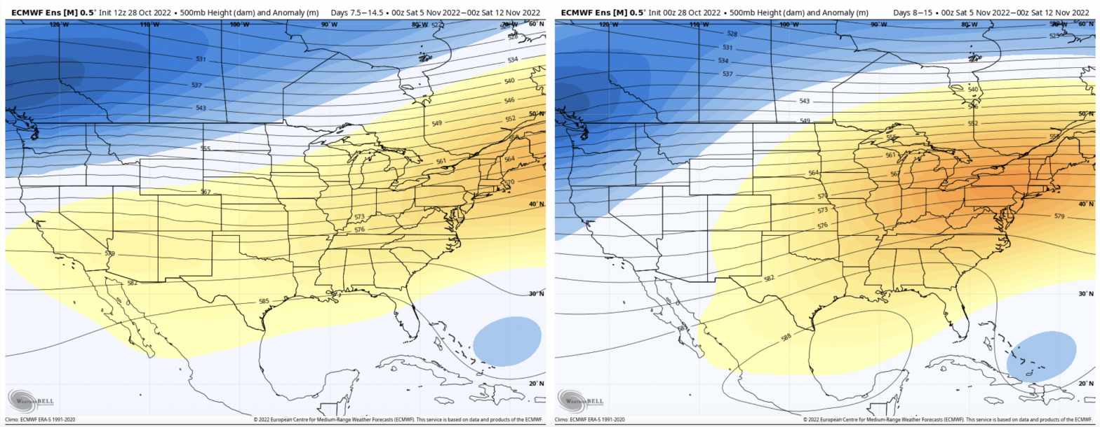
For the last several weeks, we’ve been talking about the active tropics creating volatility in the long term. Due to the weak handling of tropical systems by models, we tend to have high variability in model runs for Days 5+, and cold surges not coming to fruition. I wanted to show you the last 4 …
The Week Ahead 10/31

It’s fairly quiet and warm during the week ahead as we’ve been talking about for a couple weeks now. The potential cold surge over the Sunday-Monday time frame has flattened out with the tropics remaining active. The only chance of precipitation comes from some stray showers throughout the area late Monday into early Tuesday. We …
Long Term Views 10/28
With the tropics remaining active, we’re not seeing much in the way of sustained, deep cold. However, we should be seeing some pattern changes heading into mid-month. Several models have been juggling cold surges beginning next weekend, which I’ve mentioned in the forecast notes over the past couple of days. There’s quite a bit of …
The Week Ahead 10/24
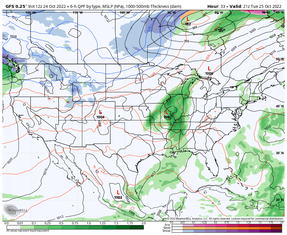
Another rainy start to the week for the Northeast as a weak low pressure system continues to bring showers and a couple isolated thunderstorms. We are also watching the tropics for a piece of energy near Bermuda that’s attaining tropical characteristics. The National Hurricane Center actually gives it a high chance of formation in the …
Long Term Views 10/21
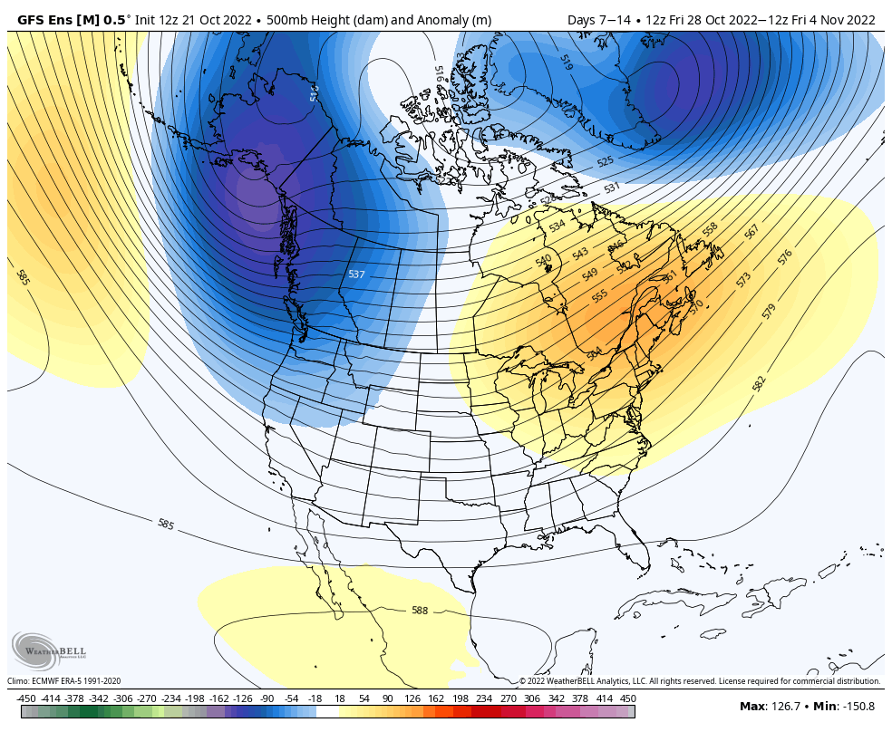
Unfortunately, we haven’t seen much change in the pattern heading toward the end of the month and early November, yielding not-so-great news in terms of snowmaking opportunities. While tropics aren’t very active, there are still a couple areas of interest that have popped up in the past week. We’re also still seeing lingering overall global …
The Week Ahead 10/17
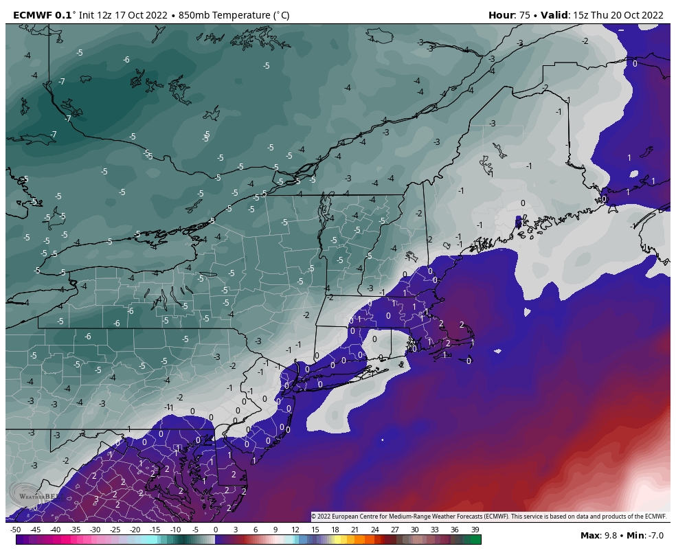
This week features some of the first lake effect snow bands in the Great Lakes, another round of rain in the Northeast (though not as heavy as last week), and a brief cool down. The depth and strength of the cold doesn’t quite make it in to the Northeast as compared to the Great Lakes, …
Long Term Views 4/29
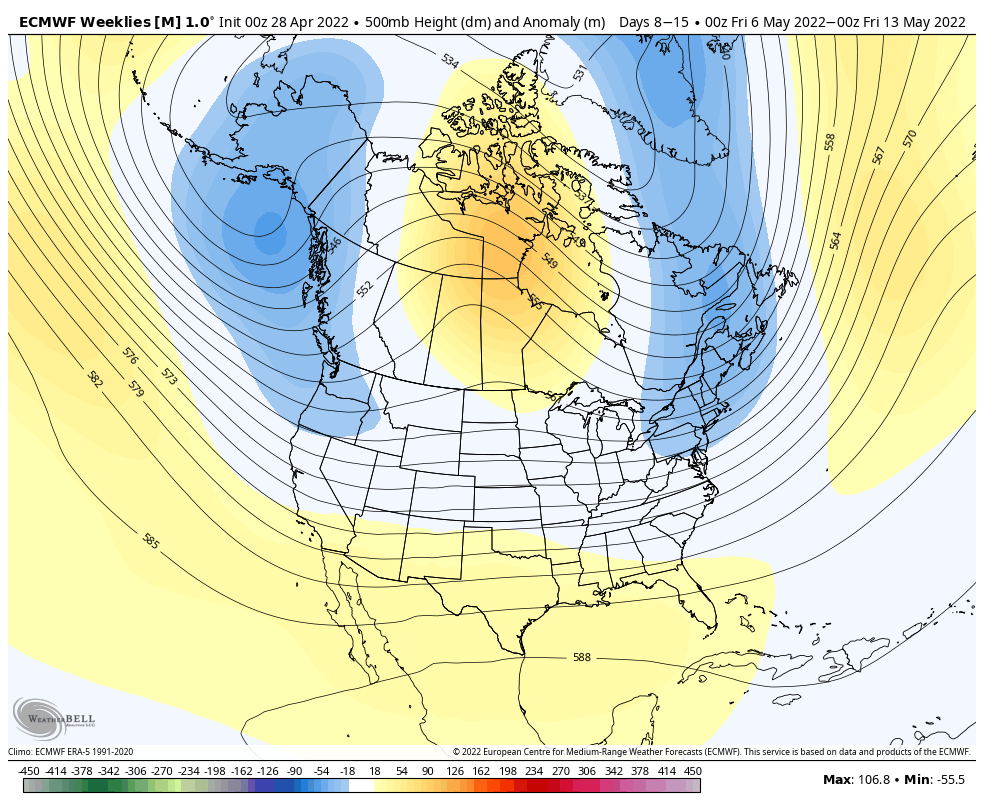
Temperatures overall will remain below average for the first 10-14 days of May. Below average is still relatively warm when it comes to ski season and snow preservation, but there will still be some small opportunities for high elevation snow going through mid-month. However, there will be higher chances of widespread rain, more specifically on …
The Week Ahead 4/25
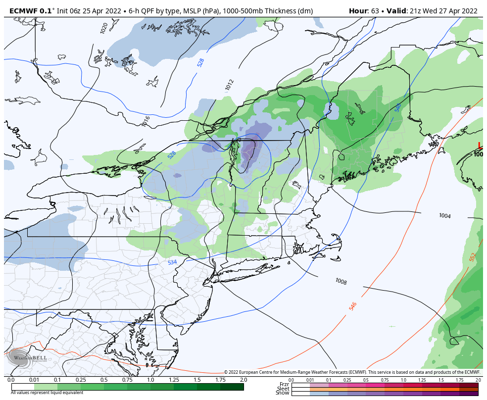
The main feature this week is a cut-off low, which initially brings showers as early as Tuesday morning to the region. Several waves of energy circle around the low this week. However on Wednesday, we’ll see a push of cold air to come in and provide higher changes of snow at higher elevations from Wednesday …