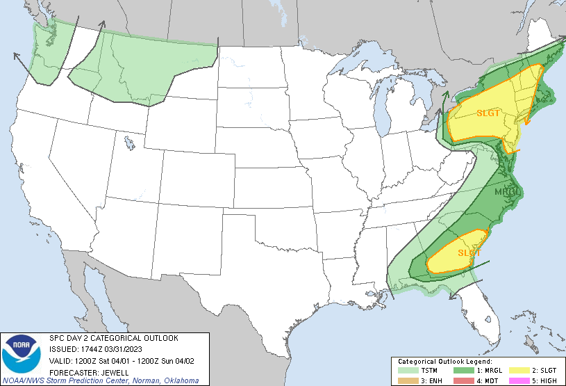
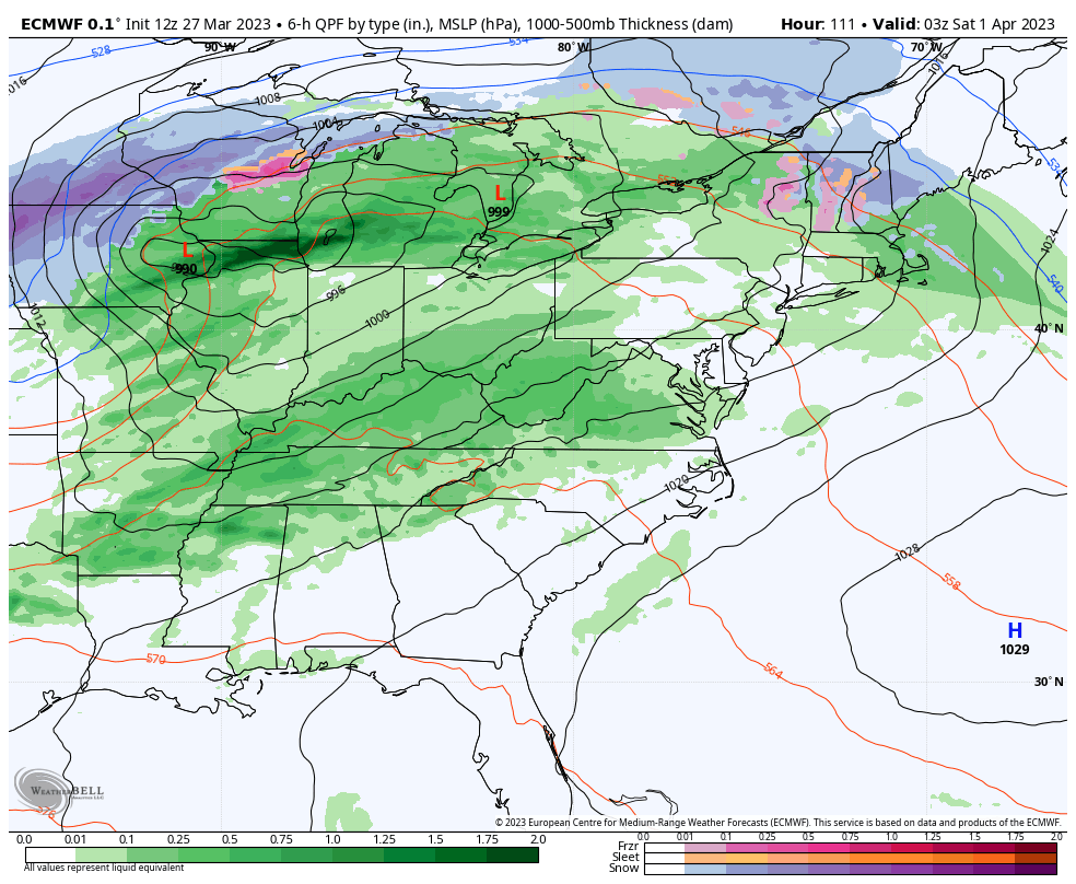
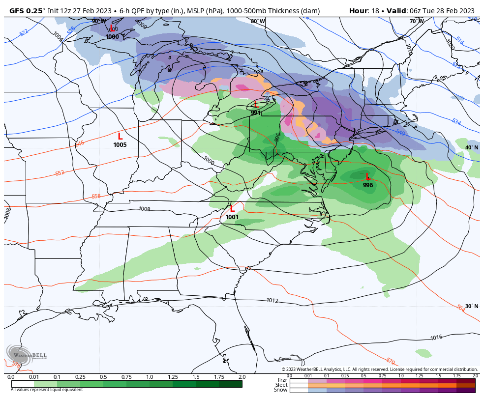
The clash of the seasons is upon us, with more mixed precipitation systems and dare I say…the first spring thunderstorms of the season possible on Saturday. It’s a little early to talk about severe storms, but they are possible across New England Saturday afternoon. Temperatures will stay close or slightly above average into Days 0-7. …
Category Archives: The Fairbank Group
The Week Ahead 3/27
The week starts off with a dry atmosphere and a weak system coming through Monday night into Tuesday morning in the east. Temperatures moved up quite a bit ahead of the system so may see some rain mix in initially. Any snow that does accumulate, which will only be on the order of 1-2″ at …
Long Term Views 3/24
The global pattern continues its shifts with the ENSO neutral cycle taking shape and we’re going to continue on a cooler than average pattern heading through Day 14. Temperatures at the surface level (local airports) are running roughly 1-3 degrees above average so far for March, but may start skewing cooler for the last 7 …
The Week Ahead 3/20
The latest ENSO cycle reading came in this morning, and we are officially in the positives, leaving La Nina fully behind since the week of February break. However, the overall atmosphere is still showing weak La Nina trends, as it takes a couple of weeks to bring the change from sea surface temperatures to the …
Long Term Views 3/17
Though cooler air settles in for the first part of next week, we’ll have moderation toward the midweek before a couple more storm systems start to ramp up. There are a few to watch – around 3/23, 3/25 and 3/28. The NAO stays close to neutral (therefore not much blocking of cold air) for 3/23 …
The Week Ahead 3/13
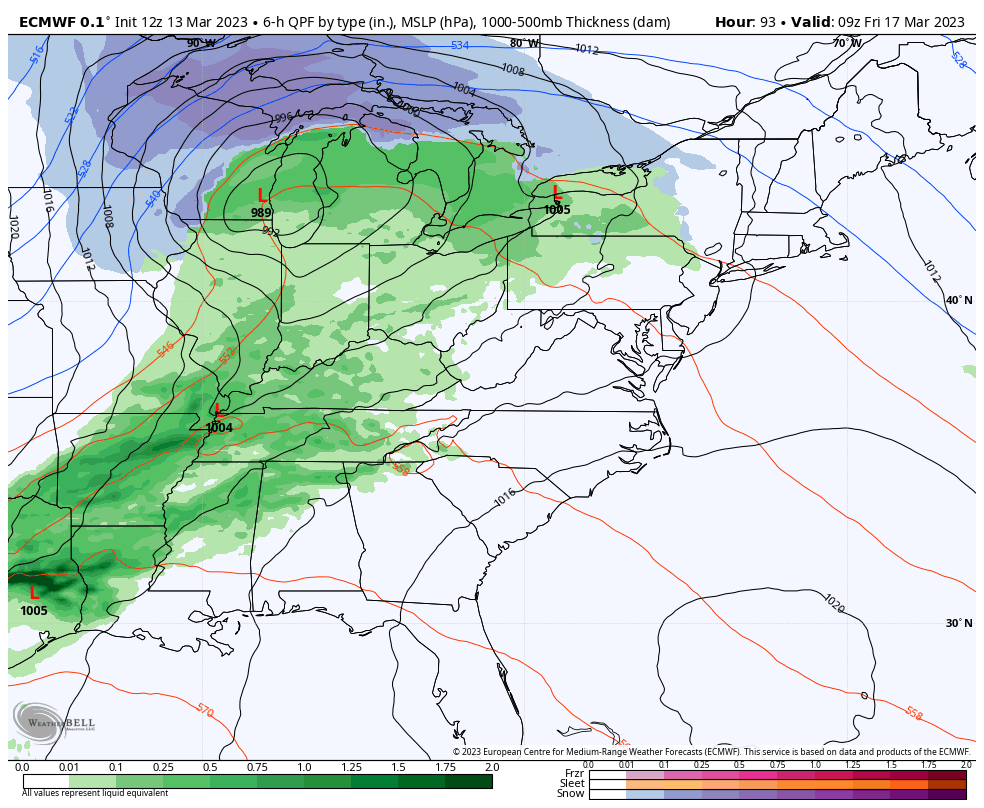
The week ahead has two storm systems to impact the east – one coastal system to affect the Northeast and one inside runner that is more impactful to the Great Lakes. The coastal system moves in later today with mostly snow expected from the Poconos up through northern Maine. The heaviest snowfall is expected in …
Long Term Views 3/10
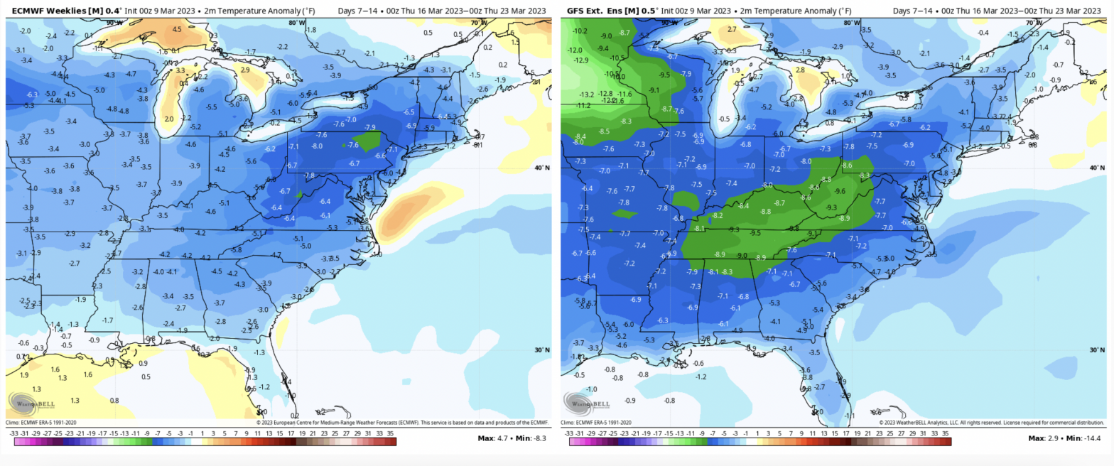
We’re looking at continued seasonable or below average temperatures through the third week of March. While there are above average moments before storm systems (similar to what we are seeing today), overall temperatures remain at or below season averages – especially in the Mid-Atlantic. There’s not much anomaly when it comes to precipitation, which makes …
The Week Ahead 3/6
The week itself is fairly quiet. There’s a low pressure to our north that is somewhat stalled, and that’s what is keeping a fair amount of breeze and intermittent snow showers in the forecast through Thursday in New England. The storm pattern takes energy from the Great Lakes into the Mid-Atlantic at this time, but …
Long Term Views 3/3
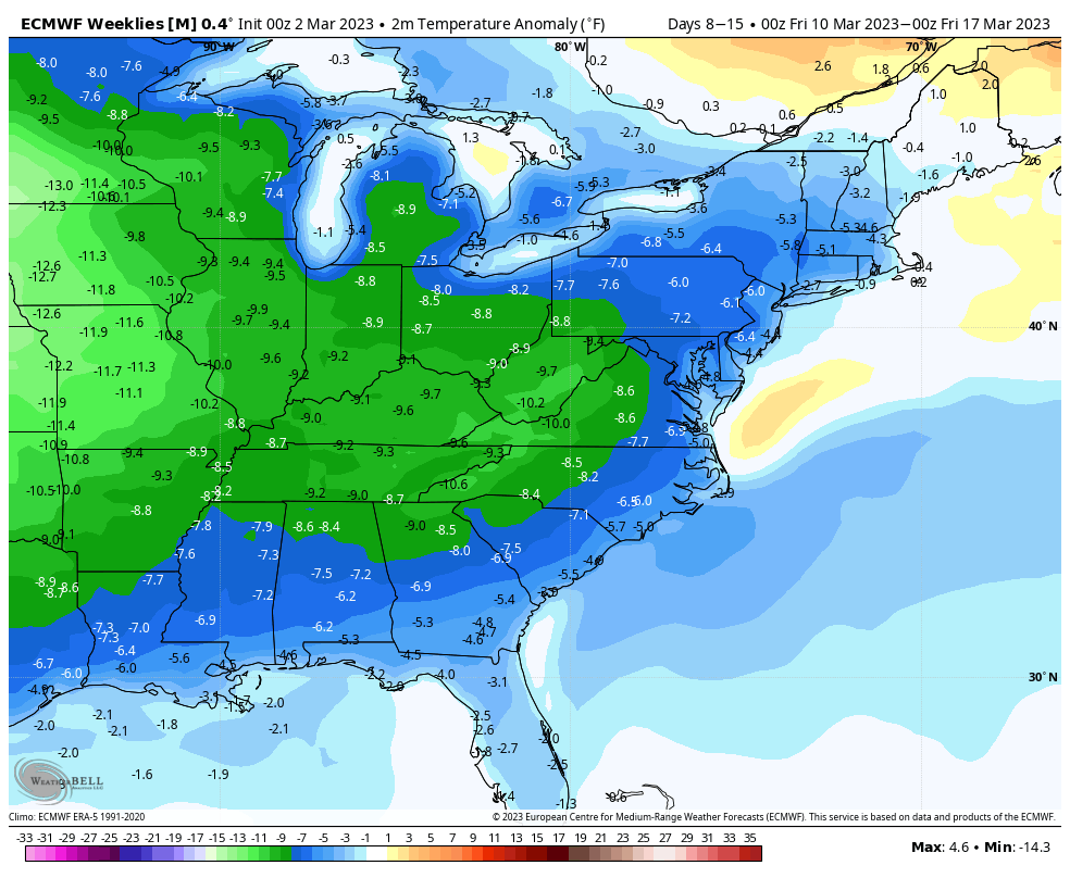
A little late to the blog tonight given the active forecast this week…the storm tonight/Saturday will be the last big storm for about a week, at least. Temperatures in the week ahead will be close to seasonable. Some lower base areas will deal with a freeze/thaw cycle as temperatures move above freezing during the day …
The Week Ahead 2/27
It seemingly took forever but this is the first week that the ONI Index is ENSO neutral. It’s the first time we’ve been here for nearly three years. Better late than never, but it would’ve been nice for this to happen a month ago… The effects of transitioning to ENSO neutral have already been seen …