Temperatures come down slightly tonight and Wednesday with a brief pass of a low pressure system Wednesday night. This brings rain to the Mid-Atlantic, a rain to snow transition in the Catskills and mostly snow elsewhere. Accumulations should be fairly light (2-4″) but with the cold coming Thursday, it does guarantee a white Christmas for …
Category Archives: ORDA
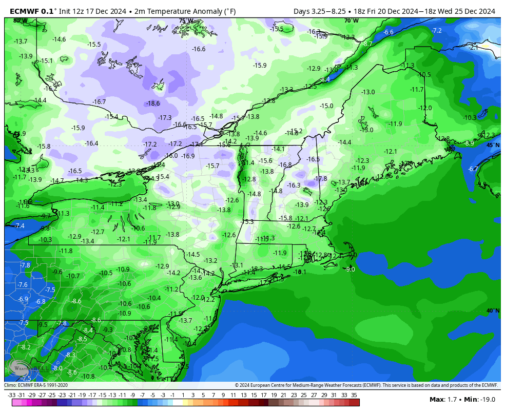
Pattern Adjustment & Regeneration
Behind the wind and rain tonight, we’ll have a hard crash in temperatures into Thursday through the early weekend. The pattern adjusts and begins regeneration – starting today and ending in about 7 days. That doesn’t mean we’re going to see warmth that entire time — but we’re on the roller coaster ride of cold, …
The Week Ahead – Snowmaking & Light Snow
If you’ve been around teenagers in the last year, you’ve probably heard the term “full send” — so I’m deeming this week “full send snowmaking” — we have lots of opportunity, often times through the day, all the way through the weekend. This may vacillate a bit more in the Mid-Atlantic as we have more …
The Week Ahead – Pattern Change Settles In 11/25
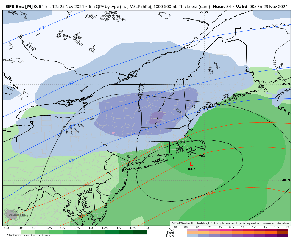
We’ve been talking about a pattern change for two weeks now, but it’s taken some time to settle in, delivering some waves of precipitation and slight warmth within it, but ultimately providing a big trend toward cold, and possibly snowy. The big talk of the town this week is a Thanksgiving storm that the models …
Continue reading “The Week Ahead – Pattern Change Settles In 11/25”
The Week Ahead: Pattern Change Continues 11/18
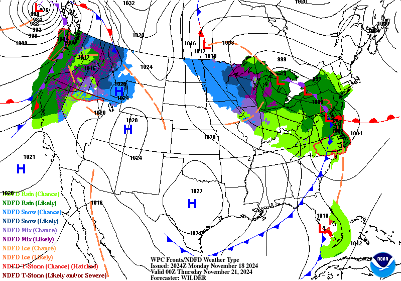
Our pattern change began last week, and we’re continuing the trend of change into this week with a cut-off low impacting us into the latter part of the week. While there’s a shallow cold air mass settling in tonight and Tuesday, it’s just that — shallow. We’ll see some temperature modification heading through Wednesday before …
Continue reading “The Week Ahead: Pattern Change Continues 11/18”
The Week Ahead 11/11 – Sneaky Cold
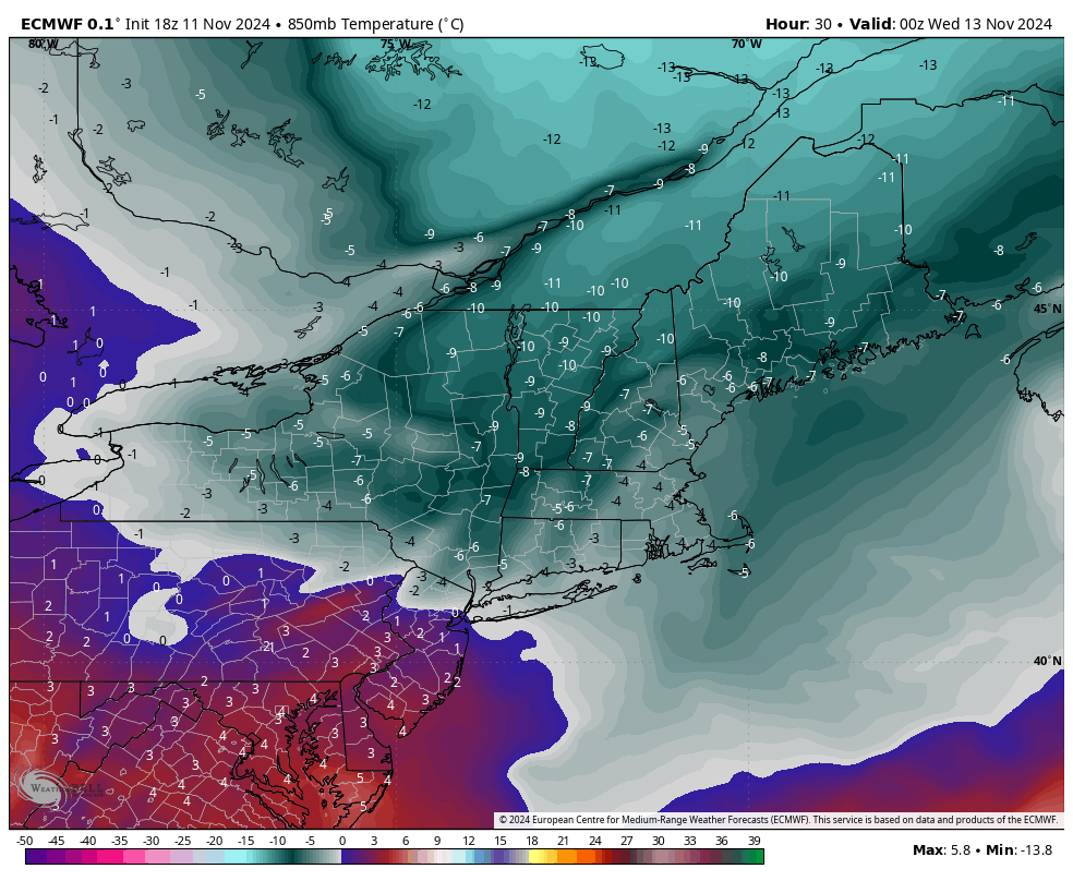
After another briefly warm day, we are heading into a much anticipated pattern change. We have a strong cold front on the way Monday night which will bring a cold air mass (and quite a bit of wind) for Tuesday, Wednesday and even into Thursday. The core of the cold settles in by 7pm Tuesday …
The Cold…Unknowns
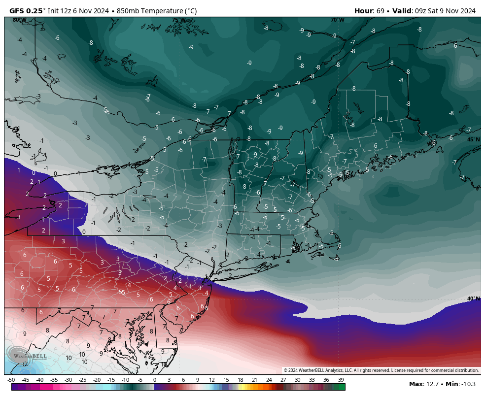
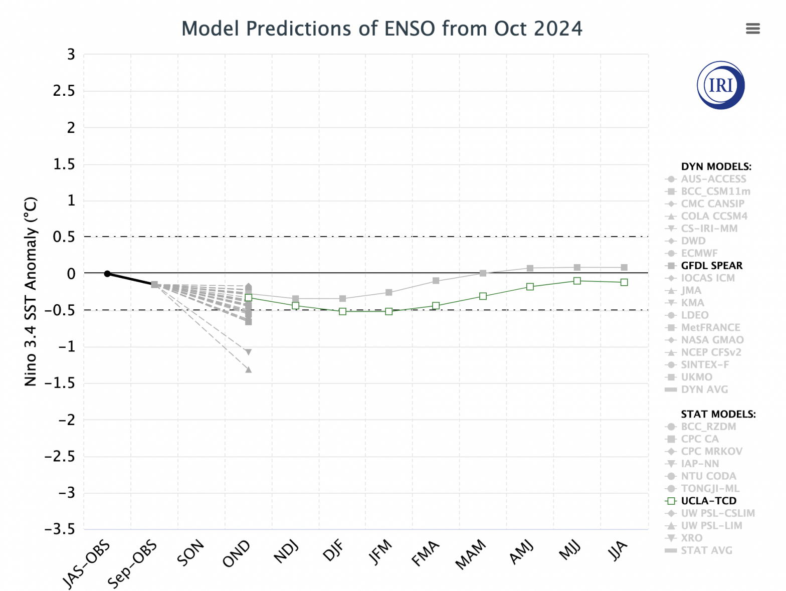
It’s the second week in a row of seeing 70+ degrees across many areas in the Northeast. However, right now most of our patterns are being influenced by the reactivated tropics, as we continue to see a neutral ENSO cycle take shape. Most tropical activity shunts cold spells to the north, or keeps them quite …
Looking Ahead…
A couple things to touch on as we come out of the coldest stretch we’ve had so far.. But first a quick look at the rest of the week. Moderation begins Tuesday though we’ll really feel it into Wednesday — especially in southern VT/NH and New York as a warm front works its way north. …