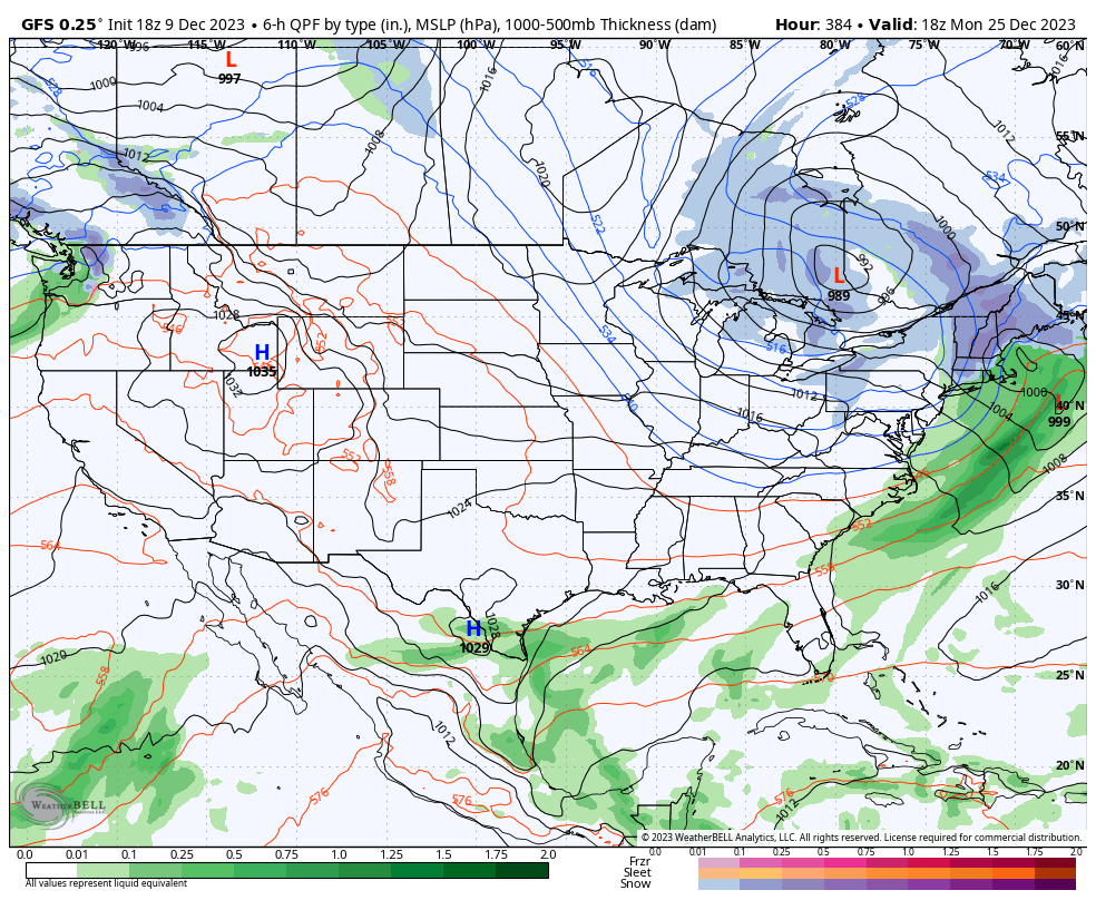
This is going to be a bit abbreviated given the volatile storm we’ve been tracking for Sunday night into Monday. It’s changed quite a bit from midweek, to say the least. There’s a lot of transitions and high impact to this system from heavy rain, to wind and then heavy snow — if you have …
Category Archives: Killington
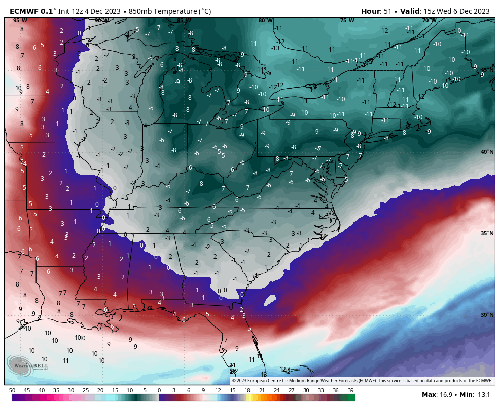
The Week Ahead 12/4
Our early week snow was the main event for the week, which brought quite a bit of accumulation to New England, especially northern regions. We have some downtime with cold air and snow showers coming through into Tuesday. The cold reaches its core Tuesday night in the Great Lakes and Wednesday in the Northeast. The …
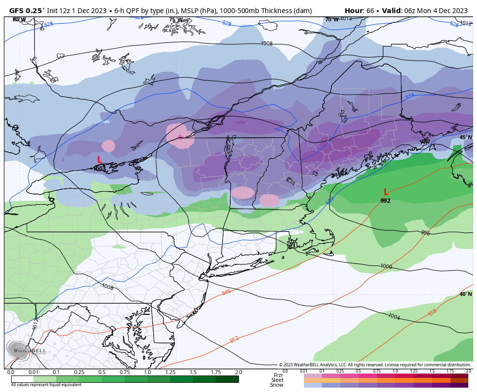
Long Term Views 12/1
We’re into December, which means we’re officially in meteorological winter. The new MEI value should be out by early next week to see where we are atmospherically, and the ONI is usually out 6-8 days after the beginning of the month, but we know that’s been running high. The last time we saw ONI’s around …
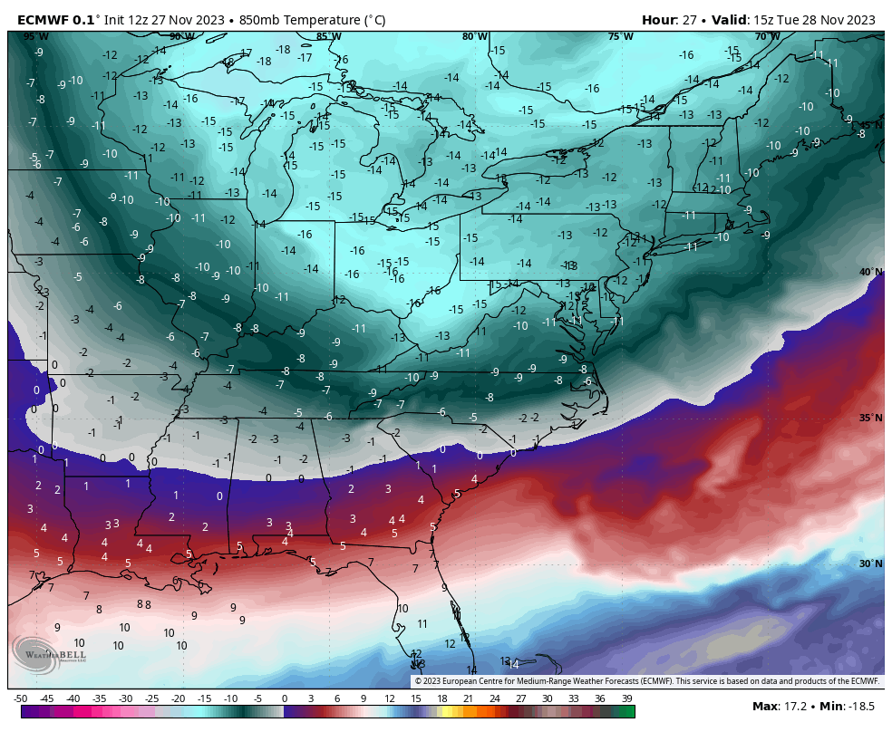
The Week Ahead 11/27
This is our transition week out of the cold punch pattern. We’ve had some consistent bouts of cold over the last couple of weeks and we’re going to ease that up a bit into the end of the week. However, the activity in the pattern is not going to stop, which means we’re still looking …
Long Term Views 11/24
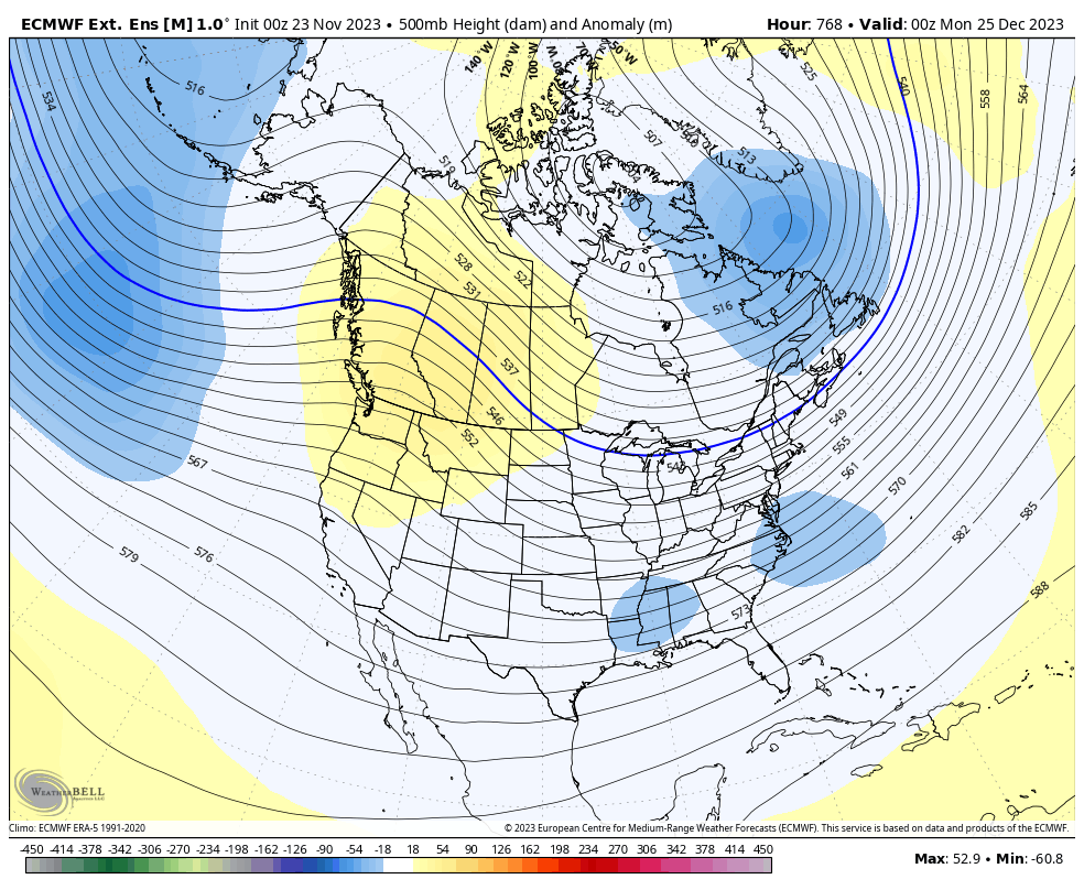
We are heading into some interesting uncharted territory has the ONI Index nearly reaches a “very strong” El Nino status while the SOI and MEI say we’re barely in a weak El Nino state. For reference, Winter 2015-2016 was the last “super Nino” (ONI >2.0) and we know how that turned out. There really aren’t …
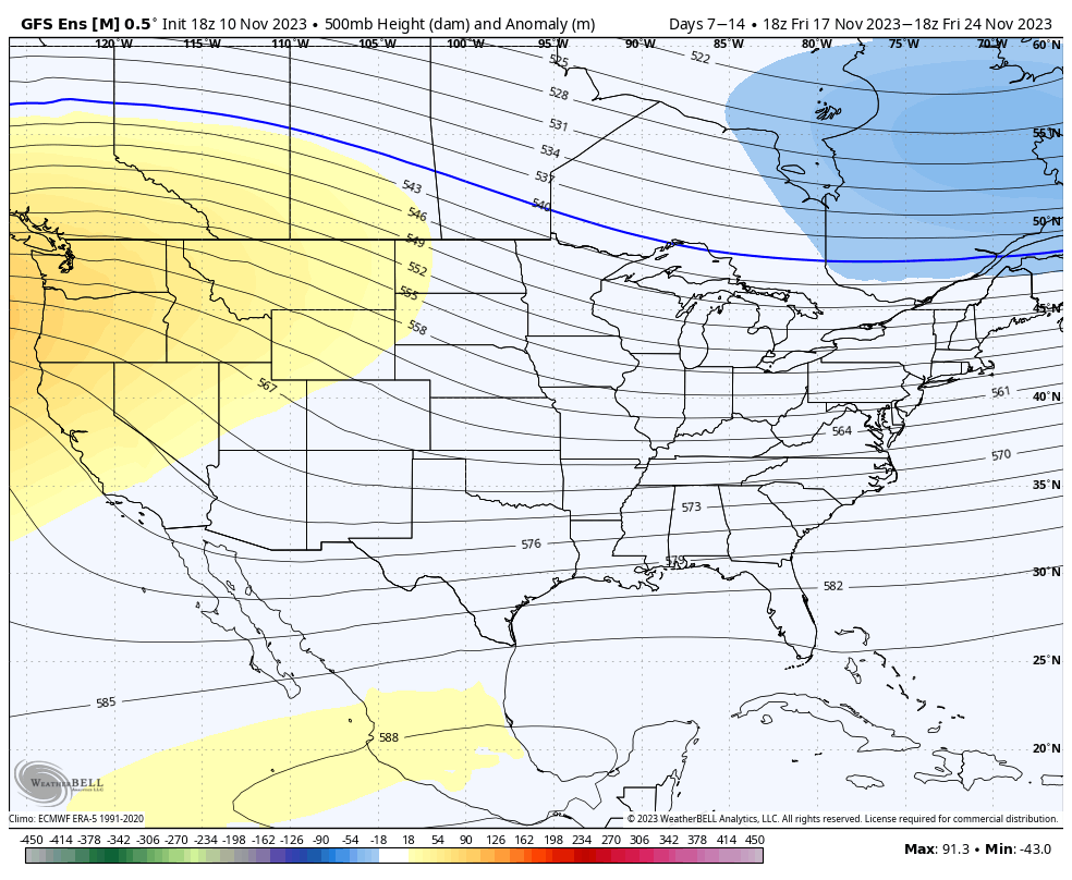
Long Term Trends 11/17
We’re about to enter into a very interesting short term and long term pattern. A strong cold front is en route to the east (take a look at the blue line in the screenshot of the front coming through a resort in Michigan). I don’t have the drop quite as sharp in the Northeast (12 …
The Week Ahead 11/13
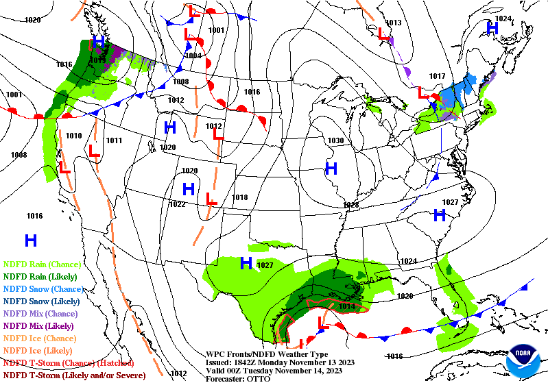
Inversions stuck around for quite some time today ahead of a weak system coming through New England tonight. We’re seeing it dissipate as it moves through the area, so we’ll likely see some minor temperature movements (up and down) as the warm front and cold front move over the Northeast while simultaneously breaking down (WPC …
Long Term Trends 11/10
We start to shift the weather pattern a bit next week; but even then there’s been some discrepancy on how that evolves. There’s clear consensus on the cold retreating Wednesday of next week. The first divide in the road comes with a system next weekend. The Euro tries to bring a disorganized low pressure up …
The Week Ahead 11/6
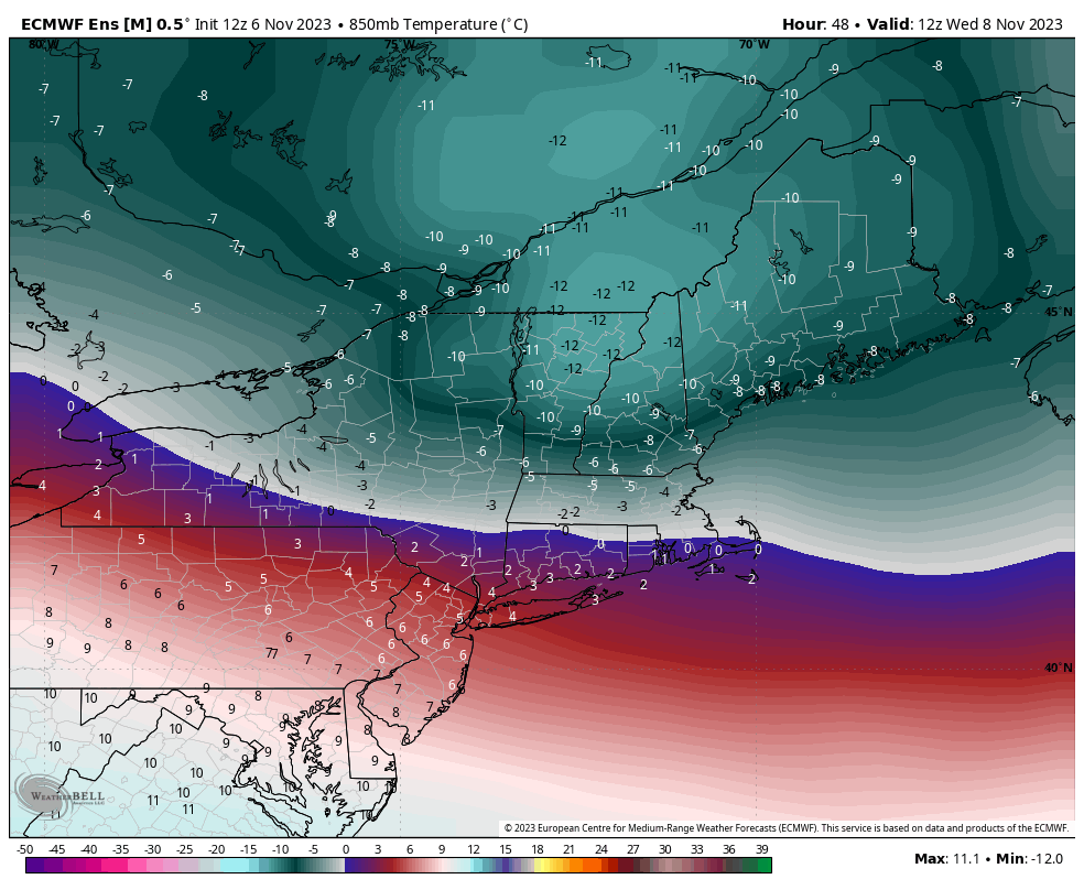
The week ahead will have some volatility to it; we don’t stay in the same place for very long until we get to the weekend. Temperatures rise tonight as the first of two systems this week arrives from the Great Lakes (after bringing some heavier rain there). The band with the warm front is fairly …
Long Term Trends 11/3
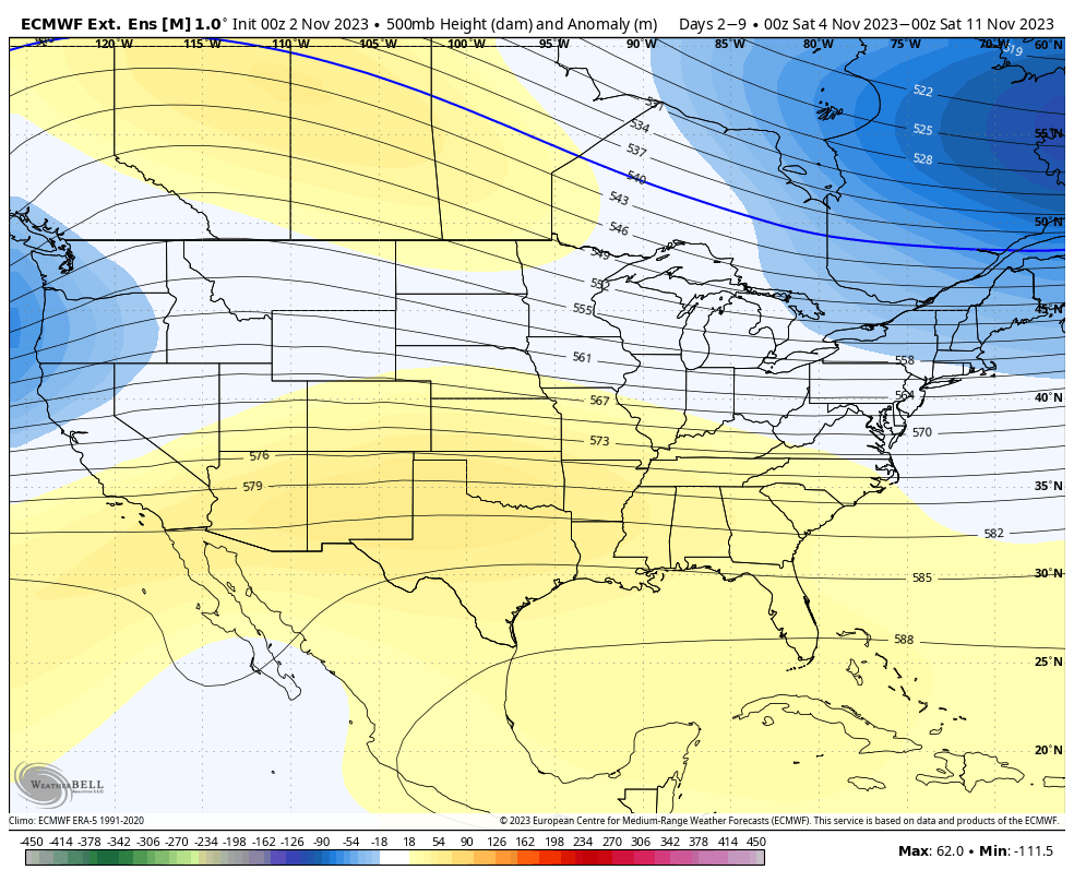
We’ve ventured through our first block of cold, and for now, it retreats until the middle of next week. Heading out into Days 7-14, the eastern trough does begin the retreat, and there’s decent consensus on that. The trough isn’t intensely deep in the East, so the pattern should stay active with the combination of …