We’re about to see our third system in 6 days arrive in the Northeast, and we’re not done yet. This one will be similar to the Tuesday/Wednesday storm, but honestly the latest runs look a smidge more intense with the damming. So while we’ll probably still see a transition to rain in all areas, snow …
Category Archives: Killington
Polar Vortex/Strat Warm Explainer
It’s been a while since I went over the intricacies of the polar vortex/stratospheric warming events. The polar vortex has had more airtime over the last several years, and the term is latched onto when temperatures plunge well below normal in the winter months. This cold intrusion has been linked to stratospheric warming events. The …
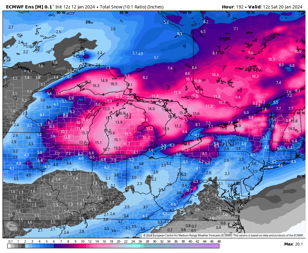
Long Term Views 1/6
The long term continues to look fairly volatile through the first 16-18 days of the month. We have the storm system tonight/tomorrow coming in, and another for Tuesday/Wednesday. While this will bring predominantly snow in the Great Lakes, it’ll be more of a mixed bag for the Northeast. Maine will hold onto snow the longest, …
The Week Ahead 1/1
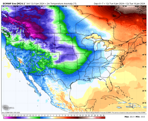
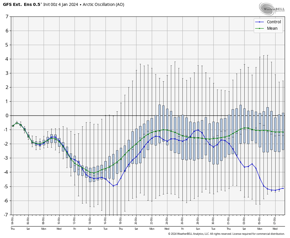
New year, new week, new weather pattern. The cold has been coming in stronger than expected over the last 24 hours. This is a good sign heading into an active weather pattern. The NAO and AO are negative, and the NAO is going to be a key indicator in these next few storms. While the …
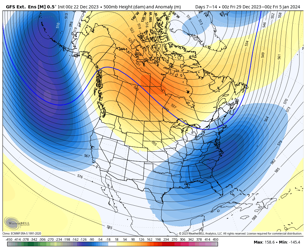
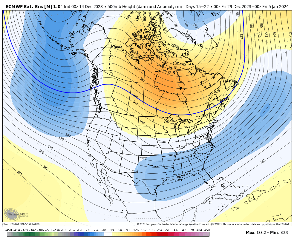
Long Term 12/29
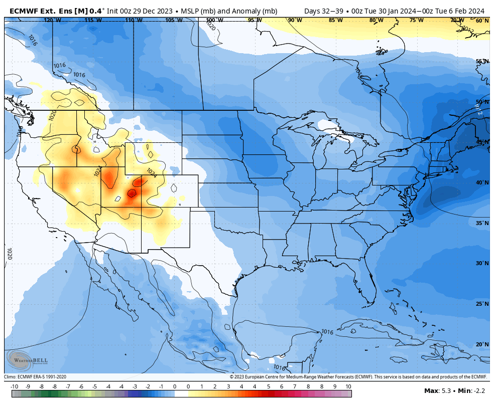
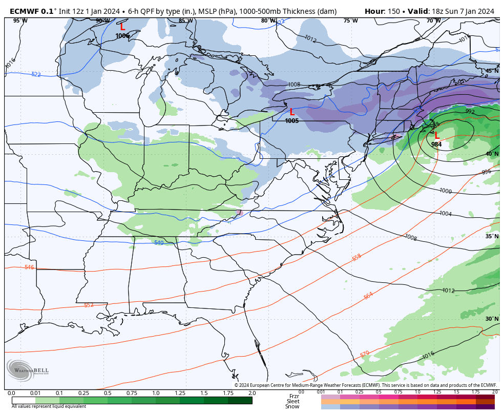
The cold is transitioning into the region through the last couple days of the year. We’ll have a couple bouts of cold come through next week, including a potential coastal system on the 5th. From there, we have an overwhelming negative anomaly throughout much of the country for Days 7-14. There are storm signals on …
The Week Ahead 12/26
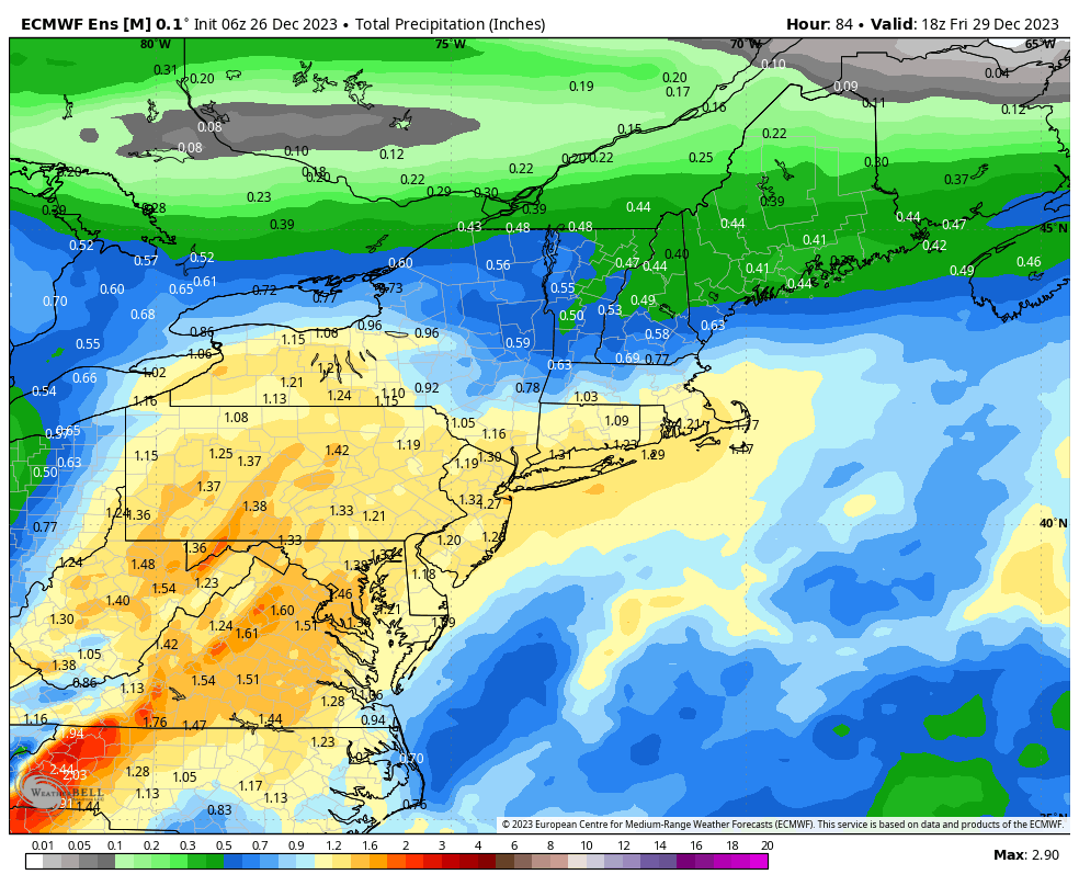
It’s a fairly dreary week in most areas as the pattern continues in a transition. We’re kind of in a no-man’s-land of little flow and wind to move things around. We have a low pressure developing for late Tuesday into Wednesday with rain expected. This won’t be the torrential rain of our last few storms, …
Long Term 12/22
We’re in the transition of patterns at the moment after the storm on Monday. We’ve stopped the Monday storm pattern that we had been in for several weeks, and we’re rather quiet until the middle/end of next week. There is a lot of inconsistency in that system, which I’ve noted for a couple days in …
The Week Ahead 12/18
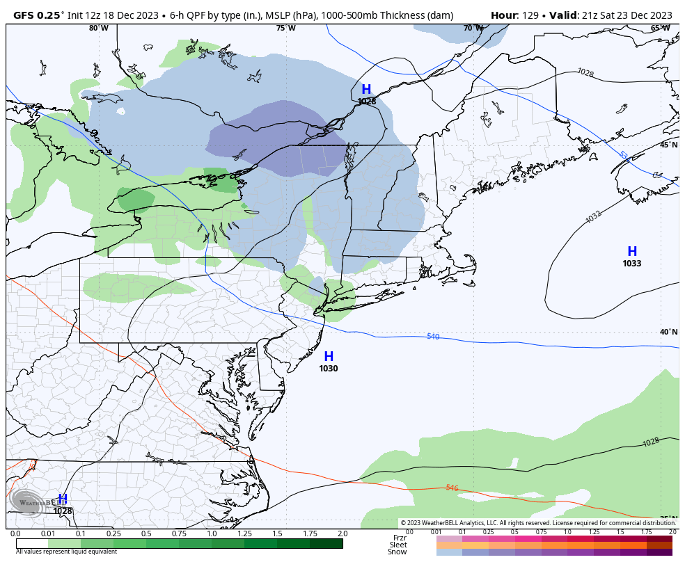
After torrential rains and high wind depart the region, we’ll have a quiet remainder of the week. While the Northeast will hold onto some cold this week, the Great Lakes region ends up on the warmer end of the weather pattern until closer to New Years. In the Northeast, temperatures continue their crash through Tuesday. …
Long Term Views 12/15
The transition is starting…roughly 7-10 days later than anticipated, but nonetheless it begins with the system coming through on Monday. That system will be mostly rain and quite a bit of wind as well. For Days 7-14, we are in the thick of it in the NE. While the bright red spot in the middle …
The Week Ahead 12/11
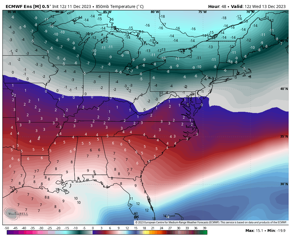
The week ahead is fairly quiet in terms of precipitation, but we are going to see a lot of movements in the temperatures in terms of weak fronts/shortwaves coming through. This may lead to non-diurnal temperature movements, which I’ve tried to outline in the discussions as well. Temperatures are already moving up in the Great …