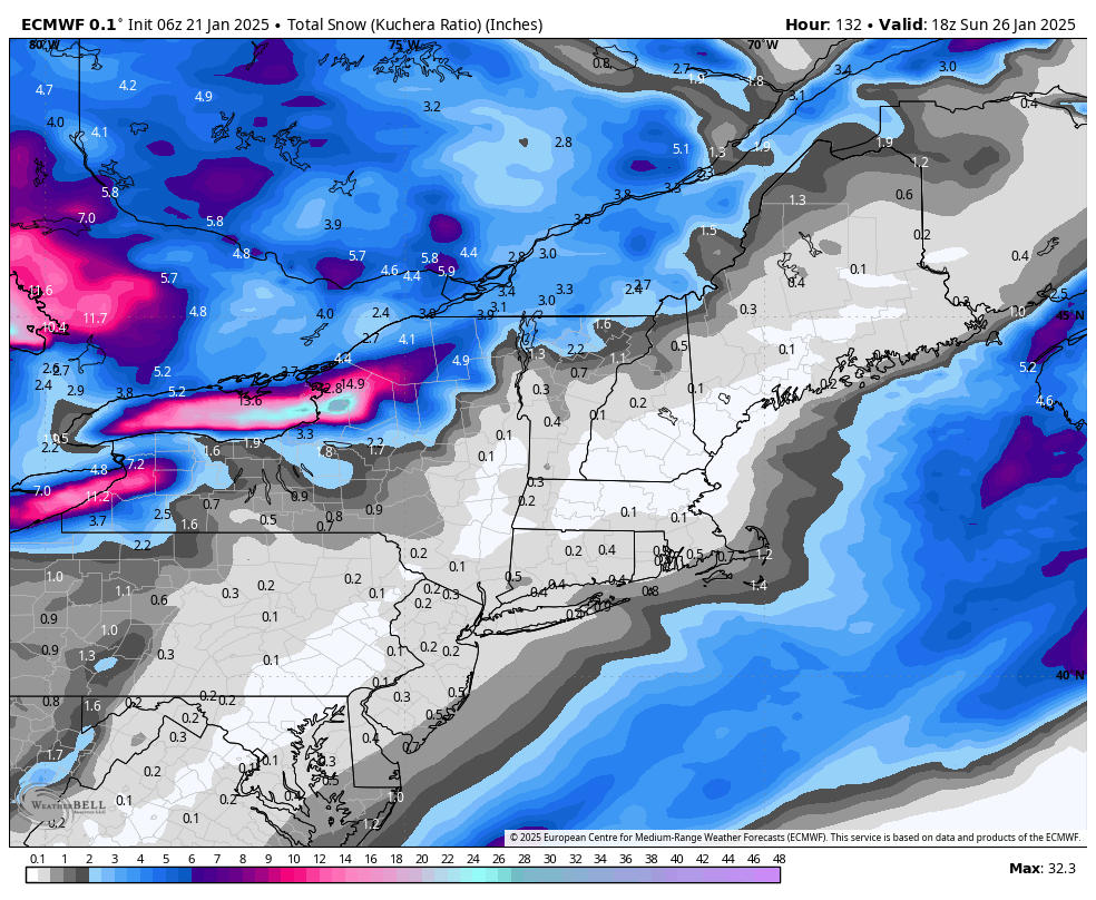
Outside of topographically induced snowfalls, it’s been a rather dry winter. While widespread, natural snow has been hard to come by, that pattern is set to continue through this week and most of next week. I do think we’ll start to see more activity next week and into early February as the pattern begins shifting. …
Category Archives: Killington
Slightly More Volatility Ahead, But Cold Prevails
The cold has been dominant over the eastern seaboard for a while now, and there’s not much change in the trajectory. We have a brief reprieve this weekend, featuring calmer wind and slightly warmer temperatures. We’ll have some light snow on Saturday but sunshine returns (for some) on Sunday. Clouds return on Monday with another …
Continue reading “Slightly More Volatility Ahead, But Cold Prevails”
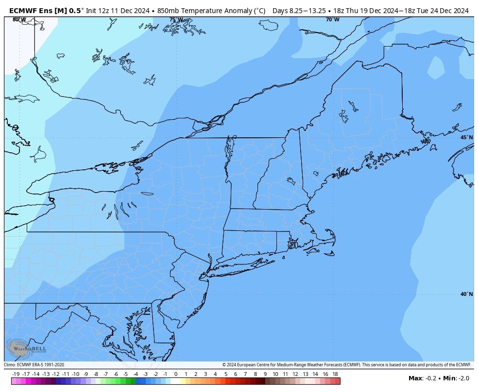
The Cold Truth…

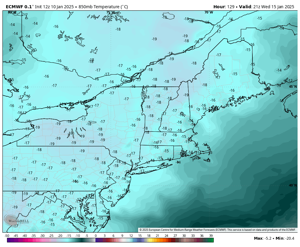
We have entered into one of the most consistent periods of cold we have seen in some time. This should easily take us into the MLK weekend time frame before we begin to see a pattern change. The Euro ensemble 2m temperature (F) anomaly shows below normal conditions in all areas outside of extreme northern …
Here Comes The (Mix) Rain
It would be nice to get through a holiday week without the dreaded ‘R’ word, but alas, it won’t happen this year….although we made it through the majority of the full holiday week with awesome weather! In full transparency, the inversions/dry air aloft have been tough to forecast over the last 24 hours and it’ll …
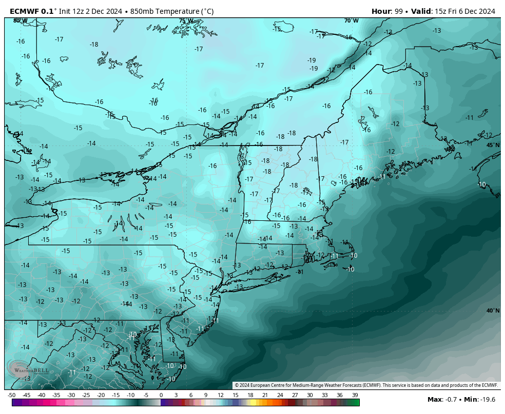
Heading Into Christmas Week
Temperatures come down slightly tonight and Wednesday with a brief pass of a low pressure system Wednesday night. This brings rain to the Mid-Atlantic, a rain to snow transition in the Catskills and mostly snow elsewhere. Accumulations should be fairly light (2-4″) but with the cold coming Thursday, it does guarantee a white Christmas for …
Pattern Adjustment & Regeneration
Behind the wind and rain tonight, we’ll have a hard crash in temperatures into Thursday through the early weekend. The pattern adjusts and begins regeneration – starting today and ending in about 7 days. That doesn’t mean we’re going to see warmth that entire time — but we’re on the roller coaster ride of cold, …
The Week Ahead – Snowmaking & Light Snow
If you’ve been around teenagers in the last year, you’ve probably heard the term “full send” — so I’m deeming this week “full send snowmaking” — we have lots of opportunity, often times through the day, all the way through the weekend. This may vacillate a bit more in the Mid-Atlantic as we have more …
The Week Ahead – Pattern Change Settles In 11/25
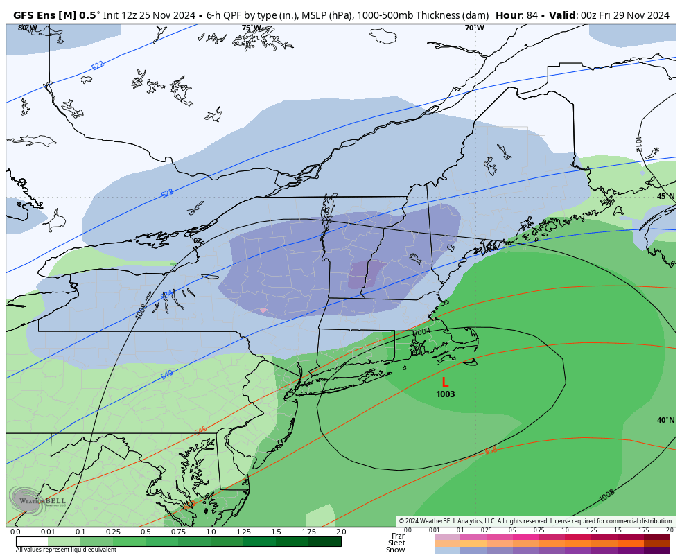
We’ve been talking about a pattern change for two weeks now, but it’s taken some time to settle in, delivering some waves of precipitation and slight warmth within it, but ultimately providing a big trend toward cold, and possibly snowy. The big talk of the town this week is a Thanksgiving storm that the models …
Continue reading “The Week Ahead – Pattern Change Settles In 11/25”
The Week Ahead: Pattern Change Continues 11/18
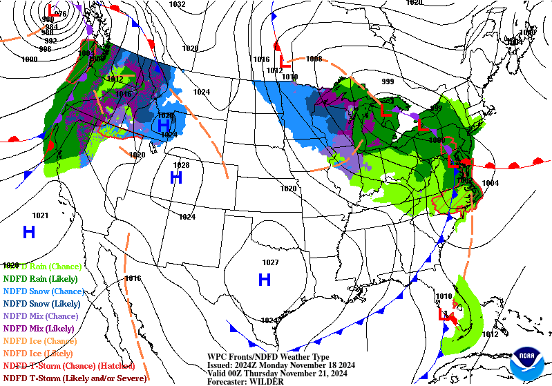
Our pattern change began last week, and we’re continuing the trend of change into this week with a cut-off low impacting us into the latter part of the week. While there’s a shallow cold air mass settling in tonight and Tuesday, it’s just that — shallow. We’ll see some temperature modification heading through Wednesday before …
Continue reading “The Week Ahead: Pattern Change Continues 11/18”
The Week Ahead 11/11 – Sneaky Cold
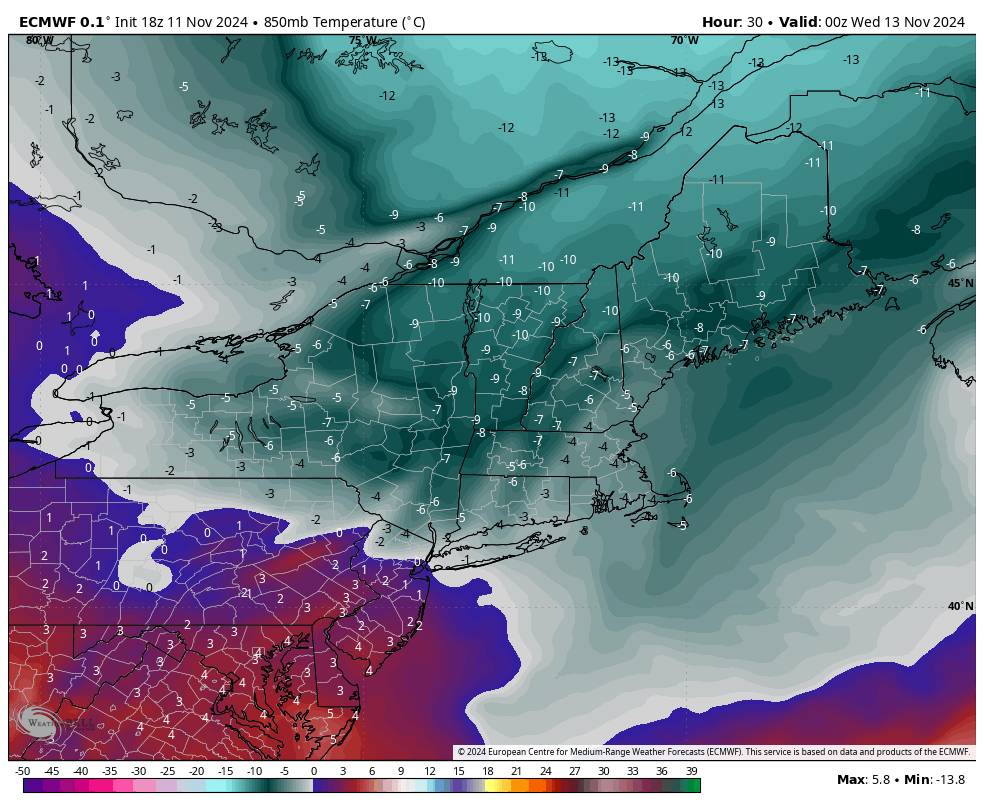
After another briefly warm day, we are heading into a much anticipated pattern change. We have a strong cold front on the way Monday night which will bring a cold air mass (and quite a bit of wind) for Tuesday, Wednesday and even into Thursday. The core of the cold settles in by 7pm Tuesday …