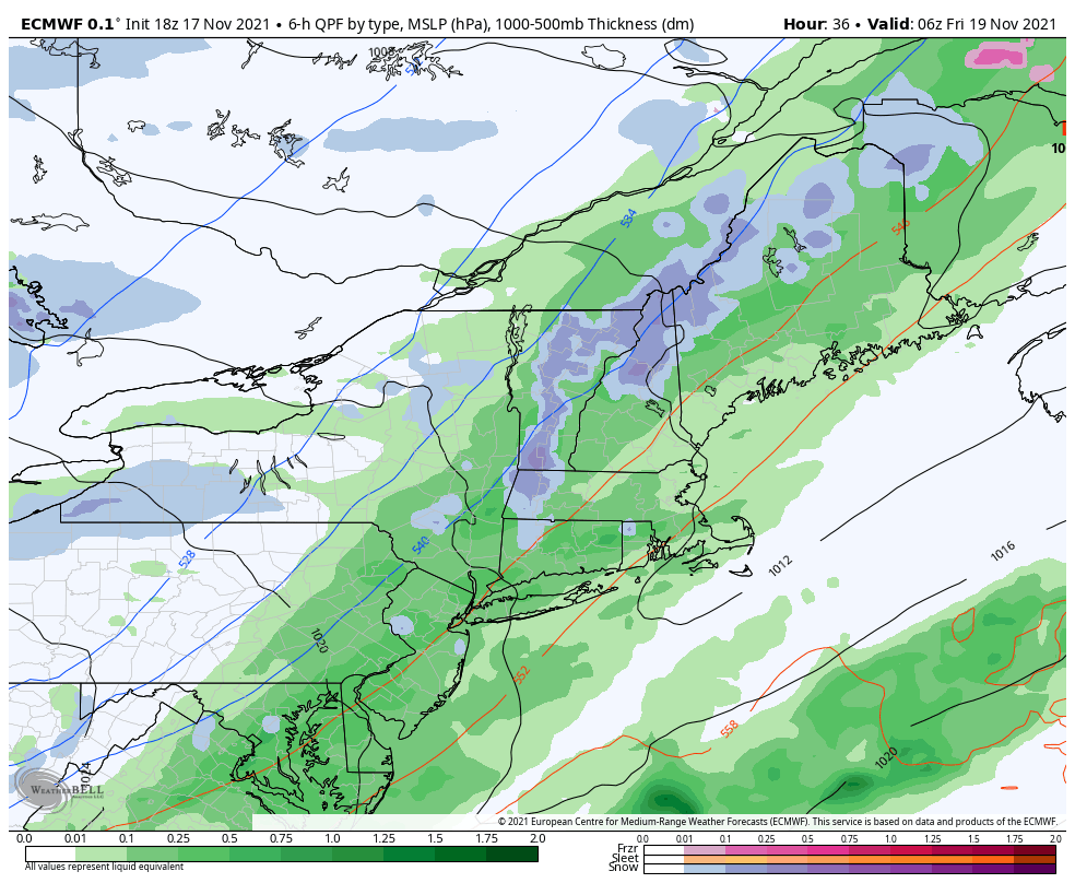
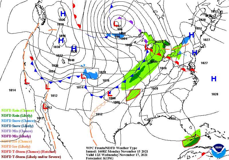
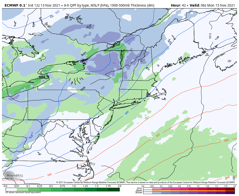
We’ve had our eyes on this system for quite some time now, with the beginnings on Sunday starting in the Great Lakes; light rain/snow is expected. By 10pm Sunday we have light precipitation overspreading the area but temperatures look to be colder than previously expected. This is likely due to the intrusion of cold air …
Category Archives: Killington
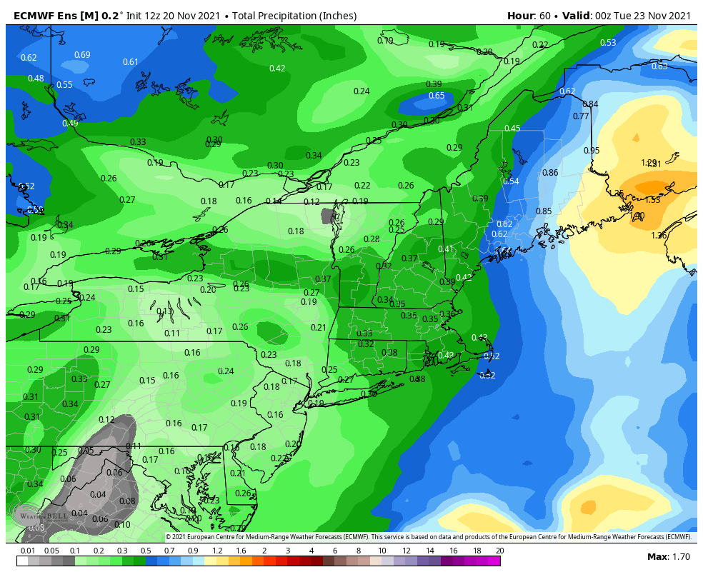
Long Term Views 11/19
The cold is settling in from the cold front last night and we are certainly in the colder pattern that we’ve been expecting. While overall a colder pattern, we still have some ups and downs to deal with. We’ll see that Sunday-Monday this week with the storm and again Thanksgiving Day; each warm up is …
WC Update
Excited to hear the confidence in moving forward with the World Cup next week. The forecast isn’t amazingly cooperative, but certainly provides opportunity. Cold stayed around a little longer than expected with cold air damming setting up. It was expected but not as deep as it was. Warmer air holds strong until Thursday after as …
A Look Ahead – Several Rounds of Cold
The first significant round of cold continues to settle in Monday over the Great Lakes, with the coldest part of the air mass over the Northeast later Monday into Tuesday. It will gradually retreat into Wednesday, from southwest to northeast as a warm front approaches from the south. We may see some cold air damming …
The Next 5-7 Days…
As World Cup closes in, I wanted to provide some extra blogs on the incoming cold air and natural snow. Based off some VT snow stakes, there’s about 3″ reported at 4,000 feet and 1″ around 3,000 feet as of 6:00pm this evening. Snow should depart by 10pm, and temperatures may go down another two …
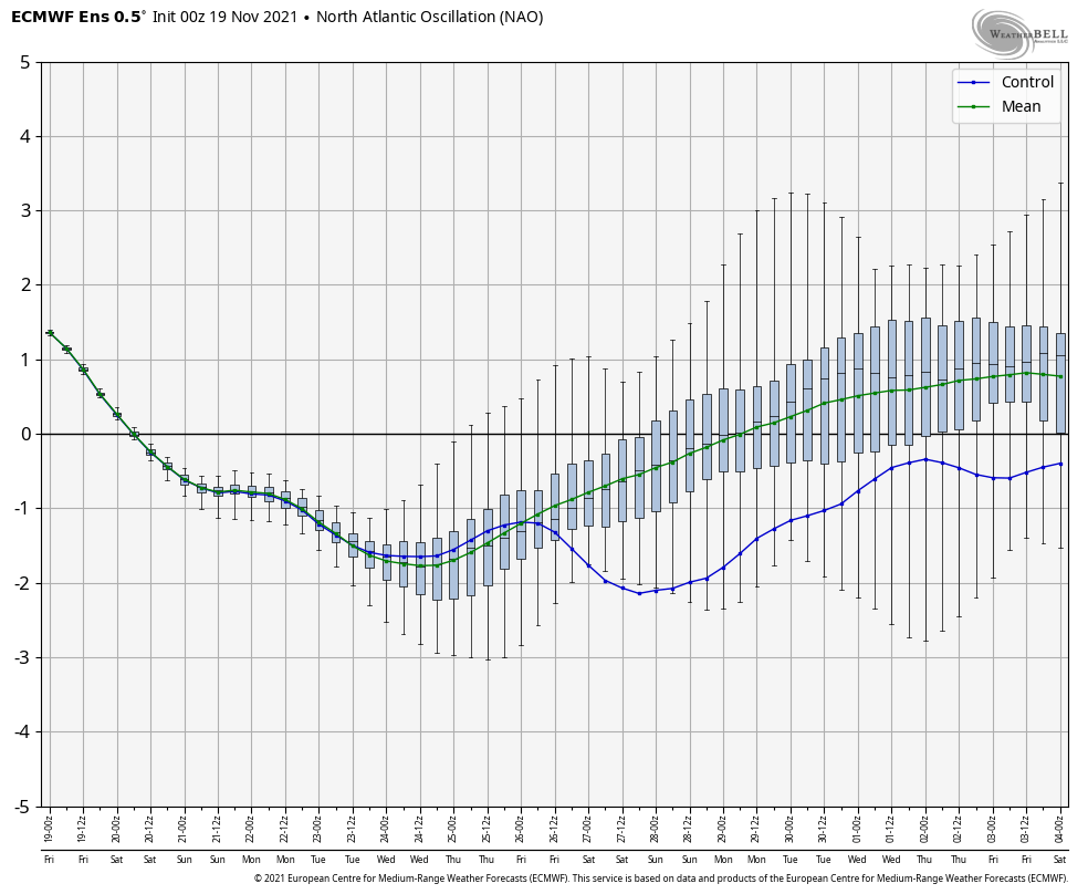
Stratospheric Warming – “Strat Warm”
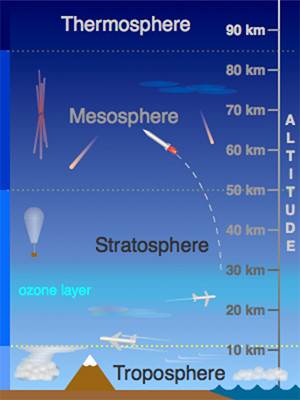
While you may not hear much of this on TV or in normal weather websites, stratospheric warming can have a large impact on the weather in the United States. Last year, it was responsible for the intense snow, ice and cold felt in Texas and many parts of the south. The stratosphere is roughly 10-50km …
A Look Ahead – Waiting for the Cold

The majority of this week is spent waiting for the colder air mass which is scheduled to arrive this weekend. There are a few discrepancies on timing and initial depth but we’ll start to see some of those details come into light as we get closer. Overall Monday and Tuesday are warm days – probably …
The Week Ahead – First Real Cold Punch Arrives
A cold front crossed the region early this morning, prompting a slow and gradual cool down during the day and continues into the overnight. The secondary front, which is bringing our first truly cold air mass, arrives on Wednesday. The core of the cold settles in for Wednesday night, which will be our coldest night …
Continue reading “The Week Ahead – First Real Cold Punch Arrives”
Long Term Views – Ups/Downs of November

This was our season changing week with not one, but two coastal lows to impact the east coast. The tropics look all but shut-off (minus the invest of what impacted us Tuesday/Wednesday), and we have our first cold shot of the season next week. Though we’ll be at the mercy of the current pattern of …
Ice Accretion Forecasts
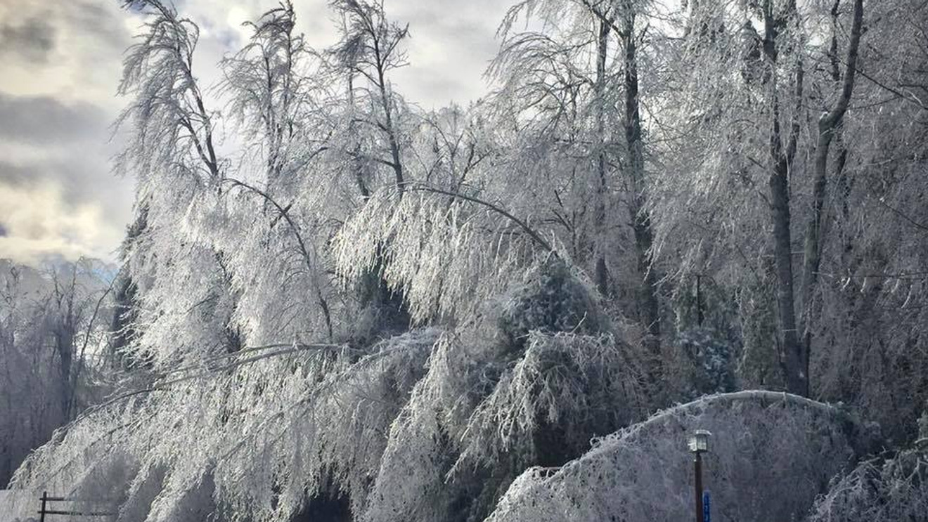
I should probably preface this blog with the fact I’m not forecasting an ice storm – yes there are some models throwing out snow next week but we’ll save that for tomorrow’s discussion! Yesterday, I attended a (virtual) winter weather workshop with the National Weather Service in Gray, ME for their annual meteorologist gathering ahead …