Heading into our final week of January, we’re continuing with the cold stretch. A weak impulse of energy brings light snow to the Great Lakes early Monday, and into New England overnight into Tuesday. Fairly light amounts are expected of just a couple inches, with another reinforcing shot of cold air coming in behind it. …
Category Archives: Killington
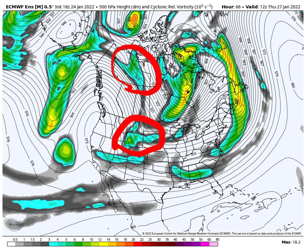
Long Term Views 1/21
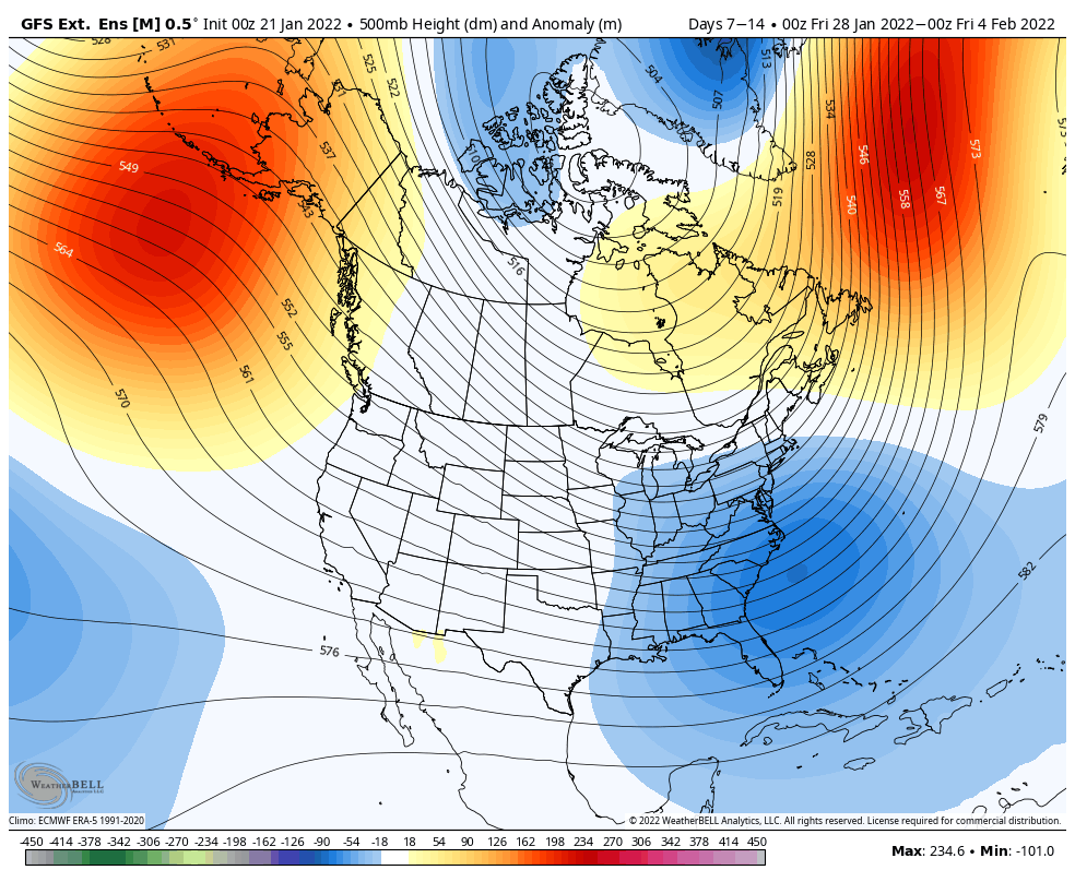
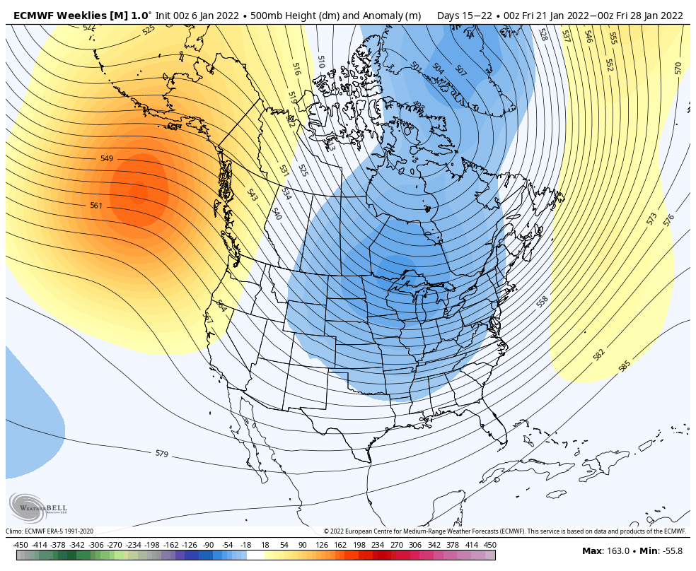
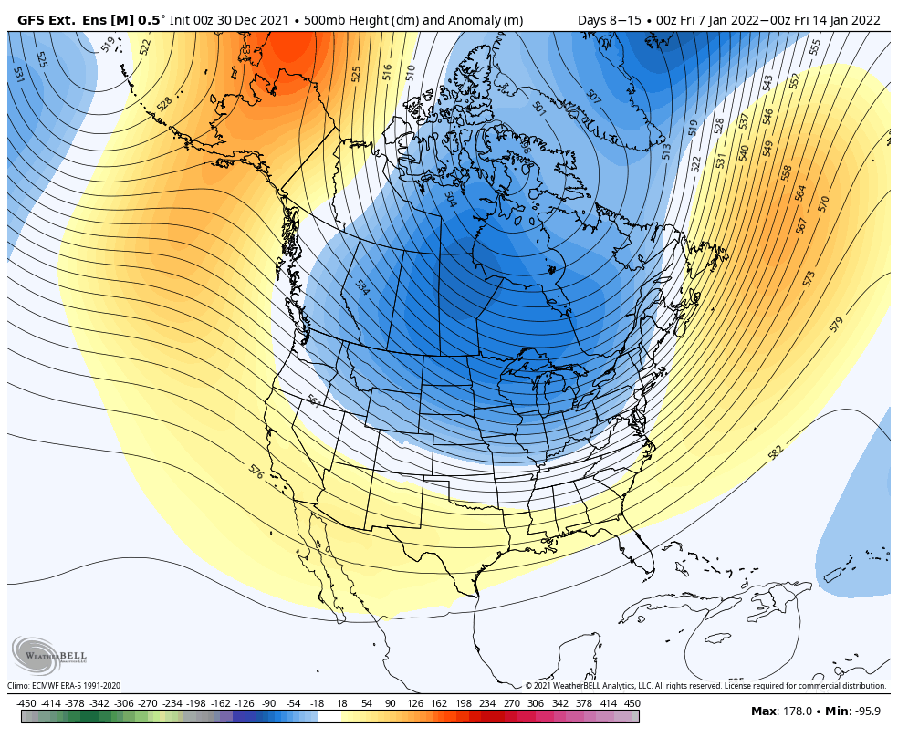
There’s a lot of inconsistency in the long term, so I’m going to focus in the first week of February for now. The Euro, of course, favors the eastern ridge for 1/28, but the GFS/Canadian see differently. I hedge toward the GFS/Canadian because they usually see cold when cold is coming, whereas the Euro is …
The Week Ahead – Fairly Cold, Quiet
There’s not a whole lot going on this week aside from cold, a few small snow chances, and more cold. This is certainly going to be a colder than normal January for us. A very weak clipper slides through the Great Lakes on Tuesday, and New England on Wednesday, and that’s about all the excitement …
Long Term Views 1/15
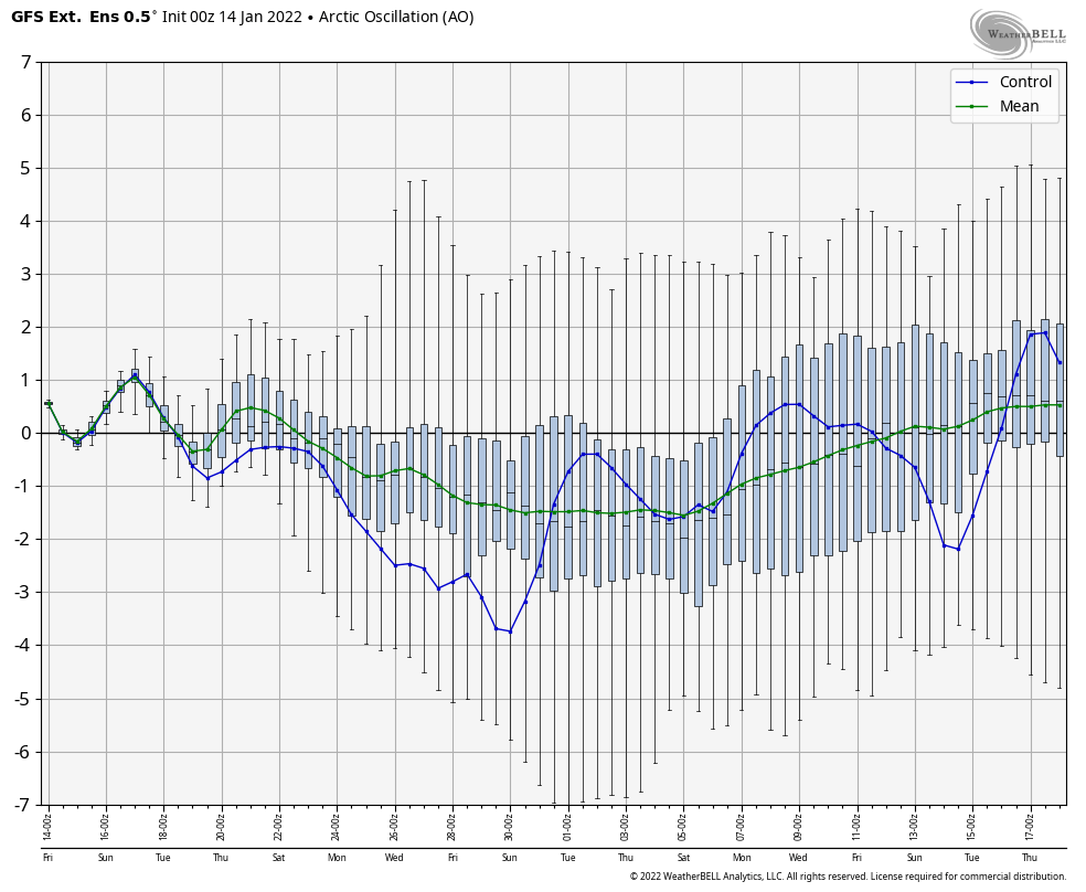
Just a quick update given the active forecast over the next 48 hours. The long term remains on course with a cold rest of January expected. Looking at the GFS, it’s holding onto the cold a little longer into February. In the long range, the GFS will more easily see the cold than the Euro …
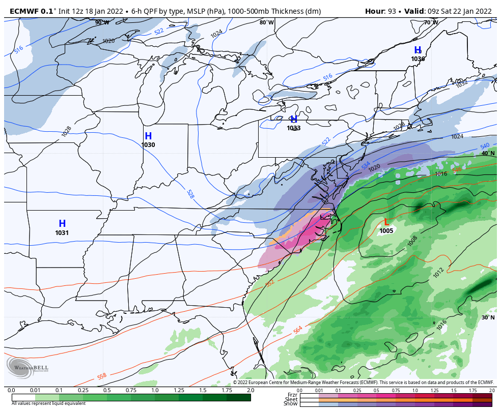
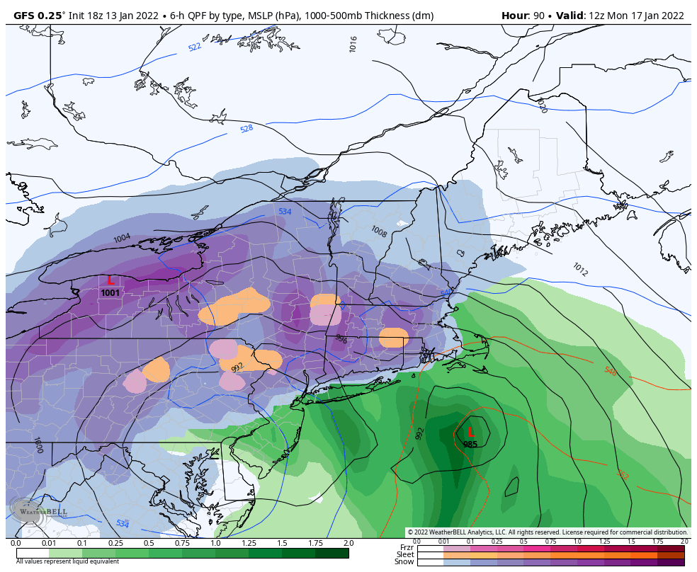
Storm Update 1/15
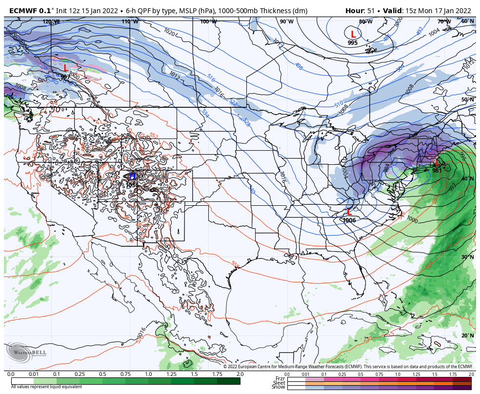
About two hours ago, I would’ve had a more confident, concise opinion about the storm movement toward a more dominant inland low. However, some of the 12z guidance has shifted more emphasis on the coastal low, and the overarching message is then again, there is not enough information on how the energy transfer is happening …
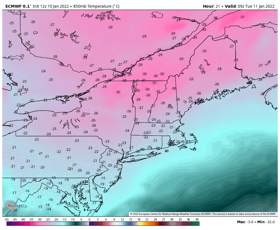
Arctic Cold & Impending Storm
We have a lot on the table for the holiday. weekend; another cold blast of arctic air and an impending low pressure system that a little temperamental. This cold blast may not be as deep as the previous, but the timing is not helpful. We’ll have the heart of it in the Northeast Friday night …
The Week Ahead – Arctic Blast Takes Hold
There’s not too much more to this week than the cold. Some of the lowest temperatures seen in the last 4-5 years will be rivaled in the next 48 hours. Pept0-pink is always exciting on snowfall maps, but not quite as welcomed on temperature maps. Wind Chill Warnings and Advisories are in place for much …
Long Term Views 1/7
It was a lackluster storm today, but it was something! Most areas received 1-3″ of very light and fluffy snow out of this system. We’ll see some upslope snow showers continue into the overnight hours in New England. We have another weak system of mixed precip/light snow on Sunday before the arctic front comes through …
The Week Ahead 1/3
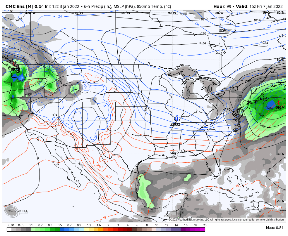
The cold is here and it will settle in deeper Monday night – we see some of the longest and deepest snowmaking windows for the season so far in the Mid-Atlantic. We’ll see a cold start to Tuesday with the sun making a reappearance as well in the east, and a brief warmup ahead of …
Long Term Views 12/31
Happy New Year everyone! We’re taking a look into the first couple weeks of January. While it’s not the most ideal overall pattern for the east, it’s one of the most favorable for since we entered the late fall/early winter season. The Euro has not been performing well with this pattern and the winter as …