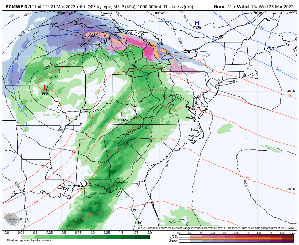
The first 36-48 hours of the week are rather quiet – breezy but no major precipitation to contend with. Temperatures are on the more mild side, but not warm. Clouds gradually increase from west to east Tuesday night through Wednesday with precipitation moving into the Great Lakes in the wee hours of the morning, and …
Category Archives: Killington
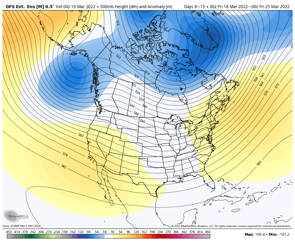
Long Term Views 3/18
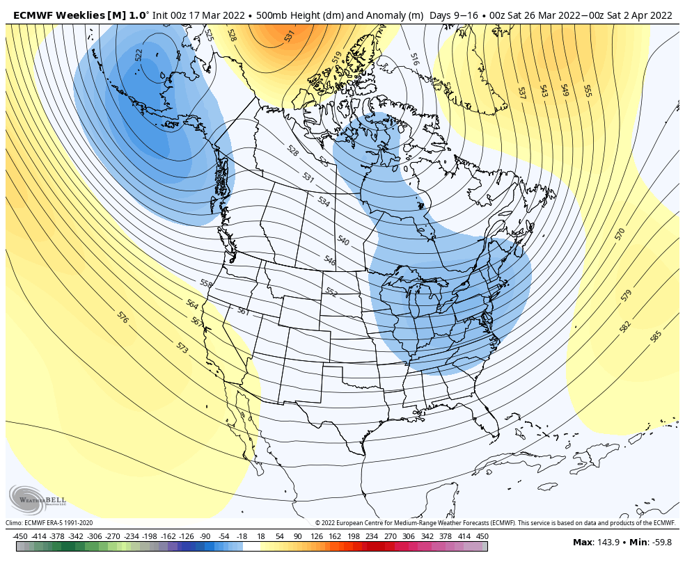
The pattern continues its volatility into the end of the month. We’re going to see somewhat of a cooler pattern into next week. The AO stays fairly neutral and the NAO stays slightly negative to neutral, which does allow for the opportunity to see some pockets of cold and even snow. Of course heading into …
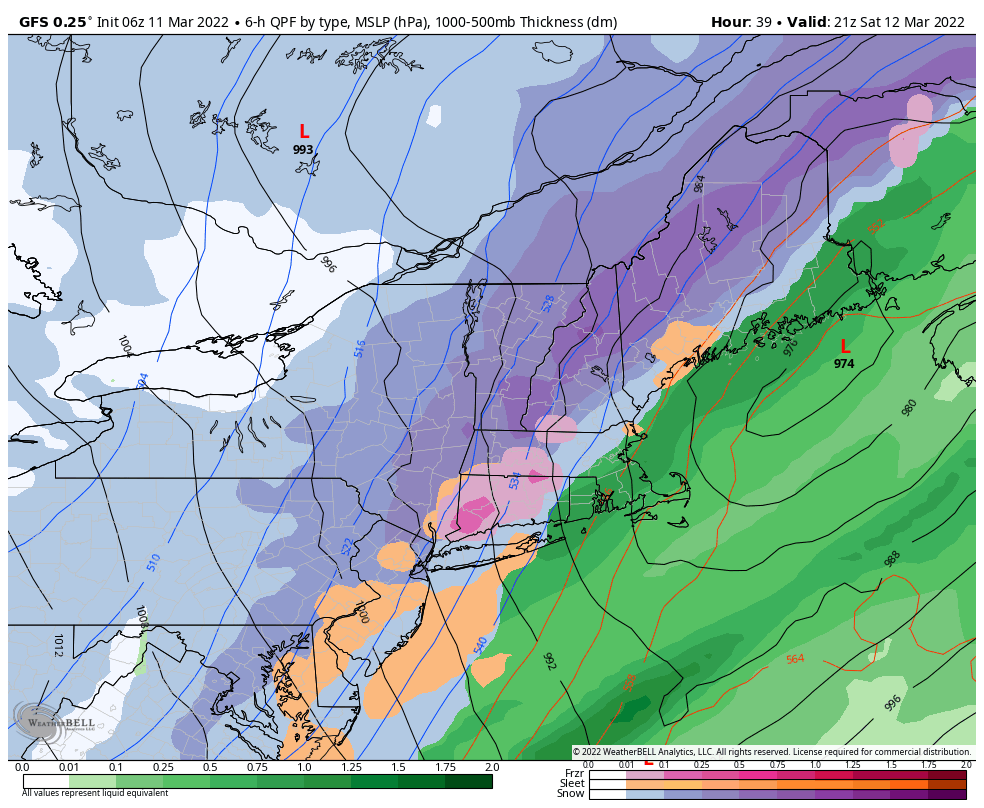
Weekend Storm System
The solution hasn’t been completely changed by cold, but there is a minor cold component from cold air damming for the onset in portions of ME, NH and possibly a couple spots in VT. Otherwise we’ll be seeing a mostly rain system coming through Saturday morning through Sunday. The bulk of the precipitation comes through …
The Week Ahead 3/14
This week features three pieces of energy that will impact the eastern region – the most impactful of those systems likely to come over the weekend and unfortunately, there’s not a large amount of agreement on it. First, we have an elongated boundary that’s strung out across the Great Lakes Monday afternoon, bringing light snow …
Long Range Views 3/11
The volatile pattern continues through March with similar warm/cold spells that we’ve been seeing over the past couple of weeks. The GFS has actually been doing better than the Euro in the long range (7+ days), so I’m going to stick with it for this blog. Heading into the middle and end of next week, …
Storm Discussion 3/11
This storm has been an interesting one to watch develop – a lot of moving pieces and components make a huge difference to the forecast. For now, it’s clear that most mountain areas will get snow at some point. Most of VT, central/northern NY, northern NH and far northern ME may not see a drop …
The Week Ahead 3/7
After some non-snow precipitation, we’re back to a slightly colder pattern heading into the midweek. We have a few systems to impact the Northeast and Mid-Atlantic, while the Great Lakes stays pretty quiet. Cold air returns Tuesday with a low pressure system arriving for Wednesday. There’s been a little discrepancy on this one but it …
Incoming Storm(s) Late Sat-Tuesday
We’re headed into this weekend with some good news for New England, not great news for the Great Lakes and Mid-Atlantic. In the Week Ahead blog from Monday, we knew that some part of this storm was going to be warm. However we had conflicting signals Monday, and as we eluded to, it looks like …
The Week Ahead 2/28
Overall the start of March is going to be rather quiet. We have no major systems that will come through during the week, and eyes will be on the weekend for a (likely) warm system. A couple clippers come through with light snow – one on Tuesday and another Wednesday night into Thursday. These will …
Long Term Views 2/25
Heading into the first weekend and second week of March, it looks as though we’re going to have a little reprieve in cold shots after the succession of them in the upcoming week. This is a little different than what we had seen last week for the 3/4-3/11 time period, but this is likely because …