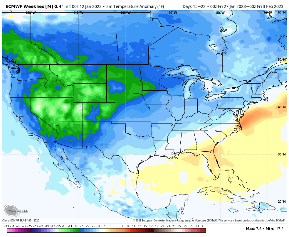
It’s been a mixed bag of everything over the last couple of days, but we’re gradually moving toward a somewhat cooler pattern. We’ll notice this more in the last week of the month, which has been the focal point for a pattern change. The good news is that from last week’s blog to this week’s, …
Category Archives: Killington
Long Term Views 1/6
After a little taste of more winter-like conditions the last few days, we’ll stay in a relatively stable pattern through the week. Next time frame of concern arrives around 1/14 and 1/15 as models are indicating another strong low pressure system. Right now it’s too early to tell how this will evolve, however the NAO …
Long Term Views 12/30
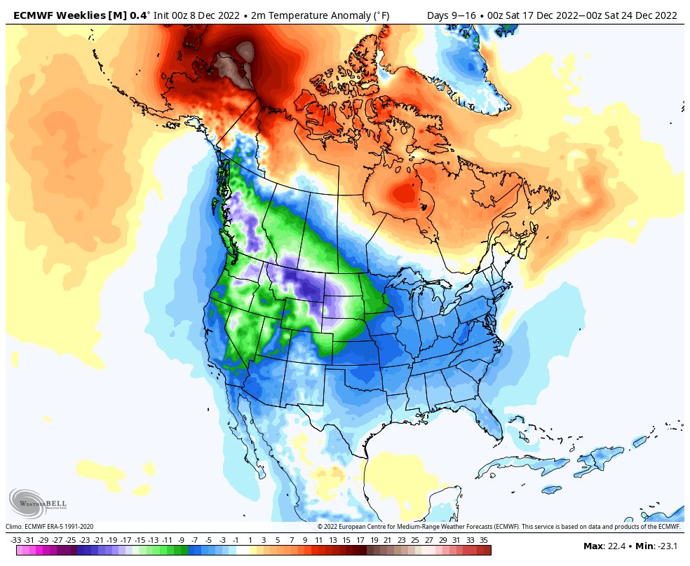
We’ll see a bit of a transition heading into next week, coming out of it in a cooler, not cold, pattern after another spike in temperatures Tuesday and Wednesday. We’re not quite seeing the eastern trough develop like we did prior to Christmas, but rather a SE trough developing into the middle of the month. …
The Week Ahead 12/26
We are moving out of the cold pattern through the next couple of days… An elongated front draped over the Great Lakes brings a few rounds of snow showers to the Northeast during the midweek, in addition to some accumulating snow mixing with sleet for the northern Great Lakes Tuesday night – Wednesday as we …
Long Term Views 12/23
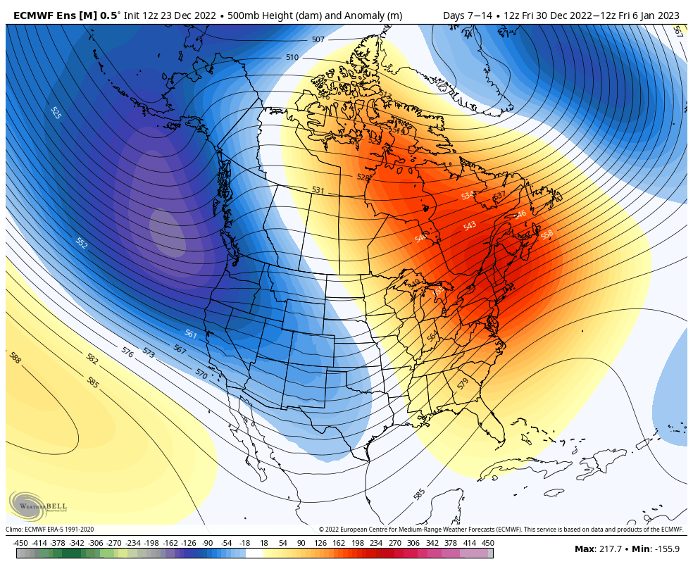
The cold that settles in with the arctic front is going to hang around through the midweek. We can expect above freezing temps coming in by Wednesday across the eastern seaboard. This is our transition out of the ‘cold’ pattern for about 2 weeks, which is sometimes called a “reloading” pattern. It’s impossible to constantly …
The Week Ahead 12/19
Heading into the week ahead, we have one system that all eyes are on. This is going to be a strong, impactful system for all areas, and especially where we are going to see rain in places we just saw high amounts of snow. It’s the tail of multiple low pressure centers, which is historically …
Long Term Views 12/16
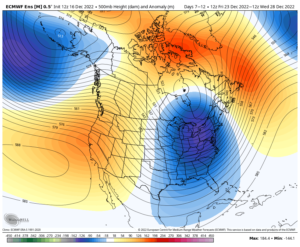
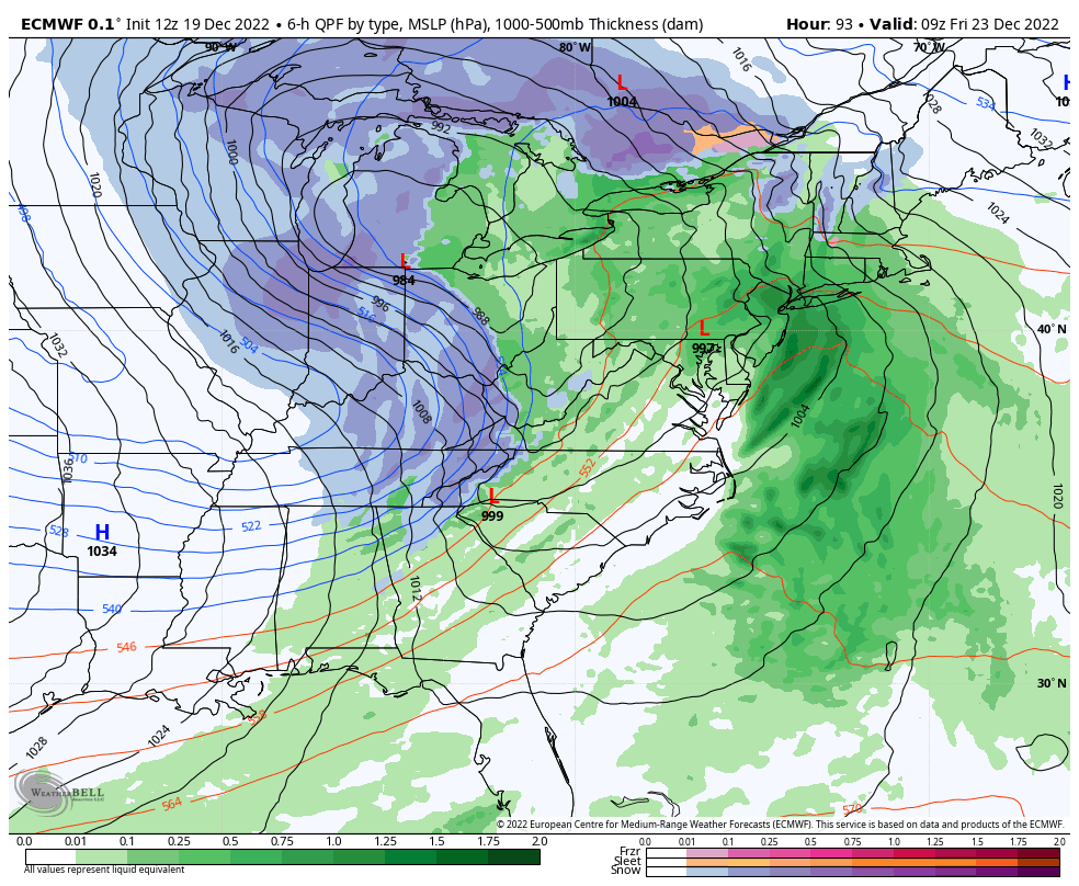
A quick update on the system; it’s over-performed in the Catskills, Adirondacks, and the central/southern Greens and otherwise been fairly on forecast…certainly more of a Northeast system while the lake effect snow machine kicks up in the Great Lakes. We’ll continue to see the snow diminish from west to east throughout the weekend in New …
Storm Update 12/14
Now that we’re getting into the short-term with our storm system, we’re seeing some finer details come in. I’ll save the video for tomorrow as we see the storm developing in real time. So here’s what we’re looking at broken down by region… Great Lakes: The storm approaches overnight with rain for the LP and …
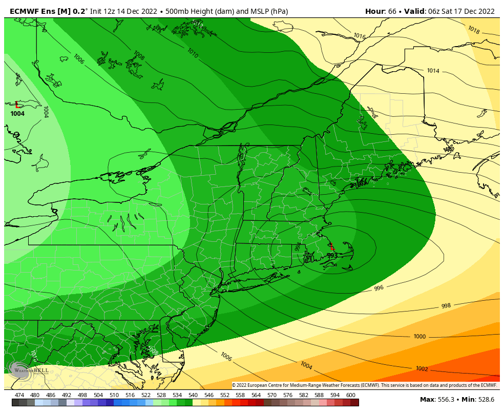
The Week Ahead 12/12
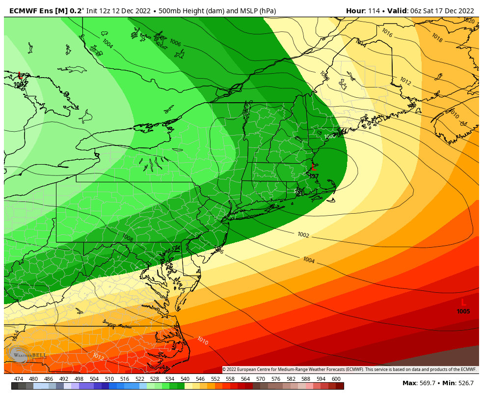
The week ahead is relatively cool and quiet until a strong low pressure moves in later this week. There’s still some finer details to work on the storm, and I’ll be updating midweek specifically on that. We’ll start to see a little moderation in temperatures Tuesday during the day in the Mid-Atlantic and Great Lakes. …
Long Term Trends 12/9
A few quick notes on the short term before we get into the long term… *Current air mass – mostly for New England areas – you may have noticed that there have been dry layers moving into different parts of the mountain today. This will likely continue into Saturday, and it can be very sporadic …