It seemingly took forever but this is the first week that the ONI Index is ENSO neutral. It’s the first time we’ve been here for nearly three years. Better late than never, but it would’ve been nice for this to happen a month ago… The effects of transitioning to ENSO neutral have already been seen …
Category Archives: Killington
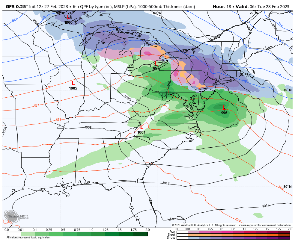
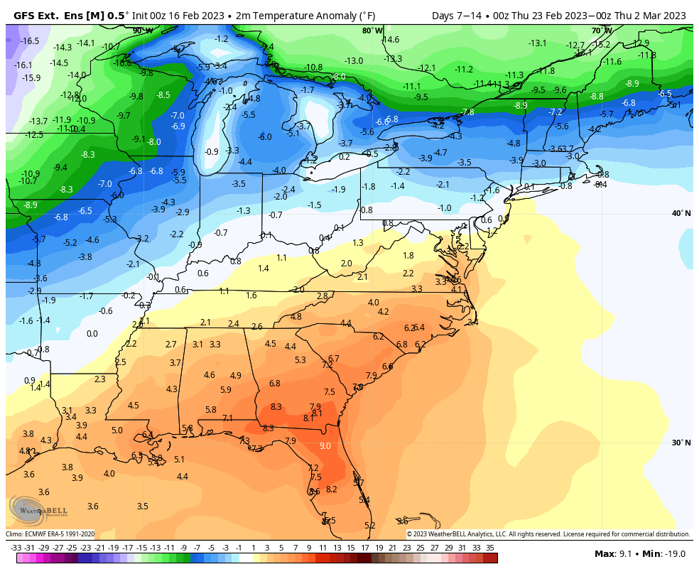
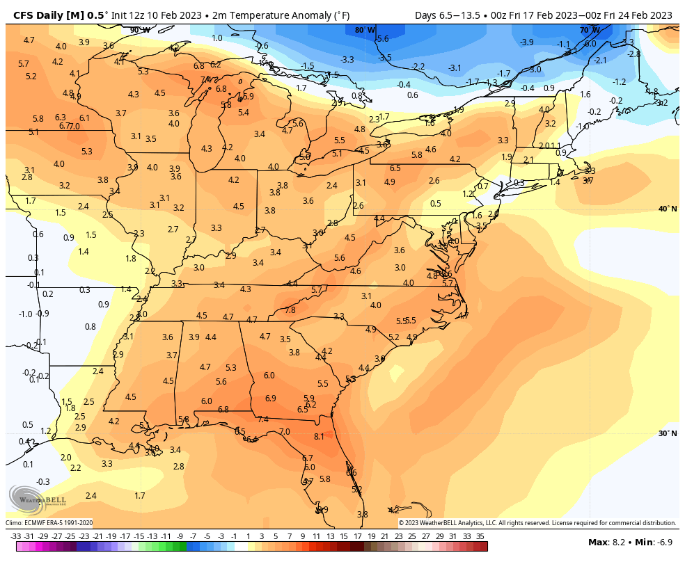
Long Term Trends 2/24
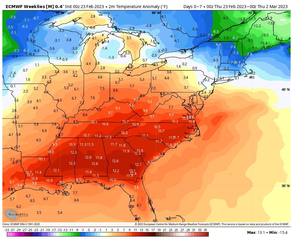
The overall trend is a cooler March for most; though it’s a bit tumultuous to start. In the next 7 days, we’ll have a fair amount of warmth from the Mid-Atlantic and south with the southeast ridge in place. Notoriously, the GFS handles the southeast ridge better than the Euro, therefore I’ll be hedging my …
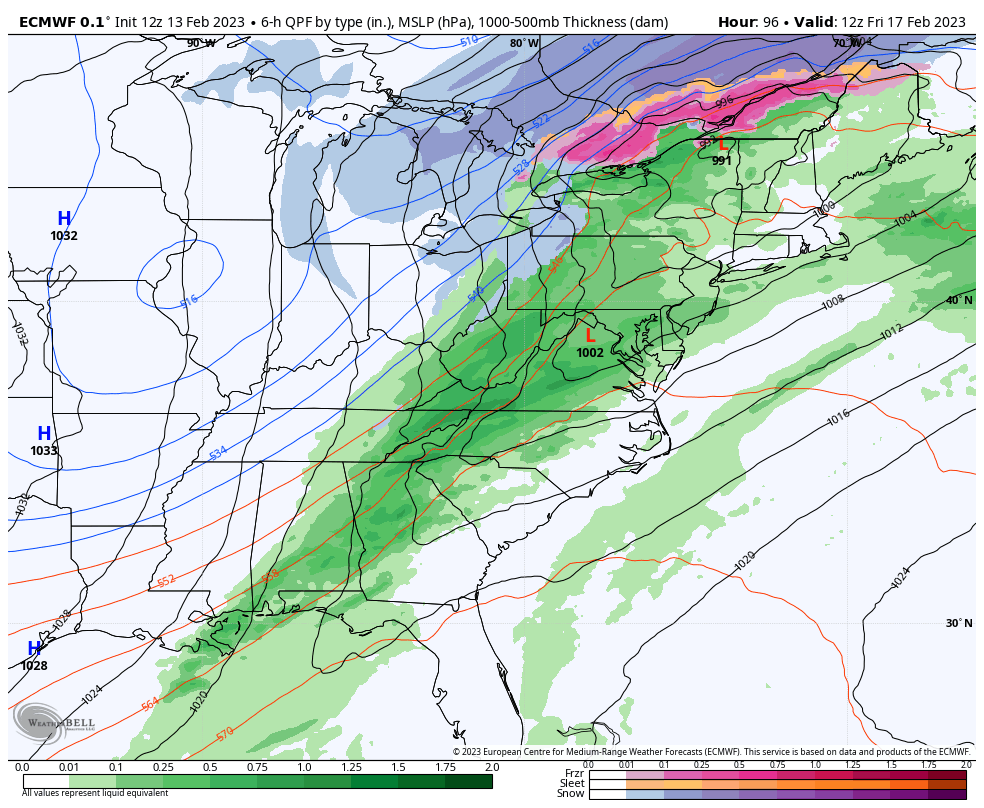
Long Term Trends 2/17
The warmth is behind us after the strong cold front came through Friday. This coming week will be more of a transition week before we start seeing a colder pattern settle in. We’ll have a couple quick systems come through, followed by a strong system Thursday/Friday which will be a mixed precipitation event for most. …
The Week Ahead 2/13
This week will ultimately be the warmest week that we have through the month. Two cold fronts come through – the first of which has already passed through the Great Lakes and will arrive in the Northeast Tuesday. We’ll see a weak low pressure develop offshore Tuesday, prompting some light snow showers early Tuesday morning …
Long Term Views 2/10
We are one week into the more progressive, warmer pattern that marks the after effects of the historic cold outbreak this time last week. Overall the pattern has been active with ebbs and flows in the temperature, therefore it hasn’t been a constant blow torch of warmth. The week before February break will be on …
The Week Ahead 2/6
There are two systems that we’re watching for the week ahead, along with several non-diurnal temperature changes. While the Northeast is cooling off more substantially than expected Monday night, we’re starting to see warming ahead of a cold front front in the Great Lakes and just getting into the Mid-Atlantic. Some summit areas in New …
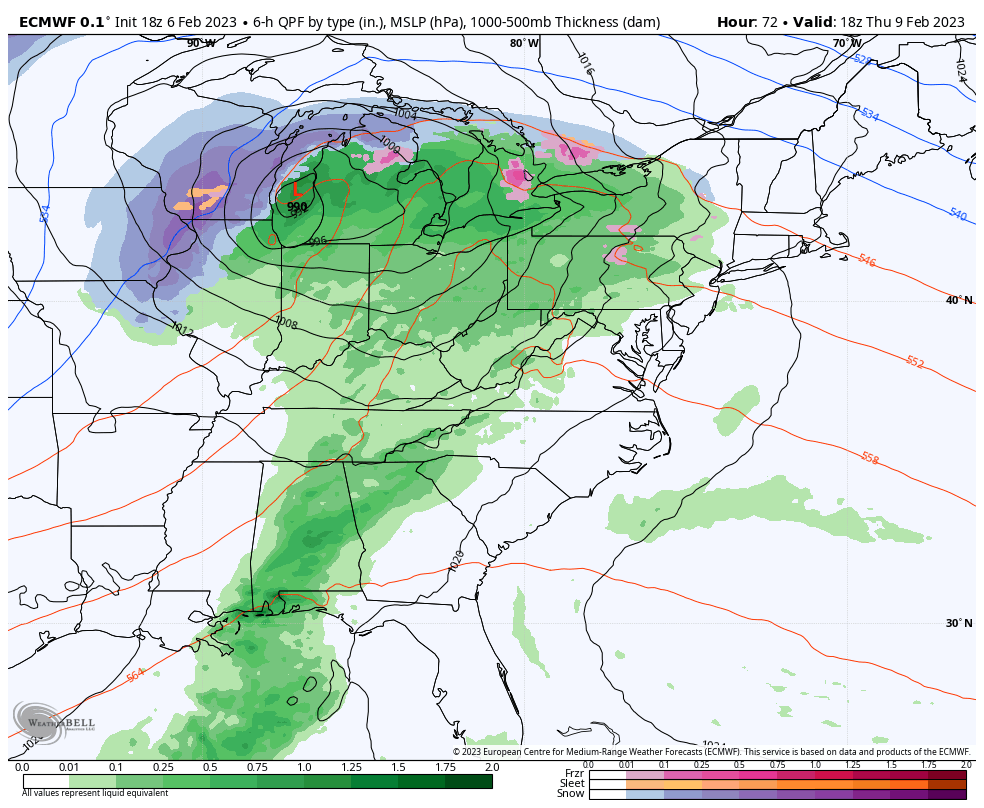
Long Term Views 2/3
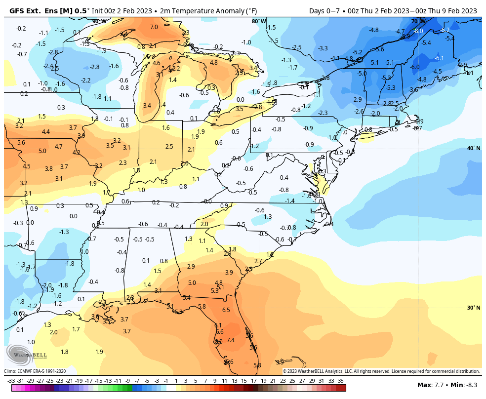
As with any major arctic outbreak, a swing to the other end is inevitable. However, we do have two differing opinions on the outcome. The GFS is slightly more on top of the temperature trends. If you look at last week’s long term trends for Days 7-14, and compare to the current 0-7 Days, both …
The Week Ahead 1/30
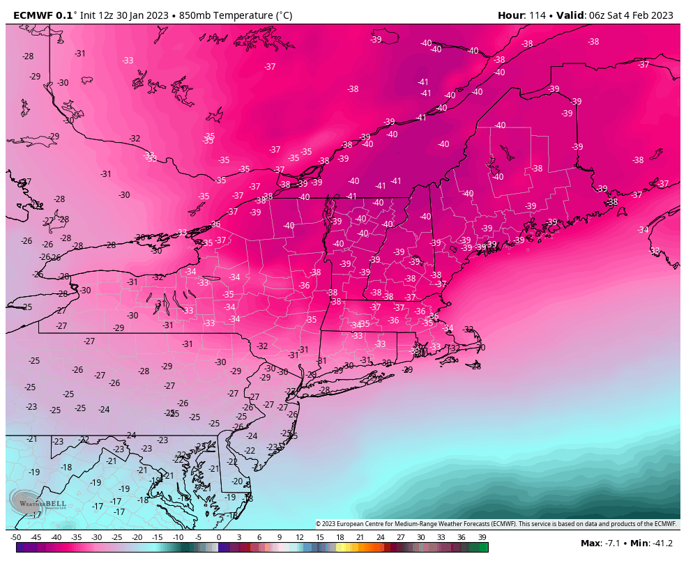
The main focus of the week ahead is the possibly historic arctic air intrusion Friday into Saturday. This will be some of the coldest air felt in quite some time when you factor in wind chills. Ahead of that, we’ll have a brief round of fairly cold air, settling in Tuesday and Wednesday before a …
Long Term Views 1/27
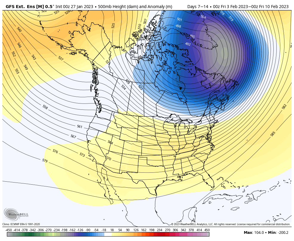
There’s a couple discrepancies in the long range that have some implications to the forecast, but overall we’re in a relatively cooler pattern. I’m going to post both the GFS Extended and the Euro Weeklies together to more easier show the comparison for Days 7-14 and then Days 14-21. Days 7-14: There are quite a …
The Week Ahead 1/16
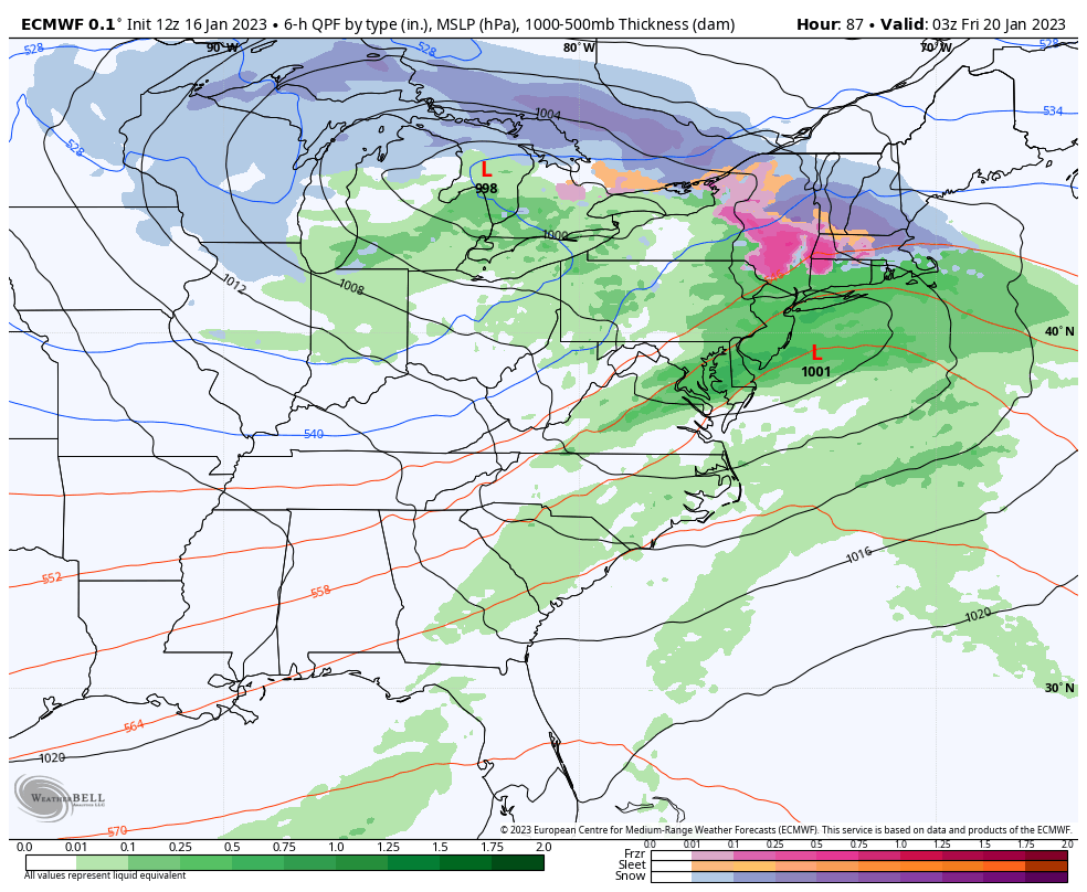
Our week ahead has a couple storms to feature. We have a Tues/Wed system, a Thur/Fri system, and another that will come sometime late Sunday into Tuesday of next week. This is the week we transition out of our current pattern. However, the pattern change isn’t one that’s going to put us into the tundra. …