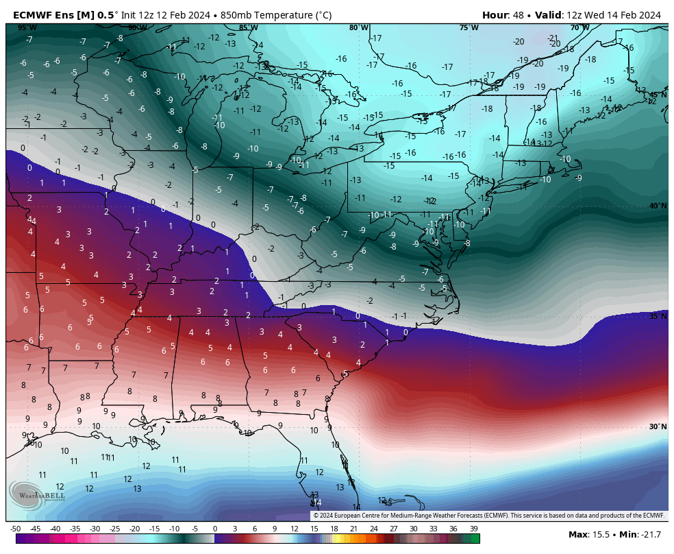
The week ahead brings quite a bit of cold air to the region and an active pattern. Our Tuesday storm system has been one of most poorly forecast coastal storms of the season — we’ve seen plenty of storms start south and shift north, but they actually come to fruition in that space (and typically …
Category Archives: Jay Peak
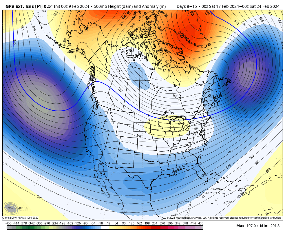
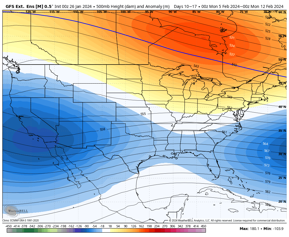
Long Term Views 2/10
We’ll be back to cold with some storminess for the week ahead. The coastal storm looks to be a bit more for southern New England and the Mid-Atlantic. Following this we have a blast of cold air through next weekend. Days 7-14, our first vacation week period has an interesting look to it. This has …
The Week Ahead 2/5
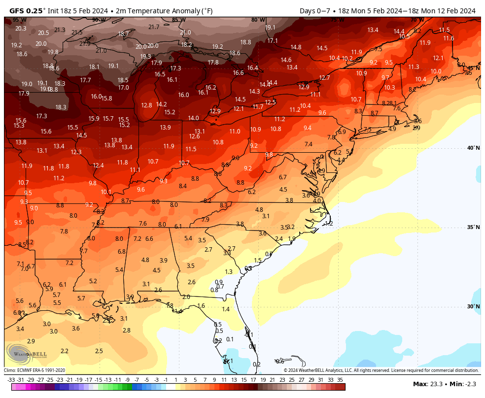
We’re in a quiet week as we transition into a colder pattern next week. Overall temperatures are moving up each day with quite a but of sunshine. This will bring us well above average for the week with some areas reaching the 40’s by Saturday. A warm front brings light rain, mixed precipitation and snow …
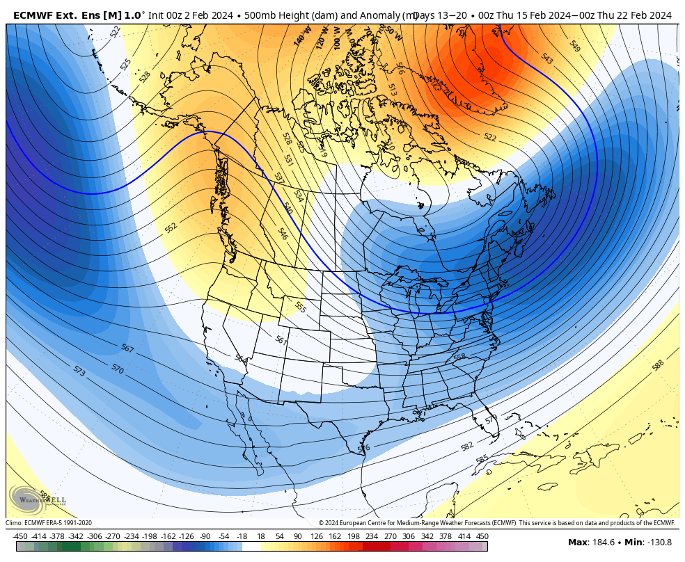
Long Term 2/2
We’re in a rather quiet pattern for the next week with more mild air in place, but outside the Great Lakes and portions of the Mid-Atlantic, it’s not overwhelmingly warm. This begins to change next weekend. We’ll start to see more “troughiness” develop across the country which will regenerate the pattern in Days 7-14. Notice …
The Week Ahead 1/29
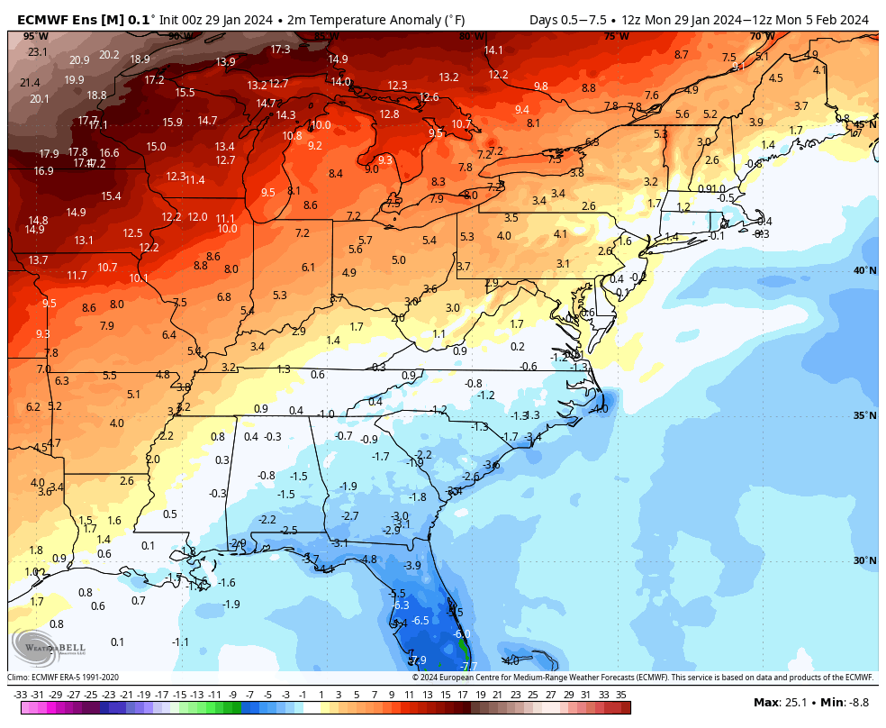
After many weeks of storm after storm, we’re entering into a less stormy pattern this week that should linger through about Feb 10/11. Temperatures go through a little up and down this week, but nothing overly mild, which has been the case in this “warm up” we’ve had. Overall temperatures stay slightly above average, but …
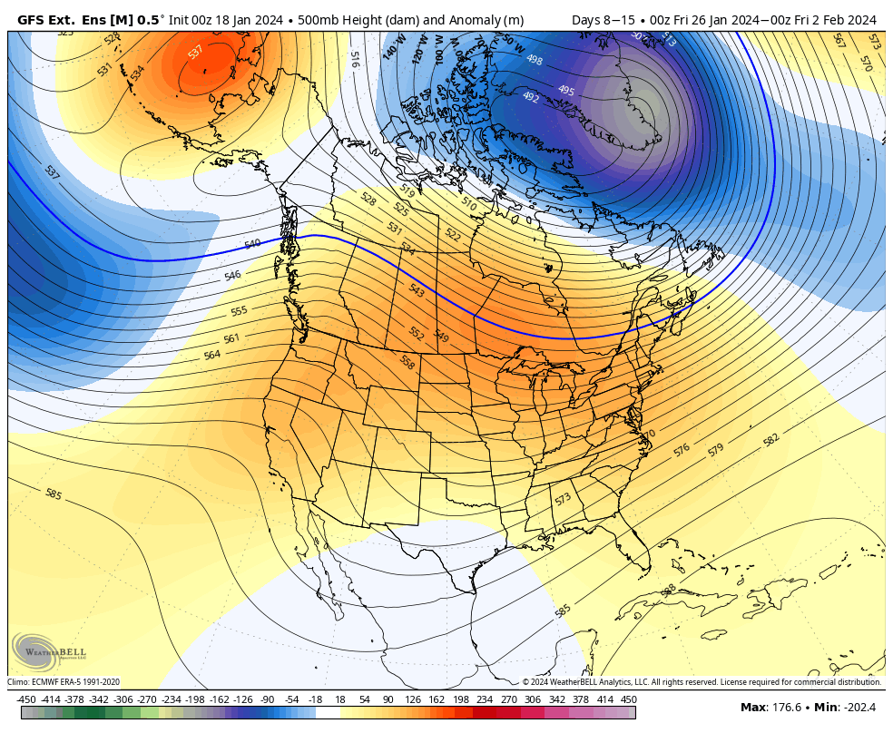
Long Term 1/26
We’re going to continue seeing very minor bouts of “warmth”, and by warmth…it’s really more like “not as cold.” Mixed precipitation events may be more prevalent in Days 7-14 as we transition. For the week of Feb 5, we’ll see a warmer cored air mass centered just north of the Great Lakes, which will bring …
Week Ahead 1/22
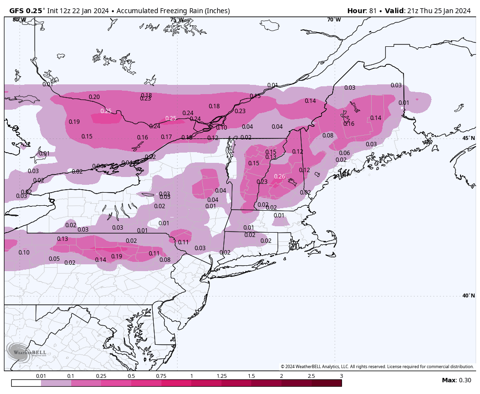
This is our week of moderation, though there’s no blowtorch of temperatures occurring, it’s actually more like a rollercoaster ride of somewhat seasonable temperatures and inclement weather. A weak wave of overrunning precipitation comes through later Tuesday into Wednesday morning from the Great Lakes to the Northeast. This is a warm front passing through but …
Long Term 1/19
Our arctic cold spell comes to an end heading into Monday with a brief “warm up” during the week. There’s not a ton of warm air in this, but it’ll get near/a bit above freezing at the height of the day, with a couple systems coming through as well – expect all p-types with these. …
The Week Ahead 1/15
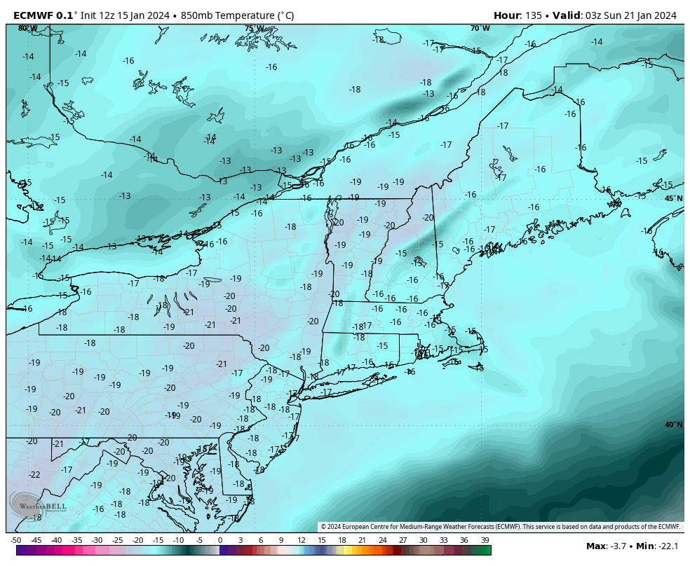
A quick blog for the week ahead…we’re not seeing much change in the forecast as it’ll be a cold week with some minor bouts of snow. The 1/16 storm system revived itself in the last couple of days, once again giving credibility to the Canadian model who never gave up on this storm system when …
Long Term 1/12
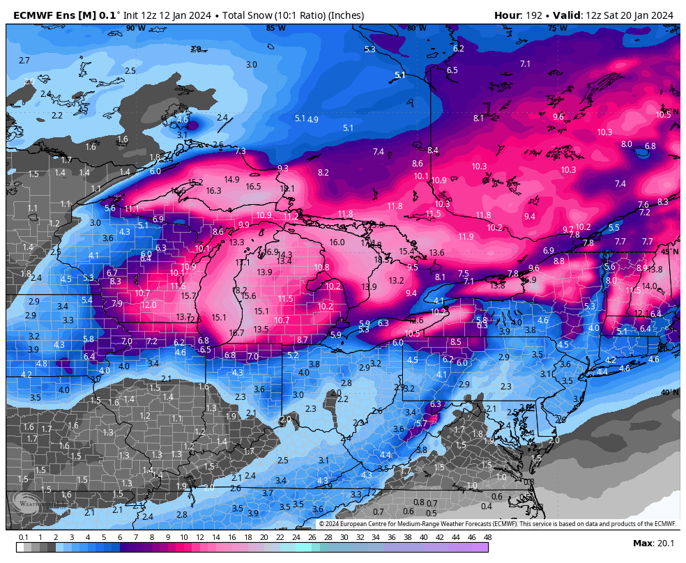
We’re about to see our third system in 6 days arrive in the Northeast, and we’re not done yet. This one will be similar to the Tuesday/Wednesday storm, but honestly the latest runs look a smidge more intense with the damming. So while we’ll probably still see a transition to rain in all areas, snow …