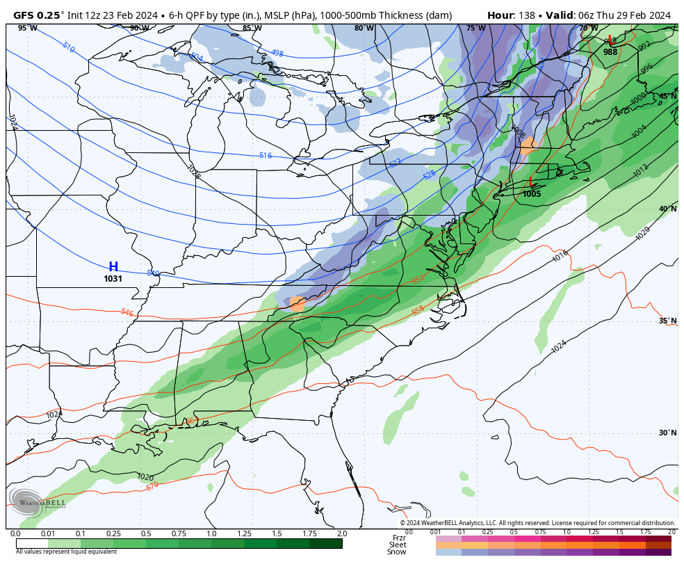
We’re about to head into a warmer phase, especially for the middle of next week. The somewhat good news is that the cold front looks to be faster — which will not only limit rain and warmth, but could also change some rain to snow before fully departing. Temperatures will crash down behind it for …
Category Archives: zzz Catamount Mountain Resort
The Week Ahead 2/19
The rollercoaster ride of temperatures continues through the week and upcoming weekend. We have a slight increase in temperatures Tuesday before moderation fully takes over for Wednesday and Thursday ahead of the incoming storm system. There’s not much precipitation to speak of beyond the low pressure system Thursday/Friday along the east coast – not much …
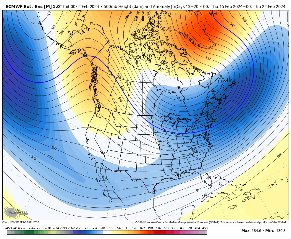
Long Term 2/17
Volatility continues to be the norm as we head through this week and the coming weeks. While El Niño is very slowly declining in the equatorial Pacific, the changes are likely not to be felt until mid-late March globally. The MEI index fell for December/January back to a weak El Niño, so they’re more likely …
The Week Ahead 2/12
The week ahead brings quite a bit of cold air to the region and an active pattern. Our Tuesday storm system has been one of most poorly forecast coastal storms of the season — we’ve seen plenty of storms start south and shift north, but they actually come to fruition in that space (and typically …
Long Term Views 2/10
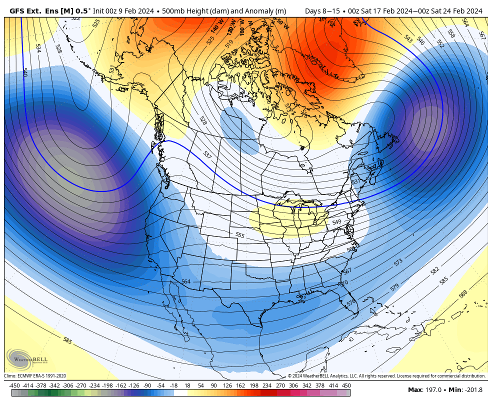
We’ll be back to cold with some storminess for the week ahead. The coastal storm looks to be a bit more for southern New England and the Mid-Atlantic. Following this we have a blast of cold air through next weekend. Days 7-14, our first vacation week period has an interesting look to it. This has …
The Week Ahead 2/5
We’re in a quiet week as we transition into a colder pattern next week. Overall temperatures are moving up each day with quite a but of sunshine. This will bring us well above average for the week with some areas reaching the 40’s by Saturday. A warm front brings light rain, mixed precipitation and snow …
Long Term 2/2
We’re in a rather quiet pattern for the next week with more mild air in place, but outside the Great Lakes and portions of the Mid-Atlantic, it’s not overwhelmingly warm. This begins to change next weekend. We’ll start to see more “troughiness” develop across the country which will regenerate the pattern in Days 7-14. Notice …
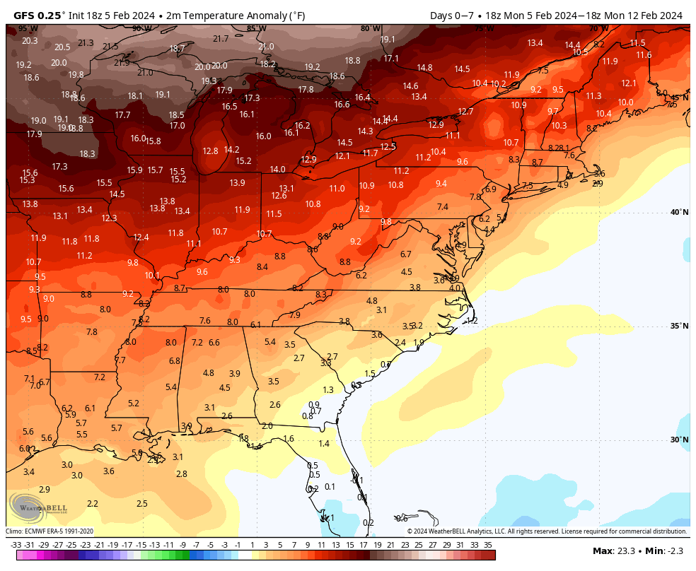
The Week Ahead 1/29
After many weeks of storm after storm, we’re entering into a less stormy pattern this week that should linger through about Feb 10/11. Temperatures go through a little up and down this week, but nothing overly mild, which has been the case in this “warm up” we’ve had. Overall temperatures stay slightly above average, but …
Long Term 1/26
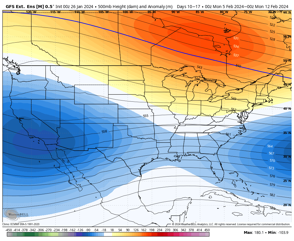
We’re going to continue seeing very minor bouts of “warmth”, and by warmth…it’s really more like “not as cold.” Mixed precipitation events may be more prevalent in Days 7-14 as we transition. For the week of Feb 5, we’ll see a warmer cored air mass centered just north of the Great Lakes, which will bring …
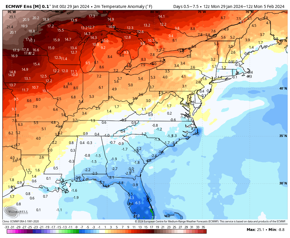
Week Ahead 1/22
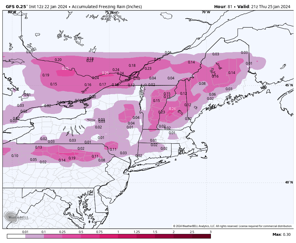
This is our week of moderation, though there’s no blowtorch of temperatures occurring, it’s actually more like a rollercoaster ride of somewhat seasonable temperatures and inclement weather. A weak wave of overrunning precipitation comes through later Tuesday into Wednesday morning from the Great Lakes to the Northeast. This is a warm front passing through but …