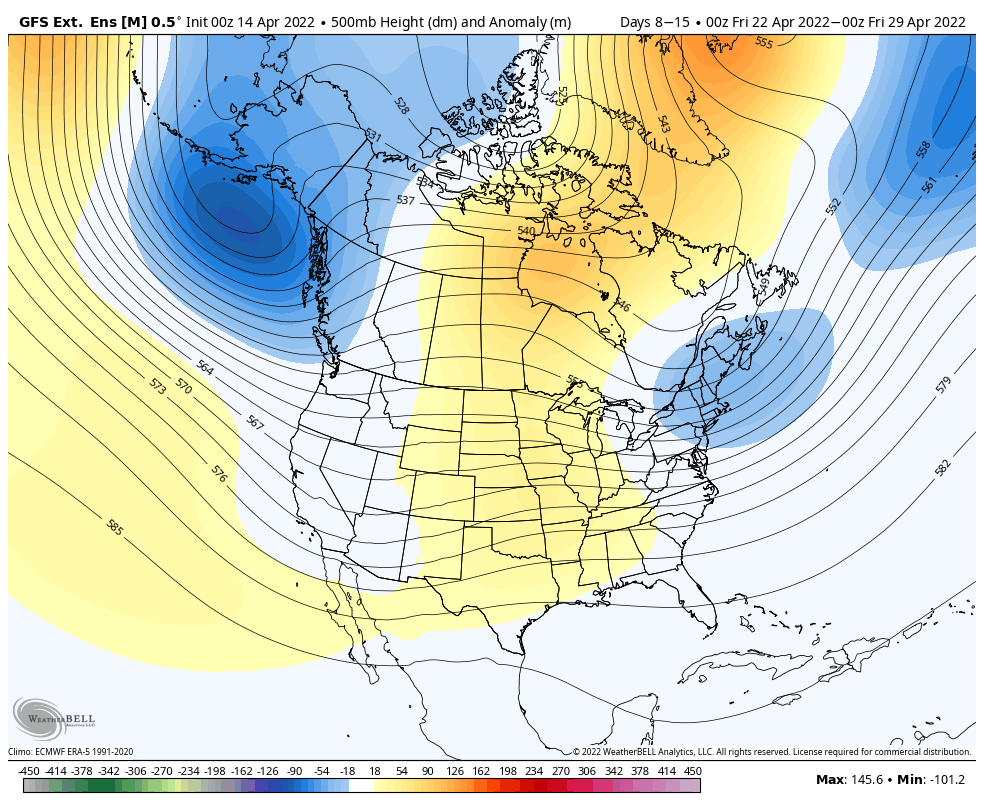
While next week certainly looks below average to start, especially with a possible wintry system arriving on Tuesday, there’s some consensus that we finish the week off well below average. Moving into the final week of the month, there’s less agreement on if the eastern trough hangs tough (which has been the trend for the …
Category Archives: zzz Burke Mountain
The Week Ahead 4/12
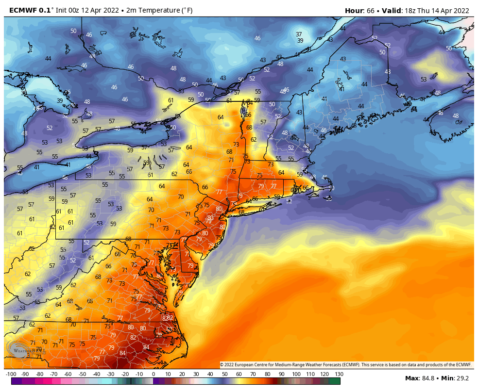
Another typical spring week begins as we head into the mid-month time frame. Plenty of rain chances along with some warmer days can be expected this week. We’ll be dealing with a couple hours of rain Tuesday, mostly in the morning, as a weak low pressure moves through the region. Behind it, we clear out …
The Week Ahead 4/4
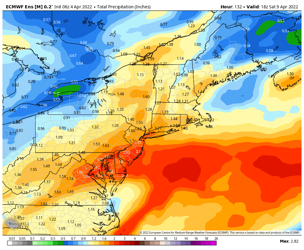
Though this week will start off relatively warm and sunny, the second half of the week bring a raw rain to most of the region. Overall temperatures will end up landing seasonably cool for the week despite the warmer days at the beginning of the week. There are two systems to impact the region; the …
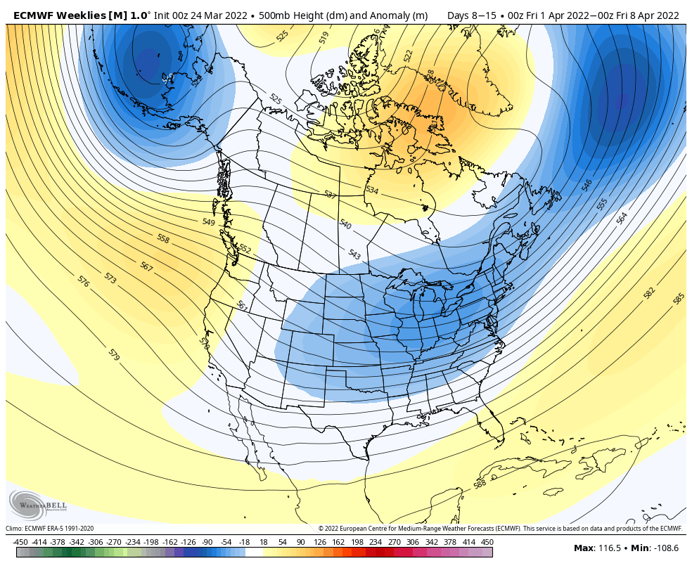
Long Term Views 4/1
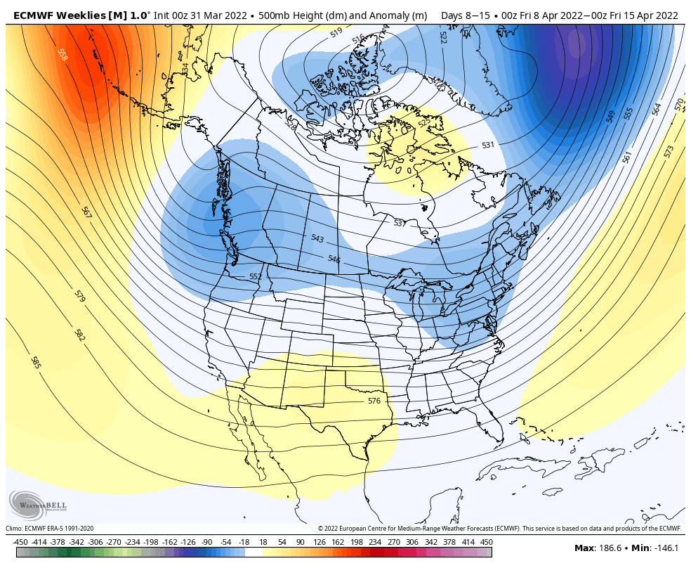
No April fools joke here, but we’re not seeing much of any resurgence of cold air beyond the first week of April. We’ll be seasonably cool (not cold…) into the first week of the month, but gradually have conditions moderate. The second week of the month will be more of a transition point – we …
The Week Ahead 3/28
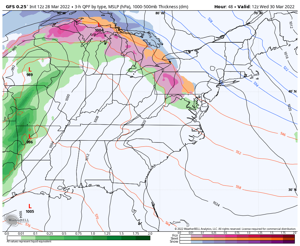
We have a very similar pattern to last week in terms of precipitation and overall pattern structure.The core of the cold comes out of the Great Lakes Monday and settles into the Northeast for Tuesday. We’ll begin some moderation on Wednesday, with an large area of overrunning precipitation associated with the warm front moving through …
Long Term Views 3/25
The main shift in the pattern actually comes in the next 7 days – which is a substantial cool down settling in Sunday through Tuesday. Beyond this, we do have some moderation, but it is tempered just a bit. At this point in the year, cool downs are less impactful given the higher sun angle …
Hindsight of Season…
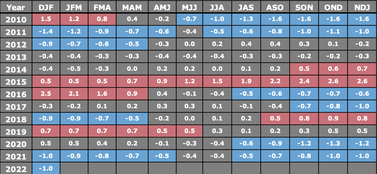
With the extreme volatility of the season and another mixed precipitation storm coming in this week, I took a quick look at where we landed in the ENSO cycle this winter. Typically, our placement in El Niño or La Niña isn’t the “end all” for the season, but there have been some correlations made that …
The Week Ahead 3/21
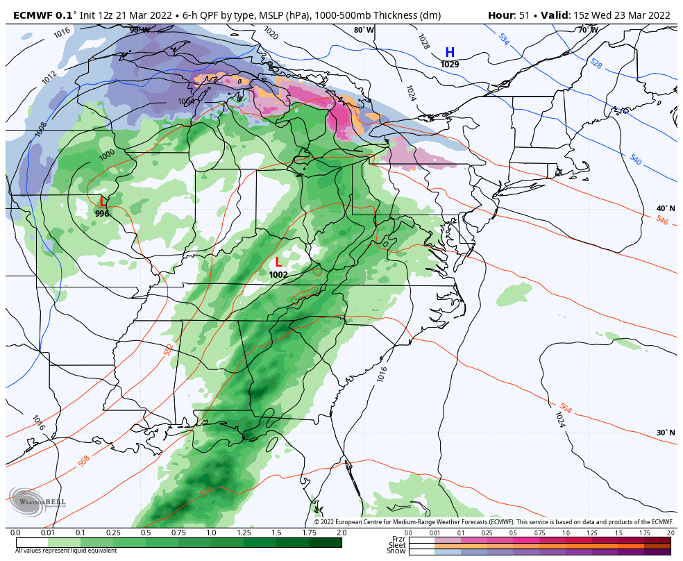
The first 36-48 hours of the week are rather quiet – breezy but no major precipitation to contend with. Temperatures are on the more mild side, but not warm. Clouds gradually increase from west to east Tuesday night through Wednesday with precipitation moving into the Great Lakes in the wee hours of the morning, and …
Long Term Views 3/18
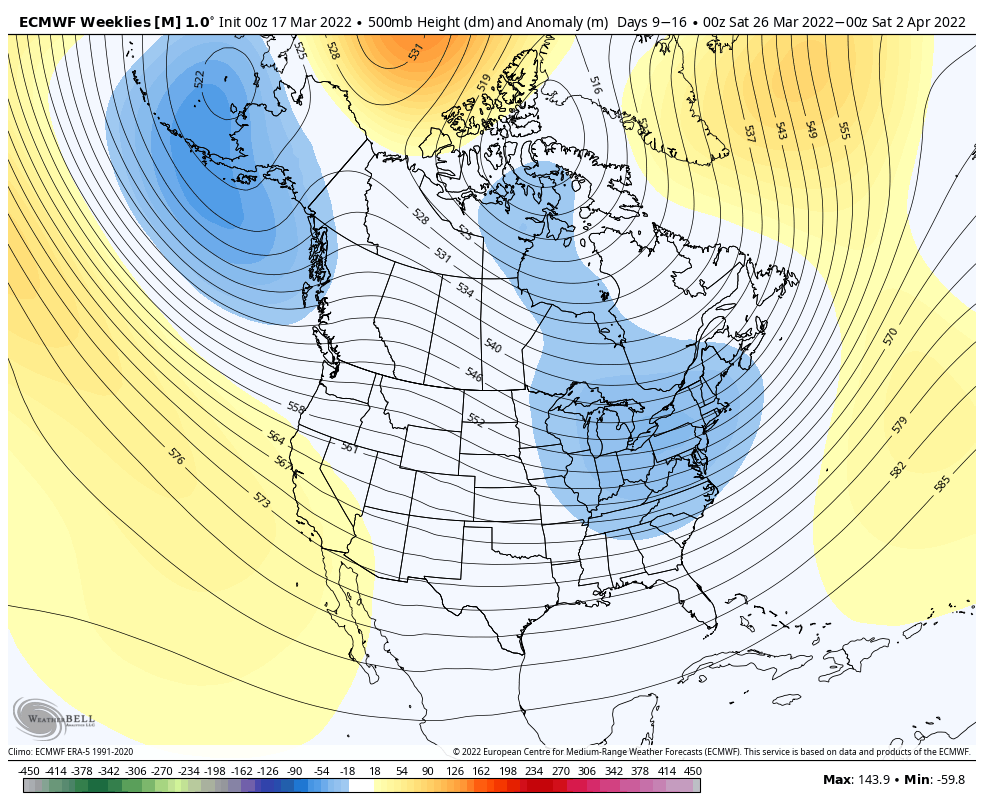
The pattern continues its volatility into the end of the month. We’re going to see somewhat of a cooler pattern into next week. The AO stays fairly neutral and the NAO stays slightly negative to neutral, which does allow for the opportunity to see some pockets of cold and even snow. Of course heading into …
Weekend Storm System
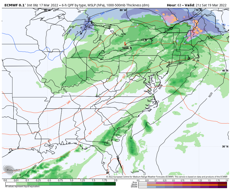
The solution hasn’t been completely changed by cold, but there is a minor cold component from cold air damming for the onset in portions of ME, NH and possibly a couple spots in VT. Otherwise we’ll be seeing a mostly rain system coming through Saturday morning through Sunday. The bulk of the precipitation comes through …