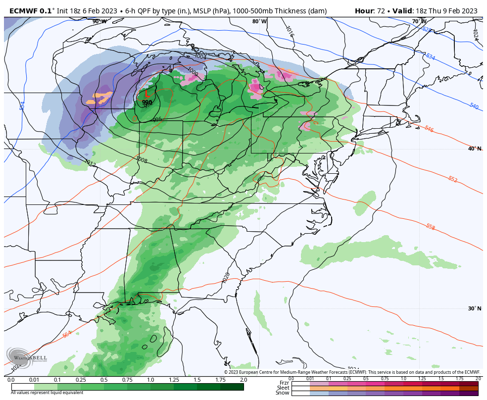
There are two systems that we’re watching for the week ahead, along with several non-diurnal temperature changes. While the Northeast is cooling off more substantially than expected Monday night, we’re starting to see warming ahead of a cold front front in the Great Lakes and just getting into the Mid-Atlantic. Some summit areas in New …
Category Archives: Bromley
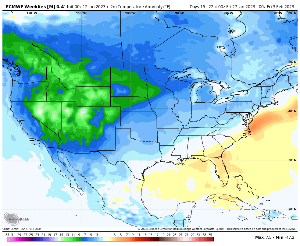
Long Term Views 2/3
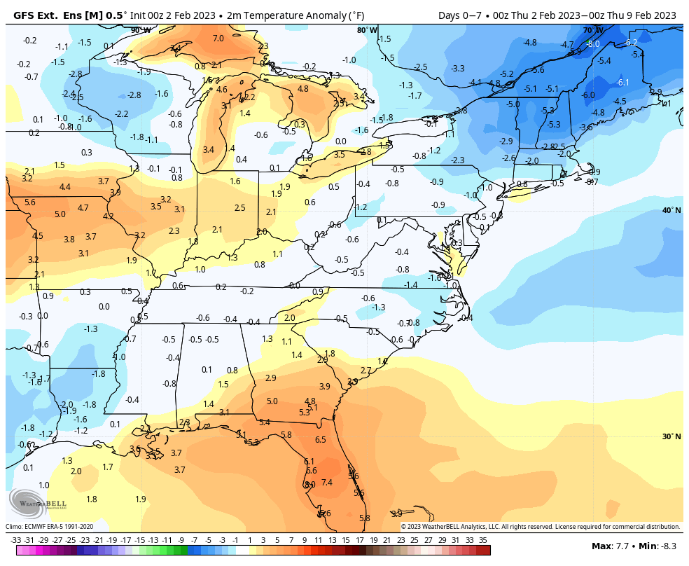
As with any major arctic outbreak, a swing to the other end is inevitable. However, we do have two differing opinions on the outcome. The GFS is slightly more on top of the temperature trends. If you look at last week’s long term trends for Days 7-14, and compare to the current 0-7 Days, both …
The Week Ahead 1/30
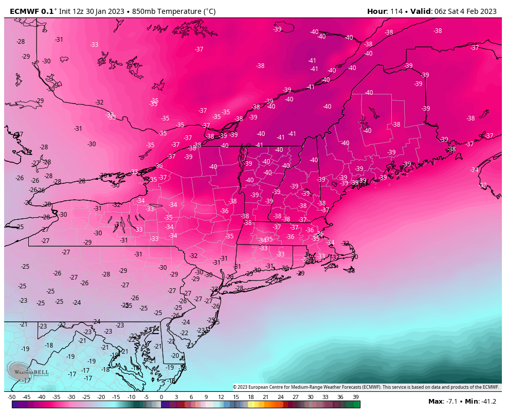
The main focus of the week ahead is the possibly historic arctic air intrusion Friday into Saturday. This will be some of the coldest air felt in quite some time when you factor in wind chills. Ahead of that, we’ll have a brief round of fairly cold air, settling in Tuesday and Wednesday before a …
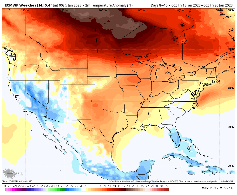
Long Term Views 1/27
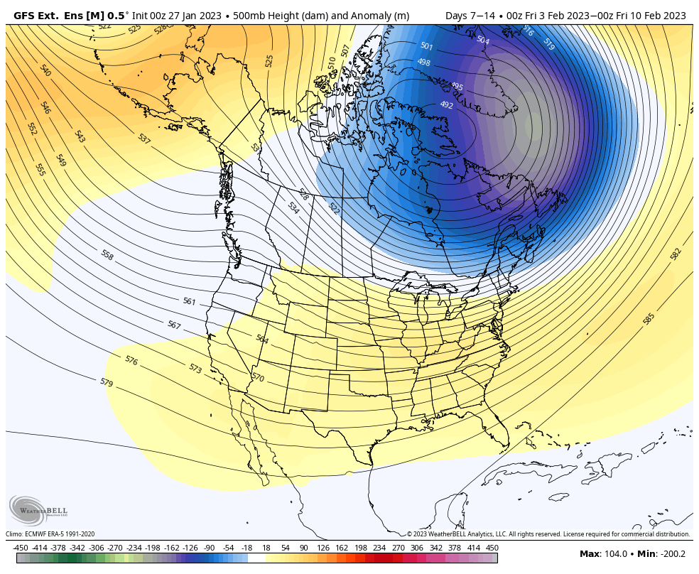
There’s a couple discrepancies in the long range that have some implications to the forecast, but overall we’re in a relatively cooler pattern. I’m going to post both the GFS Extended and the Euro Weeklies together to more easier show the comparison for Days 7-14 and then Days 14-21. Days 7-14: There are quite a …
The Week Ahead 1/16
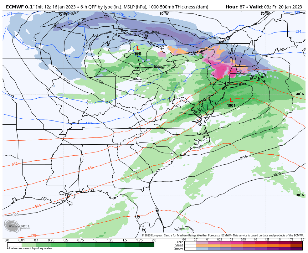
Our week ahead has a couple storms to feature. We have a Tues/Wed system, a Thur/Fri system, and another that will come sometime late Sunday into Tuesday of next week. This is the week we transition out of our current pattern. However, the pattern change isn’t one that’s going to put us into the tundra. …
Long Term Views 1/13
It’s been a mixed bag of everything over the last couple of days, but we’re gradually moving toward a somewhat cooler pattern. We’ll notice this more in the last week of the month, which has been the focal point for a pattern change. The good news is that from last week’s blog to this week’s, …
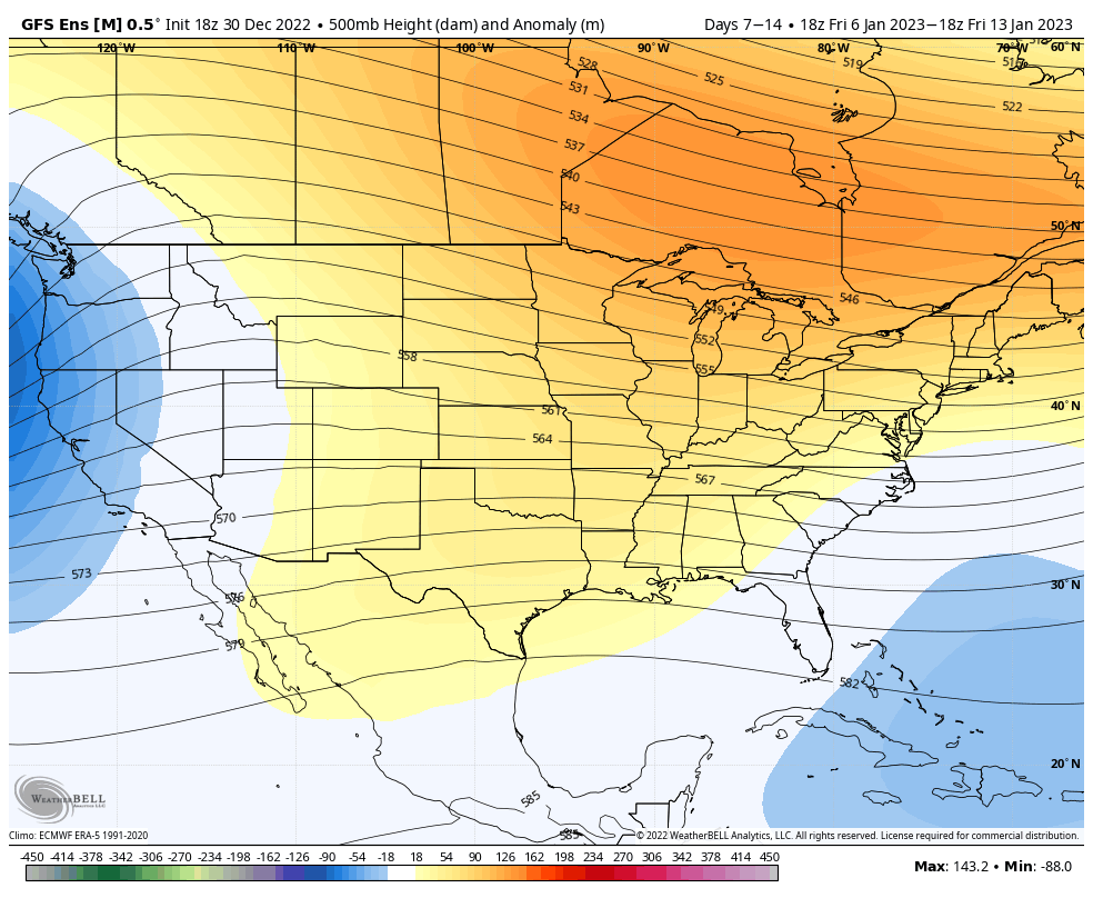
Long Term Views 1/6
After a little taste of more winter-like conditions the last few days, we’ll stay in a relatively stable pattern through the week. Next time frame of concern arrives around 1/14 and 1/15 as models are indicating another strong low pressure system. Right now it’s too early to tell how this will evolve, however the NAO …
Long Term Views 12/30
We’ll see a bit of a transition heading into next week, coming out of it in a cooler, not cold, pattern after another spike in temperatures Tuesday and Wednesday. We’re not quite seeing the eastern trough develop like we did prior to Christmas, but rather a SE trough developing into the middle of the month. …
The Week Ahead 12/26
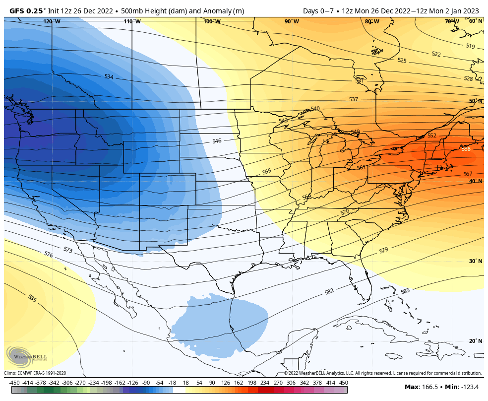
We are moving out of the cold pattern through the next couple of days… An elongated front draped over the Great Lakes brings a few rounds of snow showers to the Northeast during the midweek, in addition to some accumulating snow mixing with sleet for the northern Great Lakes Tuesday night – Wednesday as we …
Long Term Views 12/23
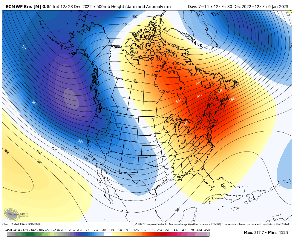
The cold that settles in with the arctic front is going to hang around through the midweek. We can expect above freezing temps coming in by Wednesday across the eastern seaboard. This is our transition out of the ‘cold’ pattern for about 2 weeks, which is sometimes called a “reloading” pattern. It’s impossible to constantly …