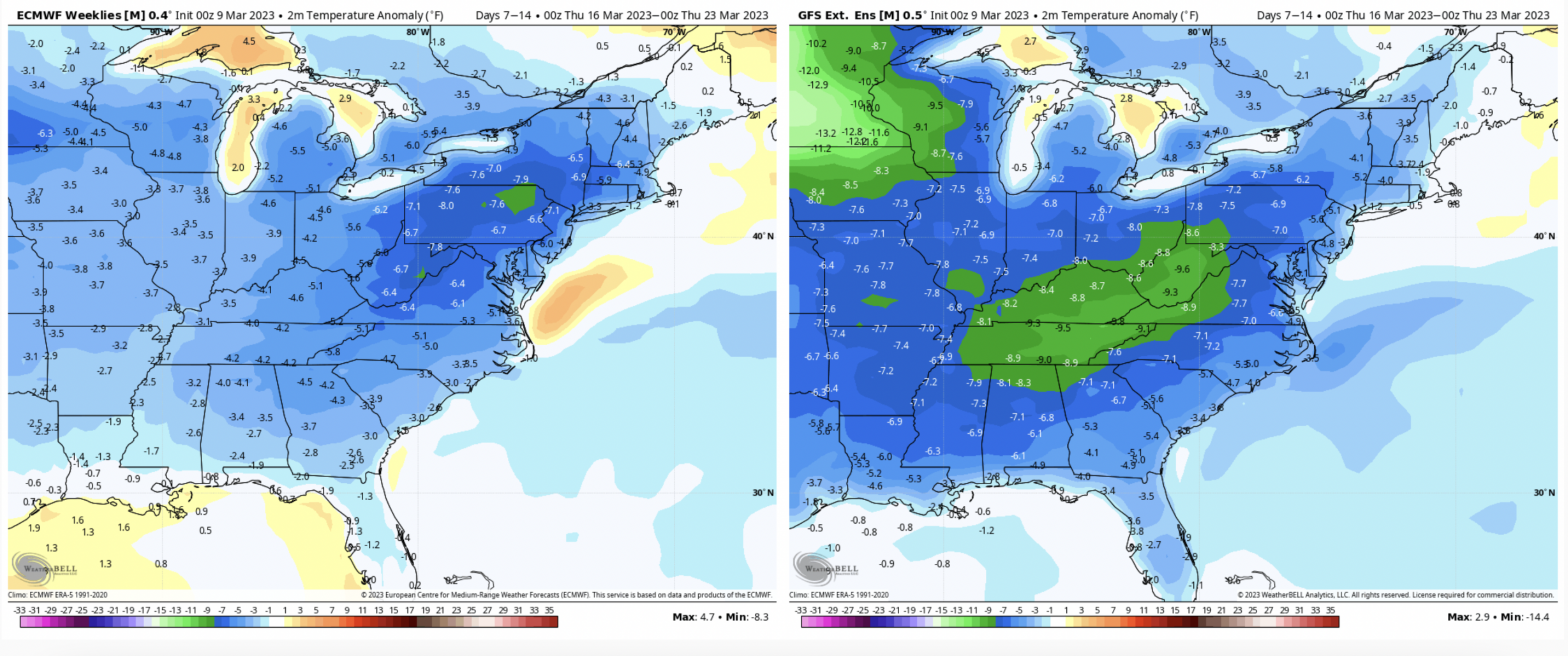
Though cooler air settles in for the first part of next week, we’ll have moderation toward the midweek before a couple more storm systems start to ramp up. There are a few to watch – around 3/23, 3/25 and 3/28. The NAO stays close to neutral (therefore not much blocking of cold air) for 3/23 …
Category Archives: Bromley
The Week Ahead 3/13
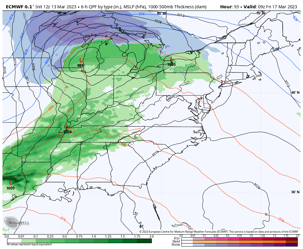
The week ahead has two storm systems to impact the east – one coastal system to affect the Northeast and one inside runner that is more impactful to the Great Lakes. The coastal system moves in later today with mostly snow expected from the Poconos up through northern Maine. The heaviest snowfall is expected in …
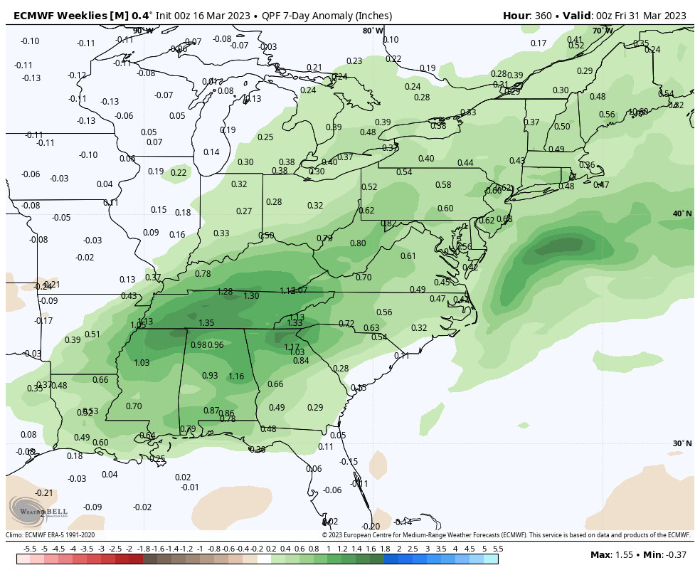
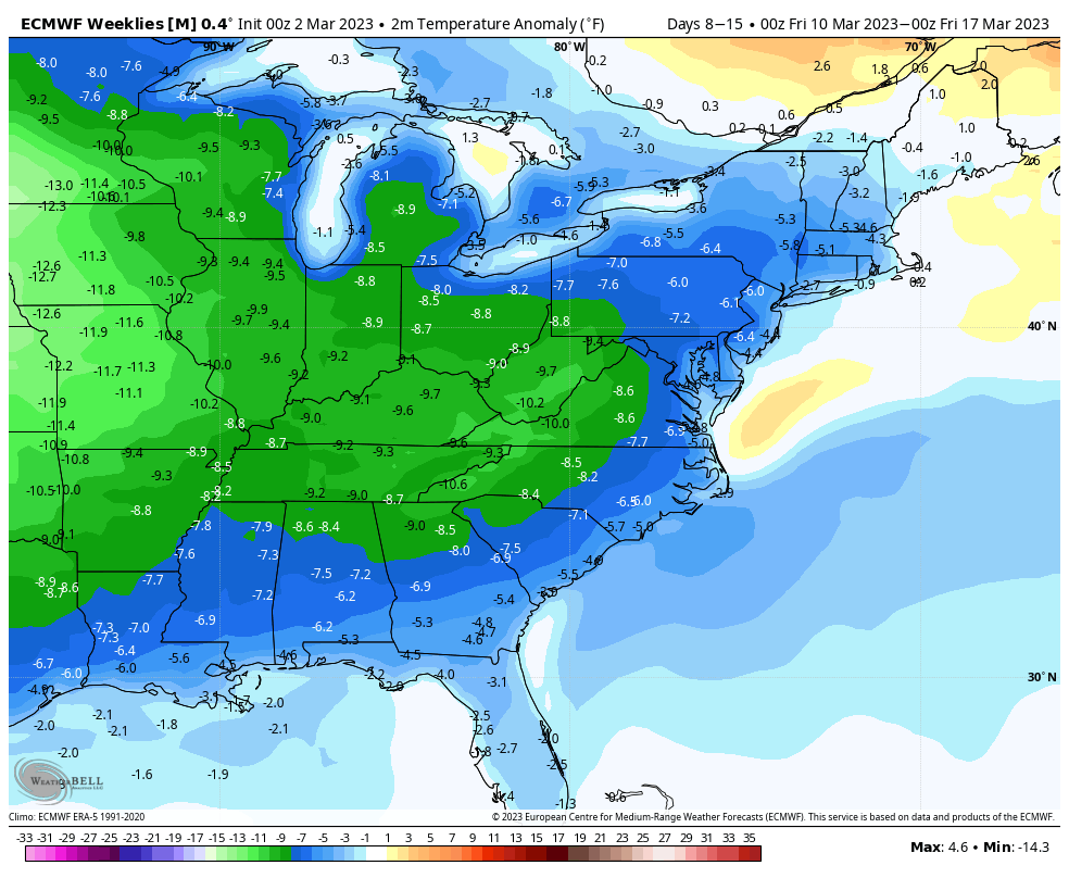
Long Term Views 3/10
We’re looking at continued seasonable or below average temperatures through the third week of March. While there are above average moments before storm systems (similar to what we are seeing today), overall temperatures remain at or below season averages – especially in the Mid-Atlantic. There’s not much anomaly when it comes to precipitation, which makes …
The Week Ahead 3/6
The week itself is fairly quiet. There’s a low pressure to our north that is somewhat stalled, and that’s what is keeping a fair amount of breeze and intermittent snow showers in the forecast through Thursday in New England. The storm pattern takes energy from the Great Lakes into the Mid-Atlantic at this time, but …
Long Term Views 3/3
A little late to the blog tonight given the active forecast this week…the storm tonight/Saturday will be the last big storm for about a week, at least. Temperatures in the week ahead will be close to seasonable. Some lower base areas will deal with a freeze/thaw cycle as temperatures move above freezing during the day …
The Week Ahead 2/27
It seemingly took forever but this is the first week that the ONI Index is ENSO neutral. It’s the first time we’ve been here for nearly three years. Better late than never, but it would’ve been nice for this to happen a month ago… The effects of transitioning to ENSO neutral have already been seen …
Long Term Trends 2/24
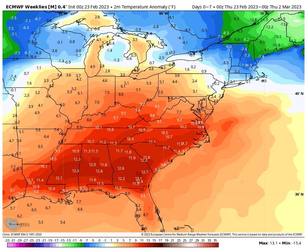
The overall trend is a cooler March for most; though it’s a bit tumultuous to start. In the next 7 days, we’ll have a fair amount of warmth from the Mid-Atlantic and south with the southeast ridge in place. Notoriously, the GFS handles the southeast ridge better than the Euro, therefore I’ll be hedging my …
Long Term Trends 2/17
The warmth is behind us after the strong cold front came through Friday. This coming week will be more of a transition week before we start seeing a colder pattern settle in. We’ll have a couple quick systems come through, followed by a strong system Thursday/Friday which will be a mixed precipitation event for most. …
The Week Ahead 2/13
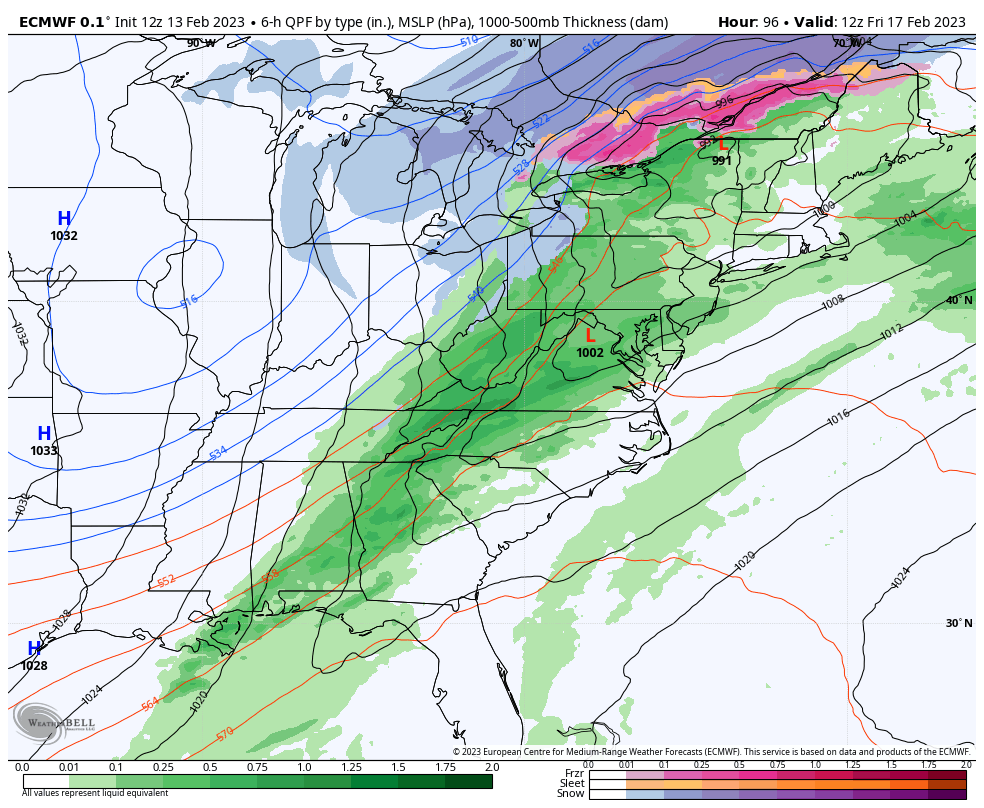
This week will ultimately be the warmest week that we have through the month. Two cold fronts come through – the first of which has already passed through the Great Lakes and will arrive in the Northeast Tuesday. We’ll see a weak low pressure develop offshore Tuesday, prompting some light snow showers early Tuesday morning …
Long Term Views 2/10
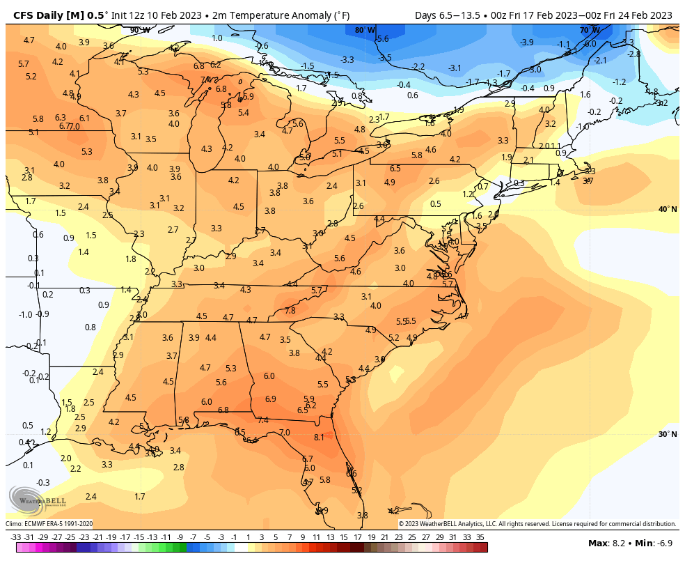
We are one week into the more progressive, warmer pattern that marks the after effects of the historic cold outbreak this time last week. Overall the pattern has been active with ebbs and flows in the temperature, therefore it hasn’t been a constant blow torch of warmth. The week before February break will be on …