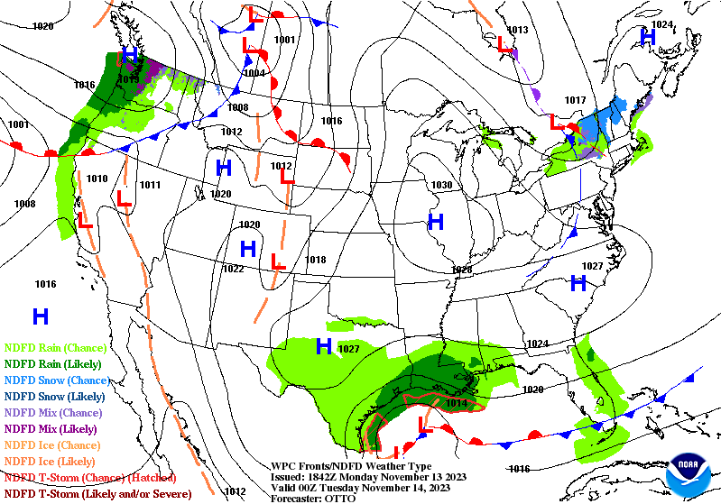
We’re about to enter into a very interesting short term and long term pattern. A strong cold front is en route to the east (take a look at the blue line in the screenshot of the front coming through a resort in Michigan). I don’t have the drop quite as sharp in the Northeast (12 …
Category Archives: Bromley
The Week Ahead 11/13
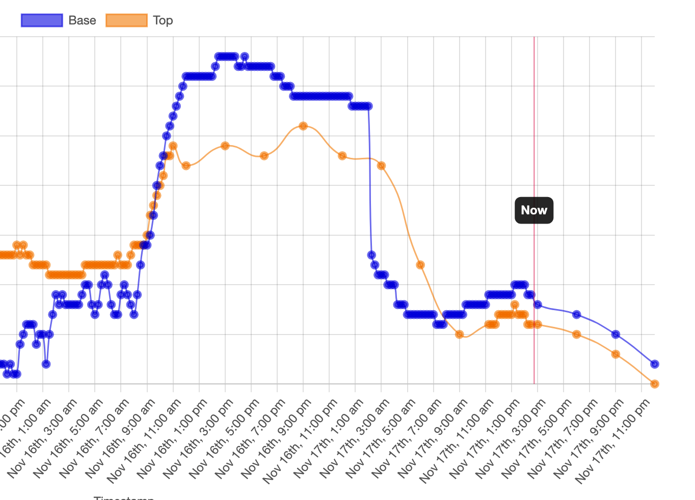
Inversions stuck around for quite some time today ahead of a weak system coming through New England tonight. We’re seeing it dissipate as it moves through the area, so we’ll likely see some minor temperature movements (up and down) as the warm front and cold front move over the Northeast while simultaneously breaking down (WPC …
Long Term Trends 11/10
We start to shift the weather pattern a bit next week; but even then there’s been some discrepancy on how that evolves. There’s clear consensus on the cold retreating Wednesday of next week. The first divide in the road comes with a system next weekend. The Euro tries to bring a disorganized low pressure up …
The Week Ahead 11/6
The week ahead will have some volatility to it; we don’t stay in the same place for very long until we get to the weekend. Temperatures rise tonight as the first of two systems this week arrives from the Great Lakes (after bringing some heavier rain there). The band with the warm front is fairly …
Long Term Trends 11/3
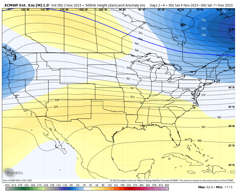
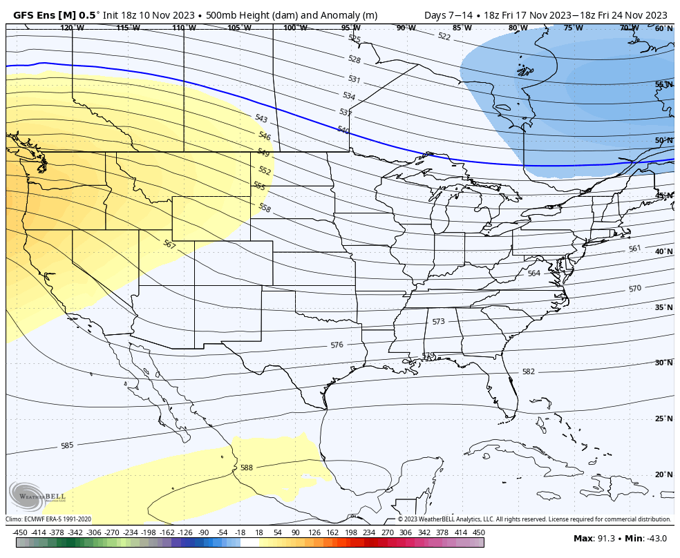
We’ve ventured through our first block of cold, and for now, it retreats until the middle of next week. Heading out into Days 7-14, the eastern trough does begin the retreat, and there’s decent consensus on that. The trough isn’t intensely deep in the East, so the pattern should stay active with the combination of …
Mobile Alert Update

Over the summer, our third-party mobile messaging service implemented new rules and regulations for mobile messaging, including vetting companies utilizing mobile messaging services (to avoid spam messaging). Snowmaker alerts have been successfully vetted and will be re-implemented October 30th after 9pm. A couple notes… Our new number is 1-207-407-5073. You can update your notification preferences …
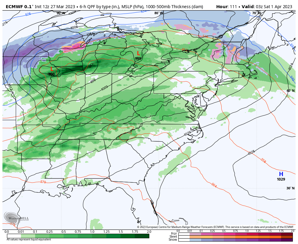
Long Term Views 3/31
The clash of the seasons is upon us, with more mixed precipitation systems and dare I say…the first spring thunderstorms of the season possible on Saturday. It’s a little early to talk about severe storms, but they are possible across New England Saturday afternoon. Temperatures will stay close or slightly above average into Days 0-7. …
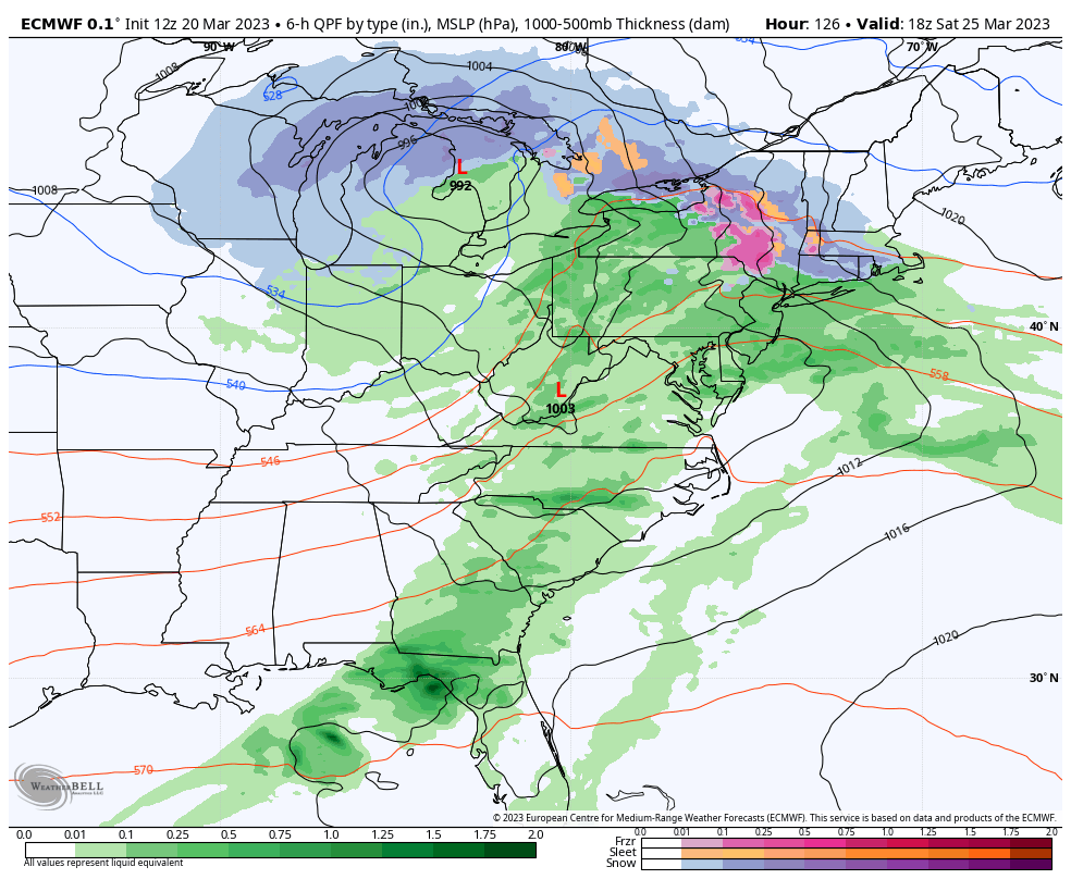
The Week Ahead 3/27
The week starts off with a dry atmosphere and a weak system coming through Monday night into Tuesday morning in the east. Temperatures moved up quite a bit ahead of the system so may see some rain mix in initially. Any snow that does accumulate, which will only be on the order of 1-2″ at …
Long Term Views 3/24
The global pattern continues its shifts with the ENSO neutral cycle taking shape and we’re going to continue on a cooler than average pattern heading through Day 14. Temperatures at the surface level (local airports) are running roughly 1-3 degrees above average so far for March, but may start skewing cooler for the last 7 …
The Week Ahead 3/20
The latest ENSO cycle reading came in this morning, and we are officially in the positives, leaving La Nina fully behind since the week of February break. However, the overall atmosphere is still showing weak La Nina trends, as it takes a couple of weeks to bring the change from sea surface temperatures to the …