
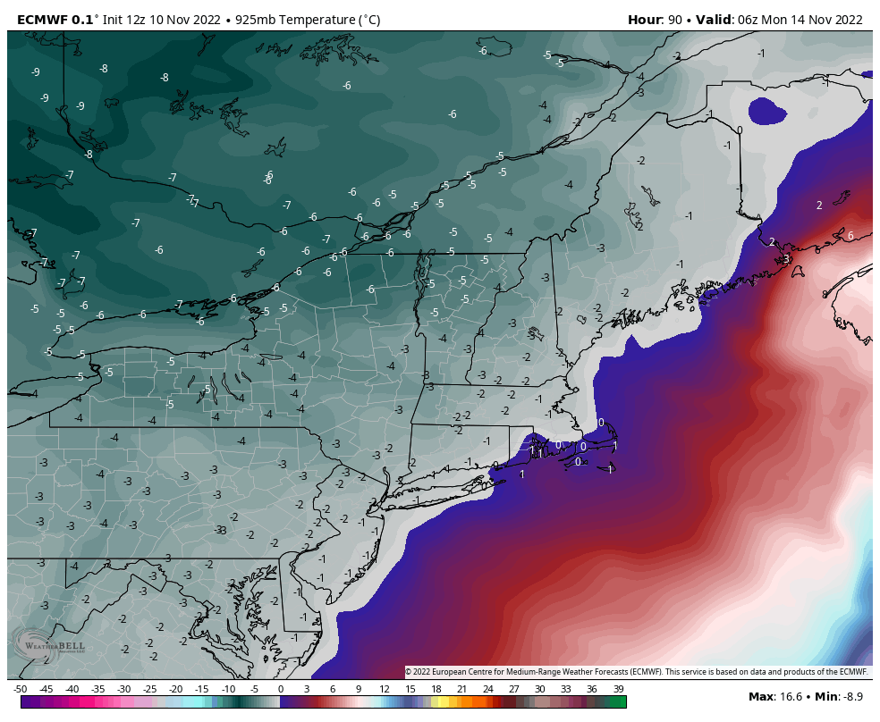
Cold air has finally arrived and will be sticking around the majority of the week. While the Great Lakes stay entrenched in the cold with snow showers throughout the entire week, we’ll have a couple ups and downs for the Northeast. Monday remained cold, and we’ll only see slight moderation into Tuesday. We do see …
Category Archives: Bromley
Long Term Views 11/11
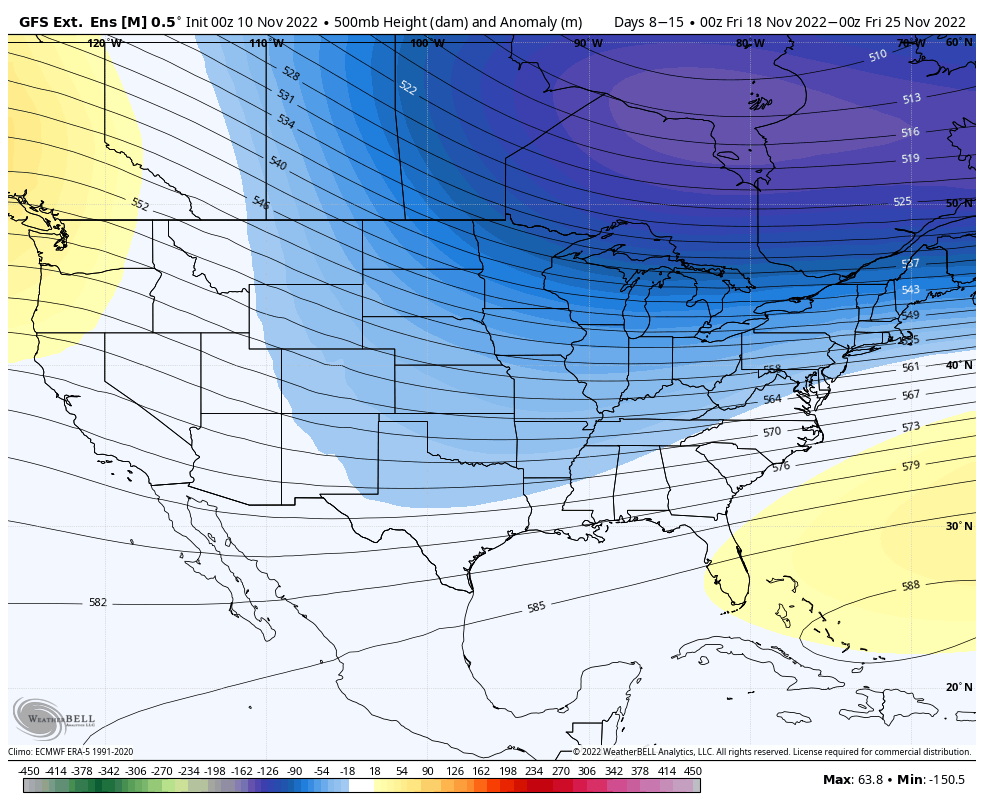
While we await the first real batch cold to come in the Northeast after the remnants of Nicole, we’ll take a quick peek at the forecast in the next 7-14 days. Overall, it’s favorable. The core of the cold continues to stay due north of the Great Lakes. I’ve chosen the GFS output because it’s …
Incoming Cold Details
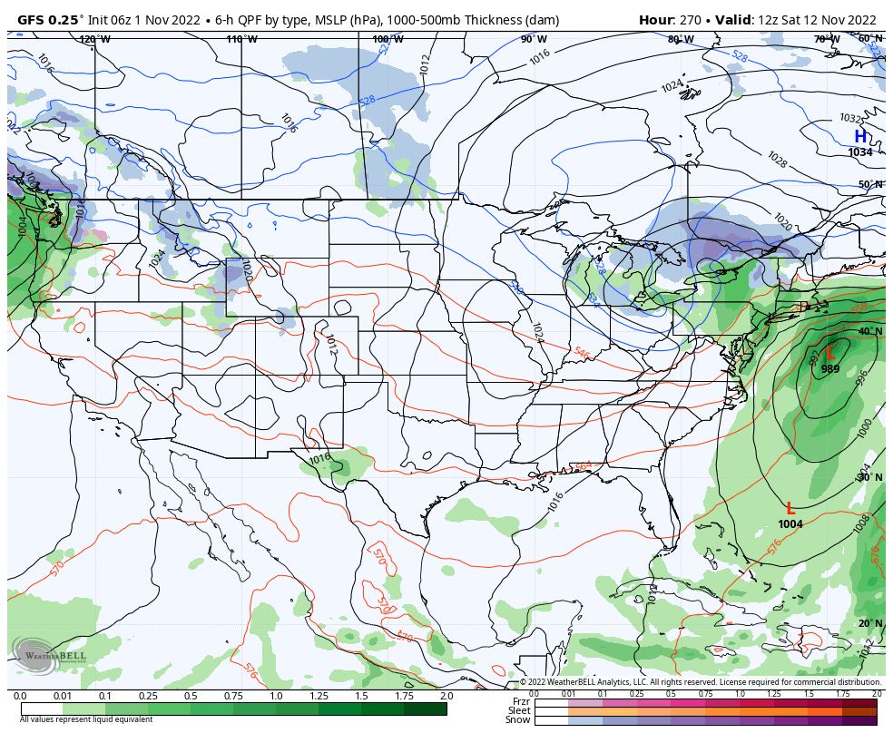
We’re finally seeing the light at the end of the tunnel – some sustained cold arrives Sunday after a strong cold front kicks out the remnants of Tropical Storm Nicole. By the time Nicole gets to the Northeast, it will be a subtropical storm with heavy rain and an expanding wind field. The timing of …
The Week Ahead 11/7

The cold slowly begins to move in this evening after getting hung up to our west earlier this afternoon. Our coldest point in the Northeast will be just around sunrise on Tuesday morning. Wind remains high, especially at higher elevations. The depth remains relatively shallow, with a sharp 0C 850mb line right along the MA …
Long Term Views 11/4
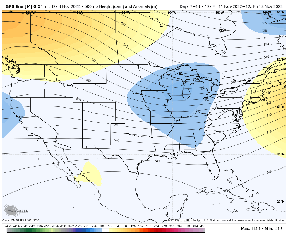
We are finally turning the corner after a warm weekend headed our way. The first infusion of cold comes quickly next week (11/8), however sustained cold will begin coming in surges beginning next weekend (11/12). The pattern will be active and there are still pieces of tropical energy that are roaming around the Atlantic, therefore …
Additional Note on Tropics 11/1
For the last several weeks, we’ve been talking about the active tropics creating volatility in the long term. Due to the weak handling of tropical systems by models, we tend to have high variability in model runs for Days 5+, and cold surges not coming to fruition. I wanted to show you the last 4 …
The Week Ahead – Arctic Blast Takes Hold
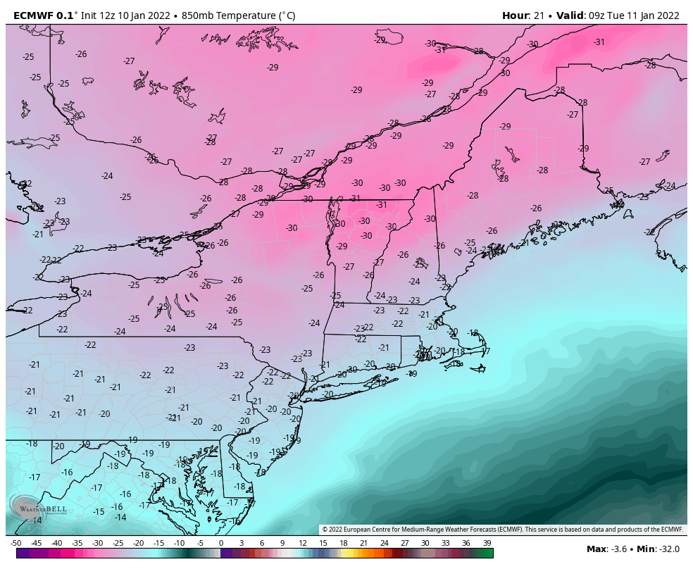
There’s not too much more to this week than the cold. Some of the lowest temperatures seen in the last 4-5 years will be rivaled in the next 48 hours. Pept0-pink is always exciting on snowfall maps, but not quite as welcomed on temperature maps. Wind Chill Warnings and Advisories are in place for much …
Long Term Views 12/17
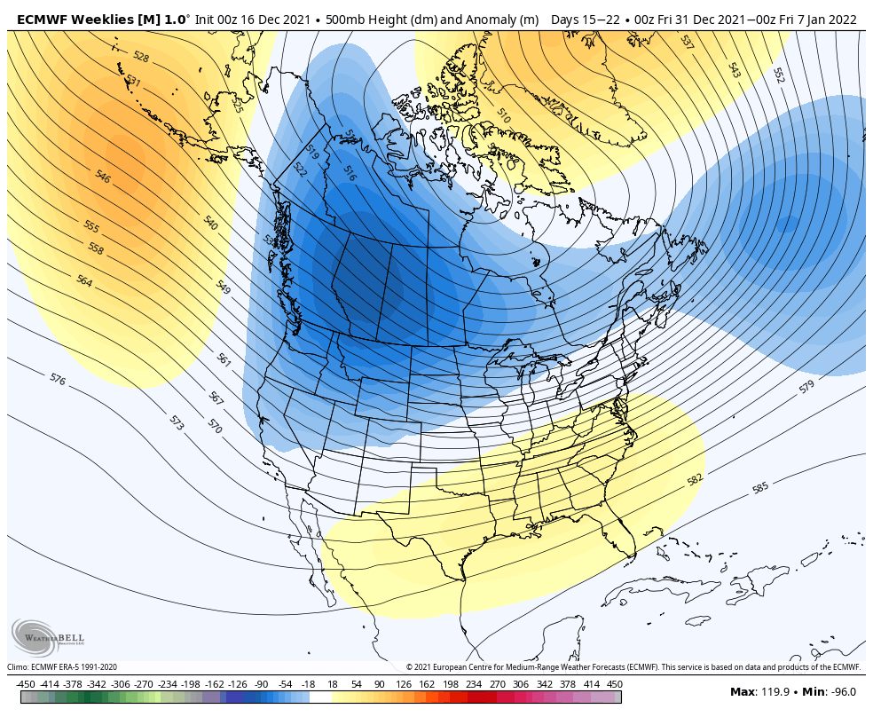
Last week we went over a lot of information in several different topics (teleconnections, ensembles and long term) and what we found was that there were several contradicting factors. In the end, we came to the conclusion that it wasn’t the worst of places to be in, because it typically meant that we were dealing …
The Week Ahead – Rollercoaster of Warm Storms & Cold Blasts
We’re somewhat back into the pattern we left last winter in – we get the cold but we can’t keep it when a storm comes. A strong cold front has been making its way through the east today…leaving snow showers in its wake from the Great Lakes to New England. Tuesday will be a cold …
Continue reading “The Week Ahead – Rollercoaster of Warm Storms & Cold Blasts”
Teleconnections – NAO/AO Overview
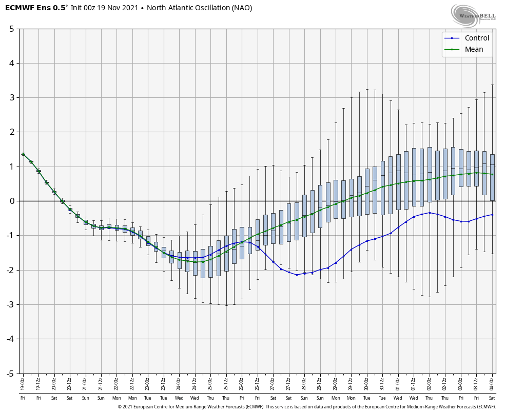
Teleconnections refer to recurring and persistent, large-scale patterns of pressure and circulation anomalies that span vast geographical areas. The most well-known one is ENSO – El Niño Southern Oscillation. While ENSO doesn’t have a major say on the east coast weather pattern, other teleconnections do tell a bit of the story. We have a weak La …