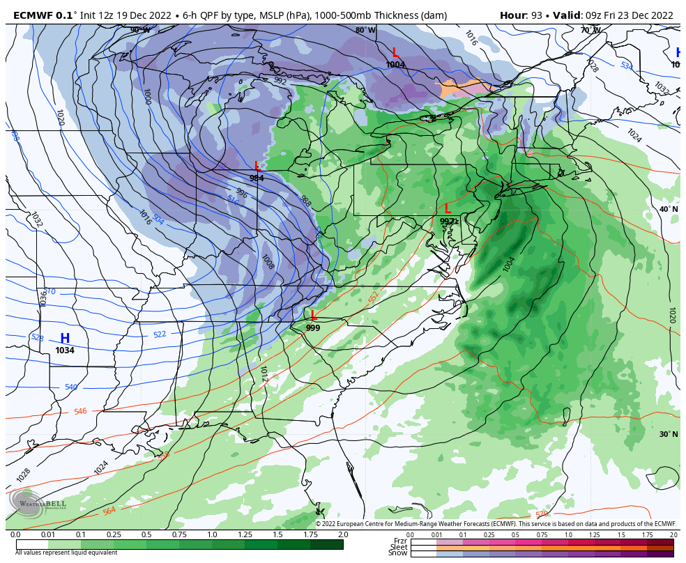
Heading into the week ahead, we have one system that all eyes are on. This is going to be a strong, impactful system for all areas, and especially where we are going to see rain in places we just saw high amounts of snow. It’s the tail of multiple low pressure centers, which is historically …
Category Archives: Bromley
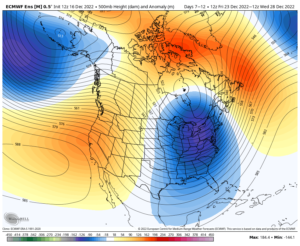
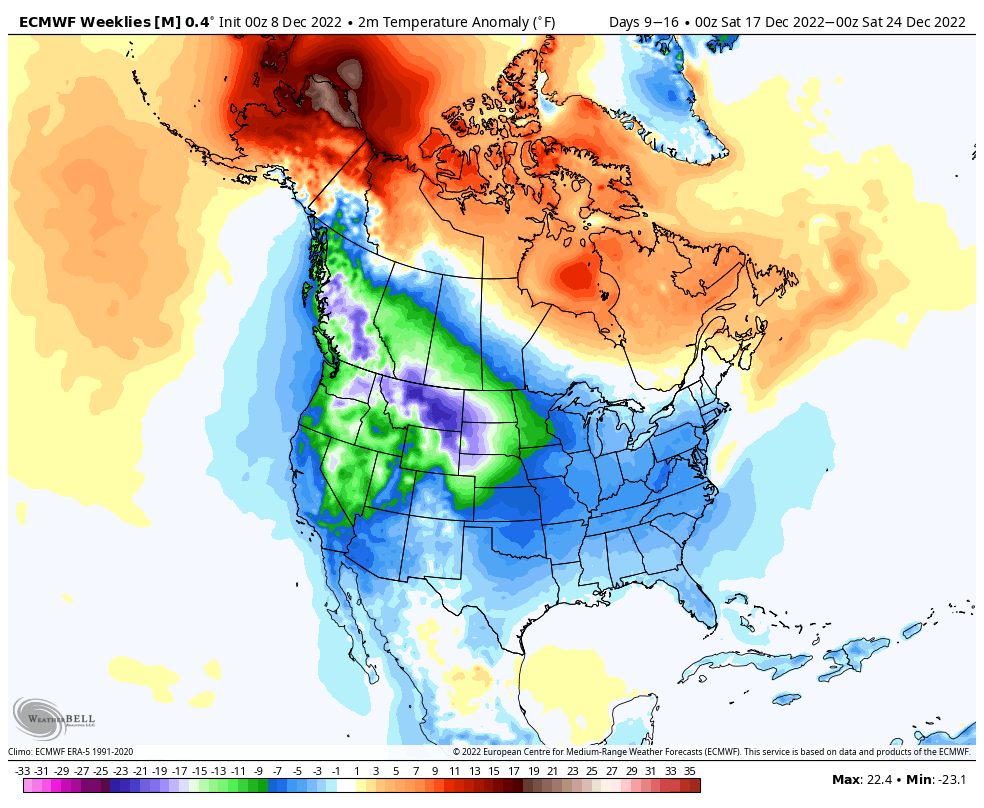
Long Term Views 12/16
A quick update on the system; it’s over-performed in the Catskills, Adirondacks, and the central/southern Greens and otherwise been fairly on forecast…certainly more of a Northeast system while the lake effect snow machine kicks up in the Great Lakes. We’ll continue to see the snow diminish from west to east throughout the weekend in New …
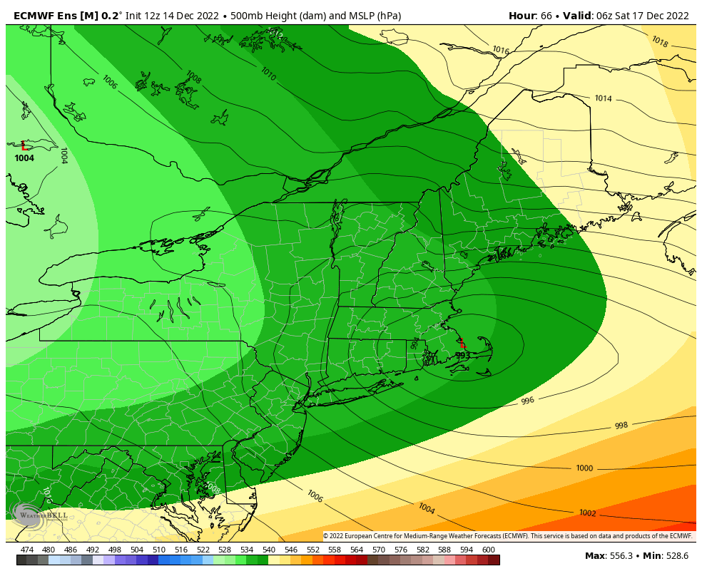
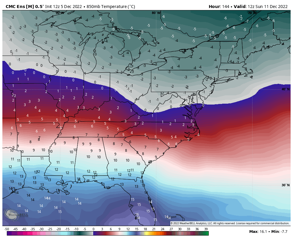
Storm Update 12/14
Now that we’re getting into the short-term with our storm system, we’re seeing some finer details come in. I’ll save the video for tomorrow as we see the storm developing in real time. So here’s what we’re looking at broken down by region… Great Lakes: The storm approaches overnight with rain for the LP and …
The Week Ahead 12/12
The week ahead is relatively cool and quiet until a strong low pressure moves in later this week. There’s still some finer details to work on the storm, and I’ll be updating midweek specifically on that. We’ll start to see a little moderation in temperatures Tuesday during the day in the Mid-Atlantic and Great Lakes. …
Long Term Trends 12/9
A few quick notes on the short term before we get into the long term… *Current air mass – mostly for New England areas – you may have noticed that there have been dry layers moving into different parts of the mountain today. This will likely continue into Saturday, and it can be very sporadic …
The Week Ahead 12/5
This week remains a bit tumultuous as the pattern shifts, but we’ve at least seen a little more consistency. As expected, we’ve seen some changes in the models as they weren’t making much sense when I recorded the long term video on Friday. However, there are still major inconsistencies in the GFS, therefore I’ve been …
The Week Ahead 11/28
The week ahead is fairly volatile and full of freeze/thaws events as we can’t quite get the pattern to settle, or the storm track to shift east. There are no massive warm ups but several events have more rain than snow followed by sharp dives into somewhat arctic air. We already experienced this briefly Friday, …
Long Term Views 11/25

After a prolonged period of cold, we’re now in a little break period, which is necessary to avoid extreme temperature movements. I’ve decided to focus on the GFS again as it has handled the early winter patterns well. We’ve seen the GFS pick up on changes in storms and timing about 24-48 hours before the …
The Week Ahead 11/21
Some interesting little movements in the weather pattern this week, but overall we begin warming toward the holiday weekend. There’s a front that comes through Tuesday morning, which allows us to warm up slightly ahead of it (most of which we’ll see overnight Monday night). Another weak front comes through Wednesday, which gives another quick …
Long Term Views 11/18
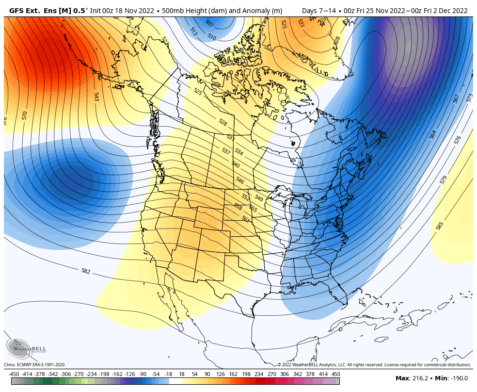
With many resorts turning on the guns (consistently) for the first time in the past week, getting natural snow, and even opening for the season, the long-awaited cold pattern is sticking around. A stronger cold punch arrives Sunday 11/20, and likely again on Sunday 11/27. The expected eastern trough should hang on through the final …