The breeze after the storm – it’s quite windy outside today and we’ll continue to have sporadic snow showers as well. Accumulations ranged from 3-4″ in Vermont to 18″ in Maine. Wind gradually subsides into the afternoon hours, and we shouldn’t have many issues with it for couple days. Post-storm, we’re left with something just …
Category Archives: Boyne Resorts
Daily Weather Update & The Week Ahead 11/30
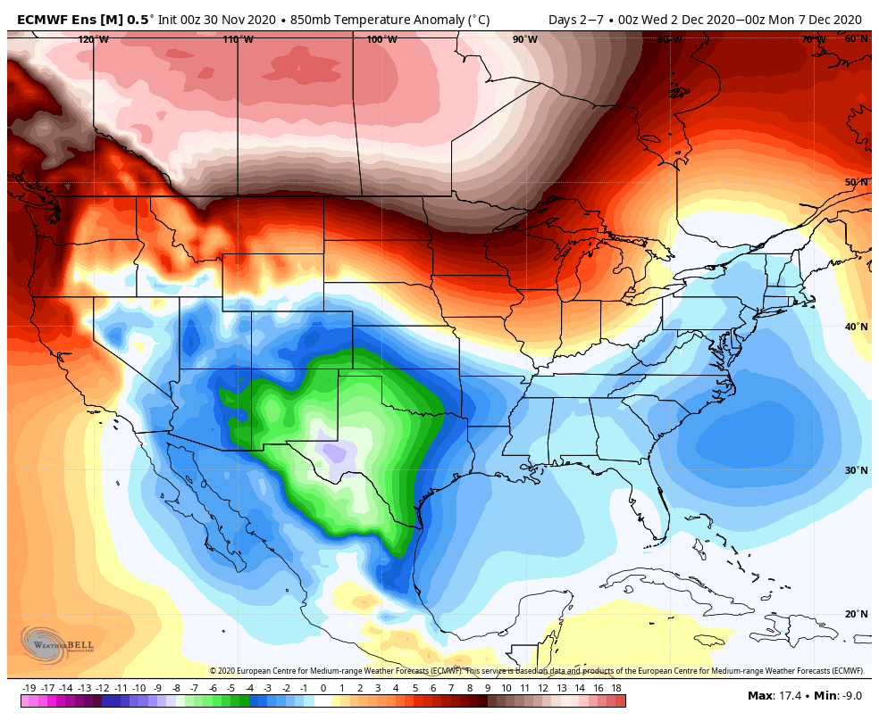
The large low pressure system continues to make its way into the Northeast this morning. Heavy rain and high wind can be expected with this system. By Tuesday, we’ll start to see the warm retreat by late in the day, ever so slowly moving toward New England through the overnight hours into Wednesday morning. We’ll …
Continue reading “Daily Weather Update & The Week Ahead 11/30”
Daily Weather Update 11/29
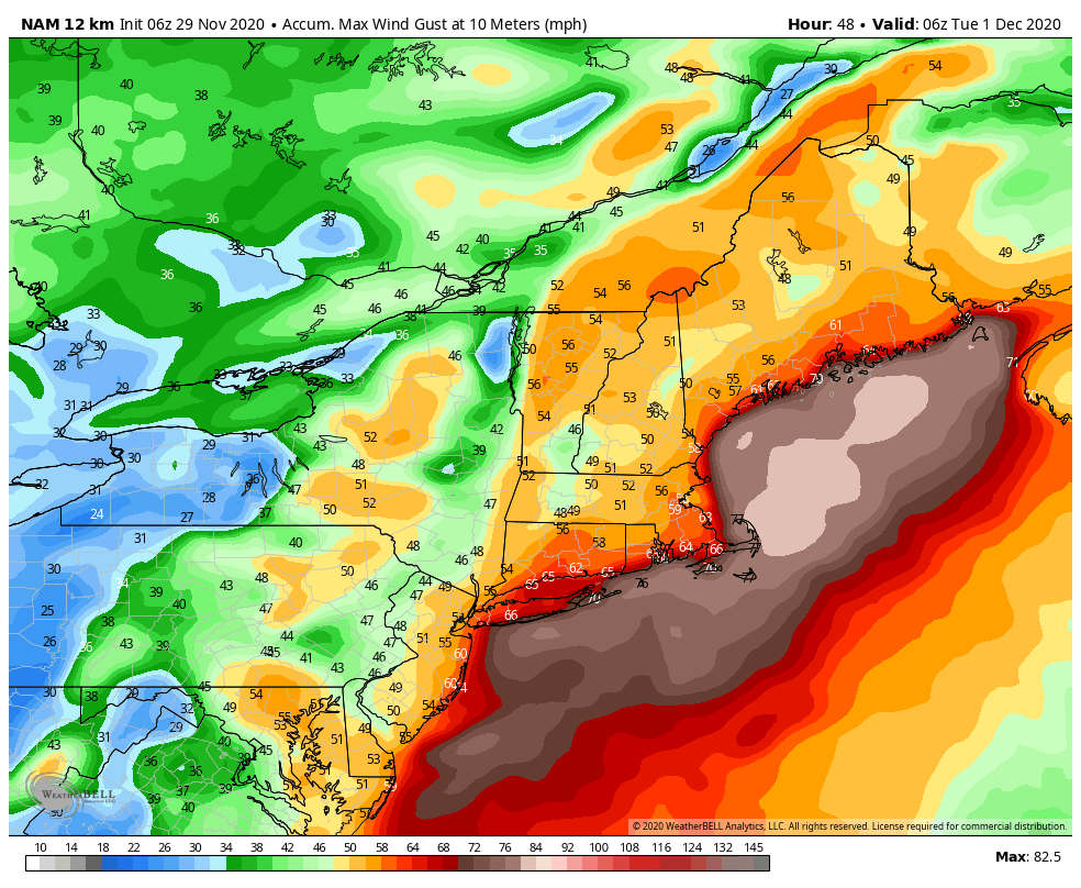
The warmth is returning today as our next system approaches with quite a bit of warm air. Rain will move in during the day Monday from southwest to northeast – with everyone seeing rain by sunset and high wind. Total rainfall will be between 1-2″ with this system. Wind will be gusty out of the …
Daily Update – Thanksgiving 11/26
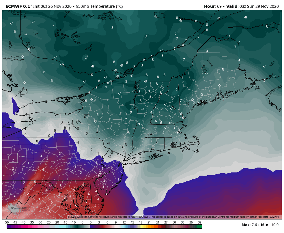
Wishing you, your families and your teams a very Happy Thanksgiving. I’m grateful for our continued work together in this season. It’s a dreary day… and good for comfort food and family. The warmth stays with us through Friday and we’ll start to see some cool downs going into Friday night and Saturday. The core …
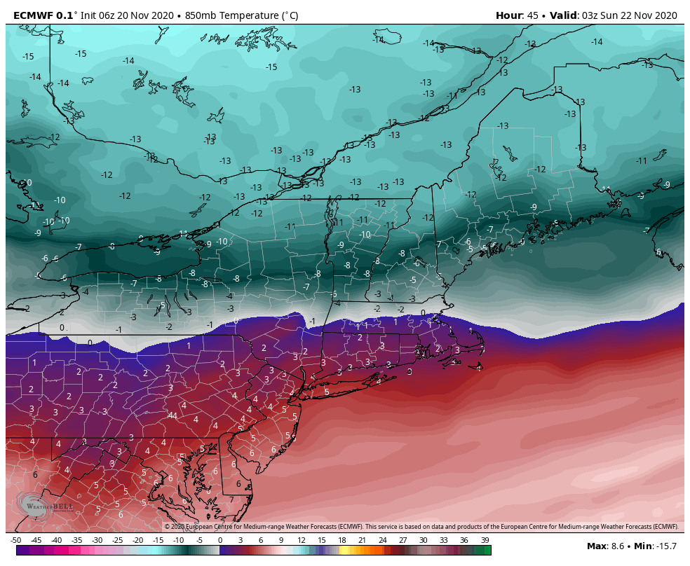
Daily Weather Update 11/22
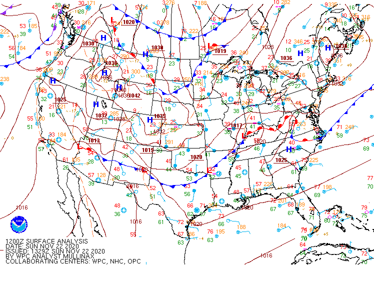
Some morning sunshine has boosted temperatures momentarily – however cloud cover has been racing in, and SE flow is beginning to impact temperatures. We may see temperatures fall, if not steady into the rest of the day as the humidity rises and we cool the air through evaporation. The cold air damming signature is clear …
Daily Weather Update 11/20
It’s our warm day of the week. Temperatures today will continue to sit in the 40’s and 50’s throughout the region. Our front comes back through on Saturday with temperatures dropping down into snowmaking ranges for parts of New England heading into Saturday night and Sunday. However the depth of this cold air is fairly …
Daily Weather Update 11/19
The cold retreats today from west to east. As expected, the overnight lows rose slow and steady, and currently we have some colder air trapped in the low levels. Expect to see temperatures shoot up quickly at different levels today and tonight, and also at different times. Currently, the warm air seems to be located …
Daily Weather Update 11/17
Temperatures continue on their slow downward trend today with the cold air mass settling in. It will be fully entrenched in the Northeast early Wednesday morning, leading to Wednesday being our coldest day of the week. There is a swift departure of the cold air on Thursday with a warm front crossing through and stalling …
Daily Weather Update 11/15

Our incoming system is moving through the Great Lakes this morning, bringing rain and eventually some snow showers. The storm will approach from the west, impacting New York/Vermont in the early to mid afternoon, and New Hampshire/Maine into the mid/late afternoon. Most will see rain out of this, though summits may pick up some very …
Daily Update & Long Term Views 11/13
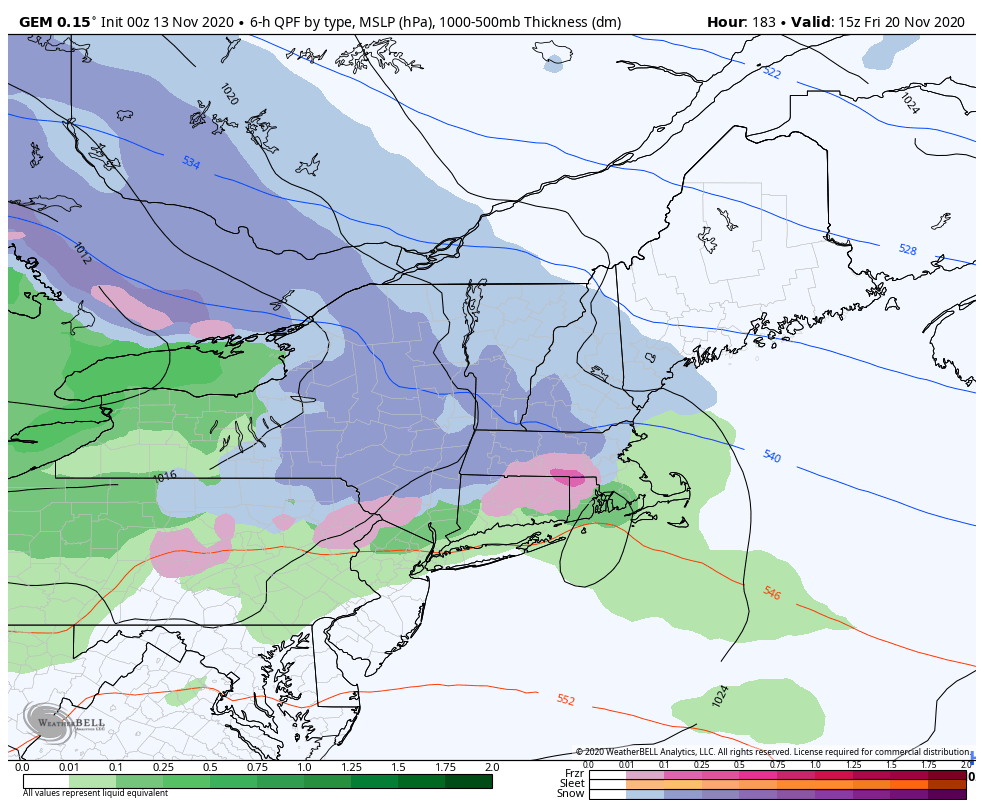
This morning we started off slightly cooler than expected with a late shift in the wind. With the southeast flow hanging on longer, temperatures are struggling to move. Once that breaks into the southwest flow, we’ll see temperatures move much quicker. The cool-down following our system today, doesn’t truly settle in until during the day …