While the relatively boring weather pattern continues, the pockets of dry air moving in randomly have been playing quite the temperature roulette game. Fluctuations of 7-10 degrees in a matter of minutes have been seen, along with sun snow showers, and some incredible inversions. This is overall due to the lack of flow at certain …
Category Archives: Boyne Resorts
Daily Update 1/7
The weather pattern continues on this uneventful path for the next couple of days. We’re starting to introduce some drier air Thursday and especially Friday, therefore expect some erratic temperature movements, in addition to base/summit temperatures not having the usual spread. We’ll stay in this zone until Saturday, when we’ll finally be influenced by something …
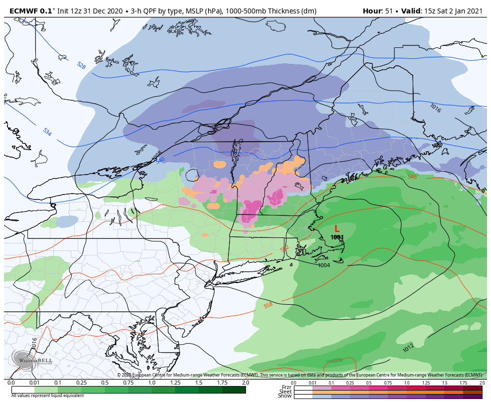
Daily Update 1/2
Not too much to update on today – the storm has departed and left a blanket of snow in its wake throughout Vermont, New Hampshire and Maine. Highest amounts were in the expected areas of northern VT, NH and into Maine. Up to 8″ have been reported. We’ll have a quiet 24 hour period before …
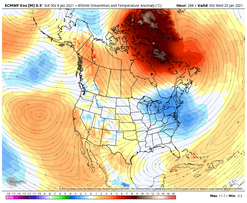
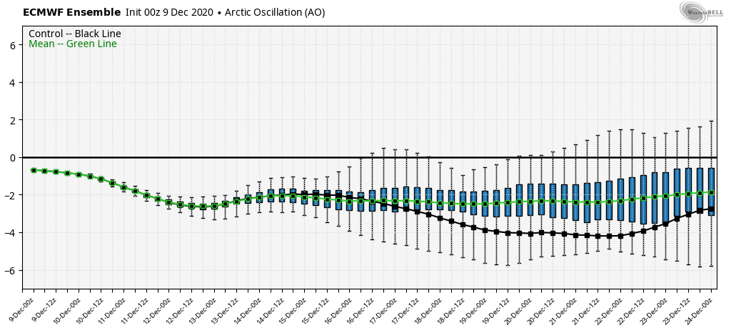
Stratospheric Warming
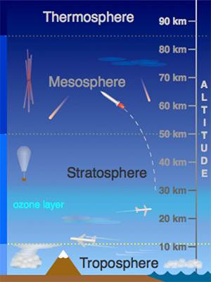
While you may not hear much of this on TV or in normal weather websites, stratospheric warming can have a large impact on the weather in the eastern United States. The stratosphere is roughly 10-50km into the atmosphere, the next “sector” of atmosphere above the troposphere, which is where weather lies, as do we. The …
Daily Update 12/31
We close out 2020 with temperatures on the move downward after some rain/snow showers came through earlier today. This front will sag to the south of the Mid-Atlantic as the next piece of energy gears up in the south. There’s a fair amount of energy with this system, producing a swath of severe weather in …
Daily Update 12/27
After a cool start, temperatures begin to moderate today ahead of a front coming through on Monday. Though not “warm”, it will be warmer than yesterday with more cloud cover as well. The front approaches Monday morning and is through the Northeast by Monday evening, along with some light snow and rain showers. Snow may …
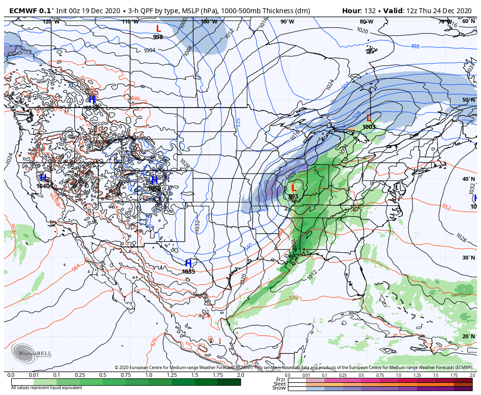
Daily Update 12/24
Clouds have come in ahead of the storm system, along with some drizzle. Moderate to heavy rain has already been reported in the Mid-Atlantic this morning. Organized precipitation should stay out of New England during the daylight hours. Rain may hold on a little longer into the afternoon and evening hours Christmas, but temperatures will …
Daily Update 12/19
A cold morning across most of the Northeast with fresh snow and calm wind. Expect inversions to hold through most of the morning with another bluebird day. Clouds begin to stream in from the west as a weak impulse moves in from the Great Lakes, which is bringing some light snow and rain showers there …
Daily Update 12/13
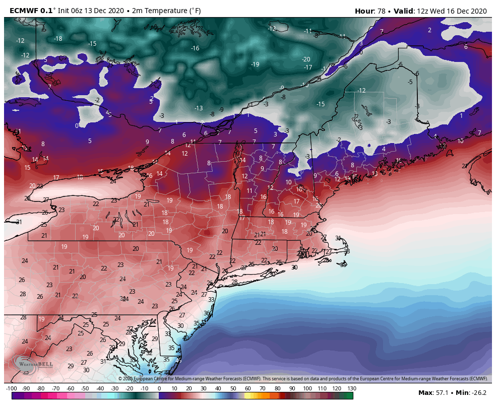
Not much changes or updates in the forecast today. We are cooling down as expected, which not much more information on the Wednesday system – still looking like it will be a Mid-Atlantic storm as opposed to a New England storm. The piece of energy responsible for it is coming onshore as we speak, so …
Daily Update 12/9
Today we’re watching a weak impulse of energy coming in with some light snow showers through the day and into Thursday morning. We’ll see a widespread 1-3″ from New York and north with this, with isolated higher amounts where we see some enhancement from terrain. Temperatures will move up with this, as opposed to the …