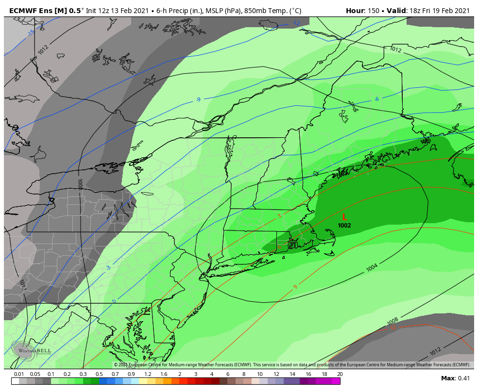
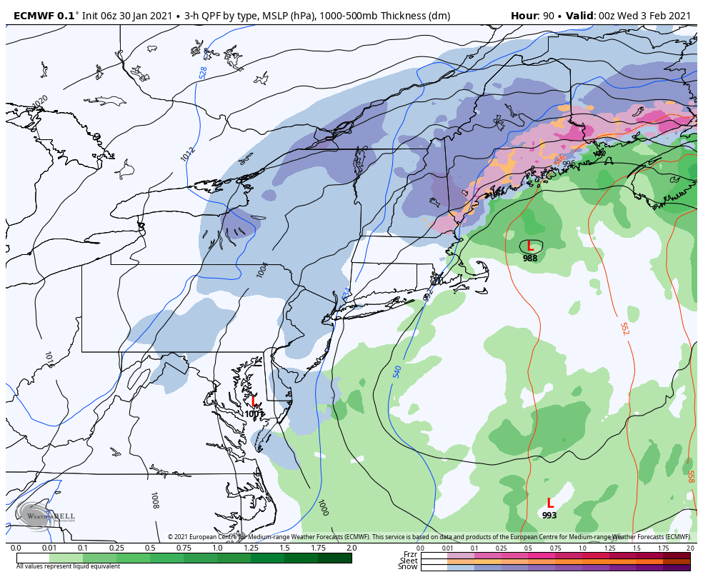
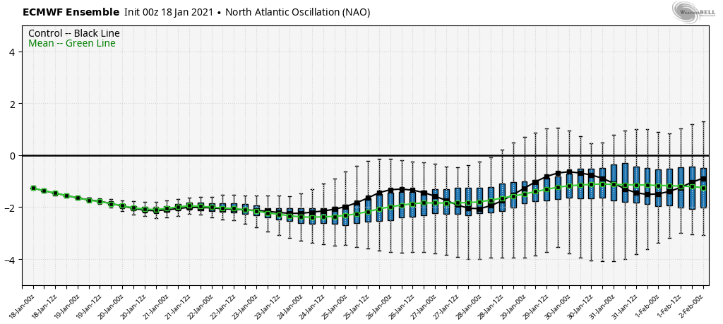
The warm air aloft is winning out with the incoming storm – the NAO has shifted positive, which was a concern in this flip – and therefore we’re not able to hold the cold through the entire column of air. We keep cold at the surface thanks to cold air damming, but that can only …
Category Archives: Boyne Resorts
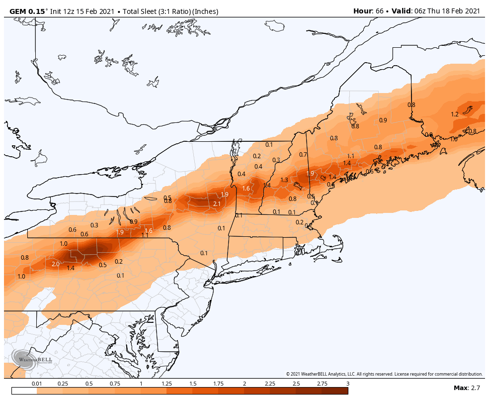
Daily Update 2/13
Not too much change with the incoming pieces of energy. We’ll have some very light snow shower activity in New England on Sunday, which may be accompanied by freezing drizzle. The moisture levels for Monday look low, however given a pattern that has strung out pieces of energy overhead, I’m still keeping the chance for …
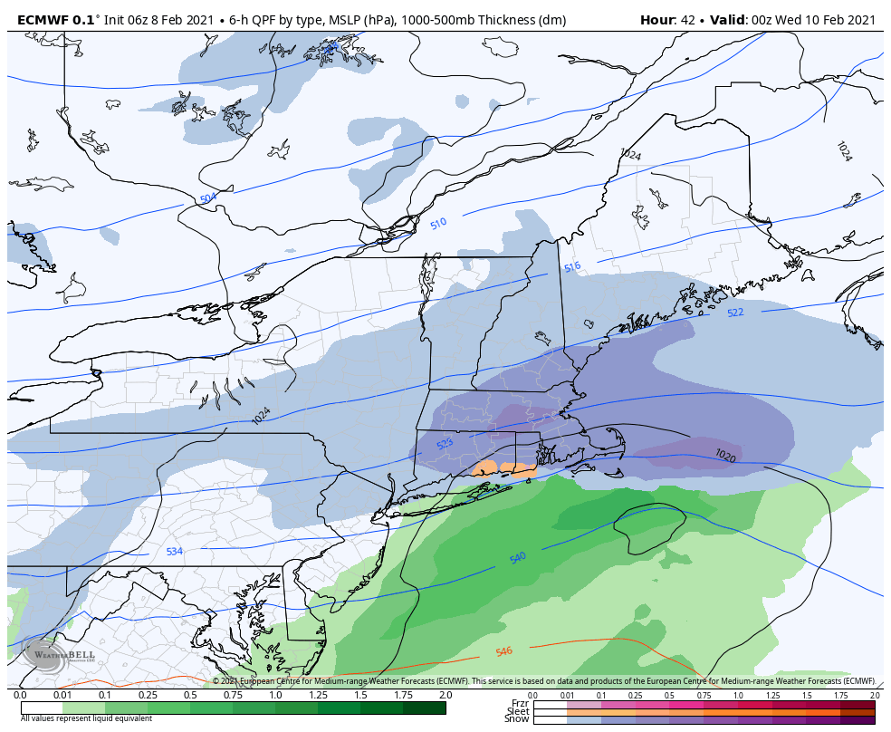
The Week Ahead 2/8
It looked more exciting previously, and while there will still be areas of energy coming through, they are being shunted to the south due to the strong blocking to our north and the arctic intrusions. The initial possibility of several light to moderate systems may just be light, at best, until we can get the NAO …
Daily Update 2/6
Wind has started to pick up as colder air settles in, especially into tonight. Sunshine has allowed temperatures to warm a bit above forecast, but they will come down quick as the sun angle falls. We’ll have a cold start to Sunday with our incoming system. This will be a fairly low impact, low snowfall …
Daily Weather Update 1/30
As the arctic grip lessens throughout today and Sunday, we’re watching our next system come in with some disorganized potential. I say disorganized because it doesn’t look like the classic nor’easter; the phasing is slightly off but good enough to develop a potentially significant snowfall, not only for New England but for much of the …
Daily Update 1/20
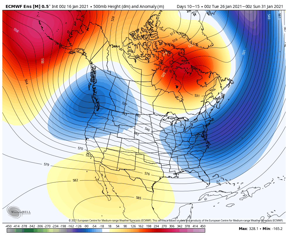
The forecast remains largely the same from previous blogs and the forecast discussion. Unfortunately it doesn’t look as though the storminess we were hoping for next week is going to pan out due to the strong blocking from a high centered in Quebec. There’s a chance the storms move through the Ohio Valley or Mid-Atlantic, …
Daily Update 1/18
Snow showers continue today as wind gradually lessens throughout the day. We’ll have some colder air come in tonight, though it will be a bit short lived as a weak impulse of energy comes in Wednesday. This will spark a slow rise in temperatures for Wednesday, but cold air returns for Thursday. This happens again …
Daily Update 1/16
The storm continues to move through New England this morning with a variety of precipitation. Most areas above 1,000 feet have done fairly well, and we’ll continue to see the snow pile up in the higher elevations. In terms of the “battleground” between rain and snow, it’s been over my house in Norway, Maine and …
Daily Update 1/13
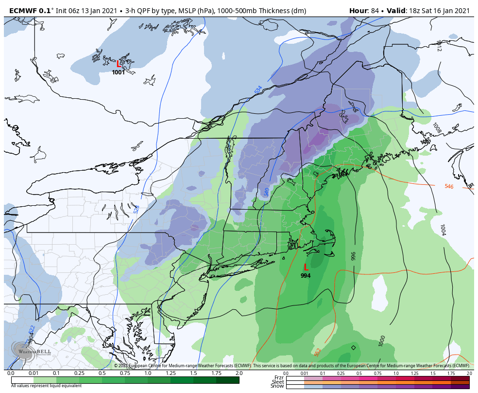
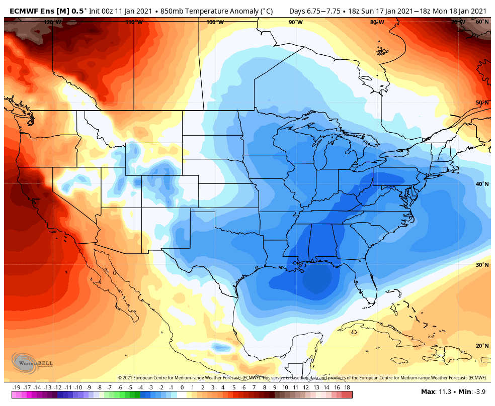
The low placement continues to be of key concern heading into Saturday’s cold front moving through the region. Models continue to try to decipher where the rain/snow line will form, and elevation will play a big role in precipitation type too. We have a negative AO & NAO, which should theoretically hold some cold air …
Daily Update/Week Ahead 1/11
We have another quiet few days before the pattern picks back up later this week into the weekend. Ahead of a cold front, we’ll have some warming late in the week, though it’s not expected to be significant warming given the current air mass. However, we’re watching the incoming front for possible low pressure development, …