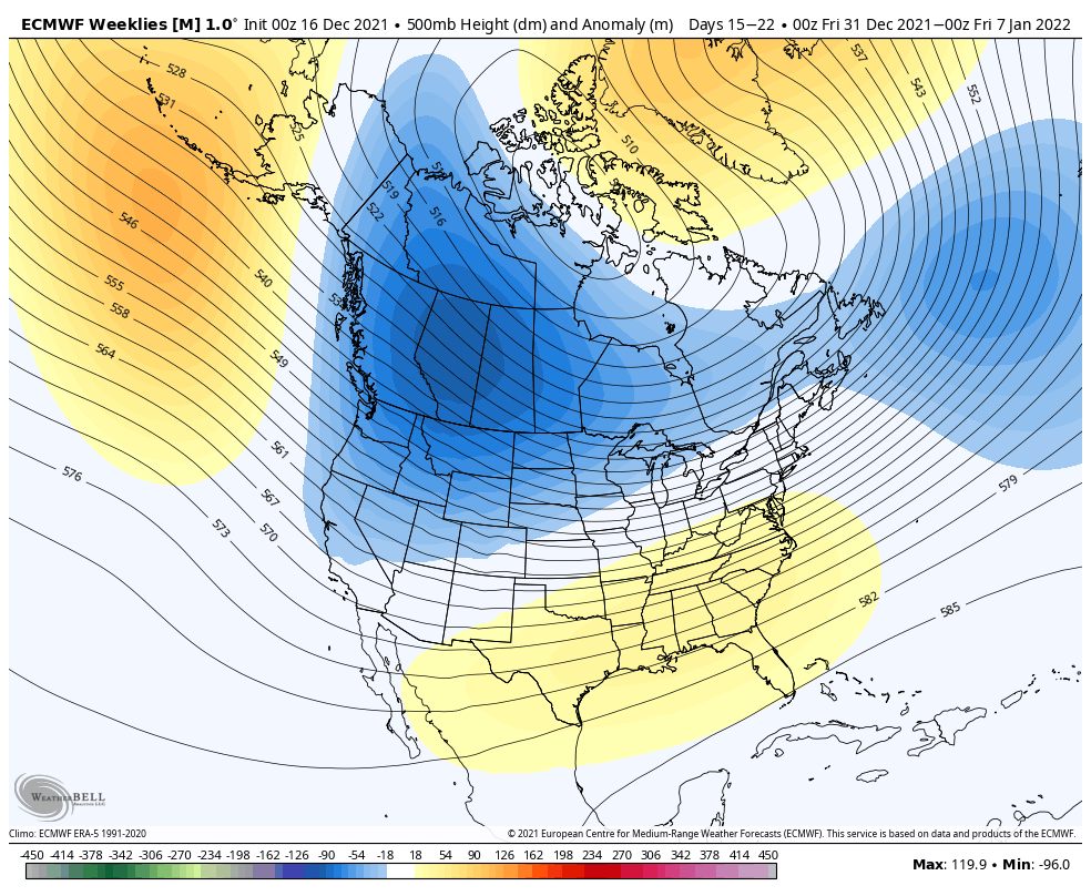
Last week we went over a lot of information in several different topics (teleconnections, ensembles and long term) and what we found was that there were several contradicting factors. In the end, we came to the conclusion that it wasn’t the worst of places to be in, because it typically meant that we were dealing …
Category Archives: Bolton Valley
First Decent Snow to Come Saturday Night
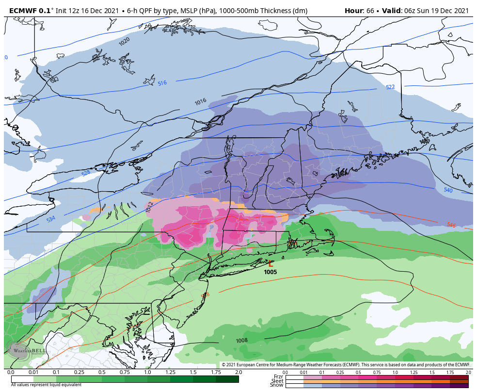
We have our first major snow of the season for the east as a low pressure rides along the stalled front that moves through tonight. While we’re still waiting for our first major snow, this will have to do to get us through Christmas week (although there are some other storms to come before Christmas). …
The Week Ahead – Rollercoaster of Warm Storms & Cold Blasts
We’re somewhat back into the pattern we left last winter in – we get the cold but we can’t keep it when a storm comes. A strong cold front has been making its way through the east today…leaving snow showers in its wake from the Great Lakes to New England. Tuesday will be a cold …
Continue reading “The Week Ahead – Rollercoaster of Warm Storms & Cold Blasts”
Teleconnections – NAO/AO Overview
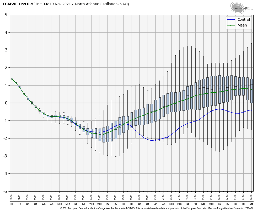
Teleconnections refer to recurring and persistent, large-scale patterns of pressure and circulation anomalies that span vast geographical areas. The most well-known one is ENSO – El Niño Southern Oscillation. While ENSO doesn’t have a major say on the east coast weather pattern, other teleconnections do tell a bit of the story. We have a weak La …
Long Term Views 12/3
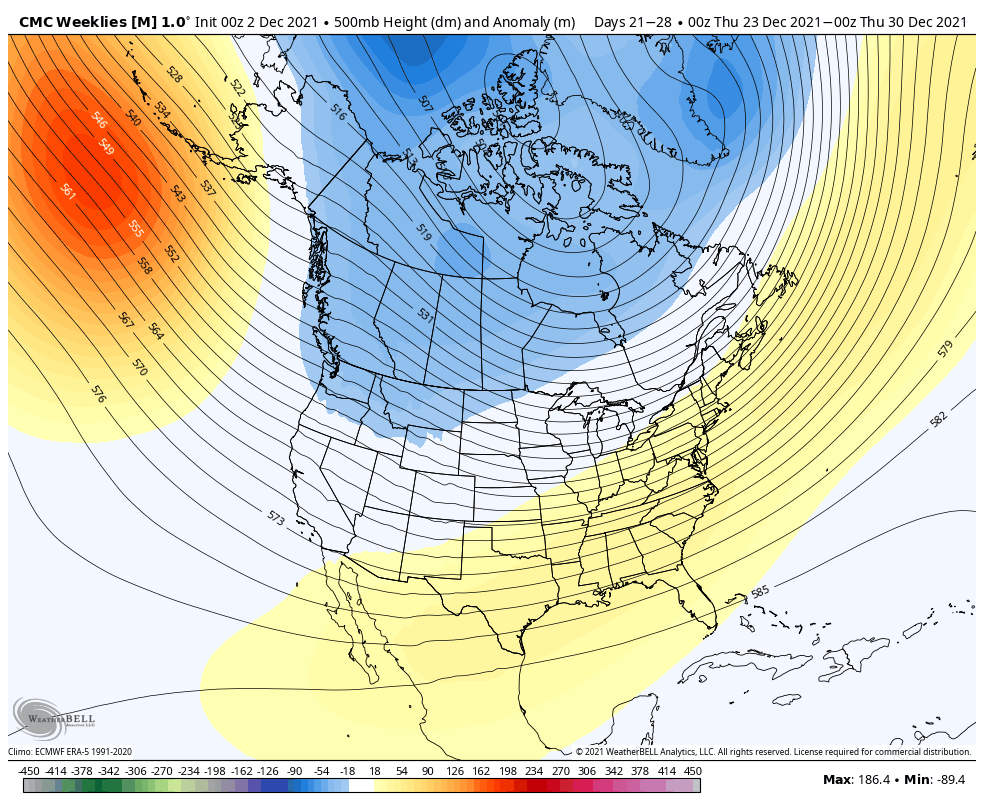
The cold is in and we’ll continue to have some waves of cold bursts in the coming week. We’ve had issues holding the cold, which means we have blocking problems (which was the trend last season), therefore there’s more bad then good coming with storms. However, in between these storms we have cold blasts, which …
Long Term Views 11/26
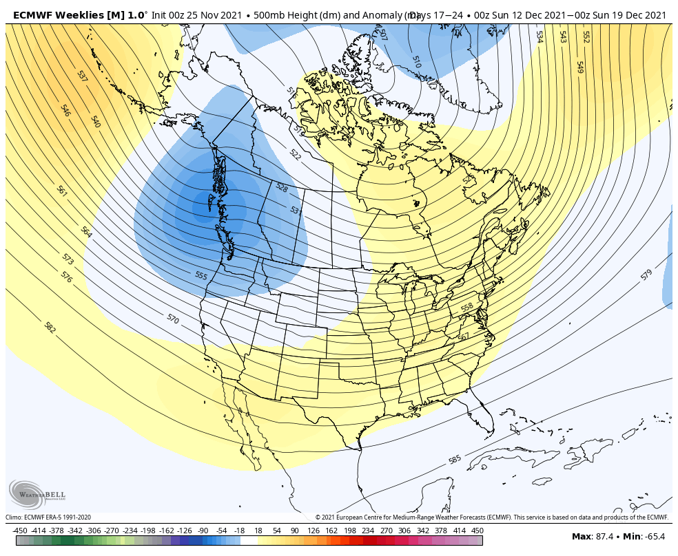
Our expected cold punch is arriving today from west to east with some significant snow expected in New England as the low pressure gathers moisture and energizes in the Gulf of Maine. Accumulations over 6″ likely in the Green Mountains, with 3-6″ possible in portions of the Whites and into the Maine mountains. Behind this …
Sunday/Monday Storm System
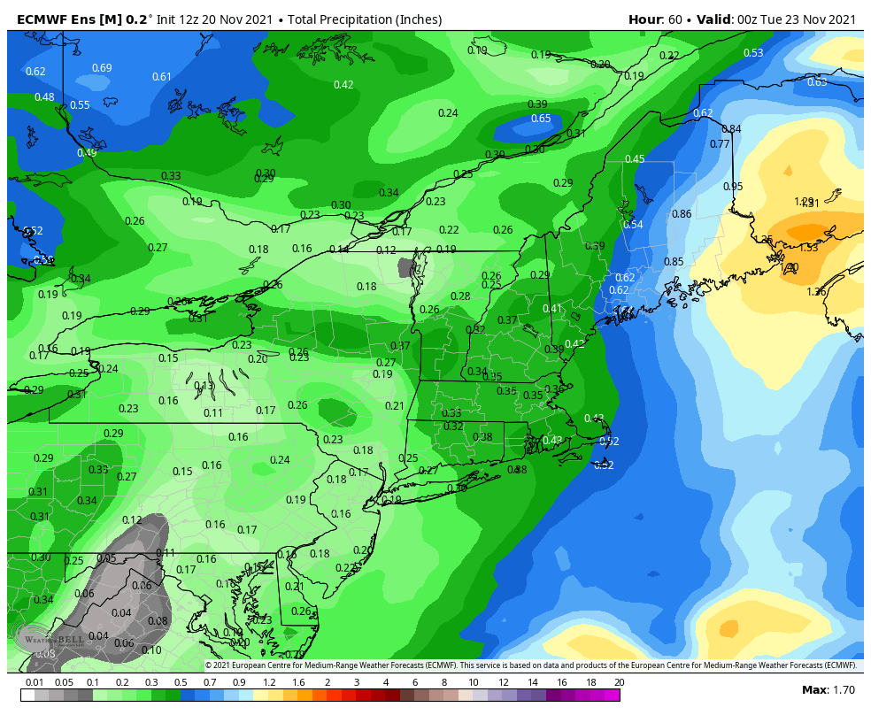
We’ve had our eyes on this system for quite some time now, with the beginnings on Sunday starting in the Great Lakes; light rain/snow is expected. By 10pm Sunday we have light precipitation overspreading the area but temperatures look to be colder than previously expected. This is likely due to the intrusion of cold air …
Long Term Views 11/19
The cold is settling in from the cold front last night and we are certainly in the colder pattern that we’ve been expecting. While overall a colder pattern, we still have some ups and downs to deal with. We’ll see that Sunday-Monday this week with the storm and again Thanksgiving Day; each warm up is …
A Look Ahead – Several Rounds of Cold
The first significant round of cold continues to settle in Monday over the Great Lakes, with the coldest part of the air mass over the Northeast later Monday into Tuesday. It will gradually retreat into Wednesday, from southwest to northeast as a warm front approaches from the south. We may see some cold air damming …
Stratospheric Warming – “Strat Warm”
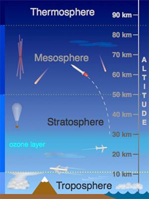
While you may not hear much of this on TV or in normal weather websites, stratospheric warming can have a large impact on the weather in the United States. Last year, it was responsible for the intense snow, ice and cold felt in Texas and many parts of the south. The stratosphere is roughly 10-50km …