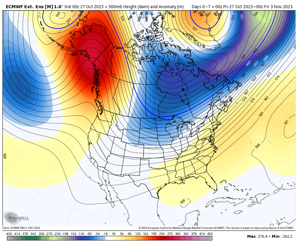
While our first blast of cold is coming in next week, there is some wobble to the depth of the cold. Until the tropics die down, we’re not going to see long term, deep cold. The good news is that week the first full week of November is starting to track a touch colder than …
Category Archives: Alterra
The Week Ahead 10/23

After another rainy weekend, we’re heading into a warm pattern for the end of the week. I hesitate to call it the last hurrah of warmth, because I think November will be a transition month, but it could be last prolonged stretch of it. Temperatures will be some 8-12 degrees above average through the weekend …
The Week Ahead 10/16
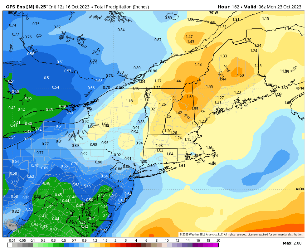
We’re in a typical fall pattern heading into mid-month, with some lingering showers to start the week, and heavier rain possible over the weekend – again. While the thought of another rainy weekend isn’t exciting, it’s encouraging to see a cycle forming in the weather pattern. This is something we haven’t seen since the spring. …
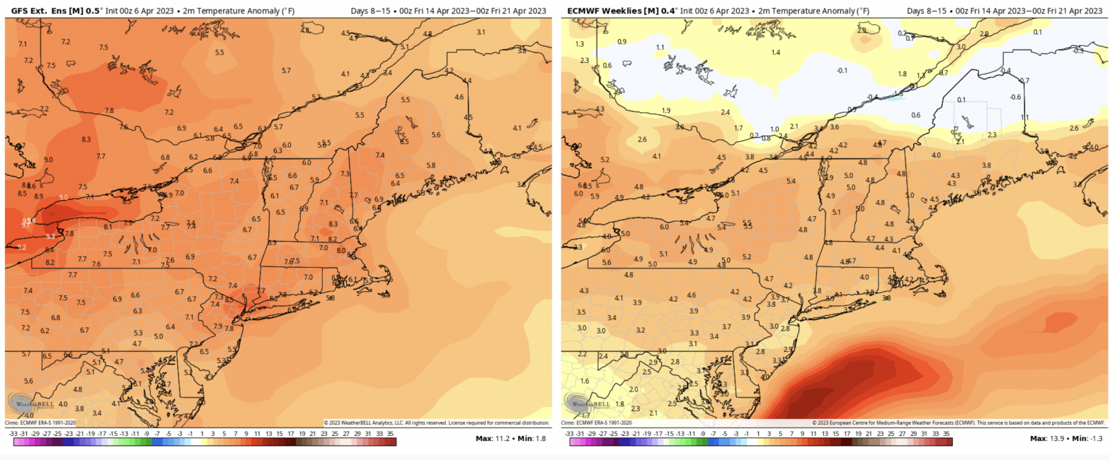
Long Term Views 4/14
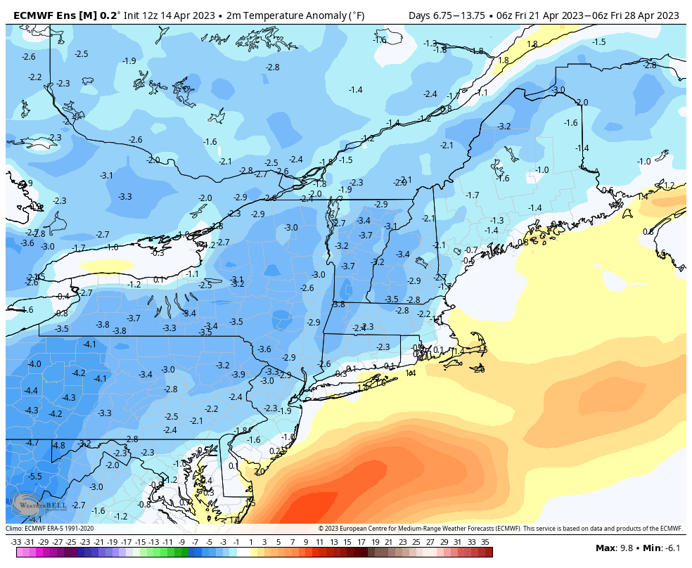
We’ll end up above average temperature-wise for next week despite more rain and active weather coming in. Much of this is skewed from the weekend’s temperatures, as those will remain well above average before we cool into early next week. However, for Days 7-14, we’ll see temperatures even out or even fall slightly below average. …
The Week Ahead 4/10
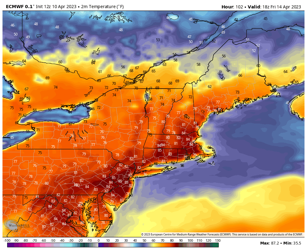
The week ahead is fairly boring weather-wise, but providing some stellar spring ski conditions to areas remaining open. Aside from some showers late Tuesday night in northern New England, we’re very dry this week. Fire Weather Watches have been issued in many areas as well. Temperatures continue rising through the end of the week – …
Long Term Views
As the season winds down, the temperatures are starting to ramp up. Bursts of cold are coming to a close as temperatures begin rising into next week. The trend continues into Days 7-14. On top of this, we’ll have little to no precipitation expected. Therefore inversions at night at be expected at low levels, while …
The Week Ahead 4/3
Not much going on this week except for one system Wednesday into Thursday. This will be rain for the majority of the storm for most areas, with the exception of portions of central VT/NH & ME. We could see some minor ice accretion before changing to rain. Beyond this, temperatures stay seasonably cool to start …
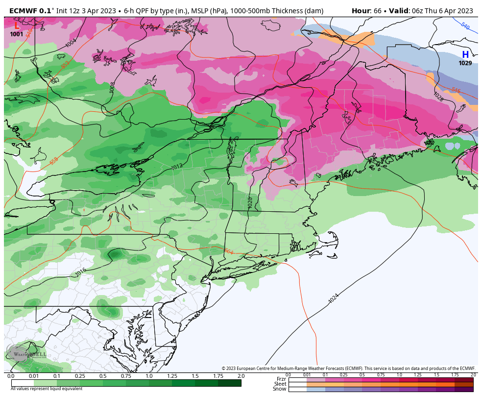
Long Term Views 3/31
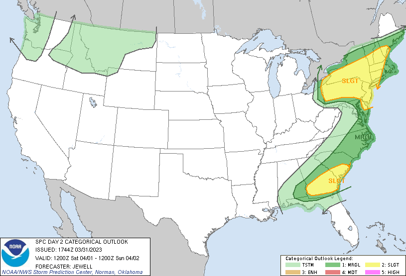
The clash of the seasons is upon us, with more mixed precipitation systems and dare I say…the first spring thunderstorms of the season possible on Saturday. It’s a little early to talk about severe storms, but they are possible across New England Saturday afternoon. Temperatures will stay close or slightly above average into Days 0-7. …
The Week Ahead 3/27
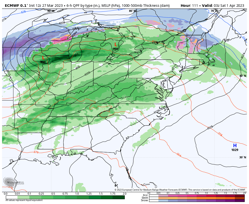
The week starts off with a dry atmosphere and a weak system coming through Monday night into Tuesday morning in the east. Temperatures moved up quite a bit ahead of the system so may see some rain mix in initially. Any snow that does accumulate, which will only be on the order of 1-2″ at …
Long Term Views 3/24
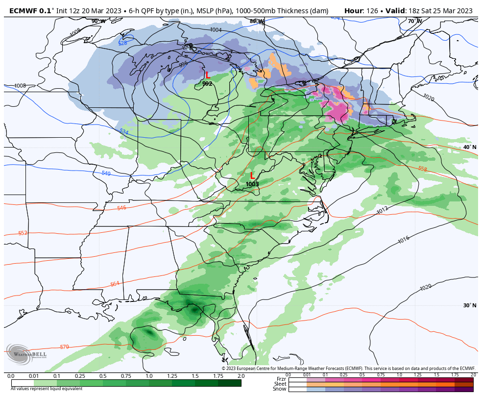
The global pattern continues its shifts with the ENSO neutral cycle taking shape and we’re going to continue on a cooler than average pattern heading through Day 14. Temperatures at the surface level (local airports) are running roughly 1-3 degrees above average so far for March, but may start skewing cooler for the last 7 …