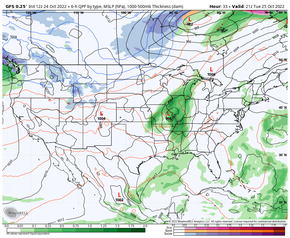
Another rainy start to the week for the Northeast as a weak low pressure system continues to bring showers and a couple isolated thunderstorms. We are also watching the tropics for a piece of energy near Bermuda that’s attaining tropical characteristics. The National Hurricane Center actually gives it a high chance of formation in the …
Category Archives: Alterra
Long Term Views 10/21
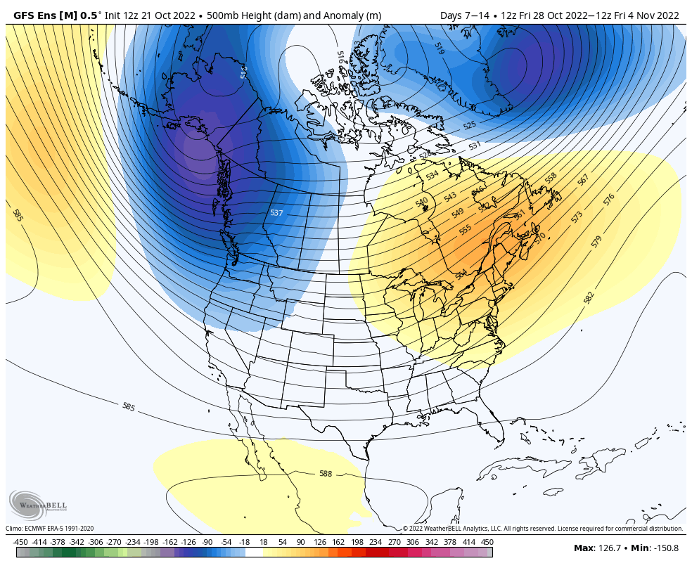
Unfortunately, we haven’t seen much change in the pattern heading toward the end of the month and early November, yielding not-so-great news in terms of snowmaking opportunities. While tropics aren’t very active, there are still a couple areas of interest that have popped up in the past week. We’re also still seeing lingering overall global …
The Week Ahead 10/17
This week features some of the first lake effect snow bands in the Great Lakes, another round of rain in the Northeast (though not as heavy as last week), and a brief cool down. The depth and strength of the cold doesn’t quite make it in to the Northeast as compared to the Great Lakes, …
The Week Ahead 4/12
Another typical spring week begins as we head into the mid-month time frame. Plenty of rain chances along with some warmer days can be expected this week. We’ll be dealing with a couple hours of rain Tuesday, mostly in the morning, as a weak low pressure moves through the region. Behind it, we clear out …
The Week Ahead 4/4
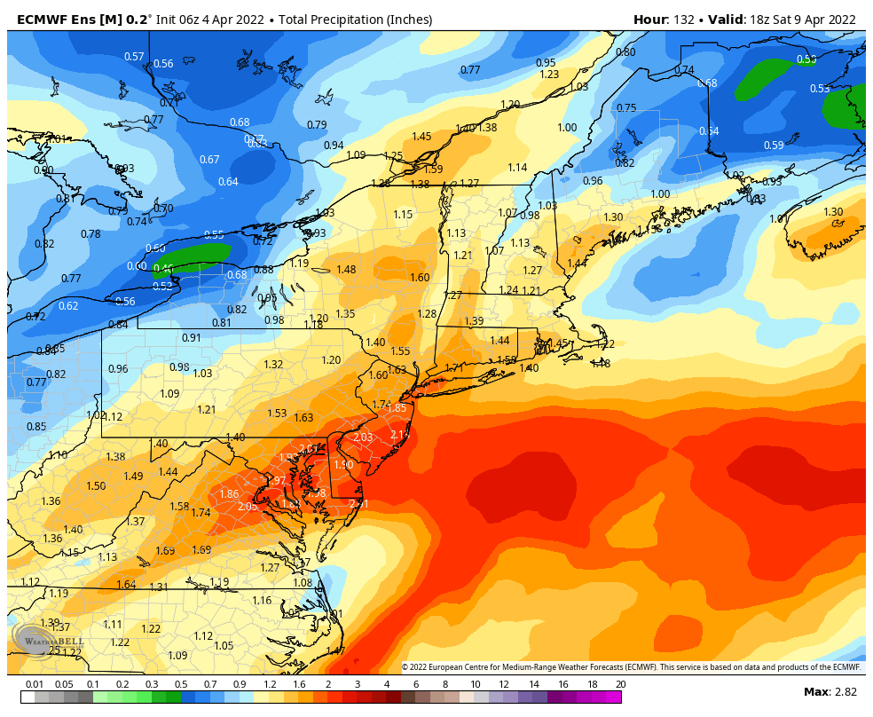
Though this week will start off relatively warm and sunny, the second half of the week bring a raw rain to most of the region. Overall temperatures will end up landing seasonably cool for the week despite the warmer days at the beginning of the week. There are two systems to impact the region; the …
Long Term Views 4/1
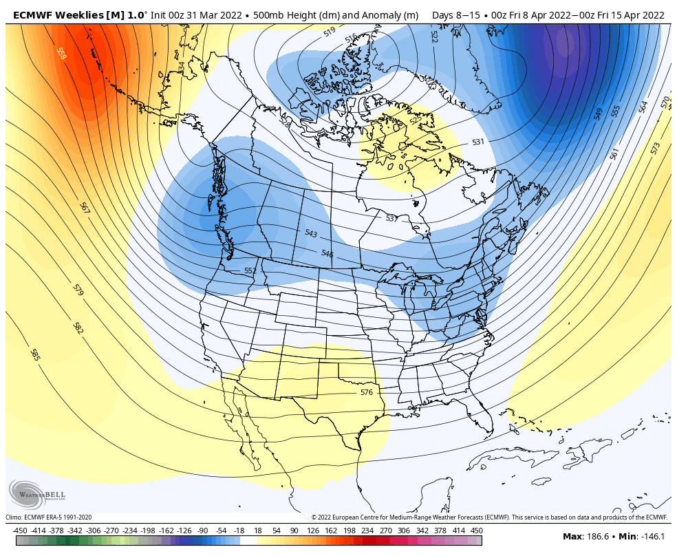
No April fools joke here, but we’re not seeing much of any resurgence of cold air beyond the first week of April. We’ll be seasonably cool (not cold…) into the first week of the month, but gradually have conditions moderate. The second week of the month will be more of a transition point – we …
The Week Ahead 3/28
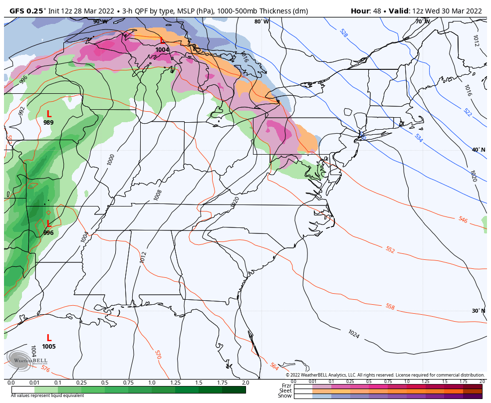
We have a very similar pattern to last week in terms of precipitation and overall pattern structure.The core of the cold comes out of the Great Lakes Monday and settles into the Northeast for Tuesday. We’ll begin some moderation on Wednesday, with an large area of overrunning precipitation associated with the warm front moving through …
Long Term Views 3/25
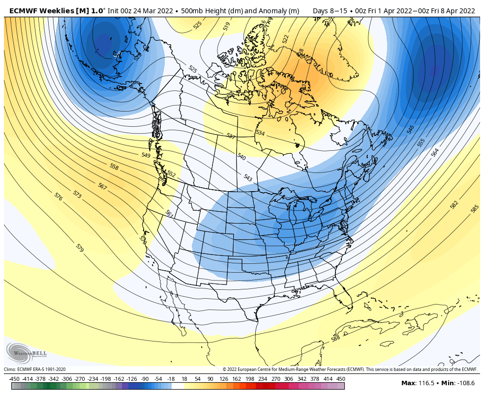
The main shift in the pattern actually comes in the next 7 days – which is a substantial cool down settling in Sunday through Tuesday. Beyond this, we do have some moderation, but it is tempered just a bit. At this point in the year, cool downs are less impactful given the higher sun angle …
Hindsight of Season…
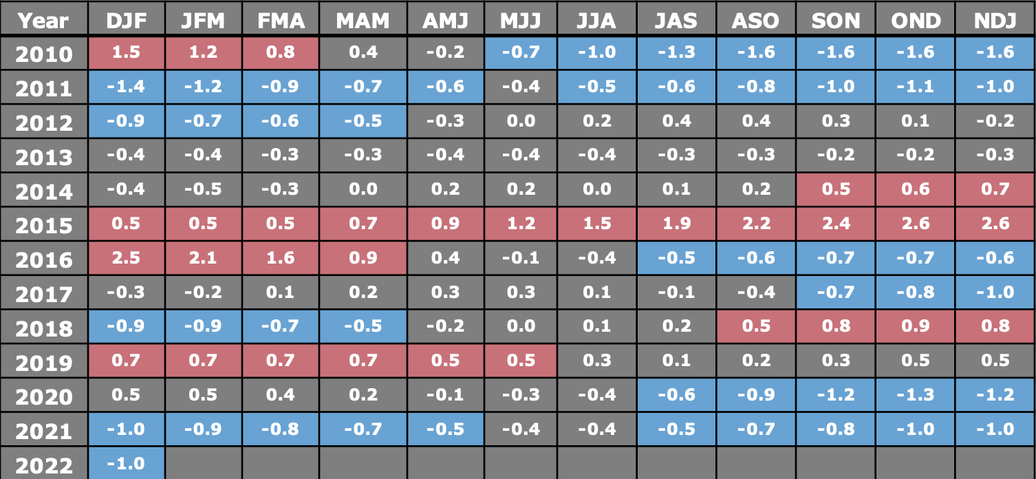
With the extreme volatility of the season and another mixed precipitation storm coming in this week, I took a quick look at where we landed in the ENSO cycle this winter. Typically, our placement in El Niño or La Niña isn’t the “end all” for the season, but there have been some correlations made that …
The Week Ahead 3/21
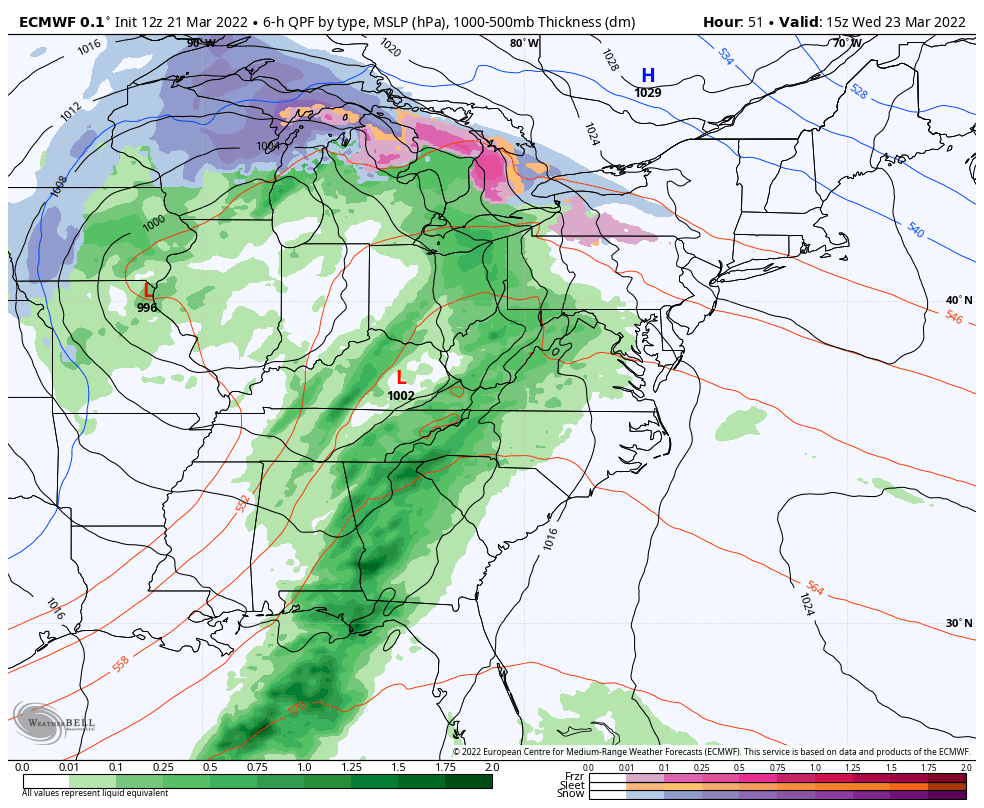
The first 36-48 hours of the week are rather quiet – breezy but no major precipitation to contend with. Temperatures are on the more mild side, but not warm. Clouds gradually increase from west to east Tuesday night through Wednesday with precipitation moving into the Great Lakes in the wee hours of the morning, and …