Some interesting little movements in the weather pattern this week, but overall we begin warming toward the holiday weekend. There’s a front that comes through Tuesday morning, which allows us to warm up slightly ahead of it (most of which we’ll see overnight Monday night). Another weak front comes through Wednesday, which gives another quick …
Category Archives: Alterra
Long Term Views 11/18
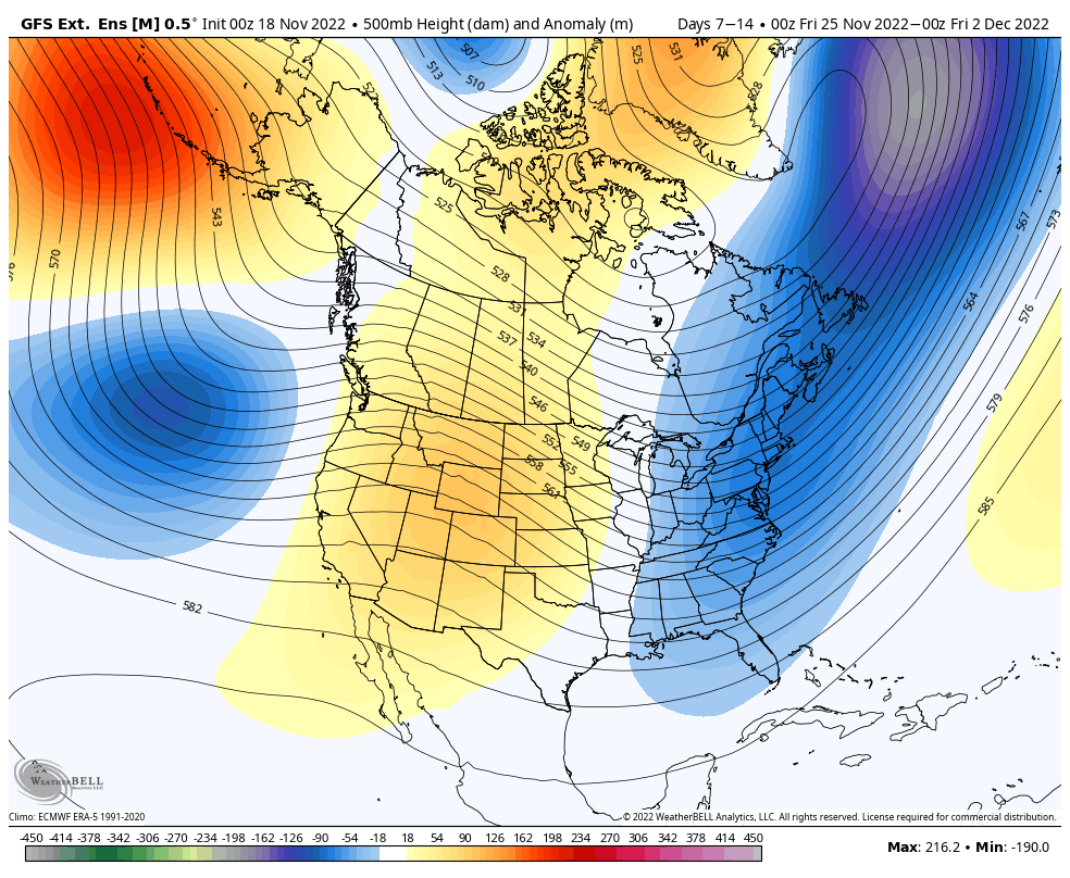
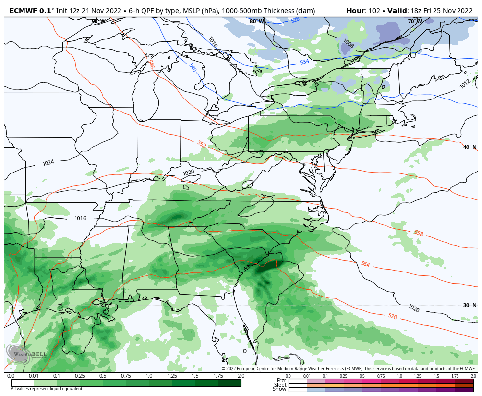
With many resorts turning on the guns (consistently) for the first time in the past week, getting natural snow, and even opening for the season, the long-awaited cold pattern is sticking around. A stronger cold punch arrives Sunday 11/20, and likely again on Sunday 11/27. The expected eastern trough should hang on through the final …
The Week Ahead 11/14

Cold air has finally arrived and will be sticking around the majority of the week. While the Great Lakes stay entrenched in the cold with snow showers throughout the entire week, we’ll have a couple ups and downs for the Northeast. Monday remained cold, and we’ll only see slight moderation into Tuesday. We do see …
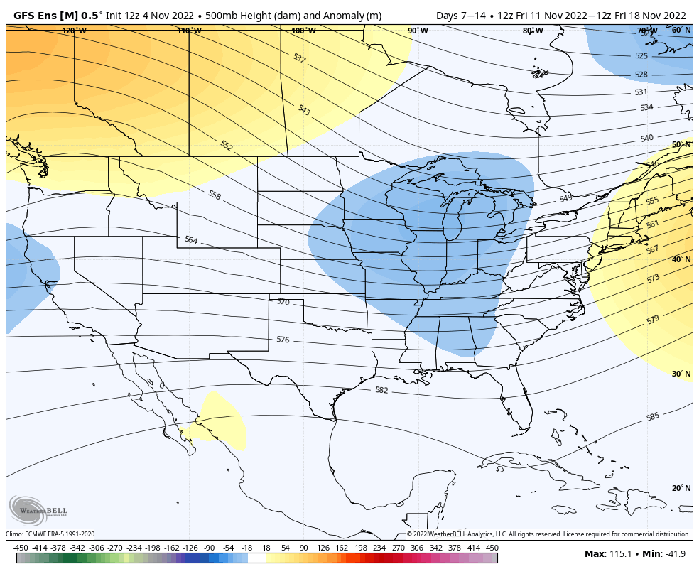
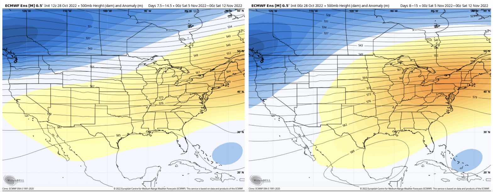
Long Term Views 11/11
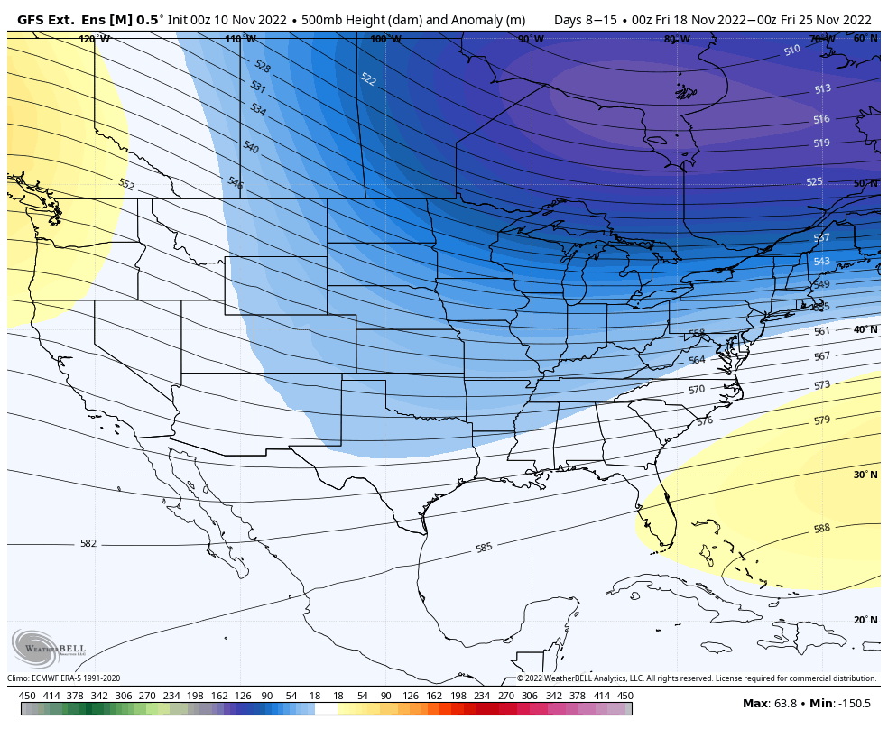
While we await the first real batch cold to come in the Northeast after the remnants of Nicole, we’ll take a quick peek at the forecast in the next 7-14 days. Overall, it’s favorable. The core of the cold continues to stay due north of the Great Lakes. I’ve chosen the GFS output because it’s …
Incoming Cold Details
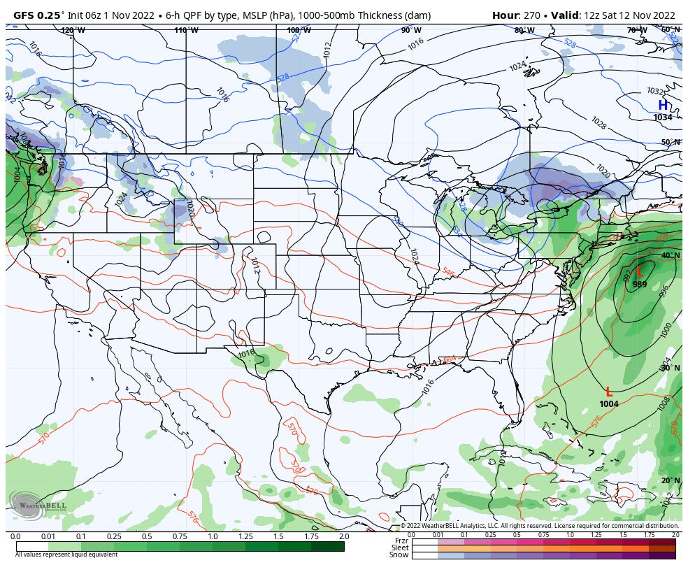
We’re finally seeing the light at the end of the tunnel – some sustained cold arrives Sunday after a strong cold front kicks out the remnants of Tropical Storm Nicole. By the time Nicole gets to the Northeast, it will be a subtropical storm with heavy rain and an expanding wind field. The timing of …
The Week Ahead 11/7

The cold slowly begins to move in this evening after getting hung up to our west earlier this afternoon. Our coldest point in the Northeast will be just around sunrise on Tuesday morning. Wind remains high, especially at higher elevations. The depth remains relatively shallow, with a sharp 0C 850mb line right along the MA …
Long Term Views 11/4
We are finally turning the corner after a warm weekend headed our way. The first infusion of cold comes quickly next week (11/8), however sustained cold will begin coming in surges beginning next weekend (11/12). The pattern will be active and there are still pieces of tropical energy that are roaming around the Atlantic, therefore …
Additional Note on Tropics 11/1
For the last several weeks, we’ve been talking about the active tropics creating volatility in the long term. Due to the weak handling of tropical systems by models, we tend to have high variability in model runs for Days 5+, and cold surges not coming to fruition. I wanted to show you the last 4 …
The Week Ahead 10/31

It’s fairly quiet and warm during the week ahead as we’ve been talking about for a couple weeks now. The potential cold surge over the Sunday-Monday time frame has flattened out with the tropics remaining active. The only chance of precipitation comes from some stray showers throughout the area late Monday into early Tuesday. We …
Long Term Views 10/28
With the tropics remaining active, we’re not seeing much in the way of sustained, deep cold. However, we should be seeing some pattern changes heading into mid-month. Several models have been juggling cold surges beginning next weekend, which I’ve mentioned in the forecast notes over the past couple of days. There’s quite a bit of …