Author Archives: Mallory Cash
One-Two Punch Thursday/Friday
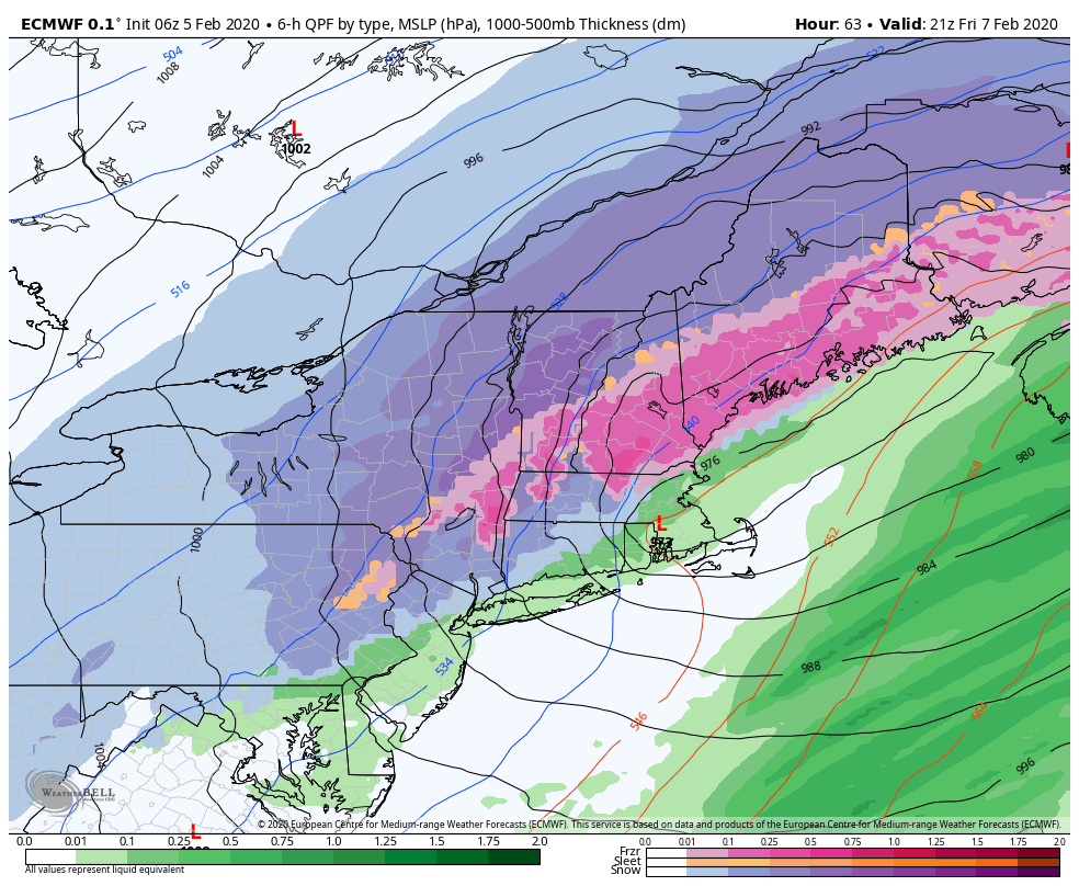
As we mentioned in the previous blog, with the NAO and AO staying overwhelming positive, we’ll be hard-pressed to see all snow events for our region. Events will be marginal and we’ll likely see rain and snow events in the same week, or for this week, nearly in the same storm. Arctic air settles in …
It’s About To Get…Interesting
Lack of blog posts means the weather’s been boring, or quiet might be a better word. But quiet has been great for conditions – key words from last week were “bluebird” and “perfection”. I was able to ski in Maine on Friday and it was indeed those two things. But alas, all good things must …
Incoming Storm Trends Warm
With humidity values plummeting to near zero % this afternoon in some cases, we had warmth a day early. Though a freeze/thaw pattern was expected for the end of the week, temperatures in the 40’s came in early this afternoon briefly before coming down with the lowering sun angle. The temperature rollercoaster ride is likely …
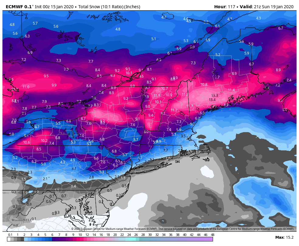
Snow to Liquid Equivalents
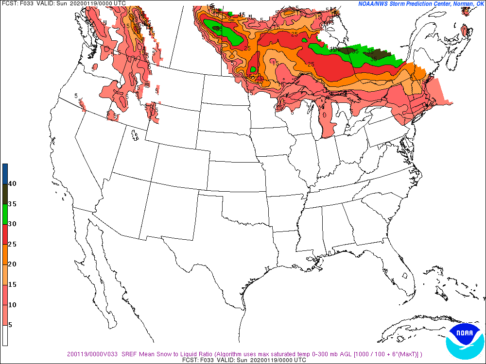
We have an incoming storm that all in all, isn’t very different from the last one if you look at the amount of liquid coming down. It’s a little larger, but same speed and low track. However, we’ll actually have some really interesting snowfall discrepancies, especially when you compare Hunter/Mount Snow to Wildcat/Attitash. The first …
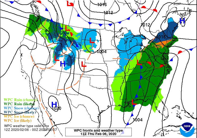
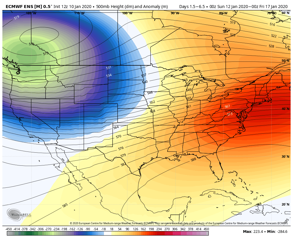
Storm(s) Overview & Arctic Cold
Aloha Arctic Air (…and some storms)
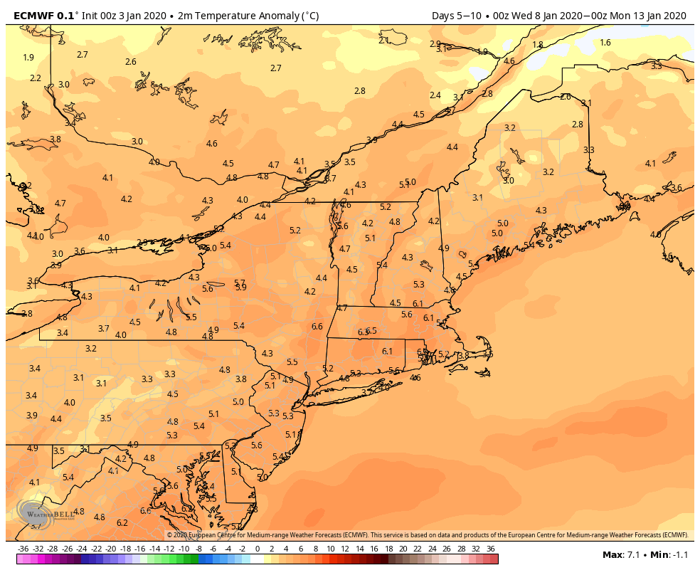
Perhaps the most commonly heard phrase from clients this winter is… Where did winter go? It seems like we get some cold, even some snow, and within a couple days the whole pattern breaks and it’s warm & rainy. Well, we have some better news. In the January 4th blog we outlined the thaw through …
The Bad News, The Good News
As we hinted at in the last blog, we’re at that dreaded “thaw” point with the “R” word in the forecast much more than any of us would like to see. What was foreshadowed has unfortunately played out as planned, however we did see a bit more snow in the days preceding the rain than …
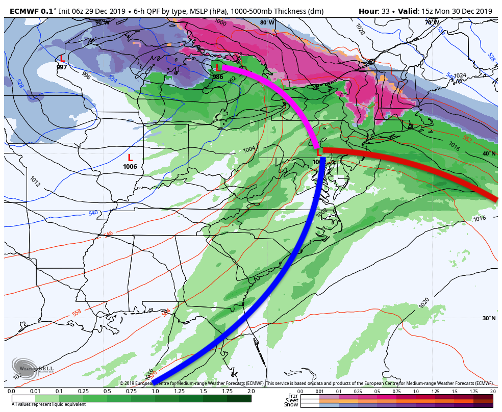
Temperature and Storm Rollercoaster
While winter is showing up in doses, the sustained cold is having trouble hanging around. That leaves us in a progressive and volatile pattern, with temperature swings and mixed precipitation storms and outputs. Each storm will determine its dominant precipitation type – whether we have cold air damming and can hold some cold, or we …
Why The Cold Will Hold
A similar structured system (but not in the cold distribution) to the storm that brought us over 2 feet of white gold exactly 4 weeks ago, is about to bring significant ice, snow, and rain to Vail Resorts properties up and down the eastern seaboard. This is a one-two punch – first with the warm …