We’re not seeing much exciting cold (if any, really) to come in this week, as expected. We have tropical systems continuing to blossom in the Atlantic basin and with that, we won’t have much cold around, let alone settling into the area. Our good news remains the amount of rain coming back into the area, …
Author Archives: Mallory Cash
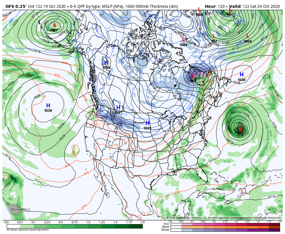
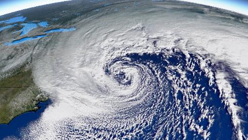
Long Term Views: October 16, Waiting On The Tropics
In general, October snowmaking windows are short, but ours have been less than that or generally non-existent. Looking at the pattern ahead, the volatility we spoke about in the October 2 blog continues, and the tropics don’t seem to want to cool down. We’re in the midst of potentially the first summit snows for most …
Continue reading “Long Term Views: October 16, Waiting On The Tropics”
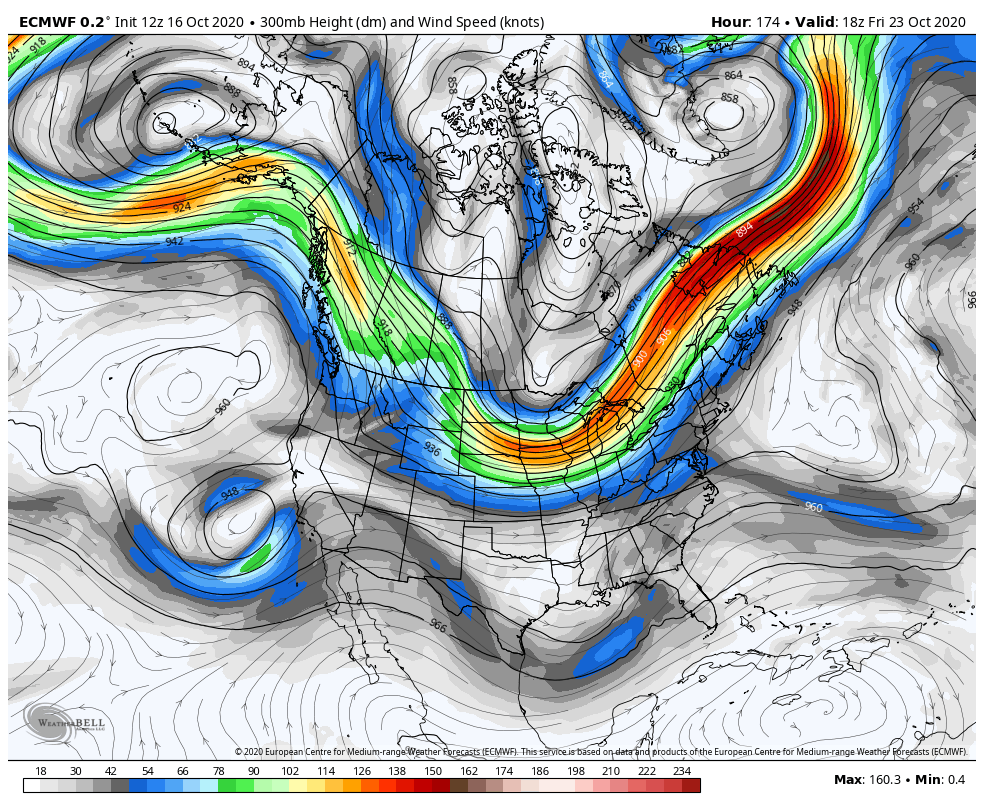
Weekend Snow? Possible…
In a typical October fashion, we’re moving through all the seasons in a short period of time. Summer like conditions returned last weekend along with severe thunderstorms, bits of spring and fall came through afterwards with wind, rain, and raw days, and now we might be entering into a brief zone of winter. Low pressure …
High Elevation Snow Possible This Weekend
In a typical October fashion, we’re moving through all the seasons in a short period of time. Summer like conditions returned last weekend along with severe thunderstorms, bits of spring and fall came through afterwards with wind, rain, and raw days, and now we might be entering into a brief zone of winter. Low pressure …
Continue reading “High Elevation Snow Possible This Weekend”
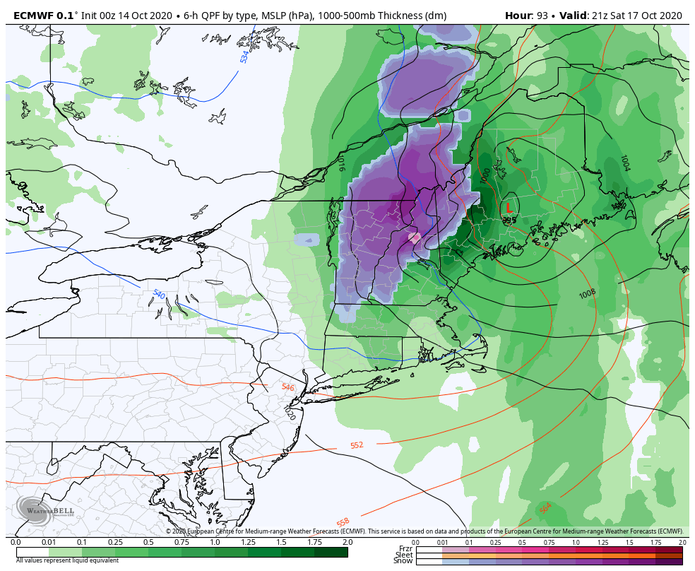
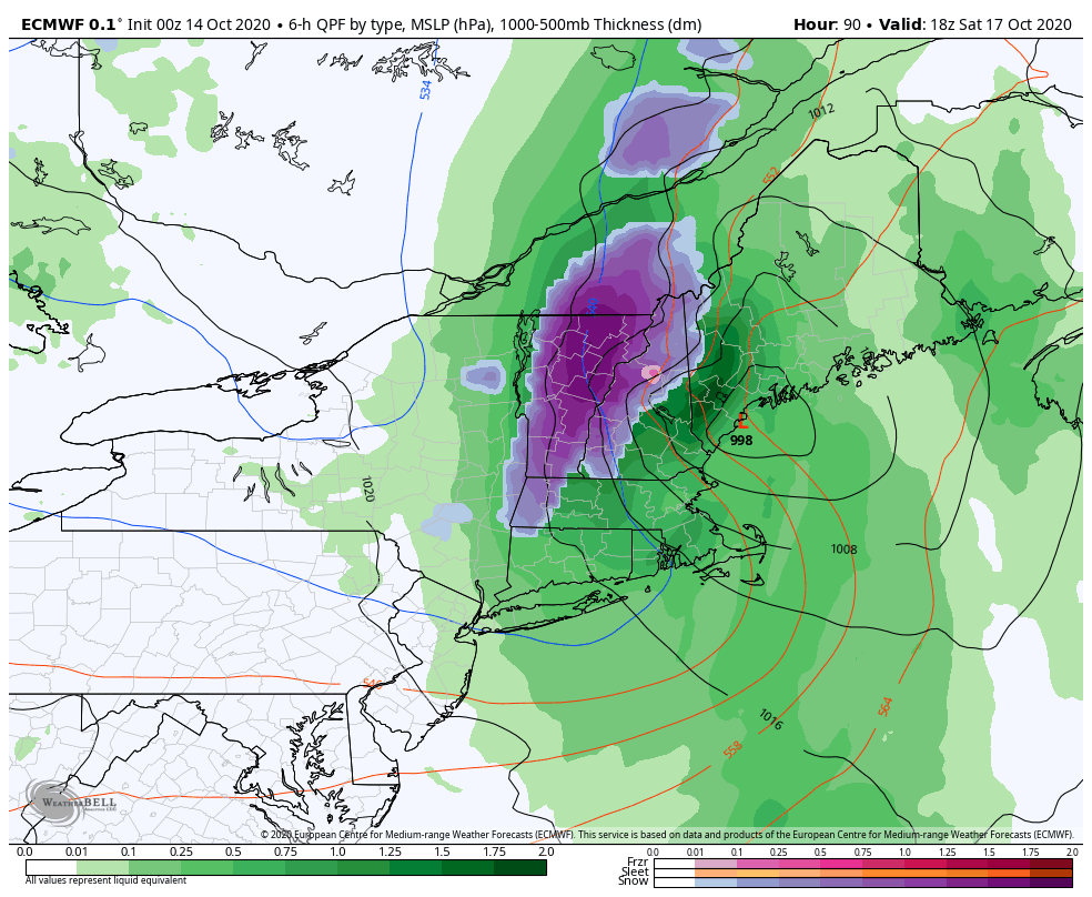
The Week Ahead: Rain Chances Galore & Weekend Cool Down
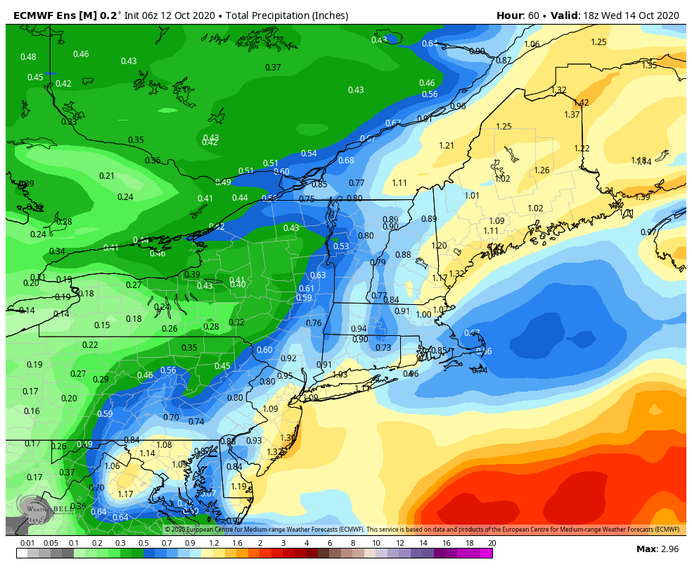
The week ahead feels quite like October. Cool breezes, more cloud cover, and several chances of rain, which we really need. The remnants of Delta converge with a low pressure system on Tuesday to bring the chance of around an inch of rain to New England. While not drought busting, it’s certainly helpful for the …
Continue reading “The Week Ahead: Rain Chances Galore & Weekend Cool Down”
A Look Ahead: Oct 12-18
The week ahead feels quite like October. Cool breezes, more cloud cover, and several chances of rain, which we really need. The remnants of Delta converge with a low pressure system on Tuesday to bring the chance of around an inch of rain to New England. While not drought busting, it’s certainly helpful for the …
Long Term Views, October 9: More Possibilities in Mid-Late October
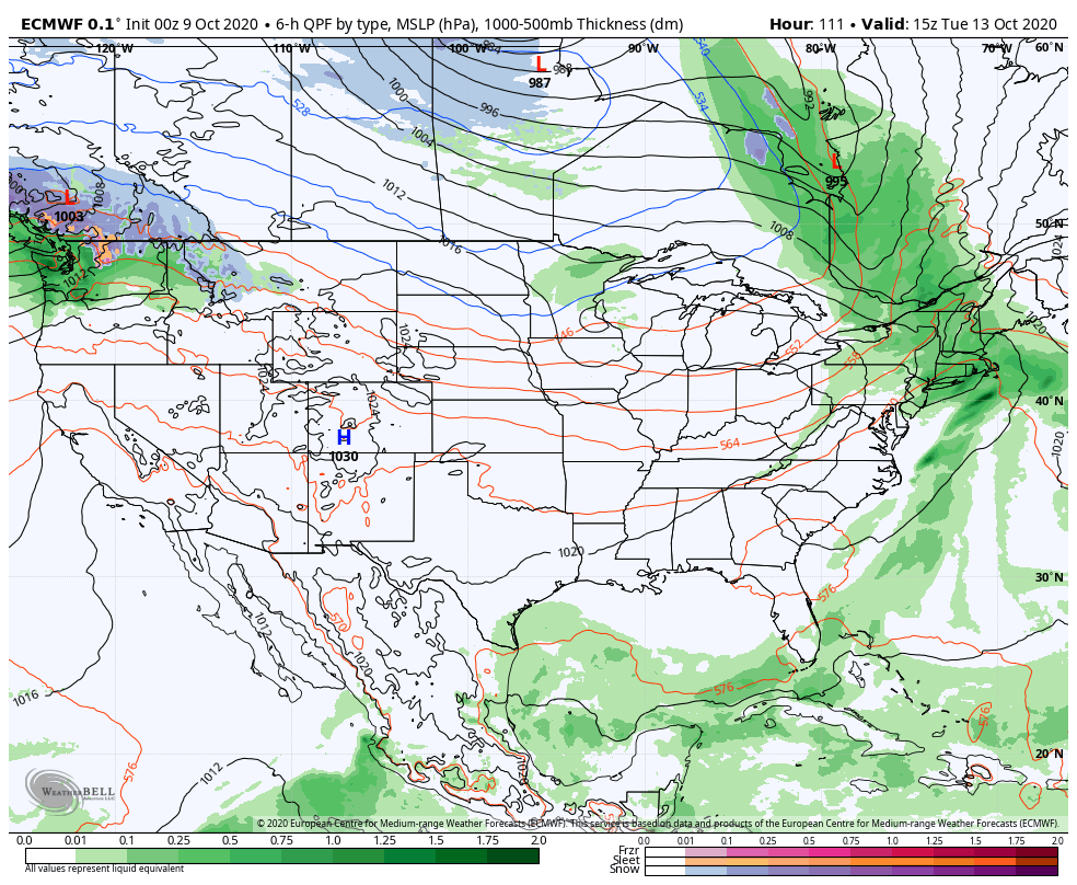
Our first round of snowmaking temperatures entered New England last night for elevations above 2,500 feet. Unfortunately, due to Hurricane Delta, the window was much shorter than initially anticipated. Long term forecasts are tough as it is, but they are honestly, more often than not, more inaccurate while the tropical systems remain in the weather …
Continue reading “Long Term Views, October 9: More Possibilities in Mid-Late October”
Update on Cold Air Intrusion This Week
The depth of the cold air expected to come into the Great Lakes and Northeast has modified a bit, with a less expansive batch of arctic to come in, and a bit of a one – two punch of it as well. Above 2,500 feet, we still see the opportunity for >24 hours of snowmaking …
The Week Ahead: October 5-12, Temperature Volatility
The big story heading into this week is the cold blast that comes into the area Thursday and Friday. However, it is short lived. Temperatures ahead of the front will boost to seasonable or seasonably warm levels, before the one-two punch of cold fronts comes through on Wednesday/Thursday. Temperatures will likely fall through the day …
Continue reading “The Week Ahead: October 5-12, Temperature Volatility”
Winter 2020/2021
There are so few things that can be categorized as normal since March 2020, but returning to forecasts and tracking cold air/snow makes it feel a little bit more like a normal fall. We’re excited to bring some enhancements to the dashboard this season. First and foremost, welcome back to your corporate dashboard! Any Vail …