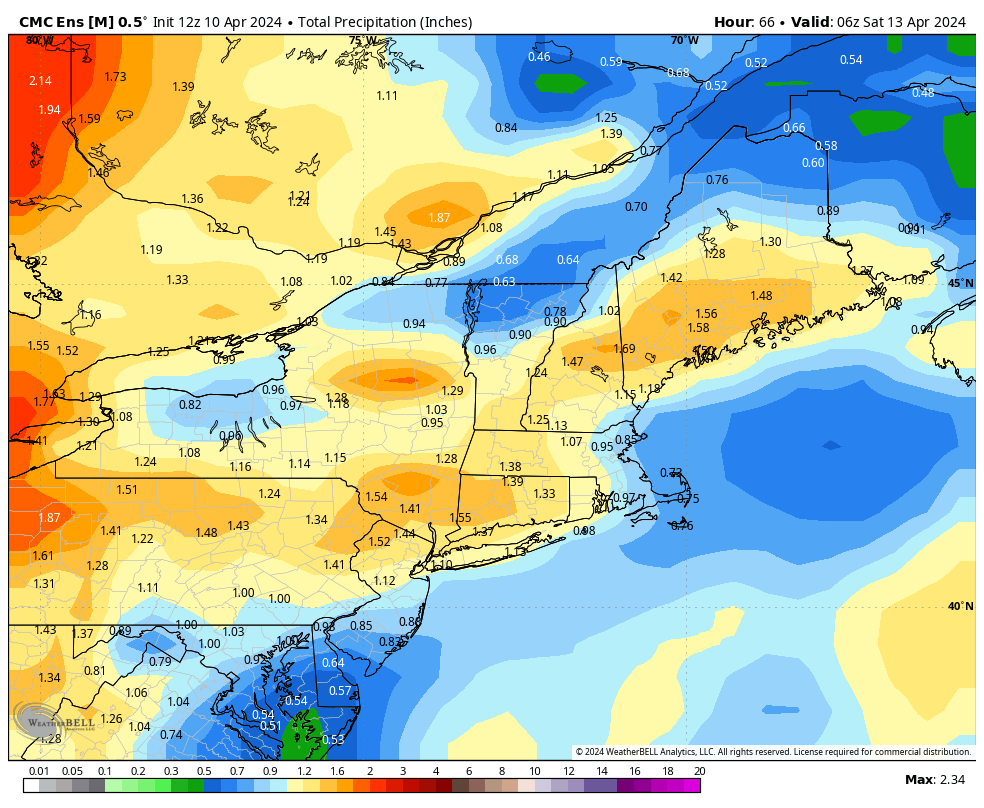
After two beautiful spring days, we’re back to a dreary pattern and some raw conditions outside. Temperatures will be cool through Thursday evening, before the southerlies really pick up and create some warmth, along with rain for Friday. Most areas are likely to see over an inch of rain throughout the next 72 hours. There …
Author Archives: Mallory Cash
Long Term 4/6
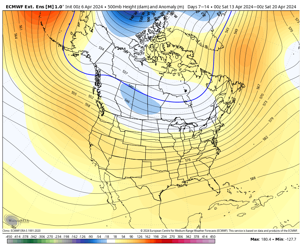
A little behind on the long term update as we’ve been dealing with power/internet outages since Thursday morning. Overall the long term is on the seasonable side. I thought we would shift back toward a cooler pattern after April break, however the teleconnections have shifted to staying more neutral rather than going into phases that …
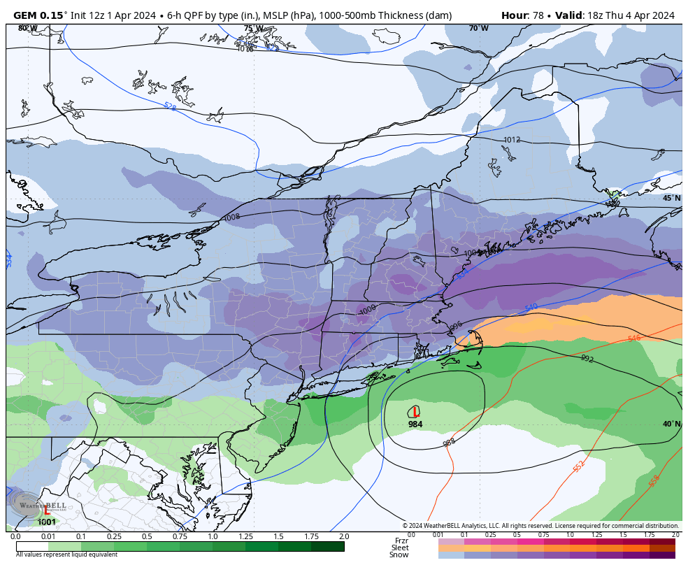
Storm Discussion 4/2
The Week Ahead 4/1
Here we go again… We have a reading of 1.0 out of the Nino 3.4 region this week (which is where the ONI is derived from ), which means we are squarely in a moderate El Niño phase at the moment atmospherically (it takes a couple weeks for the global patterns to shift). Keep in …
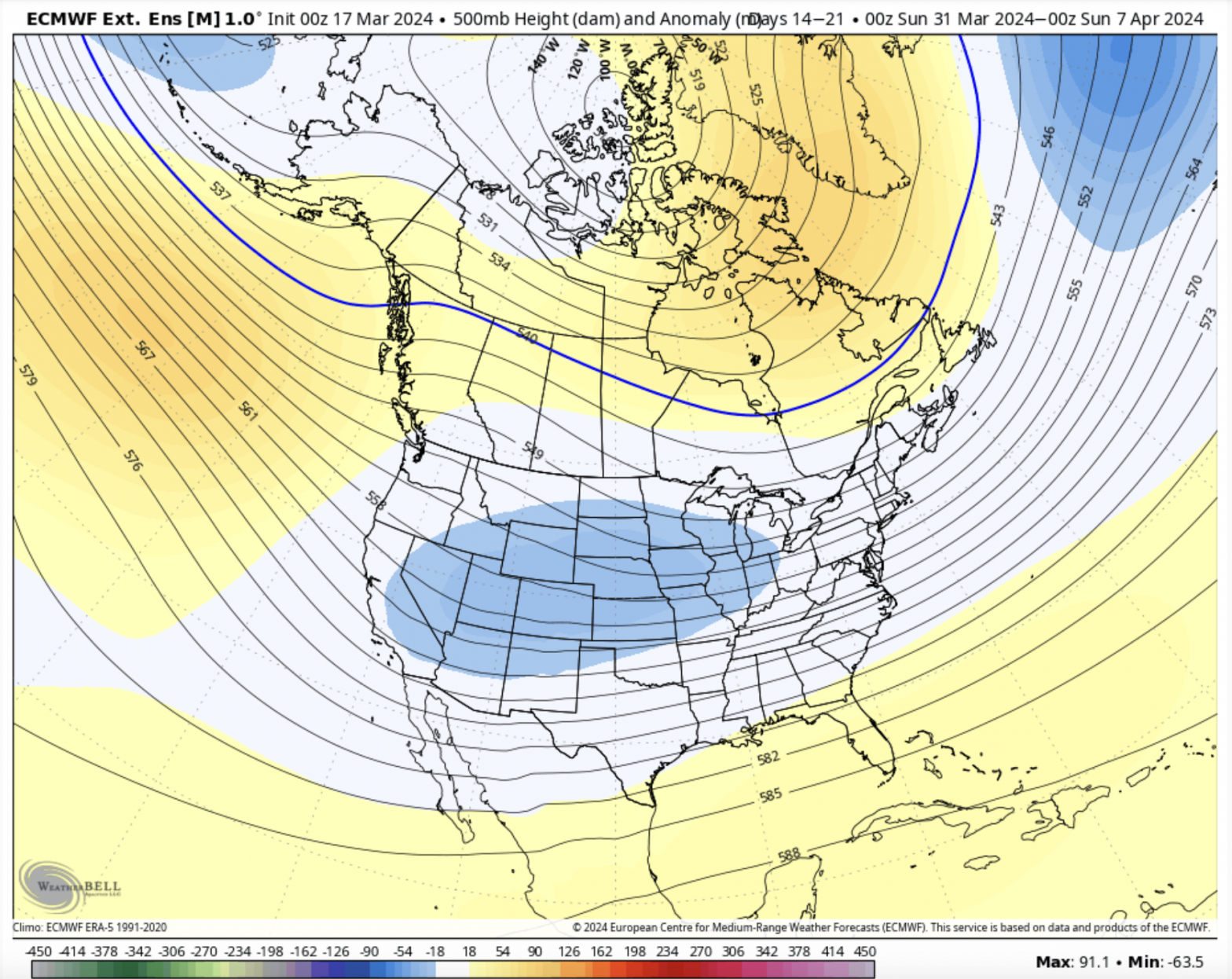
Long Term 3/29
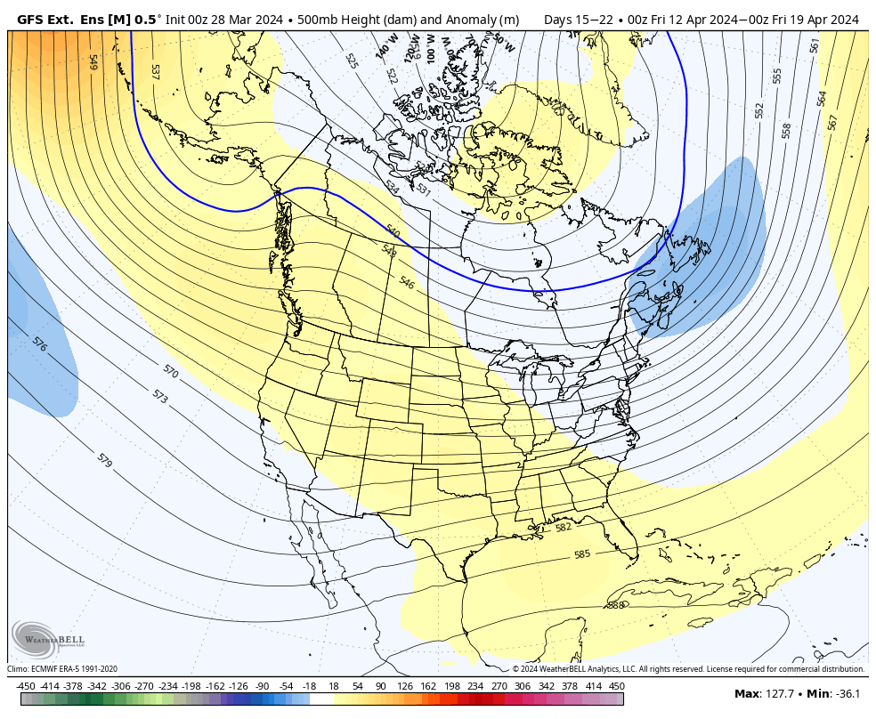
We’re heading into April shortly and while the calendar says spring, winter continues to prevail through the first week. The spring snow doesn’t seem to be over, and with the weakening El Niño, late seasons snow remain in play. For Days 7-14, we’re going to moderate a little bit out of the cooler pattern we’ve …
Week Ahead 3/25

The week ahead isn’t nearly as exciting as last week, despite the global weather pattern having us in a fairly decent early spring position. Latest information from the Climate Prediction Center has us squarely in a moderate El Niño, which means fun is still there to be had over the next couple of weeks. But …
Long Term 3/22
The big story is of course the incoming storm system bringing possibly the largest widespread snow of the season. Mixing will occur in portions of central/southern NY, VT, NH and ME which may impact totals, but we’ll still have a significant amount of snow expected before any changeover. Would also not be surprised to hear …
The Week Ahead 3/18
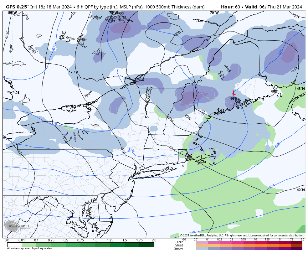
We’re back to a more winter-like pattern this week, with several opportunities of snow and an overall cooler pattern. Upslope snows will be continuous through the favored slopes through most of the week. We’ll have a system come through on Wednesday which may spawn a triple-point low and create some localized stronger banding. Depending on …
Long Term 3/15
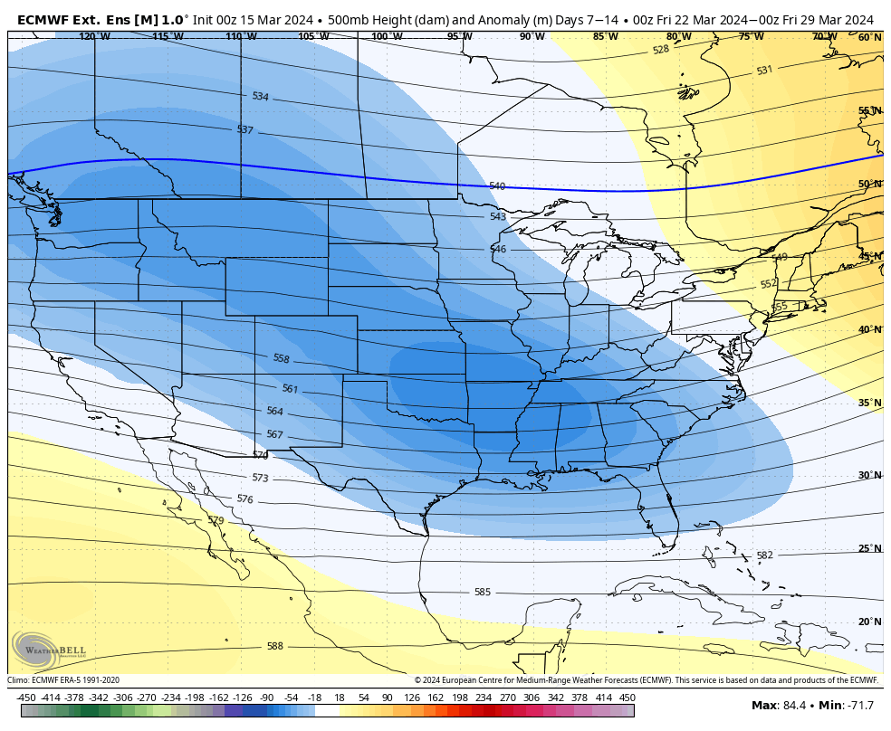
We’re heading into a cooler pattern for next week and it will start to ease up in Days 7-14. The EPO/WPO trend back to neutral in this period. It doesn’t swing hugely positive, therefore I don’t believe we’ll swing wildly the other way temperature wise. The NAO/AO stay negative through the time period as well, …
The Week Ahead 3/11
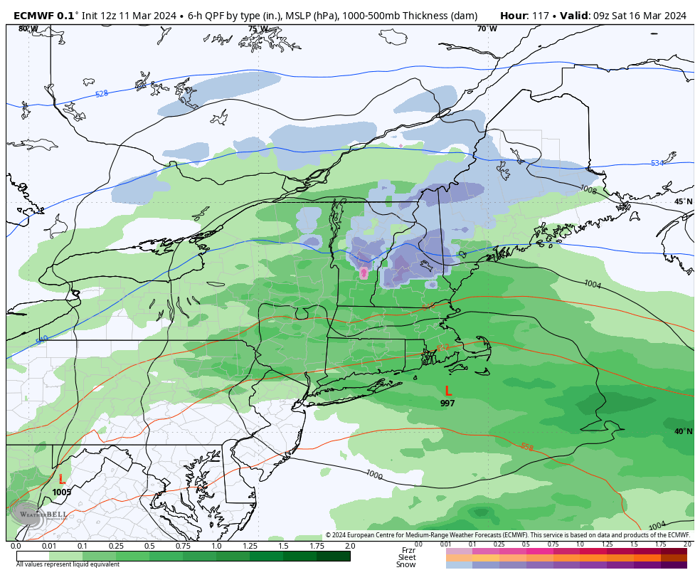
The rollercoaster ride continues into the second week of March, but overall we are colder. Windy conditions persist into Tuesday, with gusty NW winds continuing in most areas and upslope snows coming to an end in the favored slopes. Those with the upslope topography are nearing or surpassing two feet of new snow from the …