Behind the wind and rain tonight, we’ll have a hard crash in temperatures into Thursday through the early weekend. The pattern adjusts and begins regeneration – starting today and ending in about 7 days. That doesn’t mean we’re going to see warmth that entire time — but we’re on the roller coaster ride of cold, …
Author Archives: Mallory Cash
The Week Ahead – Snowmaking & Light Snow
If you’ve been around teenagers in the last year, you’ve probably heard the term “full send” — so I’m deeming this week “full send snowmaking” — we have lots of opportunity, often times through the day, all the way through the weekend. This may vacillate a bit more in the Mid-Atlantic as we have more …
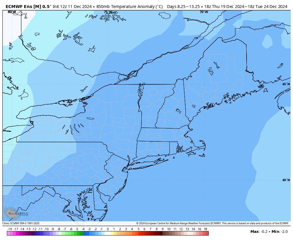
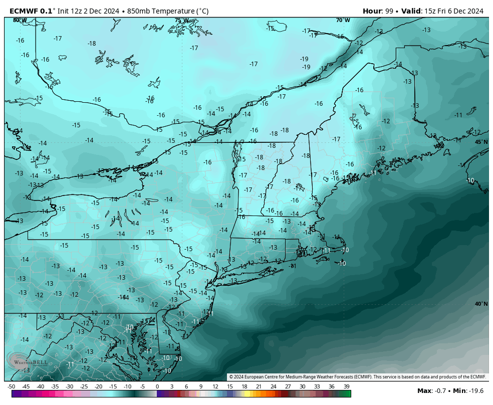
The Week Ahead – Pattern Change Settles In 11/25
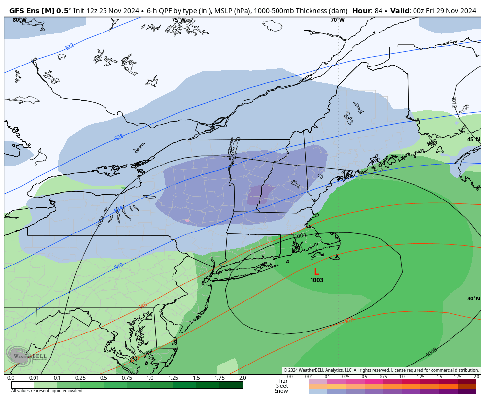
We’ve been talking about a pattern change for two weeks now, but it’s taken some time to settle in, delivering some waves of precipitation and slight warmth within it, but ultimately providing a big trend toward cold, and possibly snowy. The big talk of the town this week is a Thanksgiving storm that the models …
Continue reading “The Week Ahead – Pattern Change Settles In 11/25”
The Week Ahead: Pattern Change Continues 11/18
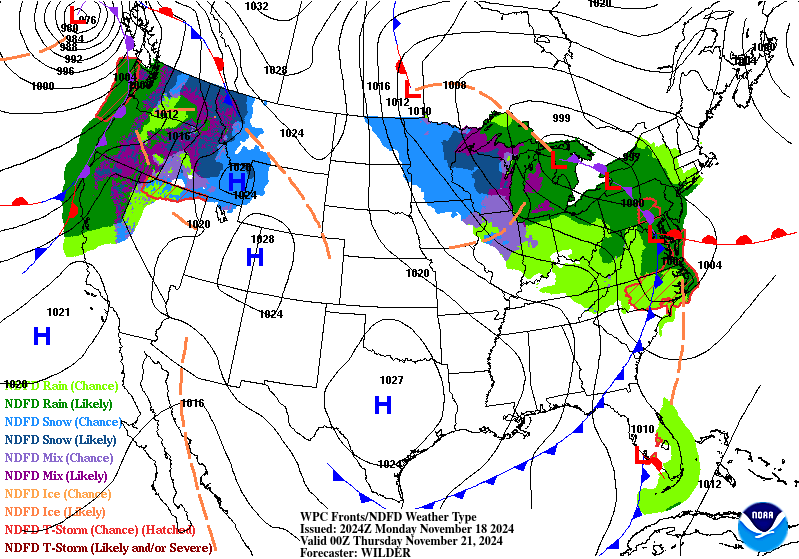
Our pattern change began last week, and we’re continuing the trend of change into this week with a cut-off low impacting us into the latter part of the week. While there’s a shallow cold air mass settling in tonight and Tuesday, it’s just that — shallow. We’ll see some temperature modification heading through Wednesday before …
Continue reading “The Week Ahead: Pattern Change Continues 11/18”
The Week Ahead 11/11 – Sneaky Cold
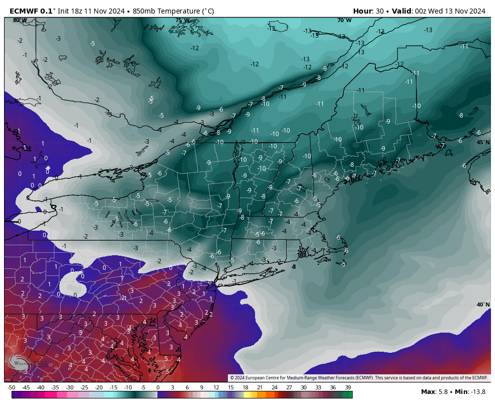
After another briefly warm day, we are heading into a much anticipated pattern change. We have a strong cold front on the way Monday night which will bring a cold air mass (and quite a bit of wind) for Tuesday, Wednesday and even into Thursday. The core of the cold settles in by 7pm Tuesday …
The Cold…Unknowns
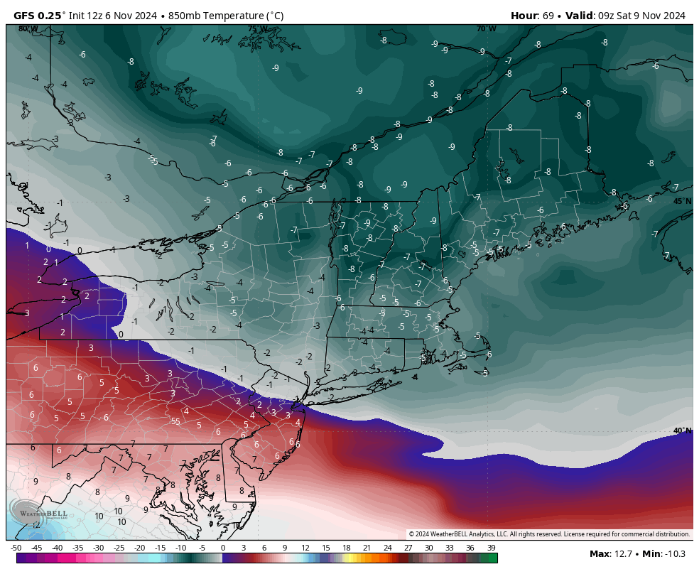
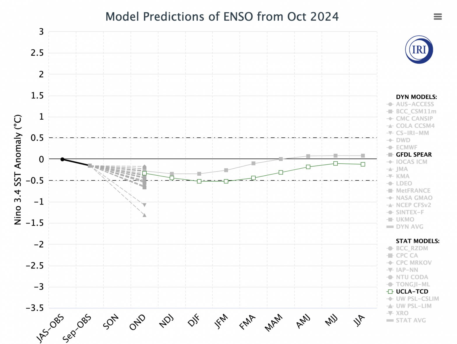
It’s the second week in a row of seeing 70+ degrees across many areas in the Northeast. However, right now most of our patterns are being influenced by the reactivated tropics, as we continue to see a neutral ENSO cycle take shape. Most tropical activity shunts cold spells to the north, or keeps them quite …
Looking Ahead…
A couple things to touch on as we come out of the coldest stretch we’ve had so far.. But first a quick look at the rest of the week. Moderation begins Tuesday though we’ll really feel it into Wednesday — especially in southern VT/NH and New York as a warm front works its way north. …
First Cold Blast Coming…

We’re back! Hard to believe the warm season flew by so quickly. The first decent cold punch of the season, with New England summits expected to drop below or near freezing, comes for the middle of next week. Initially it looked like the first punch would be stronger, but now the second punch, which arrives …
The Week Ahead 4/22
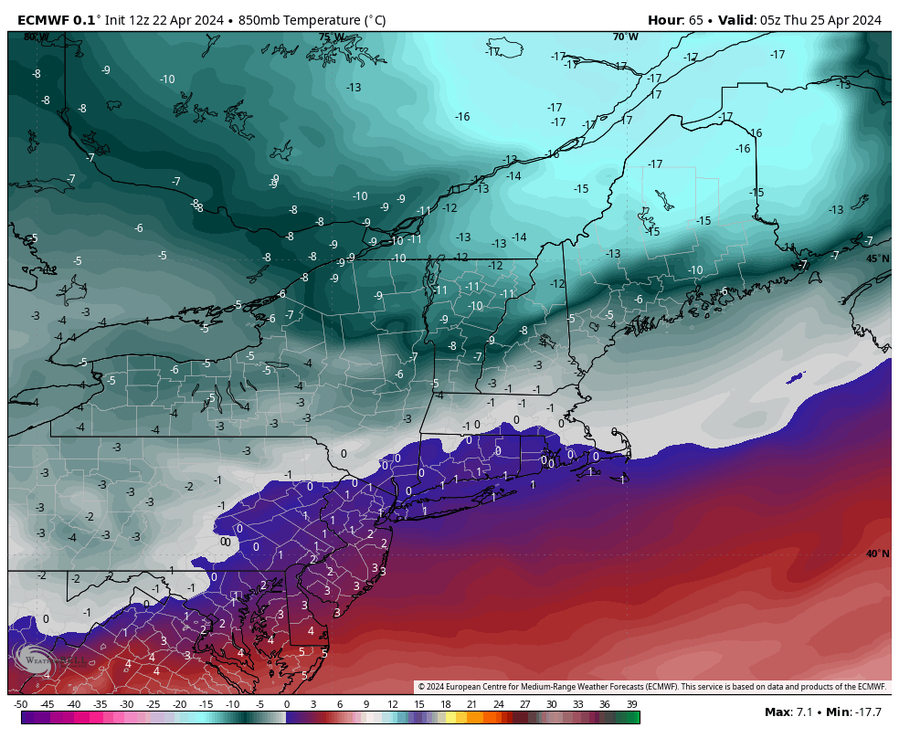
After some sunny days to start the week, clouds build in Tuesday night ahead of a cold front coming through. We’ll likely see mostly rain with this but there will be some transition to snow on the back end as a push of cold air does slam through with it. Image is from midnight Thursday …
The Week Ahead 4/15
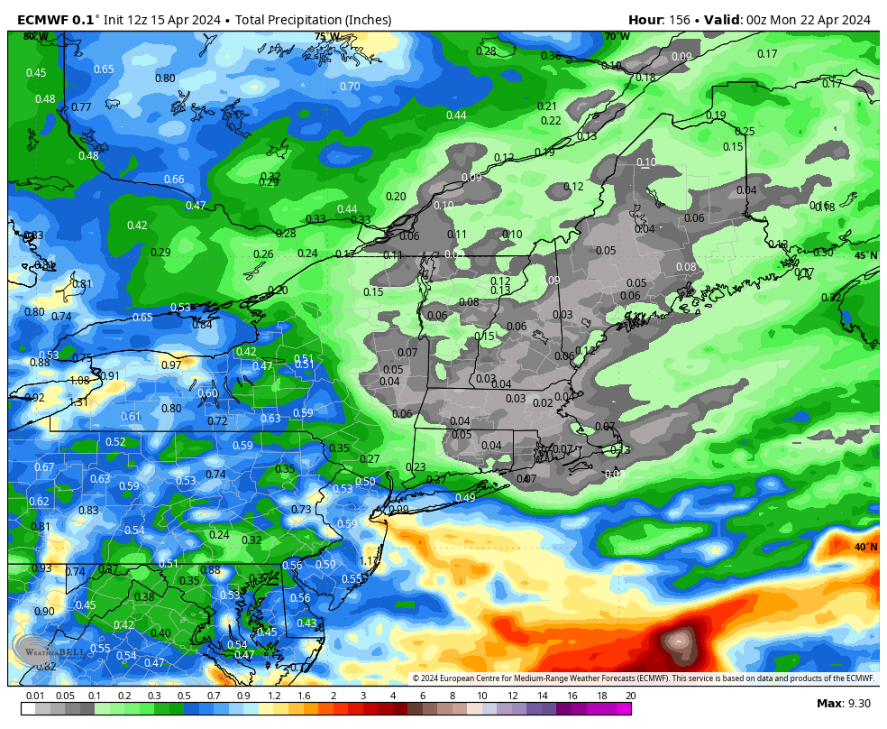
Not too much to chat about through the week ahead…the pattern is in transition and we’re actually on the quiet side of things. The total precipitation (on the right) shows less than a tenth of liquid precipitation through the end of the weekend from the Adirondacks north, and just slightly more in the Catskills. This …