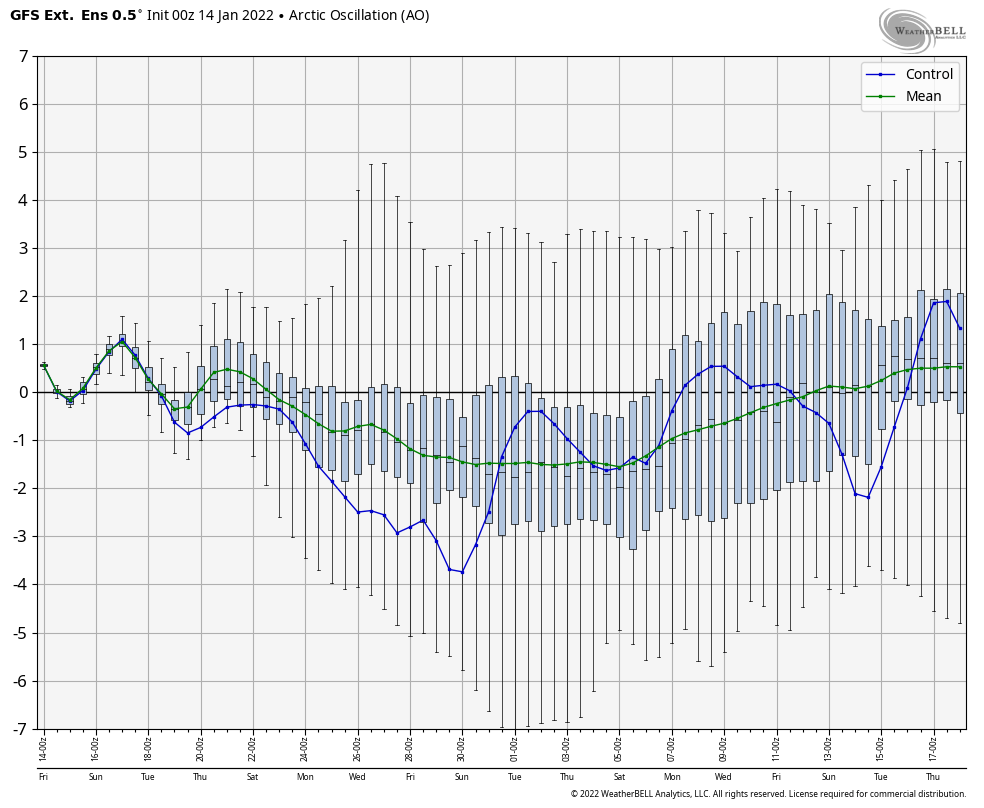
Just a quick update given the active forecast over the next 48 hours. The long term remains on course with a cold rest of January expected. Looking at the GFS, it’s holding onto the cold a little longer into February. In the long range, the GFS will more easily see the cold than the Euro …
Author Archives: Mallory Cash
Storm Update 1/15
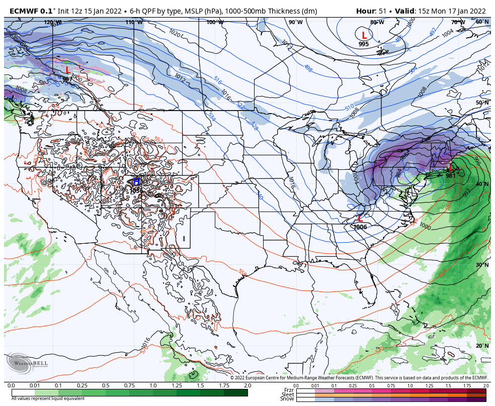
About two hours ago, I would’ve had a more confident, concise opinion about the storm movement toward a more dominant inland low. However, some of the 12z guidance has shifted more emphasis on the coastal low, and the overarching message is then again, there is not enough information on how the energy transfer is happening …
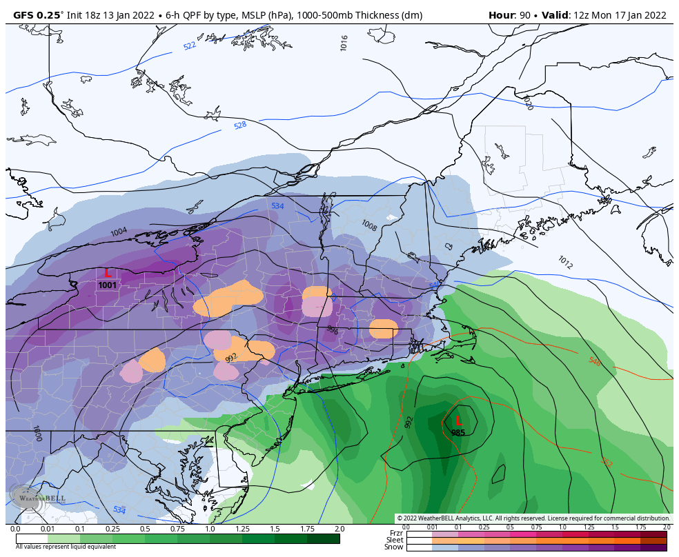
Storm Discussion 1/14
Storm Discussion 1/14
Storm Discussion 1/14
Storm Discussion 1/14
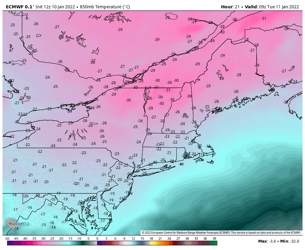
Arctic Cold & Impending Storm
We have a lot on the table for the holiday. weekend; another cold blast of arctic air and an impending low pressure system that a little temperamental. This cold blast may not be as deep as the previous, but the timing is not helpful. We’ll have the heart of it in the Northeast Friday night …
The Week Ahead – Arctic Blast Takes Hold
There’s not too much more to this week than the cold. Some of the lowest temperatures seen in the last 4-5 years will be rivaled in the next 48 hours. Pept0-pink is always exciting on snowfall maps, but not quite as welcomed on temperature maps. Wind Chill Warnings and Advisories are in place for much …
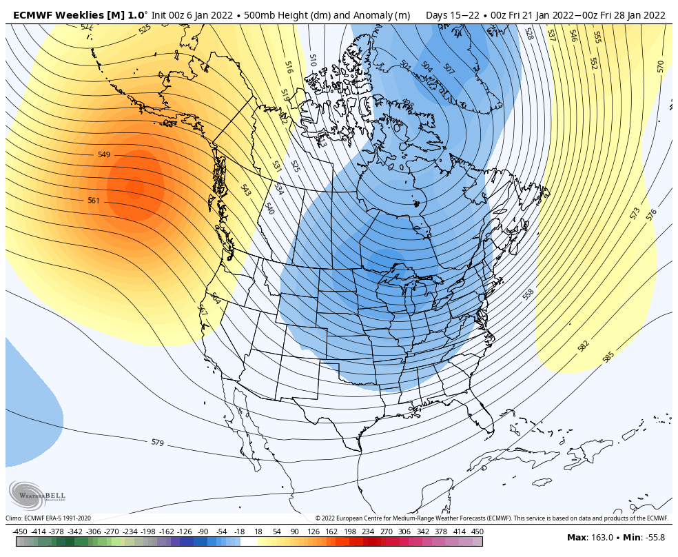
Long Term Views 1/7
It was a lackluster storm today, but it was something! Most areas received 1-3″ of very light and fluffy snow out of this system. We’ll see some upslope snow showers continue into the overnight hours in New England. We have another weak system of mixed precip/light snow on Sunday before the arctic front comes through …