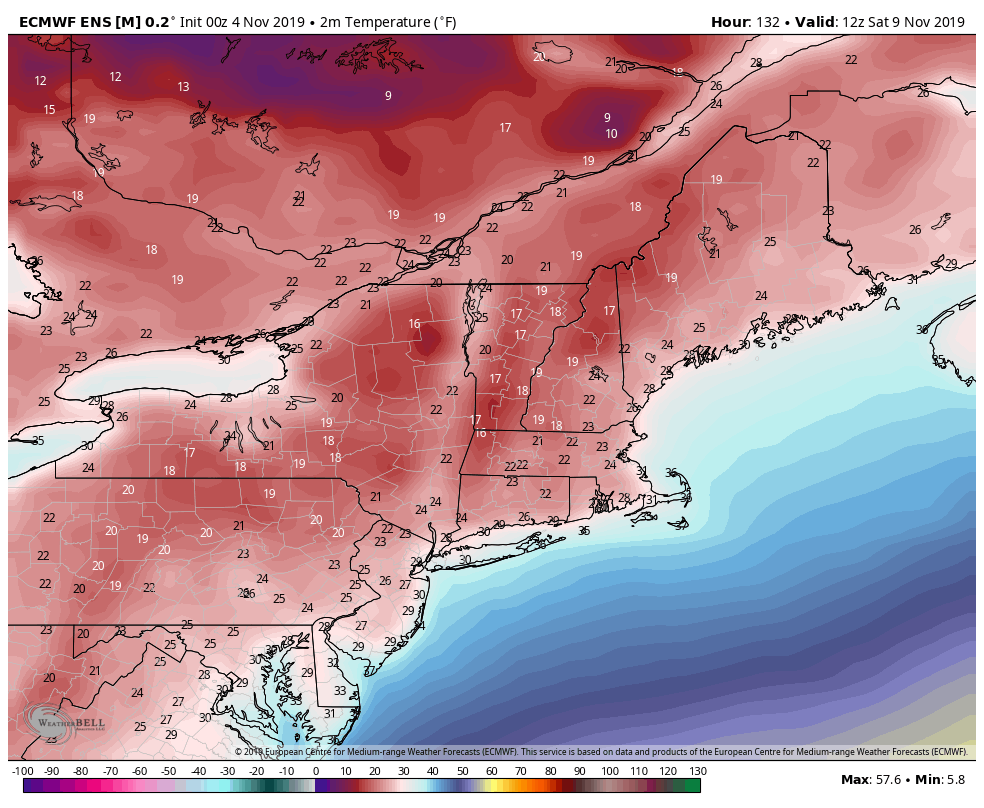
The cold begins to lift northward throughout the day Monday with temperatures rising through the overnight as well. We’ll gradually lose our snowmaking windows into the evening and overnight, with the exception of Wildcat’s summit which may hold onto reasonable temperature until Tuesday morning.
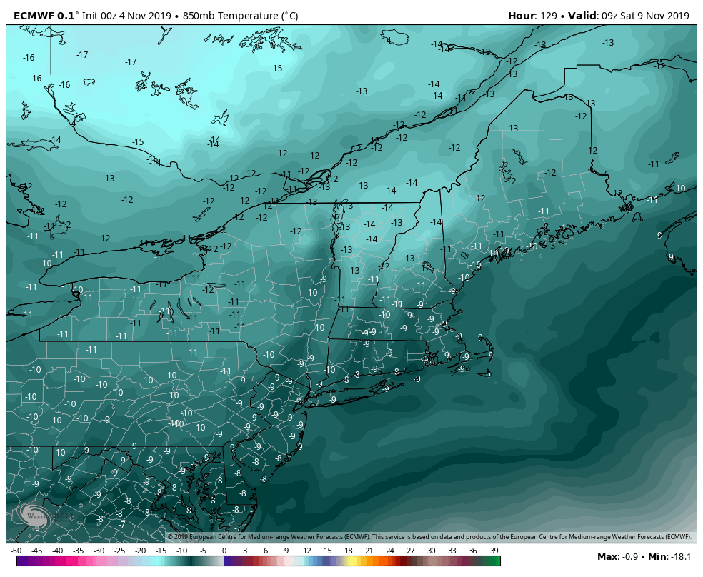
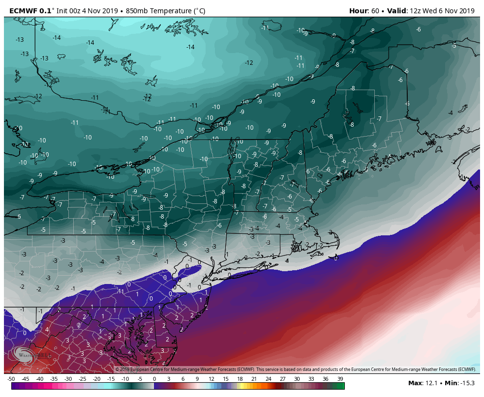
We’ll have a break Tuesday from the cold but it does rush back in Wednesday. Temperatures at 850mb (~4,500 feet) plummet down to -8C or 17-18F at the level, which means summit temperatures stay in the 20’s into Wednesday morning. The cold continues to build into the end of the week as well, and the timing will depend on if the coastal system materializes or not into Friday. There is some discrepancy in the strength of this system and how well it comes together.
The European & Canadian models have a more organized coastal system developing, where the American models don’t have quite the same amount of energy. Given the trough digging into the east, I would not be surprised to see a quick moving system come through Friday morning with light snowfall. Heaviest accumulation may stay out of the mountains, but Hunter and Mount Snow may reap the benefits of this coastal system compared to Attitash and Wildcat.
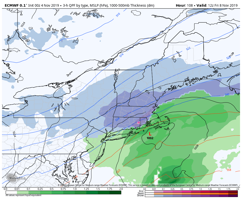
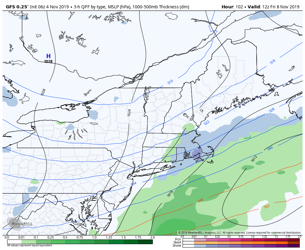
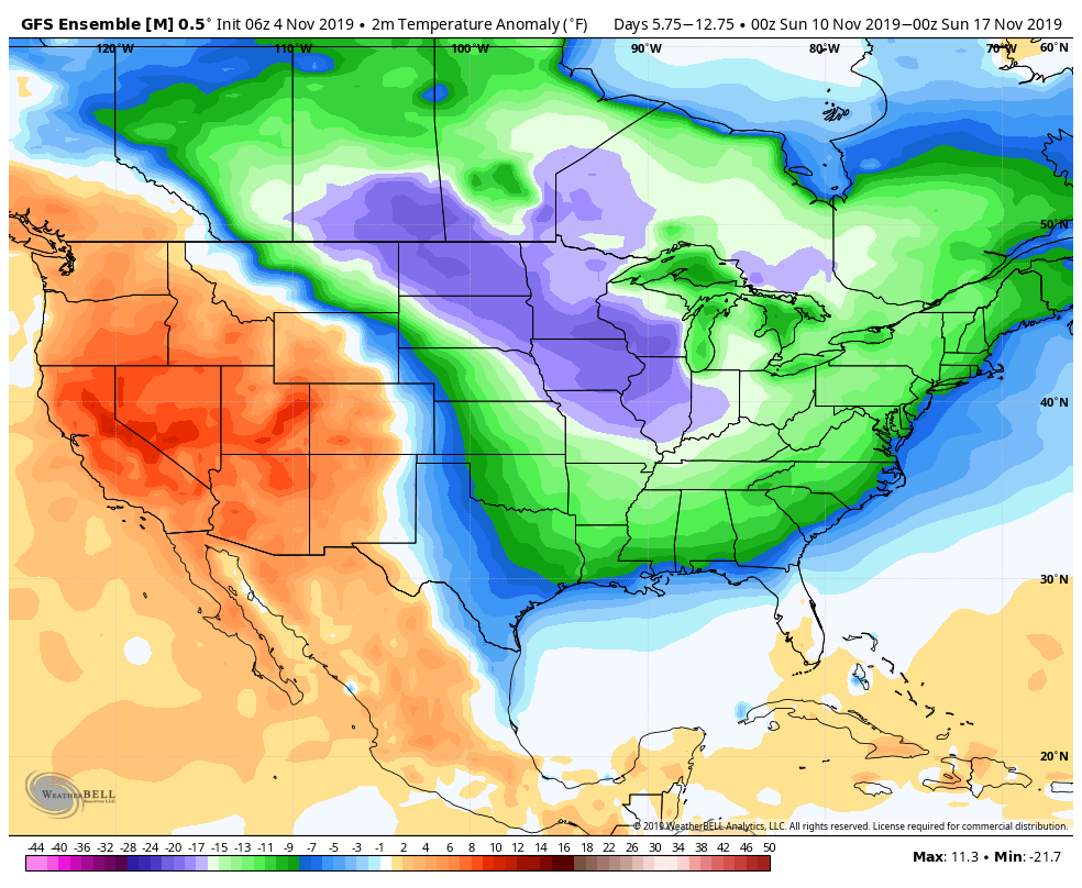
Behind the system, regardless of strength, another round of cold looks to shoot into the Northeast, Friday night, providing a blast that may even lead to favorable snowmaking ranges in our New York & Pennsylvania resorts. This round of cold looks to vary in strength for a couple days, but provides nearly consistent opportunities for snowmaking for Mount Snow, Wildcat, and potentially Hunter through the second full week of November. The first few windows of opportunity for Liberty & Roundtop come during this time period as well. There are signs that this cold begins to ease toward the second half of the month.