Some morning sunshine has boosted temperatures momentarily – however cloud cover has been racing in, and SE flow is beginning to impact temperatures.
We may see temperatures fall, if not steady into the rest of the day as the humidity rises and we cool the air through evaporation. The cold air damming signature is clear in the surface map this morning down the Appalachian spine through NC. That kink in the front will likely hold its form all the way through southern New England before the cold front starts catching up to it.
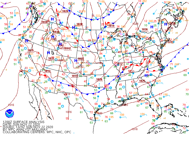
The warm front is expect to crest NY around midnight and then move through New England through the remainder of the early morning hours, with the cold front trailing close behind. This means that we’ll have a big surge in temps up and a quick crash down in most cases Monday morning. This setup may also set the stage for mixed precipitation and even some snow hanging on a bit longer before all changes to rain. In general snow amounts should stay <2″ before the cold front. Snow showers behind the front may accumulate as well.
The cold continues to settle in Tuesday and Wednesday. Wednesday may be very similar to today in that we may have some warming in the first part of the day, but cloud cover and SE flow will ensue, keeping temperatures down or bringing them back down after they had come up from morning lows.