Good morning!
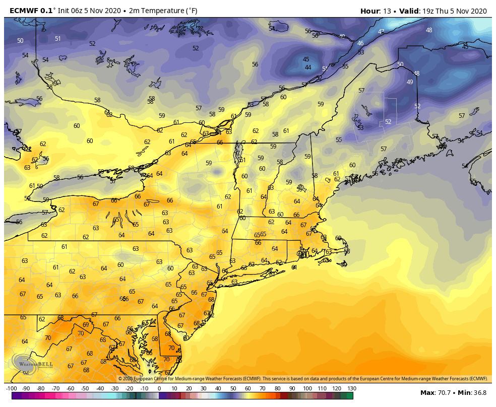
Another warm day expected after a very warm overnight – at least the mid to upper levels. There were a few impressive inversions this morning, with a >20 degree spread from top to bottom in some cases.
The warmth continues to filter in. High temperatures at the surface peak around 2pm today and are in the 60’s for many base levels.
We’ll continue to see warmth hold on through next week.
First cold front looks to arrive around 11/11, but I don’t think it’ll knock us into any usable snowmaking ranges. Following that front, it looks like we’ll start to see a parade of low pressures come through, but the depth of cold along with them doesn’t look deep – for now. Especially since one of them may involve the remnants or regeneration of Tropical Depression Eta…and we know how unfavorable tropical systems are for cold.