Our first round of snowmaking temperatures entered New England last night for elevations above 2,500 feet. Unfortunately, due to Hurricane Delta, the window was much shorter than initially anticipated. Long term forecasts are tough as it is, but they are honestly, more often than not, more inaccurate while the tropical systems remain in the weather pattern. Tropical activity in general is poorly forecast by numerical weather prediction models, therefore the intensity, movement, and vastness of the system is poorly defined and often affects other features across the rest of the country.
Looking forward, there’s not too much to get excited about in terms of cold. I’d call it a typical October with some cool stretches and some warm stretches. What is exciting to see is that we may receive some significant rain next week as Delta gets absorbed into a cold front (which we spoke about last week). The good news, in terms of less damage from the remnants, is that it’s getting picked up in the Tennessee Valley and not off or near the Mid-Atlantic coast. This allows us to have more of a soaking rain than a torrential rain and wind event.
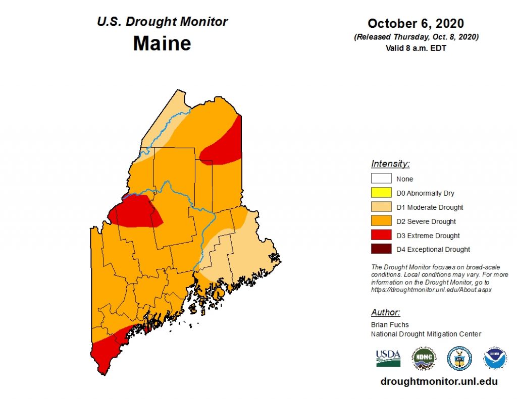
The drought remains severe to extreme in the western and northern Maine mountains.
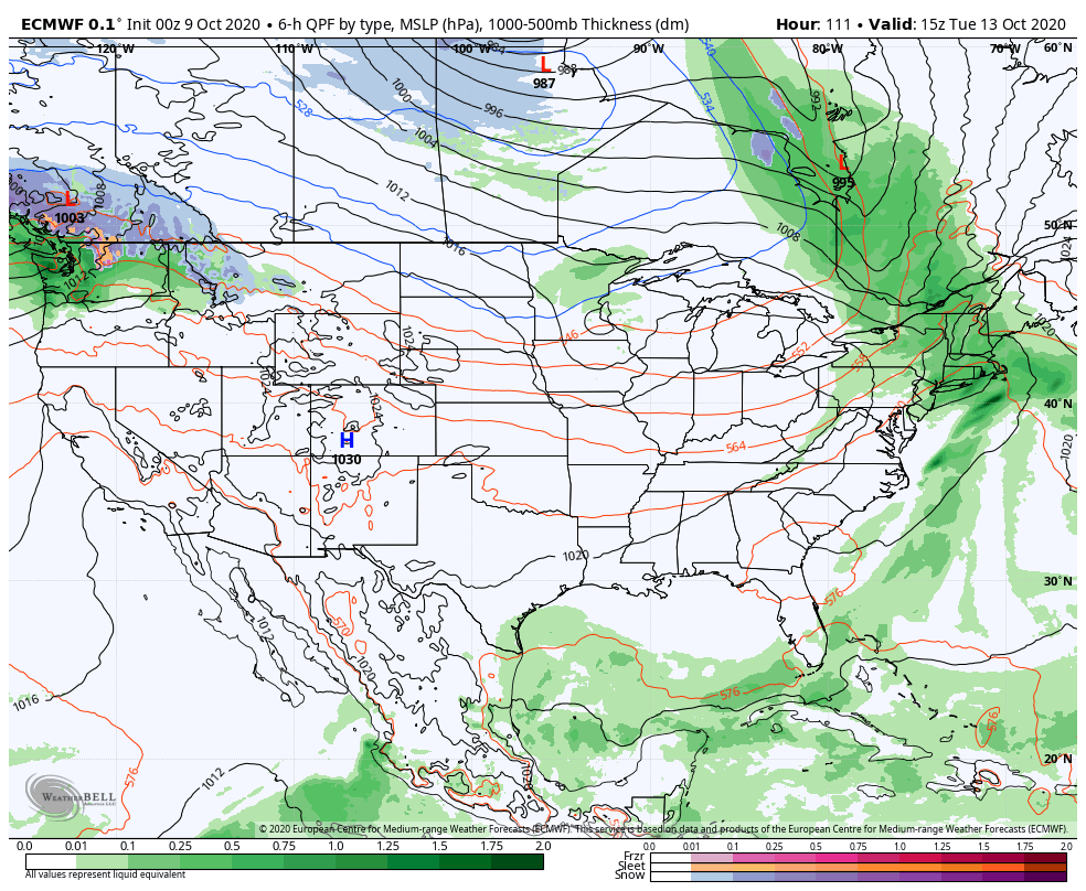
There is some cold behind that system on 10/13, but it doesn’t look to dig deep enough into the region 10/14-10/15 to provide cold enough temperatures for snowmaking. However, there is a secondary low to come through around 10/16, which may open up some windows into the weekend and following week. The ECMWF has been running a warm bias, so if that holds true, we may have more significant windows coming our way. Even better if we can get this record tropical season to tone itself down…