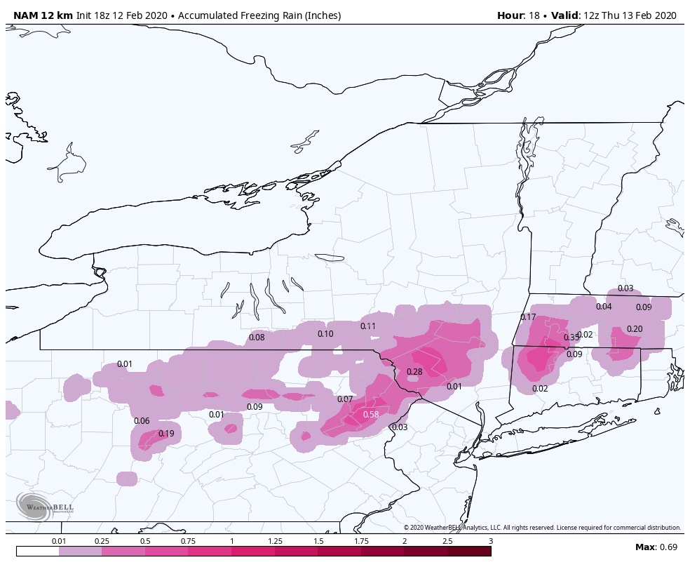
We have a light refresher snowfall coming our way at the most important time frame – right before vacation weeks. It’s a quick moving system with marginal temperatures, so it will be a wetter snow for Hunter, Mount Snow, and likely Attitash. Wildcat may sneak away with a less-wet snowfall.
Overall, amounts will range from 3-5″ for Mount Snow, Attitash and Wildcat. We’ll likely see a changeover at Hunter, which actually may result in some light icing during the day on Thursday.
Our PA resorts have already started to receive rain this evening.
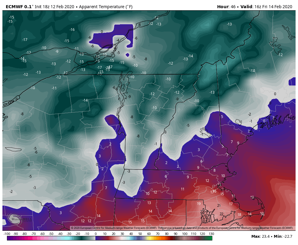
Perhaps the larger story is the arctic outbreak behind this storm, so while we’re receiving some much appreciated snowfall in New England, it’s going to be (dare I say) bitterly cold going into Friday and even Saturday. It will feel like we are below zero throughout the day on Friday over the entire mountain in VT & NH, and we may get above zero for touch of the afternoon at Hunter. Saturday will start off frigid, but we’ll start to rebound heading into Sunday.
The not-so-great news looks to be another mixed precipitation system moving in later Tuesday into Wednesday. As mentioned in previous blogs, we are at the mercy of well-placed Canadian highs and cold air damming. So while we’re going to be shivering through the weekend, as soon as this next system approaches, we’re hoping for some stubborn cold air damming. The American model holds it, and the European does not, and the Canadian is in the middle. My hunch is that since we’ve had two snow events this week, we’re probably headed toward more mixed precipitation and rain for VT & NH. Hunter and PA will likely see all rain for this system. As is typical with this season, temperatures look to crash, again, after the event.