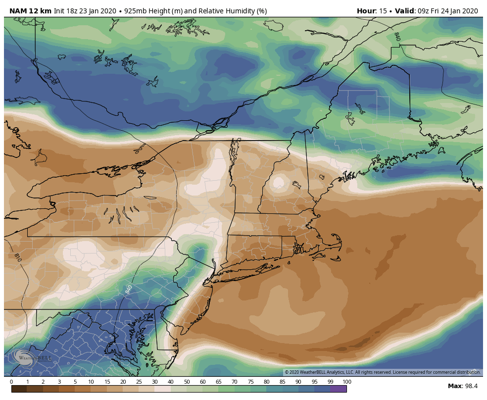
With humidity values plummeting to near zero % this afternoon in some cases, we had warmth a day early. Though a freeze/thaw pattern was expected for the end of the week, temperatures in the 40’s came in early this afternoon briefly before coming down with the lowering sun angle.
The temperature rollercoaster ride is likely to continue into tonight, especially in central and southern Vermont & NH with low humidity values expected to stay in the low to mid levels, minus at the base where we may have inversions again tomorrow morning (Thursday morning we had 25+ degree differences from base to top in NH & NY).
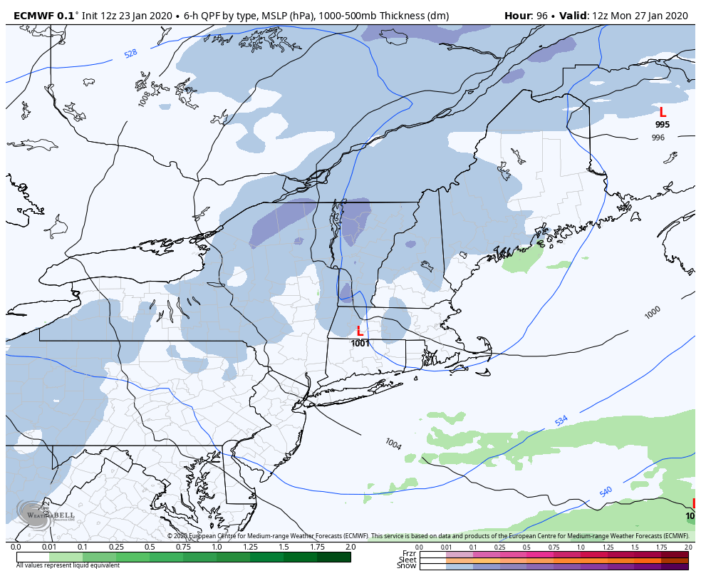
We won’t see the rollercoaster end until Saturday when we begin saturating the atmosphere ahead of the storm.
This has been a frustrating winter for storms. They look great in the long-mid term ranges and as they come to fruition, they just fall apart. It’s great insight to the technology this winter – that they’re exaggerating storms and potential phasing of energies – but they sure are a buzz kill.
While we’ve been seeing the storms fairly well with teleconnections, the output of the storms seems as inconsistent as ever. After two moderate snows thankfully before the MLK holiday weekend, the cold settled and we had a brief period of glory to enjoy – and then we had this weekends storm take a more northerly track and dislodge the cold that looked like it should’ve been strong enough to hold on.
Some cold will hang onto the higher terrain, but I’ve introduced rain into the forecast for Mount Snow (2-4″ possible, less at base), and turned most of the precip into rain at Hunter where initially it looked like we could’ve skated by with mostly snow. Attitash and Wildcat do have the highest chance for mostly snow (3-6″) as some cold air damming may help keep temperatures down. Liberty & Roundtop were expected to be rain and will continue on that trend.
I had a ski client call this winter “The Winter That Doesn’t Play Nice” – from a meteorological end of things, I’m calling this winter “The Winter Without A Blocking High”. They both work! A blocking high pressure does two things for us – holds the cold air in and slows down the storms movement. With that, storms don’t have precipitation-type issues, and last for more than 6-10 hours.
The small upside (if I have to find one) is that behind the storm, we should have some persistent snow showers that bring a couple inches of snow as upper level low passes over Monday morning into Vermont. Mount Snow may pick up more snow in those snow showers than in the storm itself.
Behind this system, we stay quiet again for most of the week with seasonable temperatures. Teleconnections point to the next system around 2/1, which matches the current cycle well of Saturday night to Sunday storms. It will be interesting to see what breaks the cycle in the weeks to come.