It’s hard writing forecasts with the R word in it – especially after the large mass of snow received just over a week ago at Hunter & Mount Snow. Unfortunately, we have one more warm system to go through before we can think about the possibility of snow.
Why are we getting the warm, inside runner storms instead of pow days filled with white gold? No blocking high pressure – and we see that in our teleconnections. Teleconnections refer to recurring and persistent, large-scale patterns of pressure and circulation anomalies that span vast geographical areas. The most well-known one is ENSO – El Niño Southern Oscillation. While ENSO doesn’t have a major say on the east coast weather pattern, other teleconnections do tell a bit of the story.
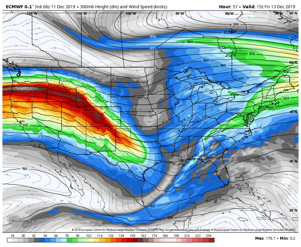
We’re getting batches of cold (deep cold at that), but when the atmosphere gets rolling and the storms develop, there’s nothing to hold the cold air in place. We have a positive EPO for 12/13-14 (Eastern Pacific Oscillation, or the Alaskan Oscillation) – which means we have troughing in the west/midwest, and ridging in the east. It looks like a roller coaster ride bottoming out in Texas and then hitting the crest near New England when you look at the jet stream. This keeps the cold to our west, and the storm is known as an “inside runner”, because it doesn’t run along the east coast over the ocean, but rather over land.
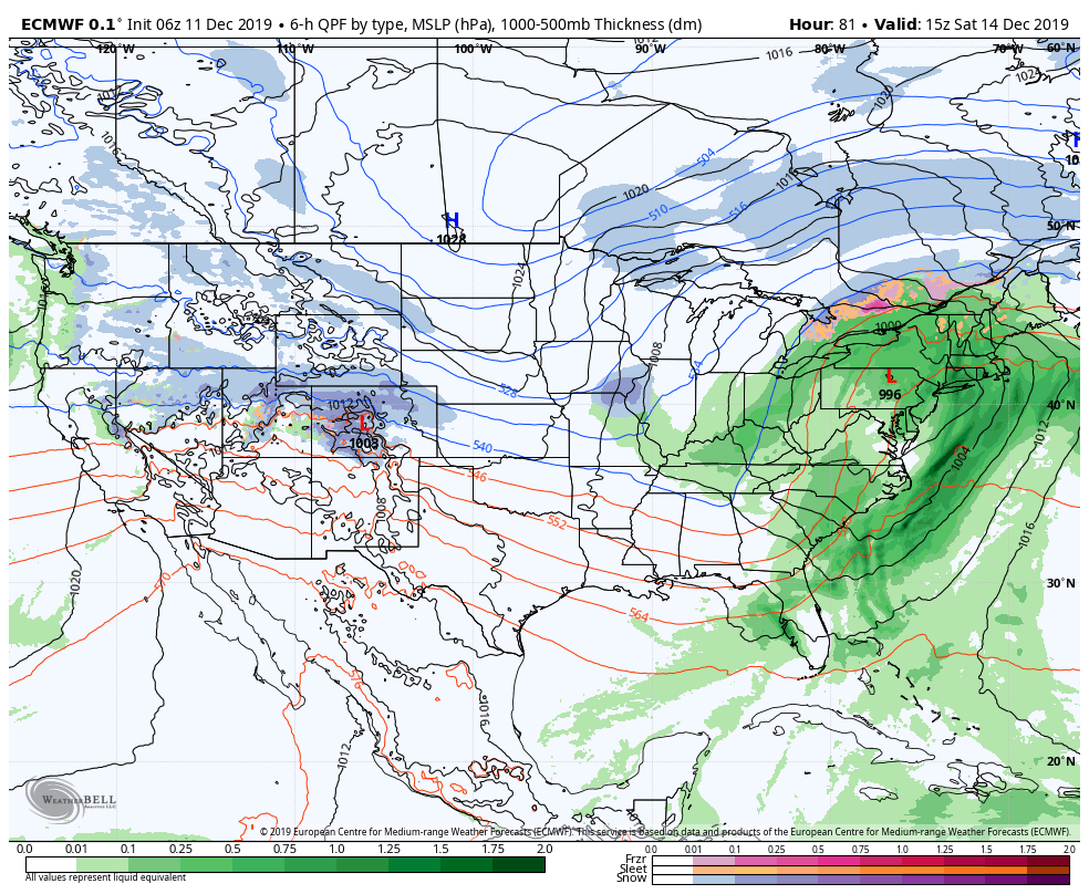
We also have a positive AO (Arctic Oscillation) and NAO (North Atlantic Oscillation) through 12/15. Those oscillations are measures of the availability of sustained arctic air (think polar vortex) and the ability to block/sustain it – which go hand in hand for a classic snowstorm. The high pressure on 12/14 is over Saskatchewan/Manitoba and another over Newfoundland – but our ideal (for a negative NAO) is in western Quebec (hovering north of Lake Ontario). Therefore the low runs up between the two highs, giving a track right across the mountains instead of to the east of them, and bringing rain, and not snow.
Two rain events in a row is quite enough. We outlined mid-December as a moderating period and I think we are living up to that (and we’re over it). It’s into early next week that we start to see some changes. First, the AO & NAO are going negative as of Dec 15. When we see up & down movements between positive and negative in teleconnections, it typically signifies pattern changes. Inflection points (peaks & troughs) are highly correlated with storms. The EPO goes slightly negative for a couple days, signifying some troughing in the east and therefore a more favorable run at ditching some of the non-snow precipitation.
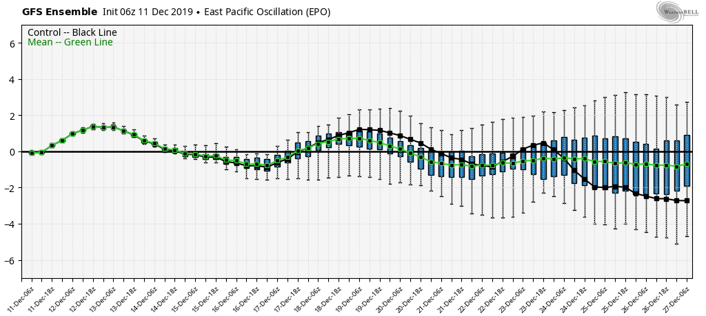
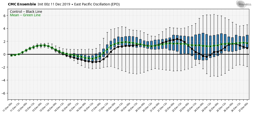
Based on these the ensemble teleconnections, we’d expect to see a storm around Dec 17, something minor around the the 19-20th, and potentially something larger into Dec 23-25 (A quick note on ensembles – these are all the possibilities within the computer model based on different weighted variables. In the long term, it’s best to look at ensembles because you’re looking at all possible outcomes, instead of just one, which would have a high degree of variability from run to run beyond 7 days).
So I’ll finish with a brief note on the Dec 17th storm, given that’s within the 7 day range. Most models have a storm system with minor blocking (slightly negative AO/NAO) in place, but it’s not as strong as it needs to be to keep everyone as snow. Therefore there’s some discrepancy on final precipitation type(s), but at least it doesn’t look like an all rain washout at this point. Rain is likely for our PA resorts after some freezing rain. Hunter & Mount Snow may start as snow and transition to sleet/freezing rain (with a brief period of rain possible), while areas north and east look to have the most snow possible.