Outside of topographically induced snowfalls, it’s been a rather dry winter. While widespread, natural snow has been hard to come by, that pattern is set to continue through this week and most of next week. I do think we’ll start to see more activity next week and into early February as the pattern begins shifting.
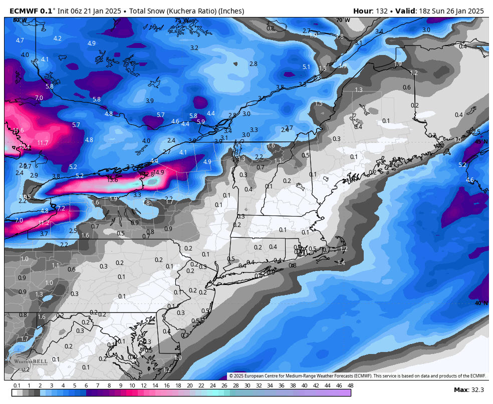
The Euro total snowfall through Sunday shows mostly lake-effect snows taking hold and some minor upslope snows in the NEK. Otherwise, we’re staying cool and dry.
I’ve been noting in discussions that the pattern will likely flip into next month. At first it looked more immediate, but the true pattern flip may take a week or so into the month to fully show its form.
There are some contradictory signals, however, as to how constant the flip/warmup may be. Teleconnections are helpful with pattern changes, and we have the NAO/AO moving positive, which means we don’t have a lot of cold air to work with and if we do, it’s hard to block it in. The PNA is going negative, which indicates a ridge building in the east. The EPO moves sharply positive and then heads to neutral, which should allow warmer air to come in. However, the WPO remains negative, which is usually an indicator of cold air infiltrating into North America. Hence why we may struggle with consistency in this new pattern.
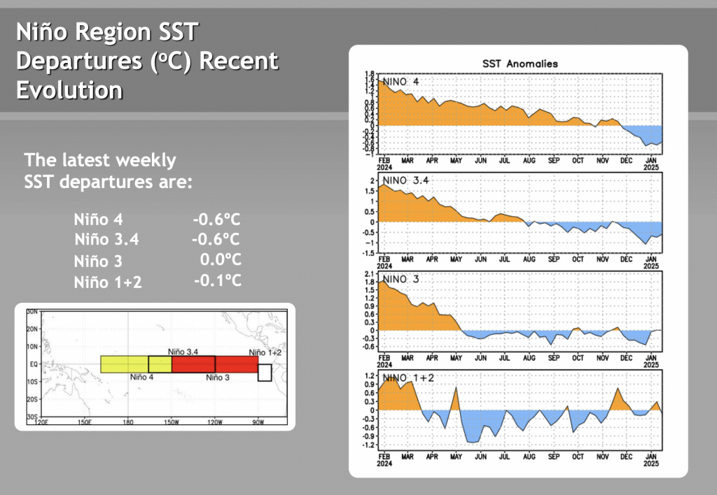
When it comes to the ENSO cycle, we’re coming out of the brief peak which put us in a weak La Niña for the last month or so. The peak was in late December with a steady climb since. As of the CPC update today, January 21, the eastern areas of the equatorial Pacific are already close at/near zero, which means we should be shifting out of any La Niña influence soon. With a neutral phase taking shape, the patterns can start shifting more while keeping those regional influences, as we talked about earlier in the season. This is very apparent by the amount of lake-effect / topographically induced snows this season. Therefore I don’t think the warmup in February will be a month-long slog through rain and warm weather, but rather more of a rollercoaster ride through warm spells. As long as the NAO remains positive, it may be hard to keep snow for precipitation events — but it’s also February, which is a cold month in itself.
In the end, there are signs (and my general hunch) that a miracle March may be coming back for another round — especially if we start to see those ENSO numbers tick up into positive territory for all zones.