We’ve been talking about a pattern change for two weeks now, but it’s taken some time to settle in, delivering some waves of precipitation and slight warmth within it, but ultimately providing a big trend toward cold, and possibly snowy.
The big talk of the town this week is a Thanksgiving storm that the models refuse to agree on in the deterministic world, but we’re seeing the ensembles shed more light this afternoon. The reason we haven’t seen much agreement at this point is that one piece of energy, which is incredibly fast-moving, is just coming onshore in the Pac NW tonight (and yes, will zoom toward us for a storm in 60 hours).
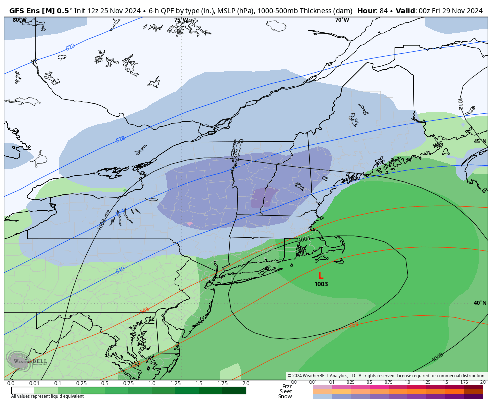
The GFS has been the outlier of the last 2 days, but the ensemble this morning showed a very clear picture – a mean low position that crosses Cape Cod is not a bad setup, by any means. The 18z NAM has a position about ~30 miles to the east of the GFS, whereas the Euro ensemble is just a hair to the west (the deterministic models have been about ~50 mile to the west).
The GFS is known to go into “la la land” with storms in the past, and it seems that it’s still happening given the ensembles are painting a very different picture.
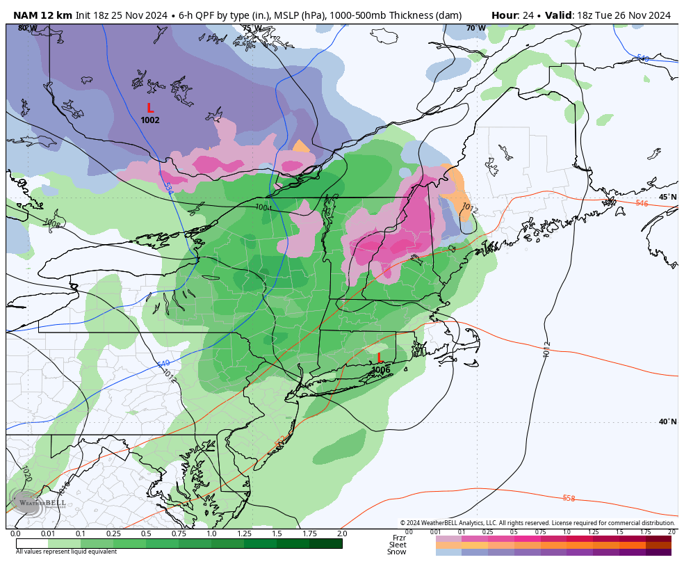
But before that happens — we have a pesky little warm up beginning this evening that will start at the upper levels and eventually make its way to the base (cold air damming in play).
This means icing is possible for Tuesday morning, especially in low lying base areas (see NAM image valid at 1pm for the previous 6 hours) — and may impact operations for resorts already open. Tuesday overall will be “warm”, and we’ll bring down temperatures quickly Tuesday afternoon to the overnight from west to east.
Wednesday is cool but not frigid as we have our incoming storm for Thanksgiving.
From the Poconos northward, at this point, we should be mostly snow. It’s possible we start out as a little rain in the Catskills but dynamic cooling and evaporative cooling should work their magic pretty quick. It’s not going to be the storm of the century by any means, but the timing provides some major complications.
The first decent snow event of the season could bring 3-6″ (or more) to the mountains from the Adirondacks through the Greens, Whites and into Maine. I’m starting with 3-6″ to not get overly excited, but there is room for improvement.
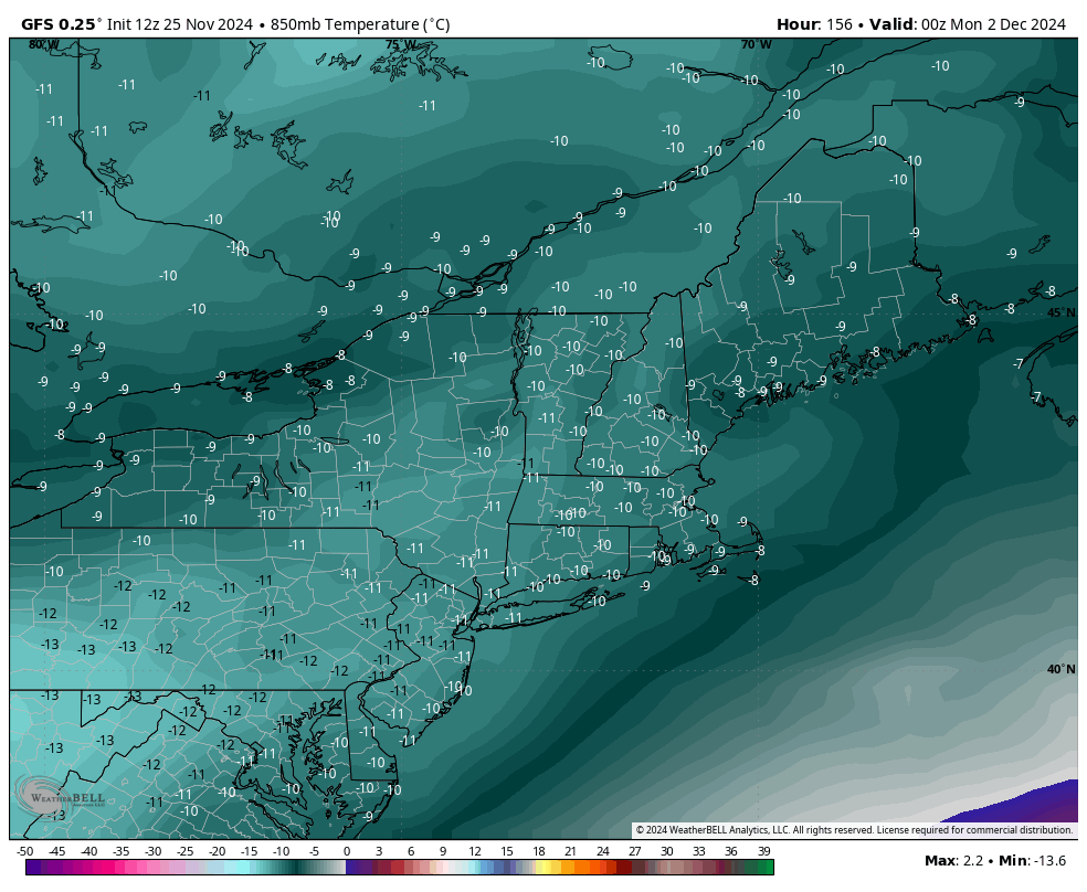
Another cold punch comes in behind this storm, which should bring widespread long-term snowmaking opportunities across much of the East, including the Mid-Atlantic for the weekend and into early next week. The GFS shows 850mb temperatures of -12 to -10 from Maine to Virginia Sunday night.