Our pattern change began last week, and we’re continuing the trend of change into this week with a cut-off low impacting us into the latter part of the week.
While there’s a shallow cold air mass settling in tonight and Tuesday, it’s just that — shallow. We’ll see some temperature modification heading through Wednesday before clouds and moisture settle in on Thursday ahead of this larger system.
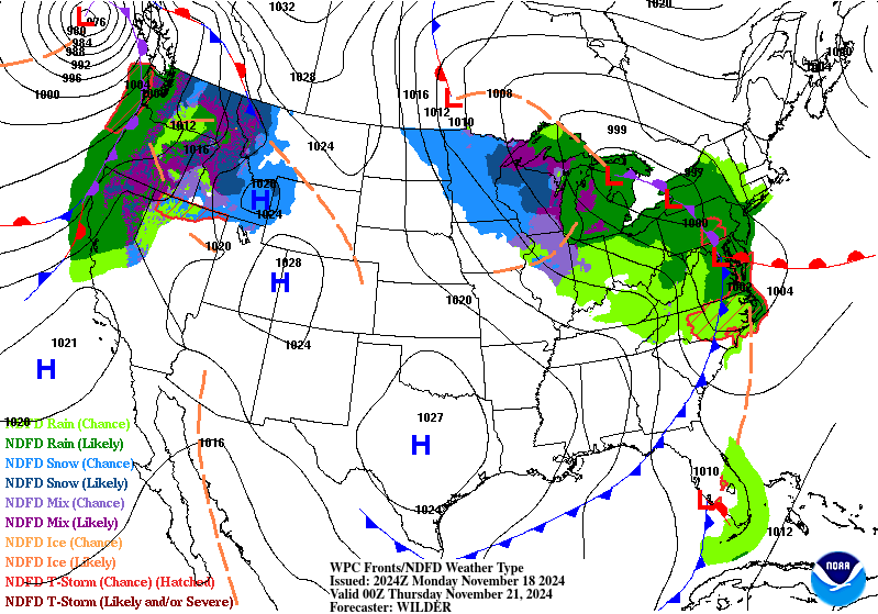
What is known as a triple-point low, it develops from a low pressure than occludes so deeply that a secondary low develops at the point of occlusion and the cold/warm front. Because of this, we really don’t get into the warm sector of the system, but we’re not getting the deep cold air either — that gets a bit washed out as the system continues to occlude.
Therefore we see somewhat shallow cold, or marginal cold, but will still allow for accumulating snow in terrain above 1,500-2,000 feet from the Poconos to the Bigelows (perhaps some lower elevations as well depending on location) and snowmaking at higher levels.
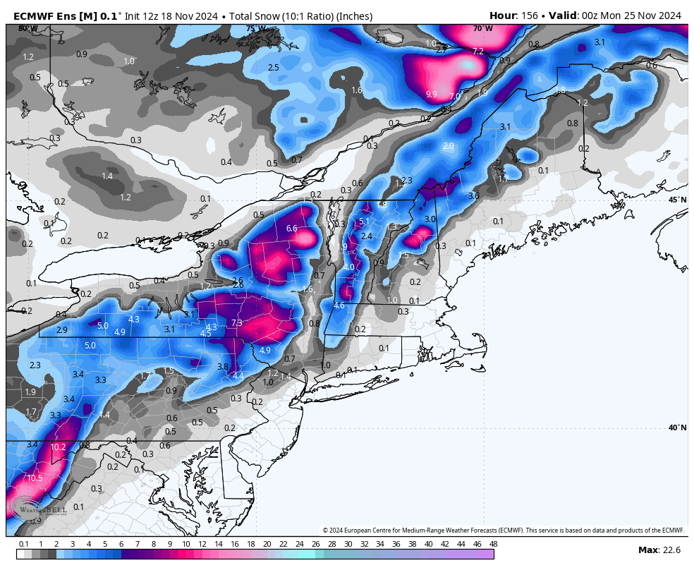
Snowfall currently looks most significant in the Adirondacks, followed by the Catskills and portions of the Greens. The GFS has been on this for about 72 hours, and the Euro is beginning to catch up. Accumulations of >6″ are possible through Sunday in the aforementioned areas above 2,000 feet. The 12z run of the Euro ensemble was the most bullish yet for snowfall out of this system.
Attached is the image from that run showing a 10:1 ratio for snow.
Precipitation will continue to circle around the upper level low (which is the original low, over the Great Lakes in the previous image), for a couple days, which will continue light snow/rain activity until the “front” associated with that upper low (not really a surface boundary anymore) comes through. That will bring the coldest air with this air mass through the region Sunday into Monday, though it may not be deep enough to get into the Catskills/south (the depth of this punch of cold air is still a bit inconsistent).