We’re back! Hard to believe the warm season flew by so quickly.
The first decent cold punch of the season, with New England summits expected to drop below or near freezing, comes for the middle of next week. Initially it looked like the first punch would be stronger, but now the second punch, which arrives in the early hours of Thursday morning, shows more strength. This is likely vacillating due to the continued active tropics and the interaction from now TS Milton (soon to be Hurricane).
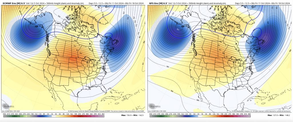
The GFS has been on this cold punch for a while along with the Canadian, with the Euro slowly coming on board. Given that models receive upgrades each year and biases change, it’s a good opportunity to see how models handle the first significant cold front of the season. Typically with active tropics, the models over-do the cold depth and strength.
Nonetheless, there may be a brief opportunity for resorts to get guns on/testing toward summit levels – most likely on Thursday morning (though some areas will have the opportunity Wednesday into Thursday, location/elevation dependent).
Behind this, we’ll get temperatures back to more seasonable levels. However, another cold front may come through around 10/15. The ridge seems to be centered in the Midwest, which could allow more cold fronts to come through. It also should keep any tropical activity far south and off to sea.